Massive blowdown in Ammonoosuc Ravine

vftt.org

Help Support vftt.org:

This site may earn a commission from merchant affiliate links, including eBay, Amazon, and others.

csprague

Member
Joined
Jun 17, 2008
Messages
108
Reaction score
20
Location
Portland, ME
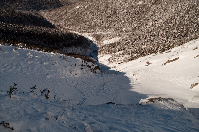
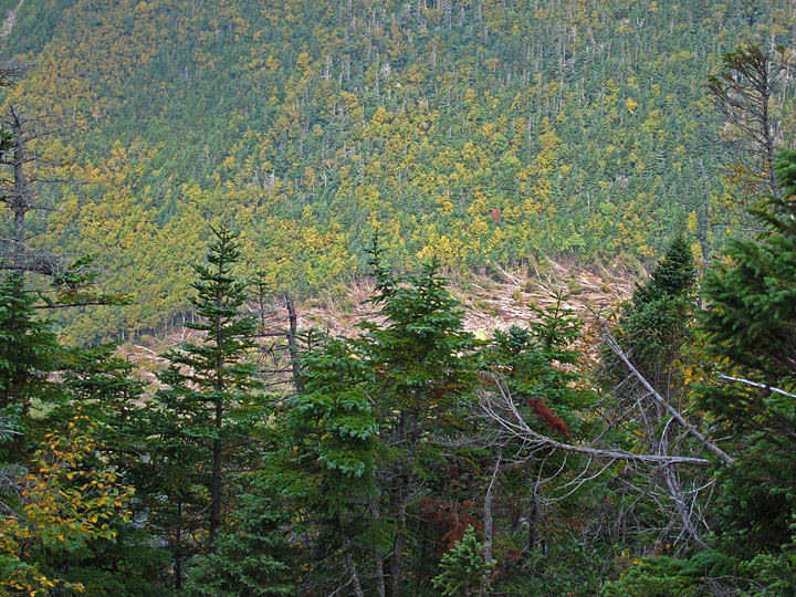
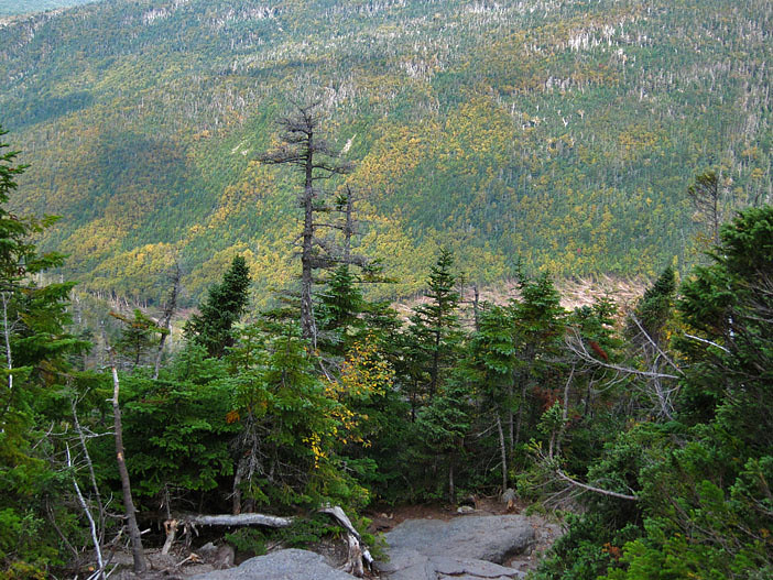
Perhaps I'm late to the game here, but I haven't hiked up this trail in awhile, and while hiking up today, I noticed a massive blowdown that was probably a quarter-mile long or more. It had a pretty clear boundary line, too. Did a tornado hit this or something, and if so, when?

Here are two pictures of this blowdown:

Zoomed in a bit:
4950371332_8c55b55267_b.jpg


And showing the swath it took:
4949778295_3fb2f4b524_b.jpg


Chris
 
Well, you're right about that you're late on this one...And it's not blowdown per se....

Think about where it is located...... Ammonoosuc Ravine?? AVALANCHE.

Not sure when it came down, somebody will chime in I'm sure. Ground level pics, included...

Pretty impressive, indeed.
 
Last edited:
Great pictures, evilhanz. Thanks for posting.

*And I do realize they're not yours, but thanks anyway! :)
 
Last edited:
We weren't really aware of this avalanche when we hiked to Monroe via the ammo...we ended up unable to follow the trail...ended up following ski tracks up... and ended up WWWWWAAAAYYYYY off track (actually, about a mile to the LEFT of the hut).

it was REALLY something to see!!!
 
I aborted an attempt at climbing the Ammo Gully on 12/19/10 due to deep powda. No sign of Avalanche on that day.

The below picture was taken on 1/23/10 during a successful climb. No sign of avalanche that day.

I have to say I'm skeptical that the damage shown in the first picture was caused by an avalanche.

DSC_0203.jpg
 
I aborted an attempt at climbing the Ammo Gully on 12/19/10 due to deep powda. No sign of Avalanche on that day.

The below picture was taken on 1/23/10 during a successful climb. No sign of avalanche that day.

I have to say I'm skeptical that the damage shown in the first picture was caused by an avalanche.
Avy debris (no question in my mind about that) were not there when I hiked down the Ammy after my traverse of Jeff, Wash, and Monroe on 13 February (the day that b/c skiers tried to steal my cache at the top of Jewell Trail; I met lots of VftT folks doing my route in reverse that day), but apparently avy debris were there by February 28th; check out the cool vid by these skiers.

http://skisickness.com/post/viewtopic.php?f=3&t=33
 
Actually, it happened in late February...

The avalanche actually occurred in late february, along with some even bigger slides off of Clay. All caught on the MWO Presidentails webcam...

Some shots...
4952841824_5215e2cd9a.jpg


4952841772_290e7e3d5e.jpg


4952249393_ff2be600ab.jpg


http://www.mountwashington.org/weather/f6/2010/02.pdf
IF you look at the F6 data from that time, it cooresponds to 130+ MPH winds from the east...aka heavy west side loading.

My question for y'all is, has anyone seen any of the new slides in the other ravines visible in these shots?
 
I am amazed. Actually, very amazed even with the easterly windloading. I'm going to have to check this out.
 
I am amazed. Actually, very amazed even with the easterly windloading. I'm going to have to check this out.

It was a strange ski season on da Wash, as the Ammy had a much better late-season snowpack than did Tucks. I remember another late-season easterly storm a few years ago around Easter weekend that plastered the west-facing slopes with so much snow that some skinned to the tops of all the Presi peaks, even Mount Adams.
 
Despite very strong circumstantial evidence, I remain bewilderingly amazed. ;)

We need an aerial photo. Anyone got a helicopter? :)
 
The avalanche actually occurred in late february, along with some even bigger slides off of Clay.

You're right. It wasn't late January. It was late February on the 24 or 25th. It's first visible on the Presi cam at sunrise on the 26th.
 
Oh that was quite a path of destruction! I was marveling at it when skiing out in early April.
 
You're right. It wasn't late January. It was late February on the 24 or 25th. It's first visible on the Presi cam at sunrise on the 26th.

How can you tell on those tiny webcam images what's a white slide path, and what's just white because of fresh snowfall or rime covering vegetation?
 
Here is a picture Dave took of me skiing on the runout in April. It was pretty impressive to see the results from the avi!

23554_413678971339_546561339_5141500_2743183_n.jpg


Downed trees below us:

23554_413678976339_546561339_5141501_4487797_n.jpg
 
3/2/2010 in the Ammo Ravine - no sign of the trail above Gem Pool (or even right below it)


There is about 5' of snow atop this blowdown. We walked underneath without ducking much.


The remains of a small slide.


In the back I believe is the river, but it could well be part of the slide track. I'm not sure at this point.

Tim
 
Top