
Kevin Judy and Emma
Well-known member
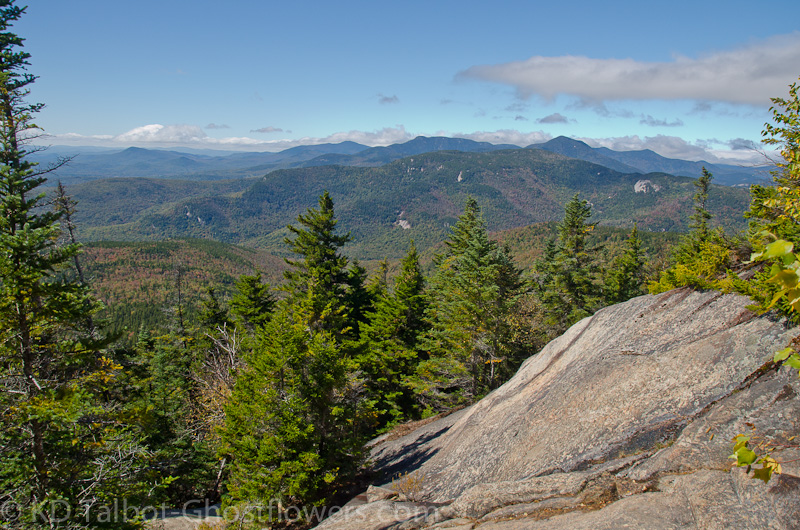
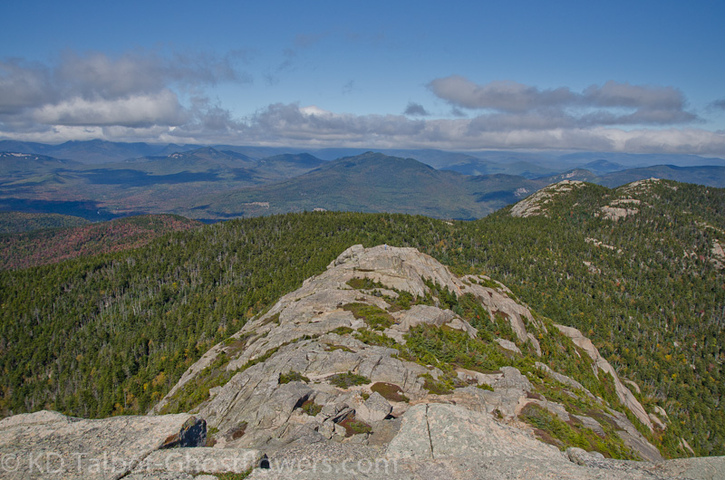
View West from the Brook Trail
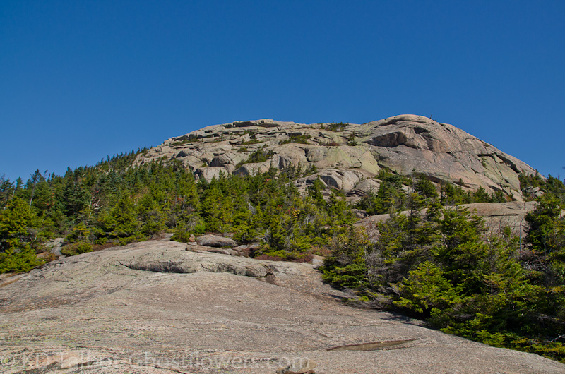
Mount Chocorua 3500'
Brook Trail/Liberty Trail
7.5 Miles 2650' Elevation gain
Kevin and Judy
The great thing about staying in a campground Sunday into Monday is that the place empties out Sunday afternoon and you have a nice quiet Sunday night. I had a better night's sleep than the night before, but had a lot of stiffness in the leg and back. I was beginning to rethink plans we had for hiking Mount Chocorua. We had decided the night before to hike some new trails to the summit and had agreed that we would ascend by the Brook Trail and descend by the Liberty Trail. It was still pretty chilly, but the sun was bright and I knew it would be an awesome day to hike, so eventually as we were breaking down camp I talked myself into at least going and see how I felt on the trail "and if I have to turn around I have to turn around." First we'd have to find the trailhead, I wasn't sure if where I thought it was would turn out to be right, but memory served me well and we drove right to it. With a pop-up trailer in tow and two kayaks on the roof I didn't want to be driving class VI roads in circles all morning.
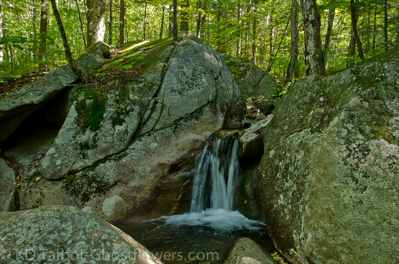
Along the Brook Trail
We started out at the trailhead where the Bolles, Brook and Liberty Trails intersect at the parking area on Paugus Road. The trail starts easily along a gravel road but soon turns into the woods and becomes a smooth path through maturing evergreens. There is no question why the trail is named the Brook Trail, as it follows the course of Claybank Brook for the first two miles or so. At one point there is a beautiful, tiny waterfall and it provided a good excuse for a break while I stopped for pictures. By this point the legs were warming up from the initial stiffness when we started out and the pack had stopped feeling like a hundred pounds. Jude made the obvious comment one of us always makes at about this point of a thus far easy hike, "This has been a breeze, all the elevation must be in the next mile." "Don't say anything discouraging," was all I could come up with as I stretched and flexed the stiff right knee and hip.
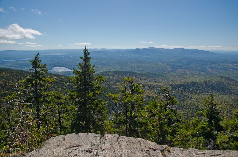
Chocorua Lake and the Ossipee Range
At about two and a half miles we crossed the brook and as predicted the hike became much steeper and began to cross a few wet ledges which had some trick to them. With two poles I was doing fine, but as we ascended the ledges got trickier. The guide book had warned of one tricky scramble and I was thinking I had done three already when we came to the warning worthy one. You know, with two good legs I would have thought this was fun, but with one recently surgically improved and the other just weak and tired from sitting around all summer waiting for the other to get back up to speed, I was finding it tricky indeed. There were nice wet, mossy spots seemingly strategically placed where all the best footholds were, and looking up and not seeing anymore blazes, I was not quite sure what point above us should be my objective. Somehow, despite all this, we managed to get up and over it and find the trail back into the woods. It wasn't after all, Hillary's Step, but it was seeming like a great accomplishment to me at that point. I was glad we hadn't decided to loop the other way with this as the descent, it would not have been good.
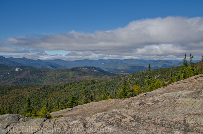
From the top of the ledge we had just scrambled we got our first views and could clearly see the rest of the Sandwich Range, Paugus, Passaconaway, Whiteface, Sandwich Dome, Middle and North Tripyramid, marching away to our west . Occasionally we would get a glimpse ahead of our progress towards Chocorua's great bald summit cone as we passed along more ledges which offered views to nearby Chocorua Lake and southeast to Ossipee lake and south to the Ossipee Range. We passed the junction where the Beeline Trail connects from Mount Paugus and we were soon on an open ledge 2/10ths below the summit, staring up at the mass of granite above us. To the north and north west we could see the main body of the White Mountains were in a low cloud bank obscuring all but the nearest peaks. We were glad for the sun that warmed us, but now, out in the open the wind became a factor and we made a mad dash for the summit, hoping to find a place out of the wind on the leeward side.
As we scrambled the last tenth of a mile the wind buffeted and actually pinned us down for a few seconds, the little scramble just below the summit being particularly interesting. We hopped over the spine hoping to drop down into a nook where we would be out of the wind and in the sun, but everywhere we tried the wind found its way in and was beginning to feel rather icy. We found a spot where I was able to pull on the rest of the clothes I had carried, but still wasn't comfortable enough to sit and eat, so we made a dash for the summit again, took some quick pictures and headed back down in search of a nice sunny ledge out of the wind. On this part of the loop the plan was to take the Liberty Trail down, so we began the descent towards the Jim Liberty Cabin, deciding that would be a good place for lunch.
3/10ths of a mile and down and over some more tricky ledge we sat on a sun soaked lawn in front of the cabin while I ate my lunch. Much better, thank you. Once again, as we had done on previous trips, we took a quick tour of the spartan cabin, mostly just to read the names of those brilliant souls written or carved indelibly in the frame and woodwork of the cabin. The cabin stands on the site of what was once a "hotel" on the side of the mountain. The sign above the door gives a brief history of the structure and mentions the man who the cabin and trail are named after, Jim Liberty. Liberty built the trail to the summit and charged people a toll to use it, so the local folk built their own trail, the Brook Trail. I don't say I blame them, in fact, I probably would have proposed it myself if I had been there.
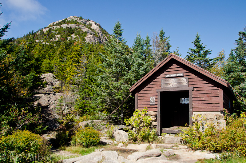
Jim Liberty Cabin
The sign also tells of how all the materials were hauled to the summit by horse and wagon. OK, I can get my mind around horses hauling things up a road, say even to Mount Washington, but the idea of some bastard whippin' horses up a mountain trail like this to support his own greedy endeavors paints an ugly picture in my mind. I think about the horses as I coax my own sore, tired legs down what the guide book describes as "probably the easiest trail to the summit of Chocorua". We pass places in the trail where boulders had obviously been blasted with dynamite to improve the "road". In Liberty's defense it was apparent he had chosen the easiest ascent route, and perhaps the horses didn't have it quite so bad as some other trails I can think of.
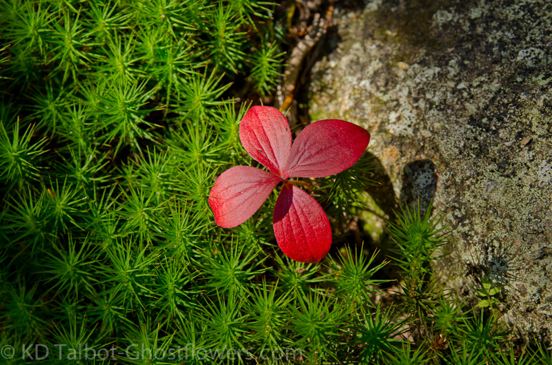
Bunchberry (Cornus canadensis)
It seemed a long way down for me, I moved slowly despite the relatively easy grade and good footing. There were no more ledges to cross, and as the guidebook had also mentioned, this trail was less scenic than the Brook Trail as it passed down through varying woods and never gave a glimpse of the surrounding landscape. After what seemed like forever to me we came at last back to the parking area and our car. We had only seen six other people all day, and two dogs. I was exhausted, it seems there is still a way to go in my rehab, but things are progressing nicely. It was good to be back on the trail and to start getting back into trail shape again. Looking forward to hiking again, soon. Both the Brook and Liberty Trails were new to us, so we can add them to our redlining-Ha-ha!
Full set of pics HERE:
Camping/Paddling pics from the weekend HERE:
KDT
Last edited: