1HappyHiker
Well-known member
Date of Hike: 16-Feb-2011
The name "Willey Pond" of course is the old name for what is now known as Ethan Pond. It was eventually renamed as a tribute to Ethan Allen Crawford who reportedly discovered the pond in 1829 while setting a trap-line. The trek that my friend Steve and I made to Ethan Pond certainly didn't involve anything remotely related to trapping, unless you include our ensnarement in a couple of spruce traps during the off-trail portion of our adventure!
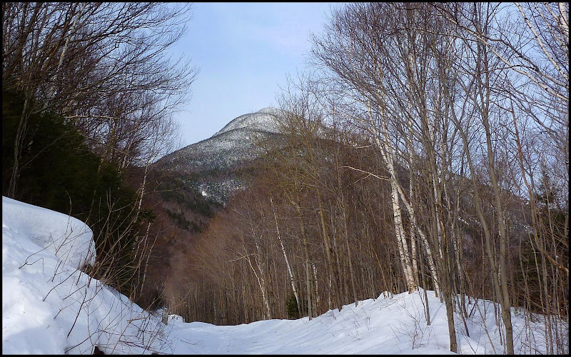
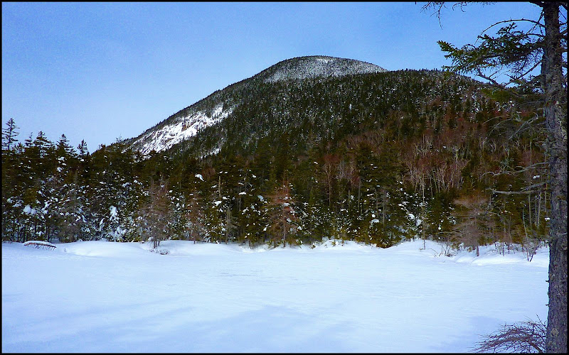
We began our trek at the Ethan Pond trailhead off Rt. 302 in Crawford Notch. After a short road-walk up the Willey House Station Road, we came to railroad tracks and got a nice glimpse of the south-facing end of Mt. Willey.
After trekking 1.6 mile up the Ethan Pond Trail toward Mt. Willey, we would eventually be turning the corner at the base of the mountain and heading due west toward Ethan Pond and the west-facing slope of Mt. Willey. The first of our off-trail excursions was to visit a little pond just a bit east of Ethan Pond. Although it has no official name, some call it Lucy Pond in honor of Ethan Allen Crawford's wife. The view from the shore of Lucy Pond looking toward Mt. Willey was worth the minor inconvenience of falling into a relatively mild-mannered spruce trap during this short 5-minute off-trail trek.
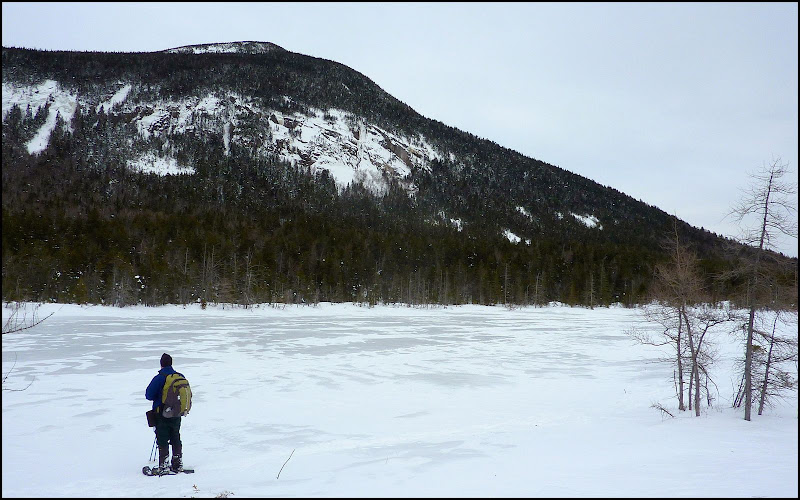
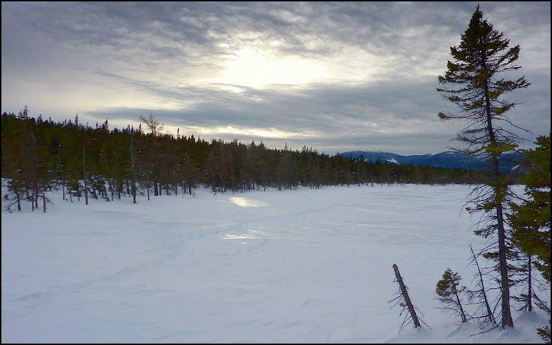
Once we got back onto the trail, it was a short journey to Ethan Pond. There was relatively no wind to speak of, which is a real treat. Oftentimes during the winter months, the wind coming across the pond can be brisk and very bone-chilling! But visiting this spot in winter is the best time (at least in my opinion). You can walk out onto the frozen pond and get some viewing perspectives that are unavailable during warm weather months.
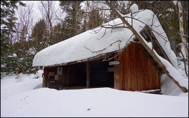
After hanging out at the pond for awhile, we paid a brief visit to the shelter. Although it had quite a snow load on its roof, it seemed to be holding up just fine! I'm not a fisherman, but I am curious about something. I noticed a sign on the inside of the shelter that read something like this. "The taking of trout between two hours after sunset and one hour before sunrise is prohibited." Why is that?
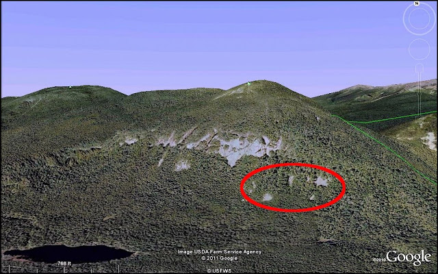
From the back of the shelter, we then launched our next off-trail adventure. Our destination was to one of the nearby talus fields that are located on the southwestern slope of Mt. Willey. There is a cluster of these rock-strewn fields located at about 3,000+ ft elevaton (see GoogleEarth snapshot below). The particular talus field that we visited was very near to one that I had visited during non-snow conditions. And in case you're curious as to what these talus fields look like without a snow cover, there is a snapshot that is included in a Trip Report that I filed for a summer trek to one of these boulder fields on the side of Mt. Willey.
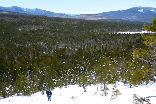
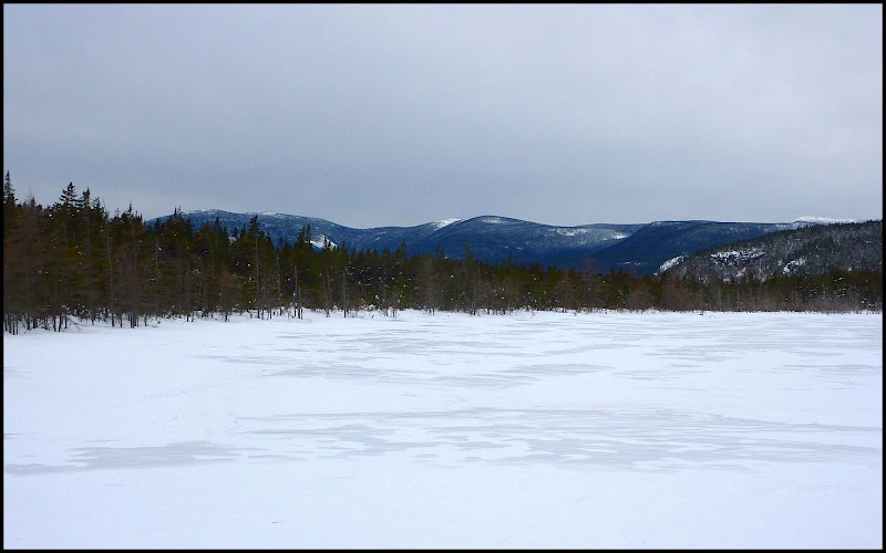
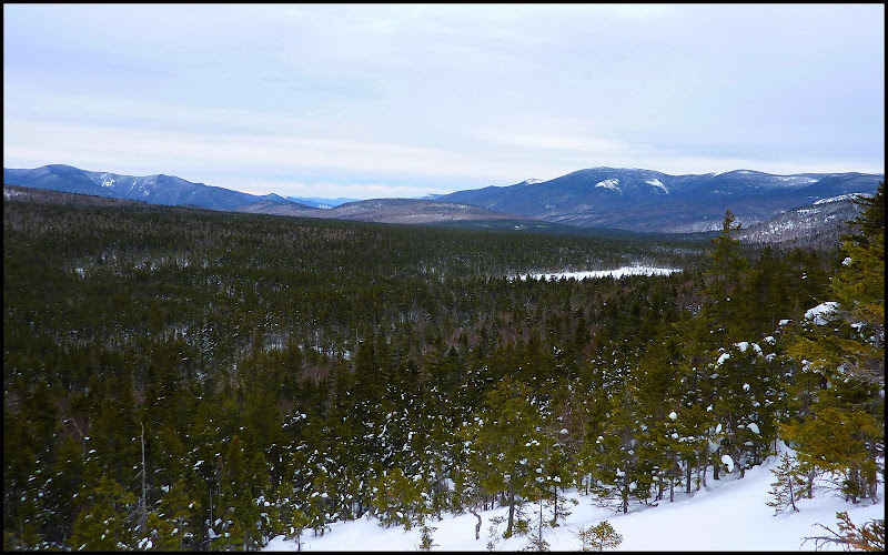
Although it's typical for a bushwhack, it's still sort of amazing (or amusing!) that our ascent to the talus field took just over 40 minutes, whereas our descent took just a tad over 15 minutes! In both directions, we managed to spring several spruce traps, but were able to extricate ourselves from each one with a modest amount of effort. And, if enduring spruce traps is the price of admission to the talus fields, it's a real bargain. The views from there are remarkable! The dominating view is the expansive vista toward peaks in the eastern Pemigewasset Wilderness with Ethan Pond in the foreground (snapshot below).
 And besides the view shown above, there are also nice southward views where the tops of peaks such as Mts. Carrigain, Bemis, Nancy are quite prominent.
After our visit to the talus field, we returned to Ethan Pond for one last look. Although sunset was still at least an hour and half away, there was a "sunset-like" appearance when we arrived at the shore of the pond.
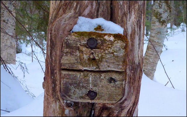
After lingering for a bit, we left the pond and headed back toward the trailhead. Not far from the junction with the Kedron Flume Trail, Steve just happened to spot a very old Appalachian Trail sign. It was very weathered, and had become partially encased by the tree where it had been mounted many decades ago.
We arrived at the trailhead just slightly after the sun had set. We had managed to squeeze every ounce of sunlight out of this day.
1HappyHiker
The name "Willey Pond" of course is the old name for what is now known as Ethan Pond. It was eventually renamed as a tribute to Ethan Allen Crawford who reportedly discovered the pond in 1829 while setting a trap-line. The trek that my friend Steve and I made to Ethan Pond certainly didn't involve anything remotely related to trapping, unless you include our ensnarement in a couple of spruce traps during the off-trail portion of our adventure!
We began our trek at the Ethan Pond trailhead off Rt. 302 in Crawford Notch. After a short road-walk up the Willey House Station Road, we came to railroad tracks and got a nice glimpse of the south-facing end of Mt. Willey.
After trekking 1.6 mile up the Ethan Pond Trail toward Mt. Willey, we would eventually be turning the corner at the base of the mountain and heading due west toward Ethan Pond and the west-facing slope of Mt. Willey. The first of our off-trail excursions was to visit a little pond just a bit east of Ethan Pond. Although it has no official name, some call it Lucy Pond in honor of Ethan Allen Crawford's wife. The view from the shore of Lucy Pond looking toward Mt. Willey was worth the minor inconvenience of falling into a relatively mild-mannered spruce trap during this short 5-minute off-trail trek.
Once we got back onto the trail, it was a short journey to Ethan Pond. There was relatively no wind to speak of, which is a real treat. Oftentimes during the winter months, the wind coming across the pond can be brisk and very bone-chilling! But visiting this spot in winter is the best time (at least in my opinion). You can walk out onto the frozen pond and get some viewing perspectives that are unavailable during warm weather months.
After hanging out at the pond for awhile, we paid a brief visit to the shelter. Although it had quite a snow load on its roof, it seemed to be holding up just fine! I'm not a fisherman, but I am curious about something. I noticed a sign on the inside of the shelter that read something like this. "The taking of trout between two hours after sunset and one hour before sunrise is prohibited." Why is that?
From the back of the shelter, we then launched our next off-trail adventure. Our destination was to one of the nearby talus fields that are located on the southwestern slope of Mt. Willey. There is a cluster of these rock-strewn fields located at about 3,000+ ft elevaton (see GoogleEarth snapshot below). The particular talus field that we visited was very near to one that I had visited during non-snow conditions. And in case you're curious as to what these talus fields look like without a snow cover, there is a snapshot that is included in a Trip Report that I filed for a summer trek to one of these boulder fields on the side of Mt. Willey.
Although it's typical for a bushwhack, it's still sort of amazing (or amusing!) that our ascent to the talus field took just over 40 minutes, whereas our descent took just a tad over 15 minutes! In both directions, we managed to spring several spruce traps, but were able to extricate ourselves from each one with a modest amount of effort. And, if enduring spruce traps is the price of admission to the talus fields, it's a real bargain. The views from there are remarkable! The dominating view is the expansive vista toward peaks in the eastern Pemigewasset Wilderness with Ethan Pond in the foreground (snapshot below).
After our visit to the talus field, we returned to Ethan Pond for one last look. Although sunset was still at least an hour and half away, there was a "sunset-like" appearance when we arrived at the shore of the pond.
After lingering for a bit, we left the pond and headed back toward the trailhead. Not far from the junction with the Kedron Flume Trail, Steve just happened to spot a very old Appalachian Trail sign. It was very weathered, and had become partially encased by the tree where it had been mounted many decades ago.
We arrived at the trailhead just slightly after the sun had set. We had managed to squeeze every ounce of sunlight out of this day.
1HappyHiker
Last edited: