
SpencerVT
Member
I had 3 more vacation days from work for the year, and it looked like a nice stretch of weather in the ADKs, so I took the rest my vacation days starting Weds to hike the remainder of the week:
Weds: Cheney Cobble / North River.
Biked to Boreas Dam, then had to walk on a perfectly good road about 2.5 miles to the base of Cheney Cobble. I hope the DEC changes this rule and allows bikes to the very end of the road because it was rather pointless to have to hike since this road is perfectly suited for bicycles.
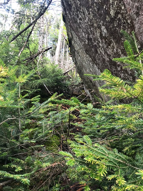
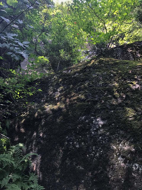
Anyhow, I began the whack up Cheney near where the Slide Brook meets the White Lily Brook. Uncharacteristically for the Adirondacks, I saw lots of moose droppings on this part of Cheney Cobble.
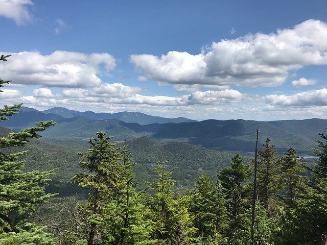
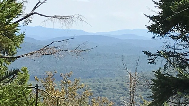
It took me two hours to whack up to the col between the two Cheney knobs. From there it was a pretty quick scramble to the summit of Cheney. This is one of my favorite Adirondacks. The surface area of the summit of Cheney is very small, - maybe half an acre, so there are views in all directions from where it drops off. I got some fantastic photos.
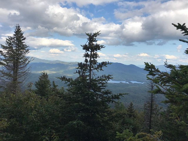
The whack to North River was hellacious suffering. I went over the lower secondary summit of Cheney, which I was told was very bad, but on the other hand I decided to do since I didn't want to lose too much elevation. Class 4 and 5 thickness descending that secondary summit off Cheney into the saddle between North River and Cheney. Once I got up on North River's flanks though, the woods opened up some and it became pretty smooth going. The summit of North River had excellent views as well, I got some great photos of Boreas ponds. Took me 3+ hours just to go from Cheney to North River. The whole hike with bike ride to and from the Dam took me ten hours. It definitely seems that the approach from the Boreas side is considerably easier and shorter than going from the Tahawus side.
In sum:
Hiking just Cheney: not bad, beautiful views
Hiking just North River: not bad, beautiful views.
Hiking from Cheney TO North River = One of Dante's circles of Hell.
Thursday: Cellar Brook Mountain, Cellar and Bradley
On the Cedar River Road there is a grown-up 3 million-year-old log road at mile marker 17. We followed this up to the notch just under Cellar Brook Mountain. From there we continued through the notch to Bradley. Pretty open woods, but it was all upland marsh/rocky swamp which made foot placement very difficult and uneven. However, the cone of Bradley was wide open and extremely easy. We had lunch on Bradley and then cruised back to the Cellar Brook, which also was very open. We descended the steep southern face of Cellar Brook and then met back up with the decrepit log trail.
Next I went up the road and took the Cellar Pond trail towards Cellar. The Cellar Pond trail was ridiculously easy and in 15 minutes I had made it the .9 mile to a high point on the trail to begin the bushwhack ascent.
It was only .2 to the summit of Cellar from this part of the trail, but it was .2 straight up. It was roughly one foot of vertical gain for every two feet forward to reach the summit. It felt like one of those staircases to an ancient Chinese Buddhist temple. The summit was thick and had a sign. I made it back down off Cellar just before dark. Would have been easier to hang-glide off the top back to the Cedar River road.
Friday: Deep Lake Peak, Northrup Pond Peak.
Good Lord, this is so ridiculously far out in the middle of nowhere. No Bank of America or KFC on these peaks. I found exactly ZERO mylar balloons in this section of the Adirondacks, which tells me that this area is so remote, that even the mylar balloons cannot float there! Haha!!
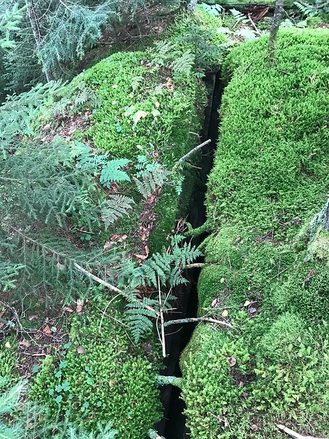
From what I can tell, Northrup Pond Peak is the most remote, inaccessible peak in the Northeast except for the North Woods of Maine. You have to drive a bazillion miles on crude back roads in the West Canada Lakes region to get to the parking area for the trail, then we hiked the trail about 6 miles to the Brooktrout Lake Leanto. (Took a short detour off the trail to summit Deep Lake Peak, which was pretty straight forward. The summit of Deep Lake has this huge fissure in the summit rock which I got a cool photograph of).
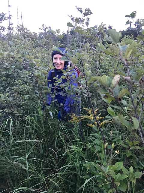
From the leanto we whacked 2 miles to the summit of Northrup Pond Peak. A really beautiful mountain and enjoyable hike. To the best of my knowledge, I believe my wife Renee is the second female to ever stand atop this mountain - pretty cool! There is a tough marsh crossing, that is very wide, but we took it slow and didn't have a problem. Made it back to the leanto at dark and cooked up some delicious food on the campfire. Brooktrout Lake is absolutely stunning and gorgeous. We were lucky to get the leanto, I would highly recommend camping at this leanto, it is such an awesome wilderness setting.
Saturday: Brooktrout Lake Peak, West Lake, Kitty Cobble.
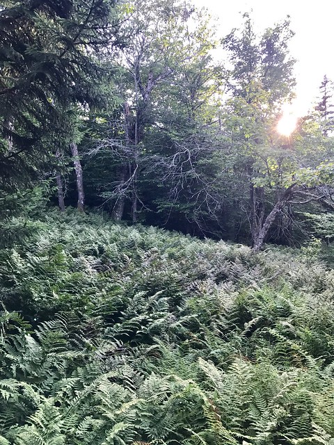
Hiked Brooktrout Lake Peak. Enjoyable peak and pretty straight forward open whack. Some huge cliffs coming off the eastern side, but I was able to get around them without a problem. As I ascended West Lake Peak it got thicker and thicker until pretty soon I was swallowed by Class 4 matchstick monsters. Took me a while to find the true summit because it was so thick. This peak, in all honestly, wasn't that great. No views anywhere, brutal thick summit, just kinda vapid and tedious.
I busted off West Lake Peak and headed toward Kitty Cobble. The woods opened up all the way to just below the summit of Kitty Cobble, where steepness and the conifer monsters closed in on me pretty horrifically until I topped out. I found a really really nice peak-out view off Kitty Cobble, which I think looked way over towards Pillsbury mountain. Perfect weather, not a cloud in the sky. I descended Kitty Cobble from the north side which was pretty open, except for some hobblebush and a beaver pond I had to tightrope balance near the dam to get across. I made it down to the Otter Brook trail, which is dead flat and an easy 2.5 mile walk back to civilization.
Exhausted from 4 days and ten peaks of mostly hard remote ADK bushwhacking, I ate like the entire menu at the Ambrosia diner on the way home, and then fell asleep for 17 hours straight; yes, 17 hours.
Weds: Cheney Cobble / North River.
Biked to Boreas Dam, then had to walk on a perfectly good road about 2.5 miles to the base of Cheney Cobble. I hope the DEC changes this rule and allows bikes to the very end of the road because it was rather pointless to have to hike since this road is perfectly suited for bicycles.
Anyhow, I began the whack up Cheney near where the Slide Brook meets the White Lily Brook. Uncharacteristically for the Adirondacks, I saw lots of moose droppings on this part of Cheney Cobble.
It took me two hours to whack up to the col between the two Cheney knobs. From there it was a pretty quick scramble to the summit of Cheney. This is one of my favorite Adirondacks. The surface area of the summit of Cheney is very small, - maybe half an acre, so there are views in all directions from where it drops off. I got some fantastic photos.
The whack to North River was hellacious suffering. I went over the lower secondary summit of Cheney, which I was told was very bad, but on the other hand I decided to do since I didn't want to lose too much elevation. Class 4 and 5 thickness descending that secondary summit off Cheney into the saddle between North River and Cheney. Once I got up on North River's flanks though, the woods opened up some and it became pretty smooth going. The summit of North River had excellent views as well, I got some great photos of Boreas ponds. Took me 3+ hours just to go from Cheney to North River. The whole hike with bike ride to and from the Dam took me ten hours. It definitely seems that the approach from the Boreas side is considerably easier and shorter than going from the Tahawus side.
In sum:
Hiking just Cheney: not bad, beautiful views
Hiking just North River: not bad, beautiful views.
Hiking from Cheney TO North River = One of Dante's circles of Hell.
Thursday: Cellar Brook Mountain, Cellar and Bradley
On the Cedar River Road there is a grown-up 3 million-year-old log road at mile marker 17. We followed this up to the notch just under Cellar Brook Mountain. From there we continued through the notch to Bradley. Pretty open woods, but it was all upland marsh/rocky swamp which made foot placement very difficult and uneven. However, the cone of Bradley was wide open and extremely easy. We had lunch on Bradley and then cruised back to the Cellar Brook, which also was very open. We descended the steep southern face of Cellar Brook and then met back up with the decrepit log trail.
Next I went up the road and took the Cellar Pond trail towards Cellar. The Cellar Pond trail was ridiculously easy and in 15 minutes I had made it the .9 mile to a high point on the trail to begin the bushwhack ascent.
It was only .2 to the summit of Cellar from this part of the trail, but it was .2 straight up. It was roughly one foot of vertical gain for every two feet forward to reach the summit. It felt like one of those staircases to an ancient Chinese Buddhist temple. The summit was thick and had a sign. I made it back down off Cellar just before dark. Would have been easier to hang-glide off the top back to the Cedar River road.
Friday: Deep Lake Peak, Northrup Pond Peak.
Good Lord, this is so ridiculously far out in the middle of nowhere. No Bank of America or KFC on these peaks. I found exactly ZERO mylar balloons in this section of the Adirondacks, which tells me that this area is so remote, that even the mylar balloons cannot float there! Haha!!
From what I can tell, Northrup Pond Peak is the most remote, inaccessible peak in the Northeast except for the North Woods of Maine. You have to drive a bazillion miles on crude back roads in the West Canada Lakes region to get to the parking area for the trail, then we hiked the trail about 6 miles to the Brooktrout Lake Leanto. (Took a short detour off the trail to summit Deep Lake Peak, which was pretty straight forward. The summit of Deep Lake has this huge fissure in the summit rock which I got a cool photograph of).
From the leanto we whacked 2 miles to the summit of Northrup Pond Peak. A really beautiful mountain and enjoyable hike. To the best of my knowledge, I believe my wife Renee is the second female to ever stand atop this mountain - pretty cool! There is a tough marsh crossing, that is very wide, but we took it slow and didn't have a problem. Made it back to the leanto at dark and cooked up some delicious food on the campfire. Brooktrout Lake is absolutely stunning and gorgeous. We were lucky to get the leanto, I would highly recommend camping at this leanto, it is such an awesome wilderness setting.
Saturday: Brooktrout Lake Peak, West Lake, Kitty Cobble.
Hiked Brooktrout Lake Peak. Enjoyable peak and pretty straight forward open whack. Some huge cliffs coming off the eastern side, but I was able to get around them without a problem. As I ascended West Lake Peak it got thicker and thicker until pretty soon I was swallowed by Class 4 matchstick monsters. Took me a while to find the true summit because it was so thick. This peak, in all honestly, wasn't that great. No views anywhere, brutal thick summit, just kinda vapid and tedious.
I busted off West Lake Peak and headed toward Kitty Cobble. The woods opened up all the way to just below the summit of Kitty Cobble, where steepness and the conifer monsters closed in on me pretty horrifically until I topped out. I found a really really nice peak-out view off Kitty Cobble, which I think looked way over towards Pillsbury mountain. Perfect weather, not a cloud in the sky. I descended Kitty Cobble from the north side which was pretty open, except for some hobblebush and a beaver pond I had to tightrope balance near the dam to get across. I made it down to the Otter Brook trail, which is dead flat and an easy 2.5 mile walk back to civilization.
Exhausted from 4 days and ten peaks of mostly hard remote ADK bushwhacking, I ate like the entire menu at the Ambrosia diner on the way home, and then fell asleep for 17 hours straight; yes, 17 hours.
 ).
).