
IQuest
New member
On Saturday the dial landed on Carrigain and after reading krpayer's backpacking report I eagerly wanted to check out Stillwater Jctn and finish off some redlining in the area. Marlie and I arrived at the Signal Ridge TH on Sawyer River Rd later than desired but still had boots/paws on trail at 7:20am.
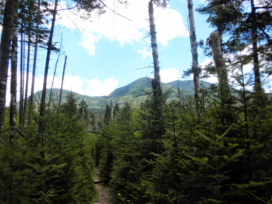
We headed up the new relocated section which has the typical greasy mud that a new trail comes with. Often times I could see the old trail a short distance below, near the brook. After passing the logging road we reached the old junction of Signal Ridge/Carrigain Notch Trails. One key note here is that these changes are not in the 29th edt WMG. The junction of Signal Ridge Tr and Carrigain Notch Tr has been moved about .2 miles up Carrigain Notch Tr and is after the crossing of Carrigain Brook. They have also added some switch backs and a small PUD after the junction on a reroute around the beaver ponds.
We worked our way up and eventually made it to Signal Ridge. It was raining that morning as I drove across the Kanc but now the clouds were clearing and most importantly, they had risen from most of the sumits.

My original plan was to cross the summit, descend the Desolation Tr, go to Stillwater Jctn, double back, ascend to Norcross Pond along Carrigain Notch and Nancy Pond Tr, then whack over Mt Anderson to Carrigain Notch and return on the trails. This was all planned to avoid a 3.2 mile road walk. Pretty ambitious and with the late start I wasn't sure if I would make it home before my boy went to bed. I decide to take a seat and enjoy some beef jerky and views and consider my options. A leisurly in and back to the summit would be nice but a loop is always better. Maybe I could just go to Stillwater Jctn the out through Carrigain Notch. That would be about 15 miles and seemed reasonable for time. Looking across the notch Mt Anderson was staring back, as was his brother Mt Lowell. Here I noticed a small bald patch on each summit that I had never noticed before. I reat about these in a TR from Bryan and they seemed worthy of a visit but probably not today. As I gnawed on a piece of jerky I decided to at least descend the Desolation Tr then decide again. On my third piece of jerky I noticed that it tasted wierd. I looked at the back of the packaging for some reason and noticed that it said "use within 3 day of opening or keep refridgerated". It had been in my pack for about a month after being opened weeks earlier (it was a jumbo pack). When I fliped it over and looked through the window on the front I saw the jerkey inside coverd with white fuzz! :x
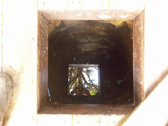
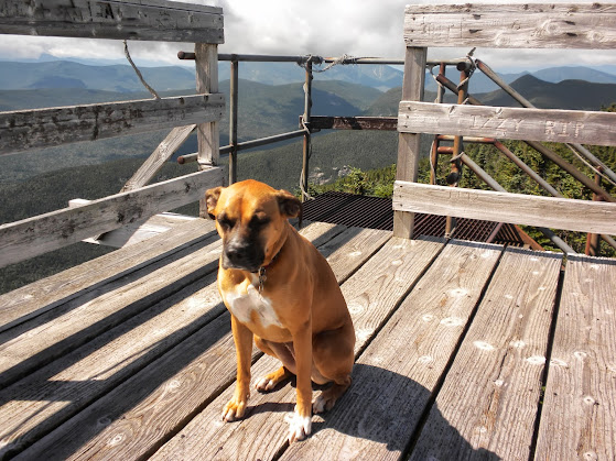
That ruined the moment, so after washing out the taste I ate a granola bar and headed to the summit. We stopped briefly at the old cabin site to check out the well and were on the tower at 10:30.
There were a few others at the summit and after another short break we headed down the Desolation Tr.
The desolation trail is very brushy near the summit but soon opens up. The rocks are very slick on this trail, probably because it is shaded most of the day. There was a large flat one, slightly sloping, that I slid off like it was covered in ice. As we descended we passed some old telegraph wire. Does anyone know where they ran to? Maybe Lincoln?
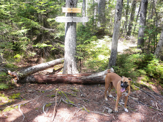
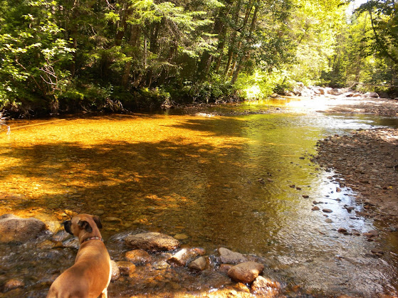
After crossing the brook we met the Carrigain Notch Tr and headed to Stillwater Jctn. This area has always intrigued me with it's remote feel and sense of solitude. No roads for at least 7 miles! We checked out the river at a few points along this section of Carrigain Notch Tr admiring the damage and finding some ledges that looked good for swimming. At Stillwater Jctn we crossed the East Branch on the Shoal Pond Trail and poked around a little before doubling back.
I was feeling good at this point, really good for some reason, and it was only noon. I decided to go for it and headed for Norcross Pond. The whole reason of going to the pond as part of the original plan was to redline the section of Nancy Pond Tr from Carrigain Notch Tr to Norcross Pond and I really didn't want to come back for that reason and I was so close. I decided that I would skip the whack though, and descend Nancy Pond Tr and walk the roads. It would add about 2.2 miles but would probably go quicker than the whack. Besides, maybe someone with a pickup would give us a ride up Sawyer River Rd.
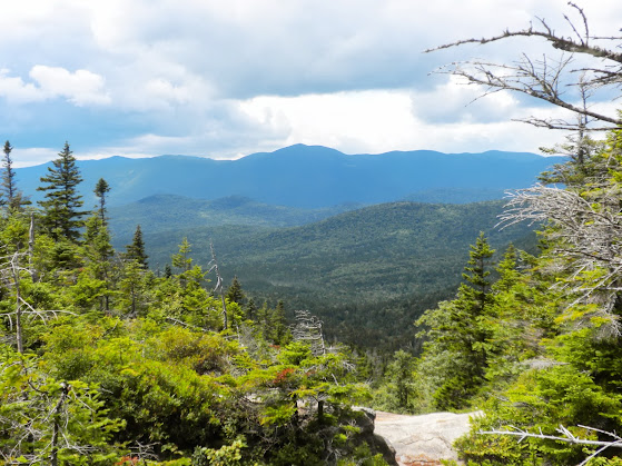
From Stillwater Jctn we motored up the Carrigain Notch and Nancy Pond Trails crossing multiple tributaries that run from the headwaters of the Pemi. The forest through here is absolutely beautiful and gives me a great sense of being disconnected. It also had an interesting view of Mt Carrigain and Vose Spur.
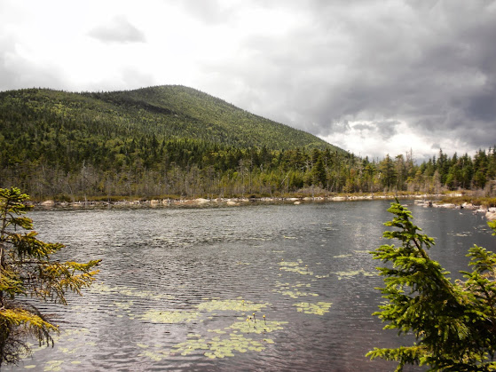
After passing the old Camp 19 clearing the trail begins to ascend along an old woods road all the way to the outlet of Norcross Pond. The grades are very kind and the footing was great. It was now 1:25 pm and we had made the 4.4 mile, 1180' climb in less that a hour and a half. :shock:
After crossing the outlet there is a maze of old trail, new trail, herd paths to camsites, and the abandoned spur to Mt Nancy. Even though I wasn't doing the whack I scoped out Mt Anderson which did not look too bad as long as the ledges are avoided.
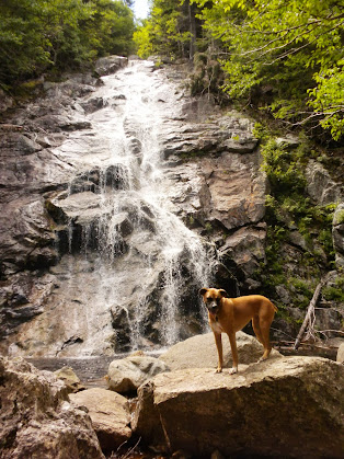
We then headed down the Nancy Pond Tr passing Nancy Pond, Nancy Cascade, a section of new trail being built high up on the bank, and the old Lucy Mill. It's sad to see these trails all being located further away from the rivers. I know it may be necessary to sustain the trail but there is something relaxing about hiking up next to and within sight of the water.
We stopped at the second to last crossing and I filtered some water before making the final push and road walk. The walk on 302 sucked and I was chased by a swarm of gnats on Sawyer River Rd :evil: but at least we got the road walk done in about an hour. We arrived back at my truck a 4:05 pm, plenty of time to get home before bed time. It was an excellent day out exploring a new corner of the forest and redlining some new miles!
The Pics: https://plus.google.com/photos/1175...581678131843187857/albums/5908409039203172993
NETC: http://www.newenglandtrailconditions.com/nh/viewreport.php?entryid=13558
We headed up the new relocated section which has the typical greasy mud that a new trail comes with. Often times I could see the old trail a short distance below, near the brook. After passing the logging road we reached the old junction of Signal Ridge/Carrigain Notch Trails. One key note here is that these changes are not in the 29th edt WMG. The junction of Signal Ridge Tr and Carrigain Notch Tr has been moved about .2 miles up Carrigain Notch Tr and is after the crossing of Carrigain Brook. They have also added some switch backs and a small PUD after the junction on a reroute around the beaver ponds.
We worked our way up and eventually made it to Signal Ridge. It was raining that morning as I drove across the Kanc but now the clouds were clearing and most importantly, they had risen from most of the sumits.
My original plan was to cross the summit, descend the Desolation Tr, go to Stillwater Jctn, double back, ascend to Norcross Pond along Carrigain Notch and Nancy Pond Tr, then whack over Mt Anderson to Carrigain Notch and return on the trails. This was all planned to avoid a 3.2 mile road walk. Pretty ambitious and with the late start I wasn't sure if I would make it home before my boy went to bed. I decide to take a seat and enjoy some beef jerky and views and consider my options. A leisurly in and back to the summit would be nice but a loop is always better. Maybe I could just go to Stillwater Jctn the out through Carrigain Notch. That would be about 15 miles and seemed reasonable for time. Looking across the notch Mt Anderson was staring back, as was his brother Mt Lowell. Here I noticed a small bald patch on each summit that I had never noticed before. I reat about these in a TR from Bryan and they seemed worthy of a visit but probably not today. As I gnawed on a piece of jerky I decided to at least descend the Desolation Tr then decide again. On my third piece of jerky I noticed that it tasted wierd. I looked at the back of the packaging for some reason and noticed that it said "use within 3 day of opening or keep refridgerated". It had been in my pack for about a month after being opened weeks earlier (it was a jumbo pack). When I fliped it over and looked through the window on the front I saw the jerkey inside coverd with white fuzz! :x
That ruined the moment, so after washing out the taste I ate a granola bar and headed to the summit. We stopped briefly at the old cabin site to check out the well and were on the tower at 10:30.
There were a few others at the summit and after another short break we headed down the Desolation Tr.
The desolation trail is very brushy near the summit but soon opens up. The rocks are very slick on this trail, probably because it is shaded most of the day. There was a large flat one, slightly sloping, that I slid off like it was covered in ice. As we descended we passed some old telegraph wire. Does anyone know where they ran to? Maybe Lincoln?
After crossing the brook we met the Carrigain Notch Tr and headed to Stillwater Jctn. This area has always intrigued me with it's remote feel and sense of solitude. No roads for at least 7 miles! We checked out the river at a few points along this section of Carrigain Notch Tr admiring the damage and finding some ledges that looked good for swimming. At Stillwater Jctn we crossed the East Branch on the Shoal Pond Trail and poked around a little before doubling back.
I was feeling good at this point, really good for some reason, and it was only noon. I decided to go for it and headed for Norcross Pond. The whole reason of going to the pond as part of the original plan was to redline the section of Nancy Pond Tr from Carrigain Notch Tr to Norcross Pond and I really didn't want to come back for that reason and I was so close. I decided that I would skip the whack though, and descend Nancy Pond Tr and walk the roads. It would add about 2.2 miles but would probably go quicker than the whack. Besides, maybe someone with a pickup would give us a ride up Sawyer River Rd.
From Stillwater Jctn we motored up the Carrigain Notch and Nancy Pond Trails crossing multiple tributaries that run from the headwaters of the Pemi. The forest through here is absolutely beautiful and gives me a great sense of being disconnected.
It also had an interesting view of Mt Carrigain and Vose Spur.
After passing the old Camp 19 clearing the trail begins to ascend along an old woods road all the way to the outlet of Norcross Pond. The grades are very kind and the footing was great. It was now 1:25 pm and we had made the 4.4 mile, 1180' climb in less that a hour and a half. :shock:
After crossing the outlet there is a maze of old trail, new trail, herd paths to camsites, and the abandoned spur to Mt Nancy. Even though I wasn't doing the whack I scoped out Mt Anderson which did not look too bad as long as the ledges are avoided.
We then headed down the Nancy Pond Tr passing Nancy Pond, Nancy Cascade, a section of new trail being built high up on the bank, and the old Lucy Mill. It's sad to see these trails all being located further away from the rivers. I know it may be necessary to sustain the trail but there is something relaxing about hiking up next to and within sight of the water.
We stopped at the second to last crossing and I filtered some water before making the final push and road walk. The walk on 302 sucked and I was chased by a swarm of gnats on Sawyer River Rd :evil: but at least we got the road walk done in about an hour. We arrived back at my truck a 4:05 pm, plenty of time to get home before bed time.
It was an excellent day out exploring a new corner of the forest and redlining some new miles!The Pics: https://plus.google.com/photos/1175...581678131843187857/albums/5908409039203172993
NETC: http://www.newenglandtrailconditions.com/nh/viewreport.php?entryid=13558
Last edited: