DSettahr
Active member
- Joined
- Apr 23, 2005
- Messages
- 980
- Reaction score
- 141
I've only had 2 Catskill High Peaks (Graham and Balsam Lake Mountains) and 1 Fire Tower Challenge peak (Balsam Lake Mountain) left for over a year. I could have easily finished both well before now... but I wanted to do it right. I had my eye on a 4 day, 30 mile backpacking trip in the Western Catskills, and this past weekend I finally had the chance to actually do it.
My plan was to do the loop from Black Bear/Basily Roads, which would allow me to not only climb Graham and Balsam Lake Mountains, but also check out the Fall Brook and Long Pond areas, and also summit a Catskill Hundred Highest peak, Willowemoc Mountain.
I arrived at the Black Bear Road parking area at the intersection with Basily Road early Friday afternoon. Rather than park at the end of Black Bear Road, I decided to park here as it would lessen the amount of hiking I'd need to do on the last day. I was afraid that hiking up Black Bear Road would be a drudge, but instead it turned out to be a very pleasant hike up a dirt road. I saw no traffic, and passed by some very nice looking hunting camps, and fields with great views of Doubletop as well as the Burroughs Range in the distance.
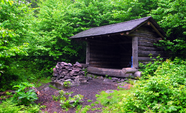
Soon I was in the woods, on state land and leaving the developed road behind. The Venture Out map shows several parking areas at the end of Black Bear Road- neither really exist. There's also no gate or barrier where the wilderness area begins... and it looks like there has been some 4WD traffic on state land. I know there are private in holdings north in the Beaverkill Valley, but this looked more like it was illegal motorized vehicle access to the lean-to.
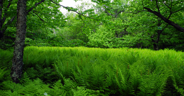
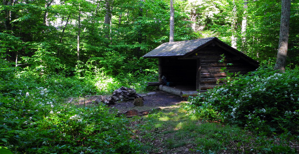
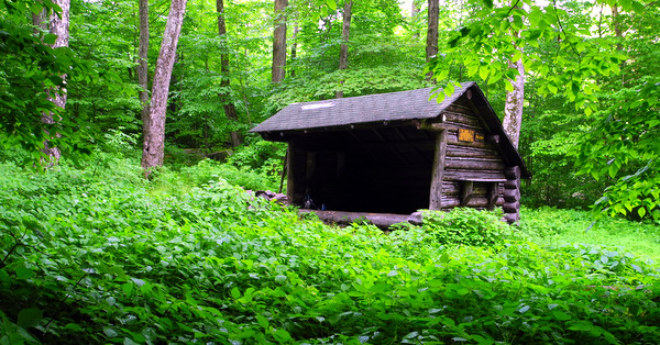
The old road obviously doesn't get much use or maintenance, but it's still in decent shape and I made good time to the lean-to. The lean-to is in a small clearing, pretty overgrown with ferns and other perennials. Both the trail and the lean-to clearly get little use- in fact I think the majority of traffic that passes through this area is the occasional through hiker on the Finger Lakes Trail. There was quite a bit of mention of snowmobile use in the winter in the lean-to register, though- I would've thought that being in a wilderness area, this trail would not be open to snowmobile traffic, though.
In any case, the lean-to was in good shape, and I enjoyed my night there. I'm not sure I've ever felt as remote in the Catskills as I did there... perhaps at Echo lake... the dense forest pressing in from all sides of the lean-to did much to enhance the feeling that I was far away from civilization!
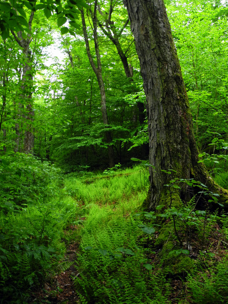
Saturday morning dawned with a fair amount of clouds in the sky and little sun. I was up by 6 and hiking by 6:30, following the trail north. The old road faded quickly, and soon I was passing through some wet spots along the edge of swamps and wetlands. Beyond, the trail started to lose elevation, and it wasn't long before I reached the Beaver Kill.
Irene had clearly sent a lot of water down this valley, and a significant portion of the trail was completely obliterated. I ended up crossing the river too soon, and bushwhacking for a bit before I realized my mistake and crossed back. Even beyond the obliterated section, there were parts where the trail was reduced to a tread only a few inches wide. Fortunately, I had no major issues navigating, though, and soon I was on the woods road that is used by private land owners to access their camps in the valley.
I had wanted to visit Tunis Pond, so I kept an eye out for any herd paths that might lead to it (the Venture Out map shows several) but I never saw anything obvious. The two designated tent sites in the valley obviously don't get much use- the eastern most one was a sizable clearing filled with ferns and looked like it hadn't been used in years. The western most site had been damaged by Irene, reduced to a cobble surface, but it looked like it'd been used more recently. Neither had any sort of marking if you're headed east on the trail, and might be hard to locate for those coming from the Balsam Lake Mountain trailhead (there were markers for those heading west, however).
The rest of the trail was pretty straightforward to the BLM parking lot. I also saw a group camped out in the field near the lot- not sure that this is a legal site, but it obviously gets some use. By the time I reached the lot, the weather had changed for the worse- the clouds had completely taken over and there was a steady rainfall.
Once I reached the BLM trail itself, the character of the path changed significantly. No longer was I on a woods path that received little use... now I was on a highway, at least until the turn off where the direct route climbs straight up the peak. Rather than head to BLM first, I decided to continue up the old road so that I could summit Graham. The old road made for some nice hiking (especially with my full pack!) although parts of it were washed out or overgrown.
The turn off for the herd path to Graham was easy to spot- a very obvious old road that leaves the main woods road in the gap between BLM and Graham, marked with a small cairn. I dropped my pack behind a tree, grabbed some water and food, and started up with the drizzling rain. The climb up Graham went easily enough, a few steep spots, a few muddy spots, some overgrown spots, but for a herd path it was in surprisingly good shape. The path more or less follows the old Jeep trail straight to the summit.
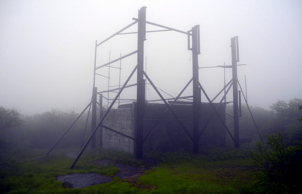
Being on the summit of Graham, with the thick clouds, drizzle, and abandoned TV tower was a bit of an eerie experience. I grabbed some food and water quickly... I was happy to be there (one more Catskill High Peak, Catskill Hundred Highest, and Ultra Fire Tower Challenge peak down!) but not eager to spend much time in the cold and wet, and I wanted to keep moving to BLM.
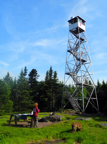
I made good time my way back to the old road, grabbed my pack, and started up the old road to the summit of BLM. From the junction, the climb is barely even noticeable, and soon I could see the firetower ahead of me through the mist.
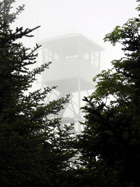
The weather on the top of BLM contrasted even with what I had encountered on Graham. While Graham had been cloudy and wet, there had been little wind, yet on BLM the wind was whipping up pretty good. And this despite Graham being the taller of the two peaks! Go figure. There was an older couple volunteering on the summit for the weekend. I spent some time in the tower with the husband, but there wasn't much fore views so I climbed down to check out the cabin. The wife was in the cabin and invited me in for some tea, which I gladly accepted. She had a nice fire going in the wood stove and the cabin was a great respite from the elements.
As with all of the other lists I've finished, the feeling was somewhat surreal... it's always hard to believe when a list is finally done and over with. Immediately my mind is like "ok, so what next?" There's always more lists to be working on!
My ultimate destination for the day was the lean-to south of the summit of BLM, and due to my early start, I made it there by 2 pm, much sooner than I'd expected. I thought about perhaps continuing on over the Beaver Kill Ridge, or maybe even relocating to the lean-to near Alder Lake to the west instead, but ultimately decided that I'd had enough of the rain and was going to stay put where I was. I had a nice afternoon staying dry in the lean-to. It got quite cold at night, enough that I wore long underwear to bed!
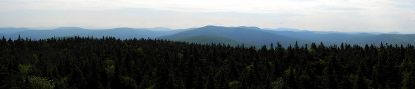
The next morning arrived bright and sunny with clear blue skies, and I decided that there was no way I was leaving BLM without getting to enjoy the views. Since the summit was a meager quarter of a mile and 200 feet in elevation away, after packing up I ran back up. I'm glad I returned, the views were definitely worth the return trip! There were also fresh bear tracks in the trail that hadn't been there the afternoon before!
-------------------------------
Continued in next post...