I havent been up there this winter but the area gets a lot of use. Unless you need that section of Mahoosuc trail, its actually more convenient to climb from the Hogan road in Shelburne via the Centennial trail. There is a cabin that is used by mostly AMC managers off Hogan Road so that side gets more traffic. The summit is not marked and before you reach it, you cross the south summit then go back in the woods. If you go this way, its worth spending the time to head to the ledges via the Mahoousuc trail (back to Gorham).
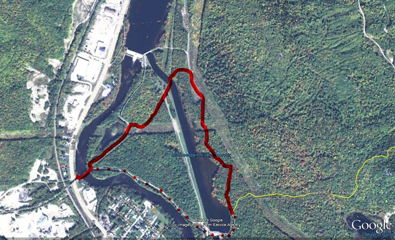
If you do take the RT 16 approach, the first 1.5 miles until the turn off of Hogan Road is poorly marked. Basically cross the train trestle and climb up the steep slope to the snowmachine trail (former railroad bed), follow the old railroad bed until you cross the river again, take an immediate right turn after crossing the bridge and walk by an old car in the woods. Follow the path to the Hogan road next to the power lines (which is also a snowmachine trail) and follow the road downriver which runs parallel with the river. When you see a hydro dam in the river look left. There should be a AMC sign. If you walk past the hydro dam you have gone too far. Turn around and look for an old woods road that goes up into the woods. The short spur to Mascot Pond is worth the five minutes . About half way up the mountain you cross an obvious old woods road, if you take a right off the trail and walk about 100 feet, there is a steep slope to your right, climb up the slope and there is very good view. When you get back on the trail it runs through hardwoods then cuts into softwood before coming out on the best view. This is not the summit, the trail goes back into the softwoods and runs basically flat until a slight rise where you come out at the junction with the Centennial trail whihc is in the general area of the assumed summit.

")