
IQuest
New member
After heading off from Starr King Rd we traveled east on US2. The AMC guide says to drive 1.1 miles east from the jctn of US2 and NH115 and park on a grassy knoll on the south side of the road. I parked on the hill opposite from the spring since there was signs of other vehicles packing down the grass but I'm not sure if this is the correct spot.
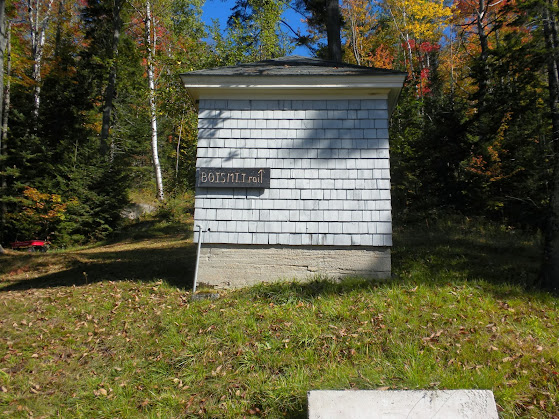
Across the way there were two houses and a couple of private driveways. I knew that there was no sign but I had really no idea where to look. There were some locals at the spring and they had no idea what I was talking about. I then walked up to one of the houses on Boismont Dr (AMC Guide mentions this drive but the sign was hidden by a tree branch) where some people told me thay were only renting. They said that there was a trail map inside but I declined since Marlie was with me. I thanked them then walked up behind the house on the right hoping someone would see me and give me some direction. No one was around but all the way behind the house, near the garage, I found the first sign.
There is almost no noticeable treadway and after a short section through the trees it joins an old road. It reminded me of hiking up Dorset Pk in VT.
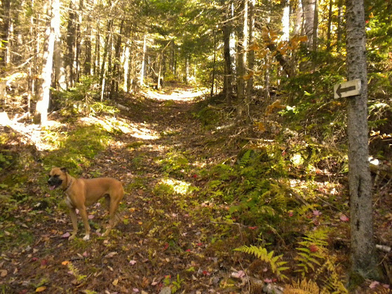
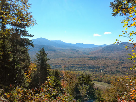
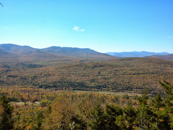
This trail is only .7 mi but gains 650'. It follows aome wooden signs with arrows, avoiding other old woods roads, and eventually gets a little rougher and steeper as it reaches an area recently logged. Some obstructed views of Starr King, Waumbek, and Pliny Mtn could be seen along the way. Just before the summit the trail ends at the ledge with an excellent view. I believe evening would be best for lighting here.
After stepping on the summit, we returned to my truck. This hike had taken us about 45 min. It is a nice out of the way hike. Needless to say we saw no one else on the trail. Now off to #3.
The Pics: https://plus.google.com/photos/117581678131843187857/albums/5929182438217687761
NETC: http://www.newenglandtrailconditions.com/nh/viewreport.php?entryid=14086
Across the way there were two houses and a couple of private driveways. I knew that there was no sign but I had really no idea where to look. There were some locals at the spring and they had no idea what I was talking about. I then walked up to one of the houses on Boismont Dr (AMC Guide mentions this drive but the sign was hidden by a tree branch) where some people told me thay were only renting. They said that there was a trail map inside but I declined since Marlie was with me. I thanked them then walked up behind the house on the right hoping someone would see me and give me some direction. No one was around but all the way behind the house, near the garage, I found the first sign.
There is almost no noticeable treadway and after a short section through the trees it joins an old road. It reminded me of hiking up Dorset Pk in VT.
This trail is only .7 mi but gains 650'. It follows aome wooden signs with arrows, avoiding other old woods roads, and eventually gets a little rougher and steeper as it reaches an area recently logged. Some obstructed views of Starr King, Waumbek, and Pliny Mtn could be seen along the way. Just before the summit the trail ends at the ledge with an excellent view. I believe evening would be best for lighting here.
After stepping on the summit, we returned to my truck. This hike had taken us about 45 min. It is a nice out of the way hike. Needless to say we saw no one else on the trail. Now off to #3.
The Pics: https://plus.google.com/photos/117581678131843187857/albums/5929182438217687761
NETC: http://www.newenglandtrailconditions.com/nh/viewreport.php?entryid=14086