
Becca M
Active member
June 9, 2012: Cave Mtn, Mt Parker, Mt Resolution using Cave Mountain Spur, Mt. Langdon Trail, Mt. Parker Trail, bushwhack, and the Davis Path
First thing to do was drop off the mountain bike at the Davis Path Trailhead on 302. Only 2 cars in that lot as I unpacked my hiking-crap-filled car and lifted my bike out. Walking my bike along the path to a good hiding/locking spot, a friendly couple greeted me and wished me a good bike ride… they looked a little confused when I emerged from the woods a minute later without the bike and drove away...
...to the cute town of Bartlet!!! I meant to clock the distance but forgot to set my trip odometer. Anyway, I was hoping there wasn’t much uphill for the way back since I’d be fully loaded with my pack and boots on my bike. Got to Bartlet, threw the pack on and started up… hit a LOT of logging areas. Not entirely clear which way to go, but, I didn’t get lost. Some of the recent skidder paths could be easily mistaken for the trail….Cave Mtn spur Was marked. Yay!!! The cave just below the top was quite a special place – a little wet with dripping water, but, aren’t most caves like that? Back down I leapfrogged a father/son team on their way up to the ridge.
Once up and along the ridge, there were occasional views in all directions, fairly flat ledges, and, just an amazing place to be! Some areas and spur paths were very difficult to follow—I wondered if they were being abandoned but maybe not/maybe so? I had a little trouble finding the summit of Mt Resolution but just found some rocks and claimed it. On the descent, I took my time to look around. Back at the bike, I fought off the bugs as I tried to swap shoes and tie my boots onto my pack. The ride wasn’t difficult back to my car – maybe 45 minutes as I was passed by many motorcyclists and road bikes.
At the end of the day, a cool dip in the Saco River, right across from the trailhead, was a good but chilly place to take a dip on my way back to meet Mark T/Silverfox for an awesome dinner at the quaint Squam Lake Inn… the perfect end to a GREAT day!!!! I hope you enjoy!!!!
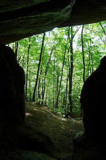
Looking out from the cave on Cave Mountain
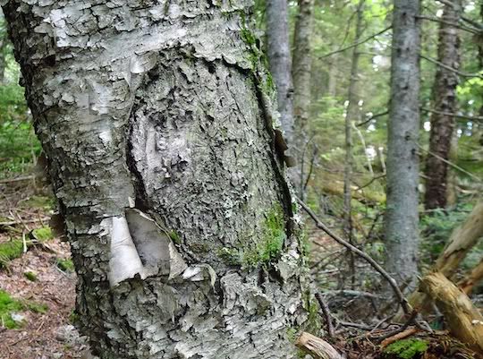
Circle on Birch – COOL!
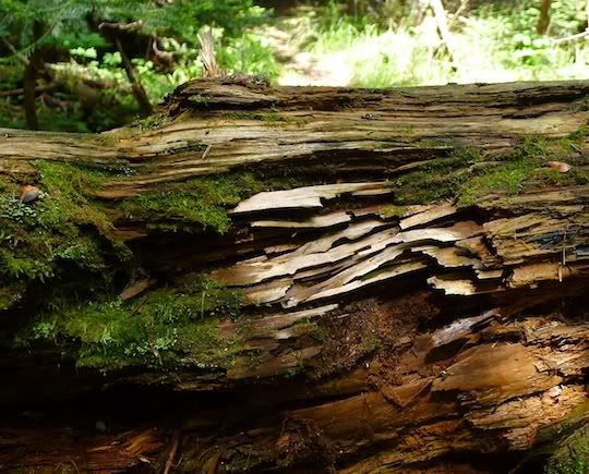
Decaying wood/parallel lines!
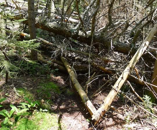
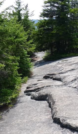
Between Mts Parker and Resolution, the trail often looked like this. The trail is straight ahead!!!
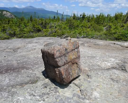
That’s a cubic rock – where are all the other giant dice????
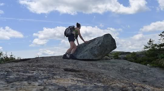
Spider woman, yours truly, just missing the 10-sec self timer on her camera
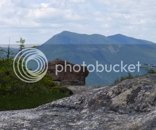
ANOTHER giant squared-off rock sitting in front of the Willey Range
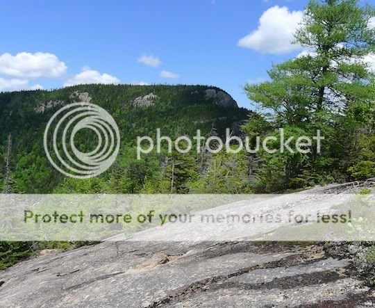
Unique view of the Giant Stairs from Mt Parker Trail
And, almost down, on the Davis Path, the rock looked like giant “hands” pointing downhill!
First thing to do was drop off the mountain bike at the Davis Path Trailhead on 302. Only 2 cars in that lot as I unpacked my hiking-crap-filled car and lifted my bike out. Walking my bike along the path to a good hiding/locking spot, a friendly couple greeted me and wished me a good bike ride… they looked a little confused when I emerged from the woods a minute later without the bike and drove away...
...to the cute town of Bartlet!!! I meant to clock the distance but forgot to set my trip odometer. Anyway, I was hoping there wasn’t much uphill for the way back since I’d be fully loaded with my pack and boots on my bike. Got to Bartlet, threw the pack on and started up… hit a LOT of logging areas. Not entirely clear which way to go, but, I didn’t get lost. Some of the recent skidder paths could be easily mistaken for the trail….Cave Mtn spur Was marked. Yay!!! The cave just below the top was quite a special place – a little wet with dripping water, but, aren’t most caves like that? Back down I leapfrogged a father/son team on their way up to the ridge.
Once up and along the ridge, there were occasional views in all directions, fairly flat ledges, and, just an amazing place to be! Some areas and spur paths were very difficult to follow—I wondered if they were being abandoned but maybe not/maybe so? I had a little trouble finding the summit of Mt Resolution but just found some rocks and claimed it. On the descent, I took my time to look around. Back at the bike, I fought off the bugs as I tried to swap shoes and tie my boots onto my pack. The ride wasn’t difficult back to my car – maybe 45 minutes as I was passed by many motorcyclists and road bikes.
At the end of the day, a cool dip in the Saco River, right across from the trailhead, was a good but chilly place to take a dip on my way back to meet Mark T/Silverfox for an awesome dinner at the quaint Squam Lake Inn… the perfect end to a GREAT day!!!! I hope you enjoy!!!!
Looking out from the cave on Cave Mountain
Circle on Birch – COOL!
Decaying wood/parallel lines!
Between Mts Parker and Resolution, the trail often looked like this. The trail is straight ahead!!!
That’s a cubic rock – where are all the other giant dice????
Spider woman, yours truly, just missing the 10-sec self timer on her camera
ANOTHER giant squared-off rock sitting in front of the Willey Range
Unique view of the Giant Stairs from Mt Parker Trail
And, almost down, on the Davis Path, the rock looked like giant “hands” pointing downhill!
")