
Kevin Judy and Emma
Well-known member
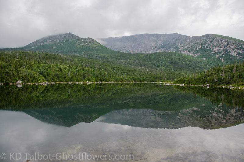
Hamlin Ridge and North Basin from Basin Pond
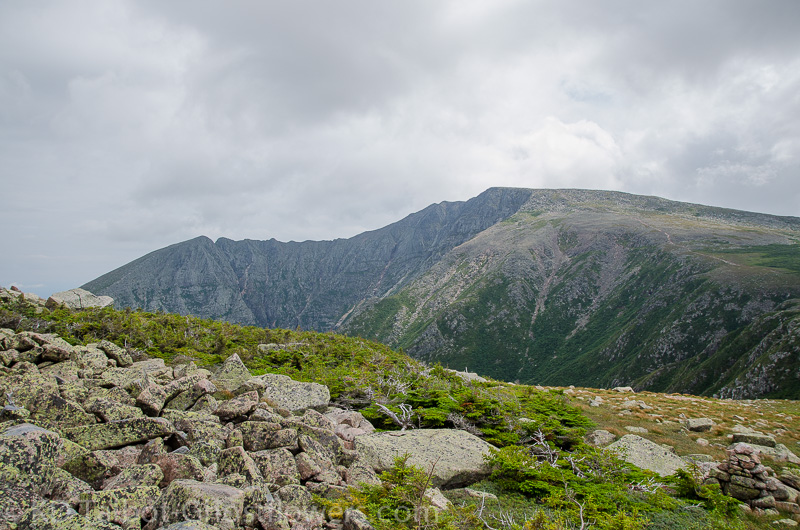
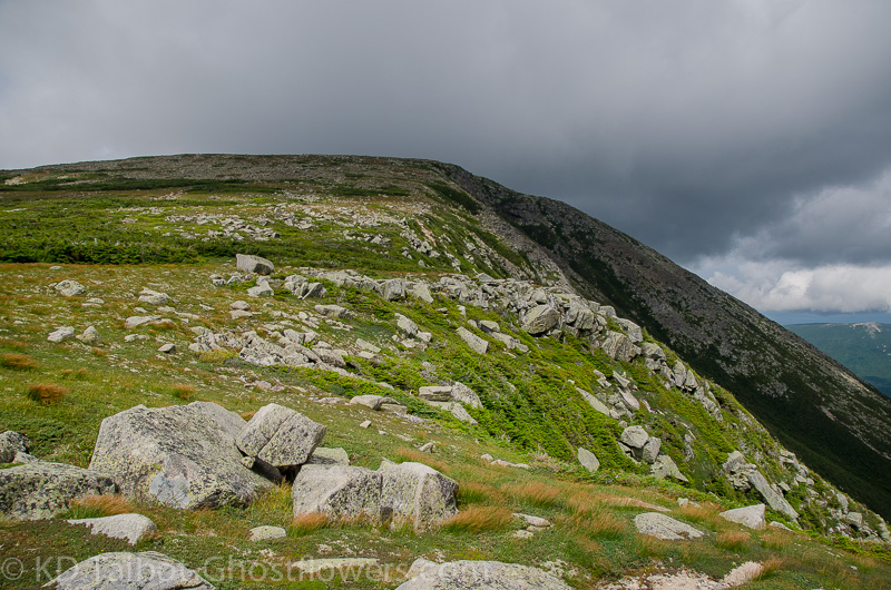
Hamlin Peak 4756'
Chimney Pond Trail/North Basin Trail/Blueberry Knoll Trail/Hamlin Ridge Trail/Saddle Trail
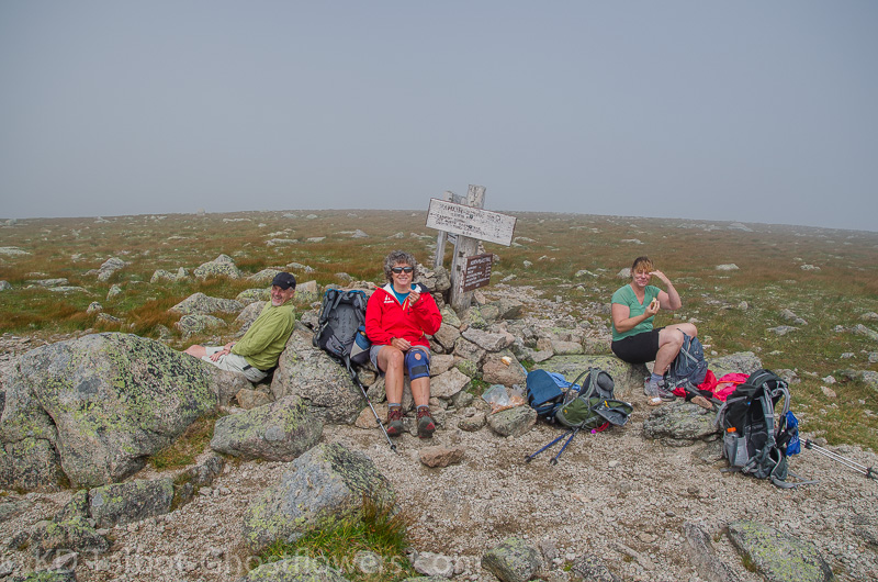
Kevin, Judy, Mark and Jen
We recently had the honor and privilege of joining the gang at Bear Brook Campground in Baxter State Park for the week. Bear Brook is about two miles from the trailheads at Roaring Brook, and we had the whole place to our group of roughly twenty. Depending on the day the total number of us camping would vary as different hikers and campers arrived and left. As always, it was a great chance to see old friends and make some new ones. Evenings spent sharing food and talking around the campfire forms bonds which can last a lifetime, and this week was no different. Anyone who sat down blind-folded to a meal with us would be hard-pressed to guess that we were camping. Offerings such as marinated shrimp and steak-tips for dinner and Eggs Benedict for breakfast made us feel as though we were gaining weight rather than working it off on the trails.
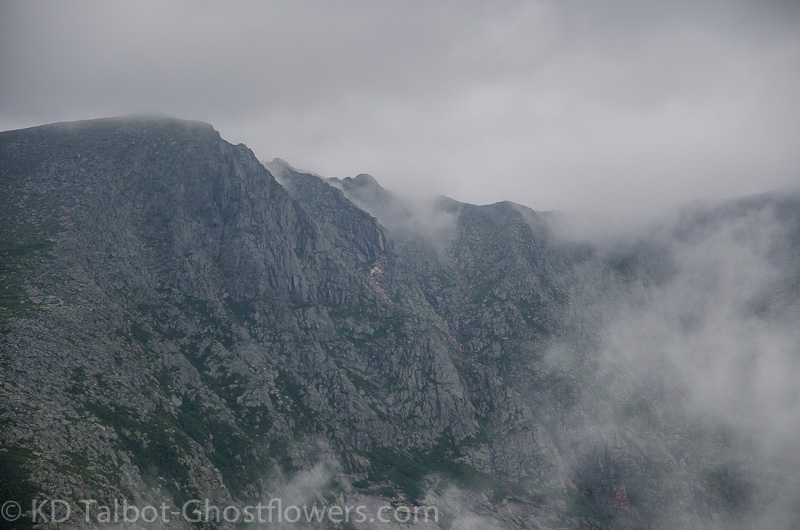
Zoom of The Knife Edge from Hamlin Ridge
Despite the long, boring road trip to get to the gate from points over three hundred miles south, people always arrive in good spirits. Once set up for camping, the meals and hiking plans begin, not necessarily in that order. Generally there are a few small groups of hikers who will set off to different destinations each day, so there is always a choice of what to hike. There is also plenty of time to relax, maybe renting a kayak or canoe and paddling one of the great ponds in the vicinity, or by simply curling up with a good book at the campsite. There are many leisurely hikes such as Sandy Stream Pond as well, where one can relax with magnificent views beside the water. Here bird and duck activity abounds and the chance of seeing moose or deer is a high probability, unless your name is Kevin and you carry a big, heavy lens around in hopes of finding them.
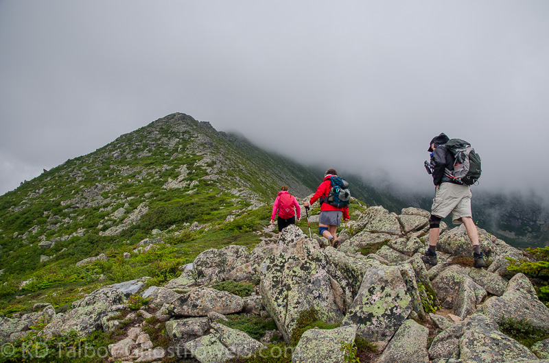
Baxter gives and Baxter takes. Despite my hopes of some great moose photos on this trip being crushed, basically by my lack of seeing any moose, I managed to drag myself to the summit of Hamlin Peak, and if that is all that Baxter would give me on this trip, I will take it. In exchange for allowing me to hike this peak there was a blood sacrifice made by myself as I fell on wet rocks as we ascended Hamlin Ridge, and again as we descended The Saddle Trail. Both slips were caused by my inability to walk properly anymore, and by brief rain during both the ascent and descent. It was a small price to pay when I consider some of the injuries which have occurred to others on previous trips. Thanks to Jen for getting me bandaged up on the first fall, and making sure I didn't die right there on the ridge, which I was seriously considering trying just to get out of pushing myself all the way to the summit.
View Back to Basin Ponds
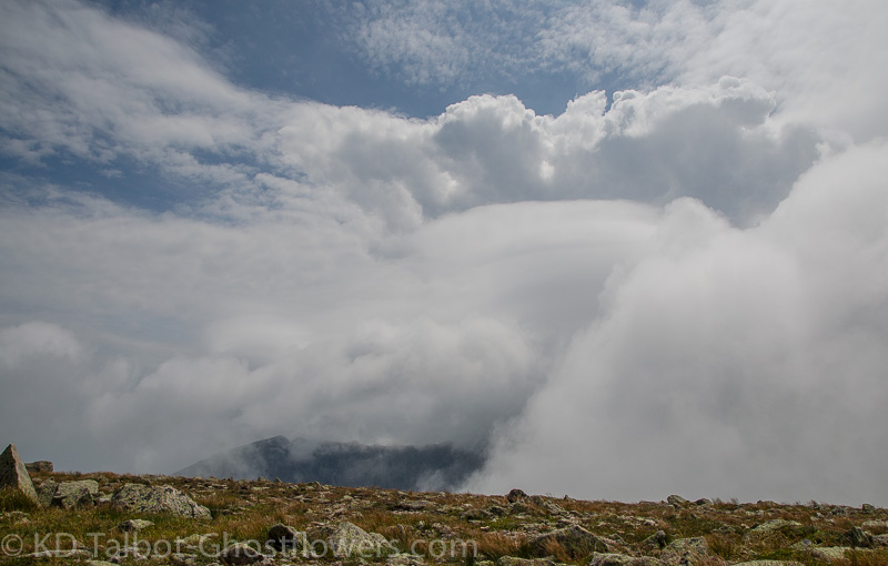
We arrived at the summit in fog, but the bright glow of the sun was present, and we watched the clouds as they raced across the rock and sedge of this barren place. Among the rocks there were still some remnants of the wildflowers which weeks earlier were surely abundant. There was an amazing amount of Bilberry, Blueberry and Mountain Cranberry to be had, the ground seemed load with them. Mark and I sat and watched the summits appear and disappear into the rolling clouds as Jude and Jen made their way over to Howe Peak and back while I tried to recover a bit. Eventually they returned and we began our descent to The Saddle as skies continued to clear and views opened up around us.
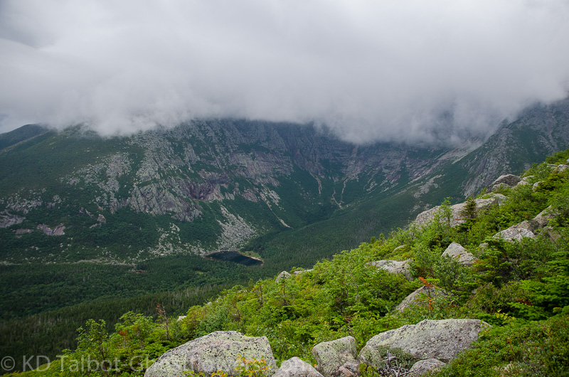
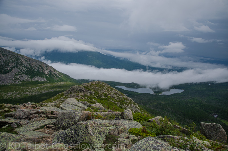
View Down to Chimney Pond from Hamlin Ridge
The descent on The Saddle Trail proved more difficult than I had remembered perhaps because last time I was still high on the euphoria of having just crossed the Knife Edge. As we started down we got another short rainfall, not enough to bother stopping or putting jackets back on, but enough to make the rockslide trail a little more treacherous. I managed to slip again, this time falling head first and smashing my mouth on the back of my hand which softened the blow somewhat as I landed on top of my firmly planted hiking pole. I though I knocked some teeth out, but it didn't break my fall and I continued to fall forward into some spruce which I instinctively grabbed and managed to break my fall before dashing my brains out on the rocks. I was feeling pretty beat up as I trudged more cautiously towards Chimney Pond which seemed a very long way.
Hamlin Peak
At the pond we rested briefly, taking in the incredible view of South Basin rising above us to the heights of Pamola, the Knife Edge and Baxter Peak. At this point I was of a mind to be done with this hike and to be sitting comfortably at camp with a full belly, so we did not linger as long as we may have liked. The trip out along Chimney Pond Trail was uneventful except for the looks of horror on many people's faces as they spied my bloodied knee which I hadn't bothered to clean, waiting instead for a proper cleaning and bandaging back at camp. I assured more than one hiker that it was merely a flesh wound, and Mark laughed as I left more blood splotches along the trail. We joked how the coyotes would be searching the trail for whatever had bled out along it, but it was only me. A cleaning, some bandages, spaghetti and meatballs and sausages, a few handfuls of advil, some Boston Lager and a gravity chair and I felt pretty much recuperated.
"Yeah, I could sit and look at this all day!"
Next day I decided to lick my wounds by sitting in a kayak on Kidney Pond, joined by several from our group, while Jude went with others and hiked the awesome double summit of Doubletop. We also spent some time swimming at beautiful, sandy bottomed Togue Pond, which actually makes me feel clean. I know it's an illusion, but I'll take it! That night we feasted again, this time on an array of marinated steak tips, and lots of fresh veggies. Later it was topped off with a slice each of strawberry rhubarb and blueberry pie made by new arrival Val who makes maybe the best pie ever! The evening brought another round of campfire sitting with a good deal of good natured ribbing going on. In the morning after another fantastic breakfast Jude and I packed up, then made a quick trip to say good bye to Sandy Stream Pond before making the long drive home. Thanks Baxter, see you again soon!
View Across to The Knife Edge from The Saddle
View Back to Hamlin from The Saddle
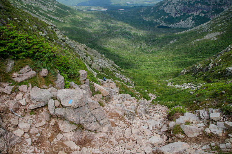
Descending The Saddle Trail
Lots more pictures HERE:
KDT
Last edited: