Candidate for 52WAV! Mount Oscar Bushwhack 10 June 2012

vftt.org

Help Support vftt.org:

This site may earn a commission from merchant affiliate links, including eBay, Amazon, and others.

Jazzbo

Well-known member
Joined
Jan 1, 2005
Messages
1,199
Reaction score
171
Location
Waltham, MA Jazzbo & Marty meet Bigfoot on Kenne
Mount Oscar is mere 2760' tall and east side is dominated by highly commercial Bretton Woods Ski slopes. Why bother? Well I'd seen some impressive looking cliffs from East Hale and wanted to check them out in person. I figured the views must be pretty good and the weather we had last weekend could not have been better for a hike with great views. It did indeed turns out the real reason to visit Mount Oscar is to check out the feeling of WIDE open ledges and views of surrounding mountains!
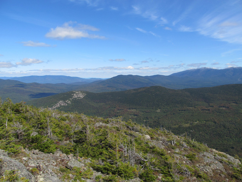
IMG3572-L.jpg


But not by traditional route via the ski trails or resort hiking trails. I did it from Zealand Road TH for the Sugarloafs. See image of my GPS track below. Not the most direct route to summit Mount Oscar, but I did want to go a ways up the logging road to see what I could see. If and when I go back I'll try something more direct. Perhaps a loop involving a ascent from west and descent the way I came down but also taking in base of the cliffs and working more directly west. I found references to the cliffs on various rock climbing web sites. One report talks about climbers trail to the cliffs that I did see some indications of.
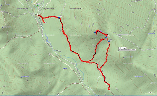
Mount-Oscar-GPS-Track-06102012-M.jpg


Further up the road I reached this high point where there is large landing area where you get this excellent full front view across the valley of the remarkable talus slopes on East Hale one of my favorite bush whack hikes. I turned back here, but the road keeps on going for quite a ways I think. I think this road is pretty nice. Have to come back here with the mountain bike some time.
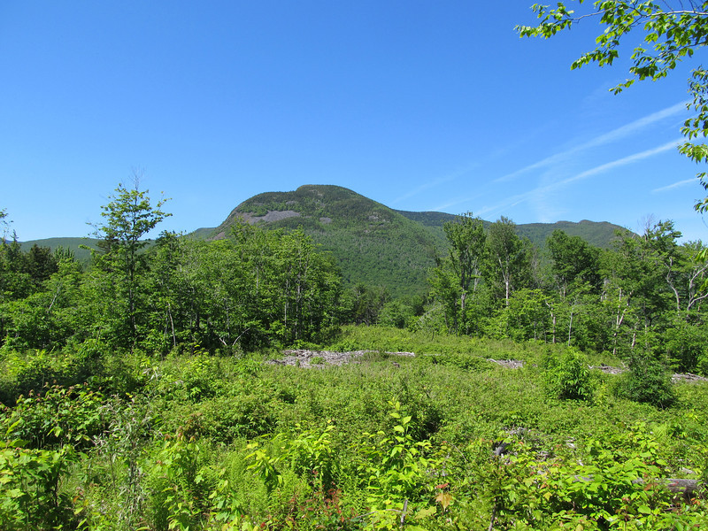
IMG5808-L.jpg


I picked a spot and bearing to get up to col between Oscar and Rosebrook. The whack up to the ridge went quickly. The forest transitioned to a majestic spruce forest about 400' below col. Very stable forest of mature spruce with only scattered blowdowns. Pure pleasure to travel.
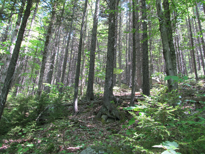
IMG5815-L.jpg


I shortly came across a climber's route that took me up to the ridgeline where I picked up the snow shoe trail maintained by Bretton Woods? I was soon at the summit which presents vistas in all directions. Such as Presidential Range.
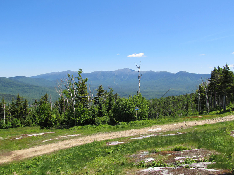
IMG5828-L.jpg


I prefer this side of the summit where there are wide open ledges form which you can see panarama views of Willey Range, Carrigain, Zealand Valley. There is a nice screen of spruce so you can forget you're right next to the ski area. I spent 1/2 hour here eating lunch. Just sample of few snaphots to give an idea.
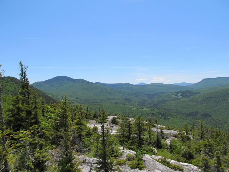
IMG5833-L.jpg


Mount Hale looks pretty good from this point of view.
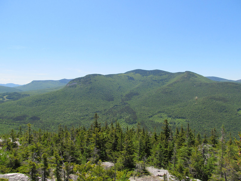
IMG5835-L.jpg


Last snapshot is this view towards Sugarloafs.
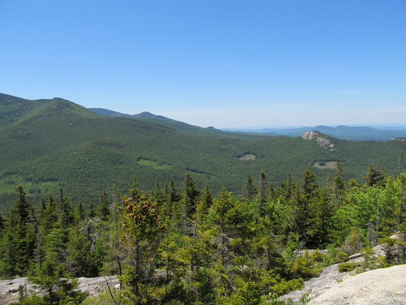
IMG5837-L.jpg


That's all folks! Hope you liked it. It's something different anyway.
 
Last edited:
Interesting approach to Mt.Oscar. I take it that logging road starts across Zealand Road from the trail west to the Sugarloaves? At the south end of your track you just decided to turn around, to head back to a closer taking-off spot for your 'whack to the col? Total distance about 6 miles?

Those are great view ledges, certainly topping a few on the current 52WAV, such as "Black Mtn." in Jackson, which is there for a view outlook that is partially grown in. Lack of an official hiking rail to Oscar would probably be an impediment.

Thanks for another off-beat adventure.
 
Last edited:
Wow, Jazzbo! That's one I have on my list to do in the next few weeks - great minds think alike! I love that old road - it's perfect for a quiet walk with the dog, and the sunsets over the Sugarloaf peaks from the clearings are awesome, especially in the fall. If you follow it to the end, you arrive in a big field with a view, then it dead-ends in a swamp. Circling the swamp through the trees can get you to the old overgrown Mount Tom road. The last time I was up there, I bushwhacked SW from the swamp and hit some cool ledges above the Zealand river before dropping way down to meet the road.

Did you take the bootleg trail that leaves one of the clearings by a small cairn? I was wondering if that was the climber's route to the cliffs, but hadn't checked it out yet.

Definitely looking forward to this one. Thanks for posting a great report and some really nice photos!
 
Interesting approach to Mt.Oscar. I take it that logging road starts across Zealand Road from the trail west to the Doubleheads? At the south end of your track you just decided to turn around, to head back to a closer taking-off spot for your 'whack to the col? Total distance about 6 miles?

Those are great view ledges, certainly topping a few on the current 52WAV, such as "Black Mtn." in Jackson, which is there for a view outlook that is partially grown in. Lack of an official hiking rail to Oscar would probably be an impediment.

Thanks for another off-beat adventure.

"Doubleheads?" Not sure what you mean by that. You must be slipping Mike! :)If you mean the Sugarloafs....yes I parked at TH for Sugarloafs. The logging road starts right there across the road. On some maps a sand pit is indicated, but there is a wild life pond at location of sandpit. The wildlife pond is worth a visit. Early in morning I would bet you might see moose there. It offers nice closeup view of Sugarloaf. GPS indicated total distance was 7.2 miles. A loop doing more direct assault would much less mileage. Just a 1/2 day outing or less. I think it deserves a regular trail actually. Would make a nice local hike of moderate difficulty for Zealand camp ground visitors and provide great bang for the buck. Also be nice to have established route for the rock climbers.
 
Wow, Jazzbo! That's one I have on my list to do in the next few weeks - great minds think alike! I love that old road - it's perfect for a quiet walk with the dog, and the sunsets over the Sugarloaf peaks from the clearings are awesome, especially in the fall. If you follow it to the end, you arrive in a big field with a view, then it dead-ends in a swamp. Circling the swamp through the trees can get you to the old overgrown Mount Tom road. The last time I was up there, I bushwhacked SW from the swamp and hit some cool ledges above the Zealand river before dropping way down to meet the road.

Did you take the bootleg trail that leaves one of the clearings by a small cairn? I was wondering if that was the climber's route to the cliffs, but hadn't checked it out yet.

Definitely looking forward to this one. Thanks for posting a great report and some really nice photos!

Thanks for the kudos Chris! Coming from you that is extra special! That road is pretty interesting. I've followed upper portions of it on the north slopes of Whitewall. Up there it is pretty bad shape, but still followable. As for the cairn and climber's route, I didn't notice anything walking along the road and I was keeping 1/2 an eye out for stuff like that as I walked the road. My post hike research did reveal one writer who spoke about a big rock on the road. All the more reason to go back. Foliage views would be very fine from Oscar. That side of hale is all birches and hardwoods. Bretton Woods web site advertises a hiking trail, but I like hiking up ski trails. I love hiking ski trails for their constant and changing views.
 
Did you take the bootleg trail that leaves one of the clearings by a small cairn? I was wondering if that was the climber's route to the cliffs, but hadn't checked it out yet.


The small cairn does mark the start of the trail to the cliffs. If you go that direction up the skidder road and then continue on straight on a trail as the the skidder road turns to the right, it brings you right to the base of the cliffs in about 3/4 mile. I've climbed there quite a bit and there is an amazing amount of routes that have been developed there. When you get to the cliff you are at basically the far left of the developed cliff area, if you work to the right the cliffs go on for quite a ways. The cliffs have a surprising amount of variation and offer some really great climbing. In the one area you can do slab, face, crack and multiple variations of all 3 in one climb. The one thing most of the climbs do have in common is very technical climbing with thin face moves. I've been suckered up a couple climbs seeing nice large jugs at the bottom and what looked like nice holds at the tops and found basically vertical slab climbing when you get into the crux. All in all a pretty area and well worth checking out even if you don't climb. It usually is very quiet there and I think I have only seen a max of about 8 people there total at the busiest.

These are not the cliffs that Bretton Woods uses for their rock guiding adventures to my knowledge. I'm pretty sure the slab area they use could be approached by staying on the main fire road and continuing basically most of the way around Oscar.
 
"Doubleheads?" Not sure what you mean by that. You must be slipping Mike! :)If you mean the Sugarloafs....yes I parked at TH for Sugarloafs.
I'm already at least halfway down the slope! :) Yes, thinking Sugarloafs, I dyslexically typed Doubleheads (which I had a nice view of Sat. from Halls Ledge) - there is a resemblance. Nat Geo Topo does show that "sandpit" which is now something better. Thanks again.
 
Very nice! Exploring that area and the Hale/Sugarloaf area were on my list for this summer before the fracture. I'll take living vicariously online instead! :)

So that's the road that loops around and crosses the A-Z trail twice, or is that the road NeoAkela mentions, past the swamp?
 
Very nice! Exploring that area and the Hale/Sugarloaf area were on my list for this summer before the fracture. I'll take living vicariously online instead! :)

So that's the road that loops around and crosses the A-Z trail twice, or is that the road NeoAkela mentions, past the swamp?

I don't quite know how to answer your question. I only followed the road as far shown on GPS. NeoAkela has followed it further and has given some clues. I've been on portions of the road or remains of the road number of times in my visits to north slope of Whitewall. Section of road on Whitewall is pretty faint in spots and has lots of bad drainage and blowdowns so you can expect to be hopping from tussucks to tussocks up there. The rest is just map data reliable or not. Garmin Mapsource is best souorce of info. Mapsource seems to show all the obscure abandoned roads. Like my recent Brown Ash Swamp Trail - Mapsource was right on the money most of the time. Map-Adventures map is also pretty good at showing assorted old roads and ski trails that AMC trail maps blithely ignore. Nat Geo Topo is not very helpful either at showing old roads (although it can be at times). Bottomline for me is I like this sort of navigational challange. Sometime I'd like to check out more of that old road.
 
The rest is just map data reliable or not. Garmin Mapsource is best souorce of info. Mapsource seems to show all the obscure abandoned roads. Like my recent Brown Ash Swamp Trail - Mapsource was right on the money most of the time. Map-Adventures map is also pretty good at showing assorted old roads and ski trails that AMC trail maps blithely ignore. Nat Geo Topo is not very helpful either at showing old roads (although it can be at times).
A key variable is the underlying topo map. The 100K topos carry more info on old roads and trails than some 24K topos. This is carried into both NG TOPO! and Mapsource Topo 100K/Topo 24K. In this case, the 100K topos show the road.

There is also a dividing line between 24K topo quads running east-west through Mt Oscar summit--the topo covering south of the line (Crawford Notch, NH Quad, altitudes in feet) shows the road and the topo covering north of the line (Mt Dartmouth, NH Quad, altitudes in meters) does not show the road. Both of the topos are dated 1995.

Doug
 
Top