
Kevin Judy and Emma
Well-known member
8/23/08
East Sleeper 3840'
13.2 Miles 2800' Elevation gain
Kevin, Judy and Emma
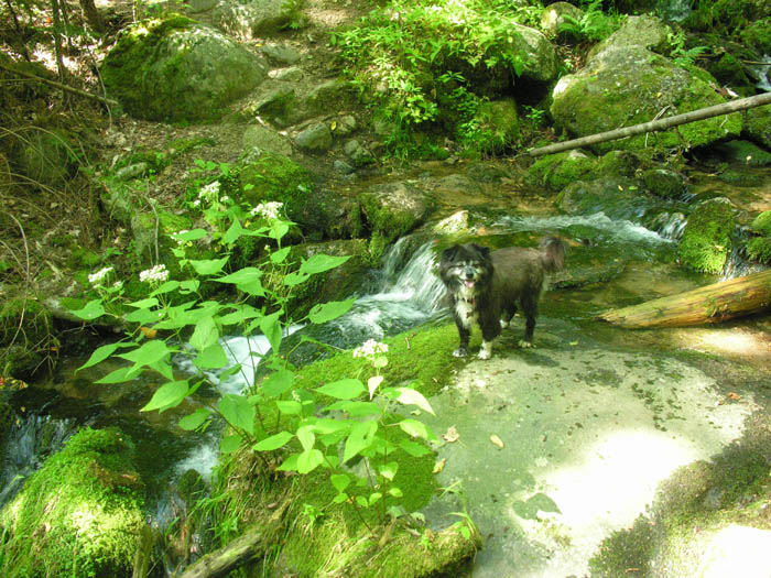
I guess with the inclusion of this peak one would have to ask, "Are you working on the NE 100 Highest?" My official answer would be, " No, I've sworn off lists." Unless, of course, you include the winter 48, which we are working on, but may never finish, or, if you insist, we might be working on this list, which we also may never finish. As we get older there is only so much I am willing to put my wife and dog through. I'm not sure we'll ever be going to any bushwhack peaks, surely not some of the worst, like Vose Spur or Scar Ridge West Peak. Well, East Sleeper is hardly a bushwhack, there is a very nice, well-maintained trail that is also well-signed, if you look for them. So basically, we're on a quest to always cover new ground, thus we made this trip. There are several options to reach this peak, but we chose to take the Livermore Road to the Mount Tripyramid Trail and ascend the South Slide to the Kate Sleeper Trail. After several trips to the Tripyramids we found the South Slide much less daunting than it had been all those years ago when we knew nothing of the mountains and began the ascent on a wet day. That tale is told elsewhere on this site and I won't re-tell it here, suffice to say it's surprising I ever got Judy to hike a mountain again after that. This day was warm and dry, good hiking conditions, though we could tell the day was going to get increasingly hot as it progressed. With an early enough start we were able to beat the heat in our climb up the South Slide. Now, nearly five miles into the hike, we came upon the Kate Sleeper Trail to our right (east) as we climbed the loose debris that makes up the slide on this side of the range. Here we found some shade and stopped for a quick sandwich and lots to drink. Emma found it hard to get comfortable and we soon started out again in an attempt to get her back into the shade of the woods. To our surprise the trail immediately leads down again, cutting across another slide and descending a hundred feet or so before re-entering the trees. If you're not expecting this I could see how it would be hard to follow the trail across this slide, although it is marked by some small cairns and blue blazes. At the point where it re-enters the trees there is an arrow sign, though it is heavily worn. From here the trail is a little rough for about a hundred yards, then smooths out and becomes a pleasureable walk in the woods along a well trodden trail that has ages of spruce needles for padding for much of its distance. There are some minor ups and downs as it winds its way across West Sleeper on its way down into the gully that separates it from East Sleeper, but even this is a minor descent through a lovely boreal forest, so quite enjoyable. Eventually the trail takes a bit of a left (northeast) and ascends towards East Sleeper. From this point it is a short hike to a side path that leads to the summit. On our way there we only noticed a sign that pointed along the Kate Sleeper Trail in either direction. The arrow pointing east saying "Mount Whiteface" and the arrow pointing west saying "Mount Tripyramid". We followed the path to the left, sort of expecting it to lead to a campsite and end, but as we followed it I realized it was too obvious and had to lead somewhere. At the end Judy asked, "Do you think this is it?" and I confirmed that I was pretty sure it was as I pointed out the sign on the tree that said "East Sleeper". She commended me for having better instincts and sense of direction and I explained that I was sure the path led somewhere because it was so obvious. Upon leaving the summit and hiking the short distance back down to where the first sign was we noticed at the end of the path, opposite the other sign, the sign that pointed up the path and said "East Sleeper" with an arrow pointing back the way we had just come. Great navigating on my part. I can do it without signs, maybe I should be bushwhacking. While on the summit we had more to eat and drink and chatted with another hiker that had come along. Emma pawed at the packs until she had not only eaten her bag of jerky, but half of mine, too. For such a small dog she is absolutely ravenous out on the trail and Judy carries as much for her to eat as she does for herself. I looked around for a register to sign, but found none. I don't know if there is supposed to be one, or if it is removed because it is in the Sandwich Range Wilderness. This would be inconsistent when you consider that there is a sign marking the summit. The trip back was uneventful, the heat of the day was beginning to take its toll and I began to dread the short climb back up the slide on the Kate Sleeper Trail and the longer descent on the Mount Tripyramid Trail as we descended South Slide without the shade of the beautiful evergreens we had enjoyed walking under for the most part of the trip. The short ascent and longer descent went by quickly as we maintained a good pace to get Emma out of the sun as quickly as possible. Many people comment on her as they encounter us along the trail. "What a little cutie, how does she do it?" to which someone will always reply, "Oh, it's easy for dogs, they have four legs." To which I always reply, "Yeah, 4-wheel drive." Well, this may be true, but if anyone thinks it's easy, put on a black fur coat and go hike with the sun beating down on you. Much to Emma's pleasure there were several streams to cool off in on the way back along the Mount Tripyramid Trail, streams that I didn't remember from previous trips. The rain this summer must have kept them flowing whereas in years gone by they had dried up by the time we crossed them. We enjoyed this hike a lot. This might be the easiest of the 100 Highest we have done.
Pictures here:
http://ghostflowers.com/white_mtns3000/eastsleeper82308/eastsleeper82308.html
KDT
Last edited:
