"Quick - what's the best way you can think of to spend George Washington's birthday?"........... "Yep, I agree!!"
On BernerBabe's list to finish the 48 we had Monroe and Jefferson, which are both fine hikes by themselves, but on a day like yesterday, they could only be made better by visiting their neighboring peaks as well. I have been busy at work, and picked up some extra stories (you Scrum people know what I mean) to help others on the team. Like enthusiastic winter hikers all over New England, Friday stood out as a "Presi Day" among a month of clouds, extreme cold, and ferocious winds. By late afternoon Thursday, I had managed to complete those stories and pulled together a small group including Kyle, Roberta (BernerBabe) and "Stinky Feet" Sue (to whom I must apologize for pulling her away from her original goal of NW Hancock...)
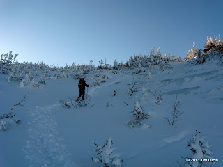
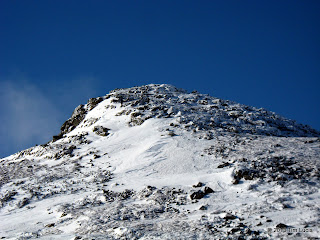
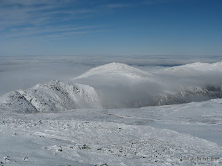
Kyle above treeline on the Ammo Ravine; Ascending Monroe (Tim C nearly at the top)
We arranged to meet at 7 at the cog hiker lot, and Kyle and I carpooled from Concord, and met Roberta at New Hampton. Having Roberta's 4WD pickup was a plus since Base Station Road had a few inches of new powder, and we were delayed while someone's Prius was being pushed over the top of one of the rises (two weeks ago, we were delayed on Franconia Notch Parkway by another car-gone-off-the-road... hmmm.) The parking lot was a winter hiker reunion, with many familiar faces. The biggest celebrity was Hiker Ed, who needed only Jefferson (which he got) to finish "Over 60 Grid #2". We set out on snowshoes following Tim C who was on a mission for Monroe-Madison to finish his SSW48 - 2013. Amongst the four of us, we enjoyed a slightly more subdued pace while following the river to Gem Pool.
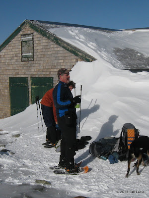
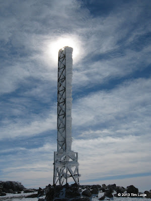
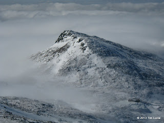
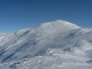
Ran into Scarpy at the hut; Tower "lighthouse" on Washington
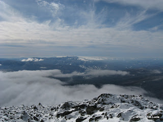
Gem Pool arrived within an hour or so, and being warmed up, we paused briefly for food and water, and to raise the televators. As the elevation increased, so did the powder depth. What was 4-6" at the base looked like 6-8" as we approached Monroe Brook and Twin Falls. The crossing here was trivial, although the track to the right (the real trail) dead-ended after only a few steps. Instead, the track follows the gulley just to the left all the way to the hut. At the hut we debated adjusting layers as the wind was still pretty light. In the end, the shells came out. While preparing for Monroe, Scarpy and his cousin Taylor appeared, with Scarpy's dog Alaska. Monroe was straight forward, the only tricky spot is the S turns on the snowfield on the steepest part of the north side. At the summit, it was 9:30, when I usually have the daily Scrum meeting ("standup") so I called in to claim my status and plans for the day (okay, I was really calling in to gloat.) Did I mention we could see the Atlantic Ocean from the summit?
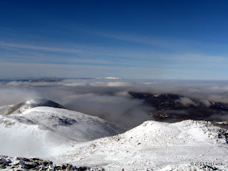
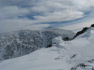
View towards Pemi and Franconia Ridge; Roberta, Sue, Tim and Kyle on Monroe
On the way down, we ran into Val and Mark, as expected having talked to Tim C earlier. Two more people, two more that we knew, also planning the same route as us. In fact, a whole conga line of people, many of whom we knew, were ascending or descending Monroe (and Washington and Jefferson too). Passing the hut, we crossed over the usual river of ice that forms from the spring-fed overflow of the Lake of the Clouds, and proceeded along the Crawford Path, or as close to it as we could come while trying to stay on snow and off rocks. Even with the recent snow, it is still pretty bony, and one could make do without snowshoes for the most part once above the trees.
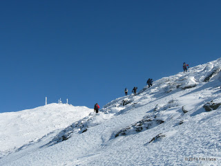
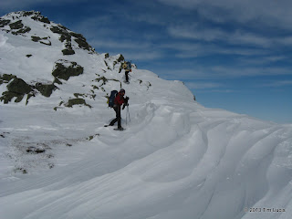
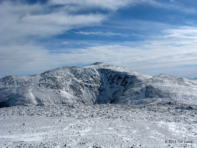
Snowfield along the Crawford Path; Looking back at Monroe
There are some decent snowfields between the Crawford Path and the Trinity Heights Connector, and we used them to ascend in snowshoes, avoiding the rocks where possible. Mixed in with the snow is a fair amount of ice as well, so caution is advised because you could go for a bit of a ride here if you lost traction. At the summit, we ran into the state parks folks, Mike Pelchat and Guy Jubinville and chatted for a bit (well, mostly Guy) while having lunch and generally just basking in the low wind, low teens and 100-mile+ views. There was actually a (short) line for photos at the summit sign!
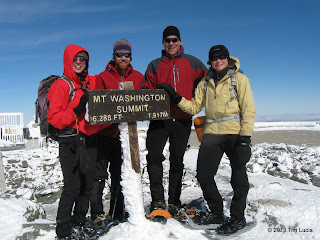
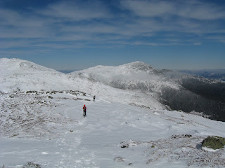
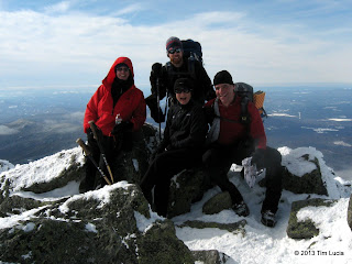
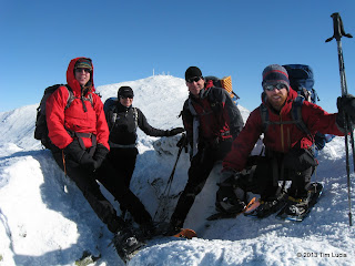
The birthday boy; Group shot - first winter summit for Roberta and Kyle
(continued)
On BernerBabe's list to finish the 48 we had Monroe and Jefferson, which are both fine hikes by themselves, but on a day like yesterday, they could only be made better by visiting their neighboring peaks as well. I have been busy at work, and picked up some extra stories (you Scrum people know what I mean) to help others on the team. Like enthusiastic winter hikers all over New England, Friday stood out as a "Presi Day" among a month of clouds, extreme cold, and ferocious winds. By late afternoon Thursday, I had managed to complete those stories and pulled together a small group including Kyle, Roberta (BernerBabe) and "Stinky Feet" Sue (to whom I must apologize for pulling her away from her original goal of NW Hancock...)
Kyle above treeline on the Ammo Ravine; Ascending Monroe (Tim C nearly at the top)
We arranged to meet at 7 at the cog hiker lot, and Kyle and I carpooled from Concord, and met Roberta at New Hampton. Having Roberta's 4WD pickup was a plus since Base Station Road had a few inches of new powder, and we were delayed while someone's Prius was being pushed over the top of one of the rises (two weeks ago, we were delayed on Franconia Notch Parkway by another car-gone-off-the-road... hmmm.) The parking lot was a winter hiker reunion, with many familiar faces. The biggest celebrity was Hiker Ed, who needed only Jefferson (which he got) to finish "Over 60 Grid #2". We set out on snowshoes following Tim C who was on a mission for Monroe-Madison to finish his SSW48 - 2013. Amongst the four of us, we enjoyed a slightly more subdued pace while following the river to Gem Pool.
Ran into Scarpy at the hut; Tower "lighthouse" on Washington
Gem Pool arrived within an hour or so, and being warmed up, we paused briefly for food and water, and to raise the televators. As the elevation increased, so did the powder depth. What was 4-6" at the base looked like 6-8" as we approached Monroe Brook and Twin Falls. The crossing here was trivial, although the track to the right (the real trail) dead-ended after only a few steps. Instead, the track follows the gulley just to the left all the way to the hut. At the hut we debated adjusting layers as the wind was still pretty light. In the end, the shells came out. While preparing for Monroe, Scarpy and his cousin Taylor appeared, with Scarpy's dog Alaska. Monroe was straight forward, the only tricky spot is the S turns on the snowfield on the steepest part of the north side. At the summit, it was 9:30, when I usually have the daily Scrum meeting ("standup") so I called in to claim my status and plans for the day (okay, I was really calling in to gloat.) Did I mention we could see the Atlantic Ocean from the summit?
View towards Pemi and Franconia Ridge; Roberta, Sue, Tim and Kyle on Monroe
On the way down, we ran into Val and Mark, as expected having talked to Tim C earlier. Two more people, two more that we knew, also planning the same route as us. In fact, a whole conga line of people, many of whom we knew, were ascending or descending Monroe (and Washington and Jefferson too). Passing the hut, we crossed over the usual river of ice that forms from the spring-fed overflow of the Lake of the Clouds, and proceeded along the Crawford Path, or as close to it as we could come while trying to stay on snow and off rocks. Even with the recent snow, it is still pretty bony, and one could make do without snowshoes for the most part once above the trees.
Snowfield along the Crawford Path; Looking back at Monroe
There are some decent snowfields between the Crawford Path and the Trinity Heights Connector, and we used them to ascend in snowshoes, avoiding the rocks where possible. Mixed in with the snow is a fair amount of ice as well, so caution is advised because you could go for a bit of a ride here if you lost traction. At the summit, we ran into the state parks folks, Mike Pelchat and Guy Jubinville and chatted for a bit (well, mostly Guy) while having lunch and generally just basking in the low wind, low teens and 100-mile+ views. There was actually a (short) line for photos at the summit sign!
The birthday boy; Group shot - first winter summit for Roberta and Kyle
(continued)
Last edited: