PETCH
New member
Peaks/Trails: OwlsHead via Lincoln Woods Tr, Black Pond Tr, BP bushwack, Lincoln Brook Tr, OwlsHead Slide Tr.
Trail Conditions: Lincoln Woods Trail: Dry and relentless. Black Pond Tr: Mostly dry with some muddy areas. BP bushwack: a combination of dry trail and boot sucking mud, lots of blowdowns. Lincoln Brook Tr: Fairly dry with a few wet areas. Stream crossings were rock hoppable with 0-2” of water over rocks. OwlsHead Slide Tr: Loose Rock and fairly dry up high. Lots of blowdowns. Patches of snow off trail on top.
Special Equipment: Bugdope, sunscreen, endurance.
Cast of Characters: Russell, Helen, Jorge, John, CrazyBob, and Petch
Commentary: I've been dreading this hike for a 1 1/2 years now since I started hiking again. I've never done a hike much over 13 miles or so- The Franconia Traverse back in 2003. And I remember it darn near killed me. Well, you know what they say "The best exercise for hiking, is hiking". Who are "They" anyway?. So, I've been doing more hiking and it has become a little easier. Well, a little easier....
We began our hike at 8am sharp. I know Jorge would have preferred the gentlemen's start time of 9am or so, but Helen and Russell were able to wake up him early enough to drag him to Lincoln Woods on time. We cranked up the Lincoln Woods Trail and took the turn to the Black Pond Trail. We ran into a couple fishermen on their way out.
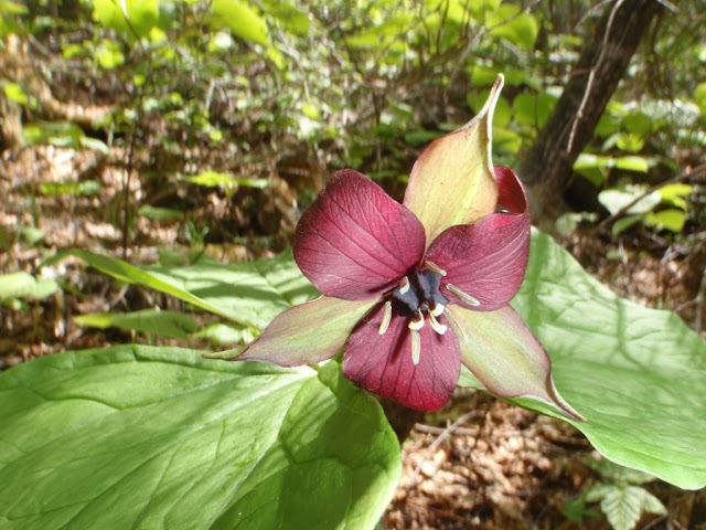
More Trailside bloomage
Then we started the Blackpond Bushwack. I had downloaded another hikers winter GPS tracks off of Wikiloc and was going to use that as a guide. Head North young man, head North! Even with the GPS tracks, the amount of blowdowns made it difficult to follow the faint footprints on the psuedo trail. Then we came across the orange blazed trees and started following those. This orange blaze path was running parallel to the GPS tracks I had then started going more NE, so we abandoned this track and bushwacked back to the original GPS tracks and found the path that led us to the stream crossing with the Lincoln Brook trail. Right where we wanted to be.
Lincoln Brook
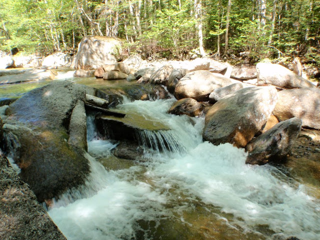
The Lincoln Brook trail is a beautiful trail with several swimming holes along the way. Somewhere along this way, I discovered that the lower section of one of my new hiking poles had fallen from my pack. I figured I'd lost it in the bushwack. This is when I discovered yet another one of my many ever challenging conditions: Tourette's syndrome. This condition would show itself at several times throughout the hike. Score: Pemi 1, Petch 0. We made it through the water crossings and started looking for the beginning of the slide. I had read that it can be hard to find. Well, not today. There was a pile of rocks to the left, and someone butchered an arrow into a poor defenseless tree to the right. The humanity.....how many more must die!
OwlsHead Slide
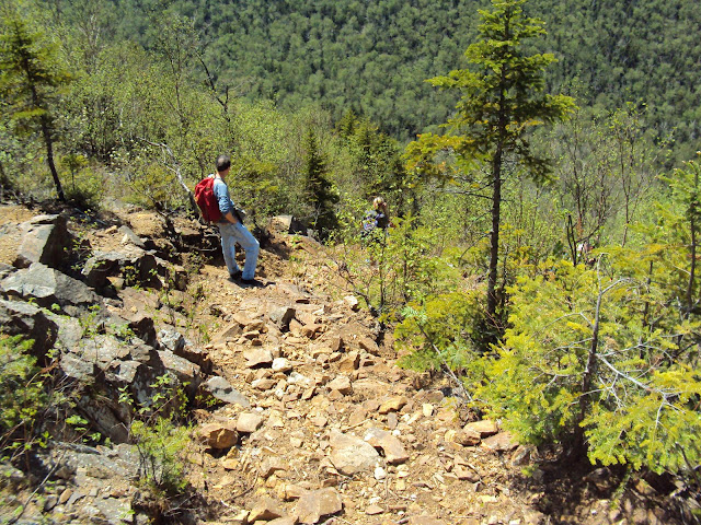
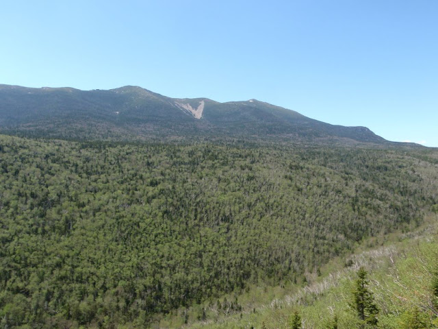
So began the relentless climb up the steep slide. Oh yeah, did I mention that it was steep? Trying to avoid causing rock slides while hiking became the challenge. With 6 of us going up, we tried to make sure we didn't bury or impale the hiker(s) behind us. There are some fantastic vistas going up the slide that provide some great views of the Franconia Ridge. There is one small patch of snow on the East side of Lafayette.
Franconia Ridge
We came across 2 hikers on their way down. Didn't get their names, but one of them had tagged OwlsHead for his 48. We congratulated him. Slipping and Sliding we climbed on. I believe this is when my Tourette's Sydrome had somehow became airborn as I heard my other hiking partner's uttering and screaming profanities as well. I became very concerned.......
Finally we gained the top of the slide and entered the woods. The smell of the fir trees was intoxicating. I love the smell of Balsam in the morning, smells like.... Christmas. Upward and onward and then we traversed the top of the mountain until we hit the pile of rocks marking the summit. Whoooohoooooo!. We made it up in 4 1/2 hours, reaching the top at 12:30pm. We hung out for about 40 minutes having lunch and relaxing in the shade.
Summit Shots
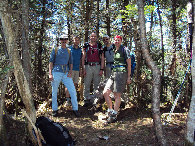
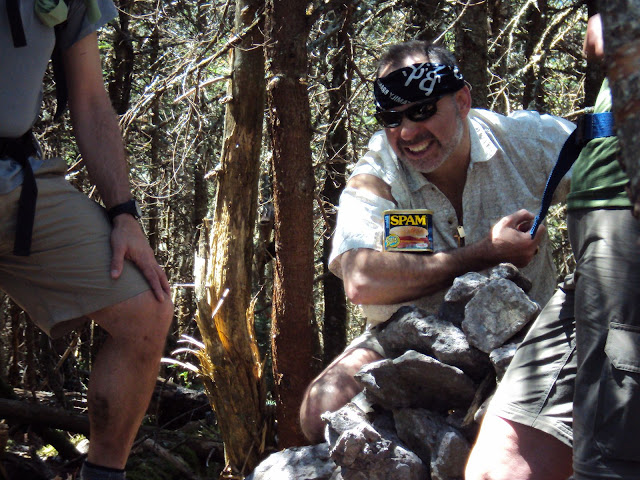
Then back down the slide. Anyone with bad unstable knees can appreciate how I dreaded going down this steep loose trail. But, it's got to be done. Again trying not to bury the hiker(s) below, was the challenge. We stopped at a vista about 2/3rds of the way down and took another good long break in the sun and basked in the beauty of the Pemi. Then we made our way down to the base of the slide and began the haul back. I stopped at the stream crossing to filter/refill my water supply, and noticed my camera was missing. First my hiking pole, then my camera! ^%^$, &^$%^# *(@#%#$!@. Score: Pemi 2, Petch 0. Then John came up behind me holding my camera. Ahhhhhhh. Score: Pemi 2, Petch 1. Jorge decided to take this moment to have a swim. To avoid what I feared could be "Irreversible shrinkage", I decided to forgo the wading for a later date when the water may be a tad warmer.
We made our down the Lincoln Brook trail, and low and behold someone had found my hiking pole section, and stuck it into the trail in plain view so I could see it. It must have been the two guys we saw earlier. Thanks guys. Score: Pemi 2, Petch 2. All tied up! We hit the BP bushwack again and soon we were back at Black Pond.
Black Pond with Bondcliff watching over
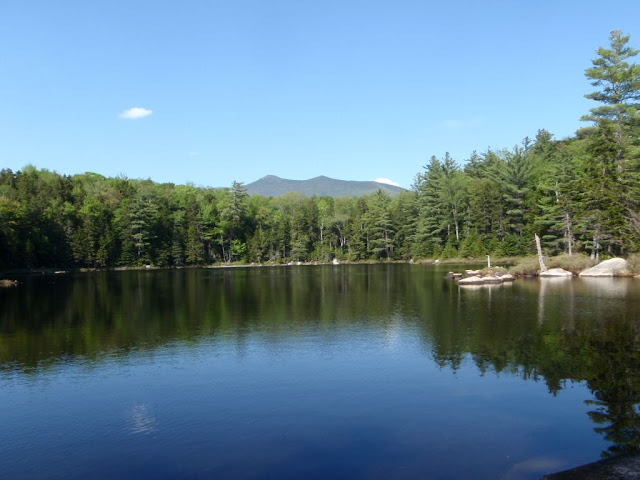
The hike back on the Lincoln Woods trail went fairly quick. CrazyBob decided to jog back (sick-o), while the rest of us walked at a moderate pace.
A couple trip reports ago, I was falsely accused of including a completely unrelated picture into my slideshow. Now, that I have had time to think about it, I think that is an absolutely fabulous idea to include a completely random unrelated picture into the slideshow. Kind of like the “I Spy” books. Or Sesame Street's "One of these pictures is not like the other...." I don't know why I didn't think of it! So, moving forward, when I can remember I plan on doing so. See if you can find this trips completely unrelated picture in the slideshow!
#44 for CrazyBob and I.
Trip stats: 16.3 miles, about 2900 ft of elevation gain, we finished between 8 hrs 50 min and 9hrs and 10mins.
Slideshow ^
Hiking Pictures:http://picasaweb.google.com/mpetcher
Ascent List:http://peakbagger.com/climber/climblistc.aspx?cid=1767
GPSTracks:http://www.wikiloc.com/wikiloc/spatialArtifacts.do?event=setCurrentSpatialArtifact&id=928233
Petch
Trail Conditions: Lincoln Woods Trail: Dry and relentless. Black Pond Tr: Mostly dry with some muddy areas. BP bushwack: a combination of dry trail and boot sucking mud, lots of blowdowns. Lincoln Brook Tr: Fairly dry with a few wet areas. Stream crossings were rock hoppable with 0-2” of water over rocks. OwlsHead Slide Tr: Loose Rock and fairly dry up high. Lots of blowdowns. Patches of snow off trail on top.
Special Equipment: Bugdope, sunscreen, endurance.
Cast of Characters: Russell, Helen, Jorge, John, CrazyBob, and Petch
Commentary: I've been dreading this hike for a 1 1/2 years now since I started hiking again. I've never done a hike much over 13 miles or so- The Franconia Traverse back in 2003. And I remember it darn near killed me. Well, you know what they say "The best exercise for hiking, is hiking". Who are "They" anyway?. So, I've been doing more hiking and it has become a little easier. Well, a little easier....
We began our hike at 8am sharp. I know Jorge would have preferred the gentlemen's start time of 9am or so, but Helen and Russell were able to wake up him early enough to drag him to Lincoln Woods on time. We cranked up the Lincoln Woods Trail and took the turn to the Black Pond Trail. We ran into a couple fishermen on their way out.
More Trailside bloomage

Then we started the Blackpond Bushwack. I had downloaded another hikers winter GPS tracks off of Wikiloc and was going to use that as a guide. Head North young man, head North! Even with the GPS tracks, the amount of blowdowns made it difficult to follow the faint footprints on the psuedo trail. Then we came across the orange blazed trees and started following those. This orange blaze path was running parallel to the GPS tracks I had then started going more NE, so we abandoned this track and bushwacked back to the original GPS tracks and found the path that led us to the stream crossing with the Lincoln Brook trail. Right where we wanted to be.
Lincoln Brook

The Lincoln Brook trail is a beautiful trail with several swimming holes along the way. Somewhere along this way, I discovered that the lower section of one of my new hiking poles had fallen from my pack. I figured I'd lost it in the bushwack. This is when I discovered yet another one of my many ever challenging conditions: Tourette's syndrome. This condition would show itself at several times throughout the hike. Score: Pemi 1, Petch 0. We made it through the water crossings and started looking for the beginning of the slide. I had read that it can be hard to find. Well, not today. There was a pile of rocks to the left, and someone butchered an arrow into a poor defenseless tree to the right. The humanity.....how many more must die!
OwlsHead Slide

So began the relentless climb up the steep slide. Oh yeah, did I mention that it was steep? Trying to avoid causing rock slides while hiking became the challenge. With 6 of us going up, we tried to make sure we didn't bury or impale the hiker(s) behind us. There are some fantastic vistas going up the slide that provide some great views of the Franconia Ridge. There is one small patch of snow on the East side of Lafayette.
Franconia Ridge

We came across 2 hikers on their way down. Didn't get their names, but one of them had tagged OwlsHead for his 48. We congratulated him. Slipping and Sliding we climbed on. I believe this is when my Tourette's Sydrome had somehow became airborn as I heard my other hiking partner's uttering and screaming profanities as well. I became very concerned.......
Finally we gained the top of the slide and entered the woods. The smell of the fir trees was intoxicating. I love the smell of Balsam in the morning, smells like.... Christmas. Upward and onward and then we traversed the top of the mountain until we hit the pile of rocks marking the summit. Whoooohoooooo!. We made it up in 4 1/2 hours, reaching the top at 12:30pm. We hung out for about 40 minutes having lunch and relaxing in the shade.
Summit Shots


Then back down the slide. Anyone with bad unstable knees can appreciate how I dreaded going down this steep loose trail. But, it's got to be done. Again trying not to bury the hiker(s) below, was the challenge. We stopped at a vista about 2/3rds of the way down and took another good long break in the sun and basked in the beauty of the Pemi. Then we made our way down to the base of the slide and began the haul back. I stopped at the stream crossing to filter/refill my water supply, and noticed my camera was missing. First my hiking pole, then my camera! ^%^$, &^$%^# *(@#%#$!@. Score: Pemi 2, Petch 0. Then John came up behind me holding my camera. Ahhhhhhh. Score: Pemi 2, Petch 1. Jorge decided to take this moment to have a swim. To avoid what I feared could be "Irreversible shrinkage", I decided to forgo the wading for a later date when the water may be a tad warmer.
We made our down the Lincoln Brook trail, and low and behold someone had found my hiking pole section, and stuck it into the trail in plain view so I could see it. It must have been the two guys we saw earlier. Thanks guys. Score: Pemi 2, Petch 2. All tied up! We hit the BP bushwack again and soon we were back at Black Pond.
Black Pond with Bondcliff watching over

The hike back on the Lincoln Woods trail went fairly quick. CrazyBob decided to jog back (sick-o), while the rest of us walked at a moderate pace.
A couple trip reports ago, I was falsely accused of including a completely unrelated picture into my slideshow. Now, that I have had time to think about it, I think that is an absolutely fabulous idea to include a completely random unrelated picture into the slideshow. Kind of like the “I Spy” books. Or Sesame Street's "One of these pictures is not like the other...." I don't know why I didn't think of it! So, moving forward, when I can remember I plan on doing so. See if you can find this trips completely unrelated picture in the slideshow!
#44 for CrazyBob and I.
Trip stats: 16.3 miles, about 2900 ft of elevation gain, we finished between 8 hrs 50 min and 9hrs and 10mins.

Slideshow ^
Hiking Pictures:http://picasaweb.google.com/mpetcher
Ascent List:http://peakbagger.com/climber/climblistc.aspx?cid=1767
GPSTracks:http://www.wikiloc.com/wikiloc/spatialArtifacts.do?event=setCurrentSpatialArtifact&id=928233
Petch
Last edited:
