
Kevin Judy and Emma
Well-known member
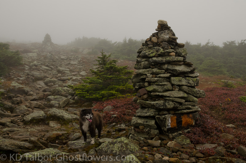
Waitin' for the Bi-peds
Moosilauke
Gorge Brook Trail / Snapper Trail / Carriage Road /
7.5 Miles 2450' Elevation gain
Kevin, Judy and Emma
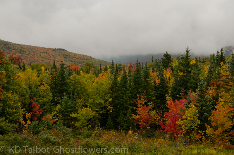
Every now and then it's nice to hike a mountain in less than excellent weather. Something between the wild night spent on Abraham in Vermont last Monday and the stifling heat we experienced on some hikes this summer. This hike was done in a light rain/heavy mist in warm temperatures with little wind. The damp forest reflected the beginnings of the next season. Birch leaves were yellowing or already fallen. Ground cover had turned many different shades of crimson and red. The occasional maple was a blaze of orange and stuck out against the dark green background of the conifers. Everything glistened with the wetness left by the penetrating foggy mist.
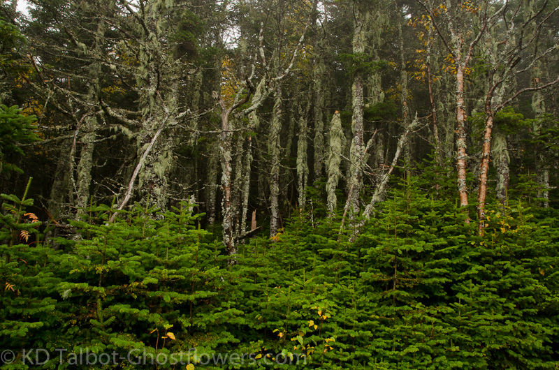
Thick Conifers Along the Carriage Road
From Gorge Brook Trail we took the Snapper Trail up to the Carriage Road reversing a hike we had done several times previously. The plan had been to join our friend Eric for his red-line finish on the Snapper Trail but we were a day early due to my inattentiveness. Instead, we hiked it in his honor, such a great accomplishment! As we headed up the Snapper Trail I thought of the ease of the grade and began to think that this was not what I remembered at all and that we would surely be hitting a steep section before long. Along the trail a herd path broke off to our right and I wondered what that was about. We never did come to the steep section I anticipated and we soon connected with the Carriage Road. Heading up we came to a small, flat area and I noticed that there was a trail heading down from there, blocked with forest debris. I realized that must be the herd path I wondered about. The steep trail down is what I remembered from previous trips and the trail must have been rerouted, or we were wrong for descending there on earlier trips.
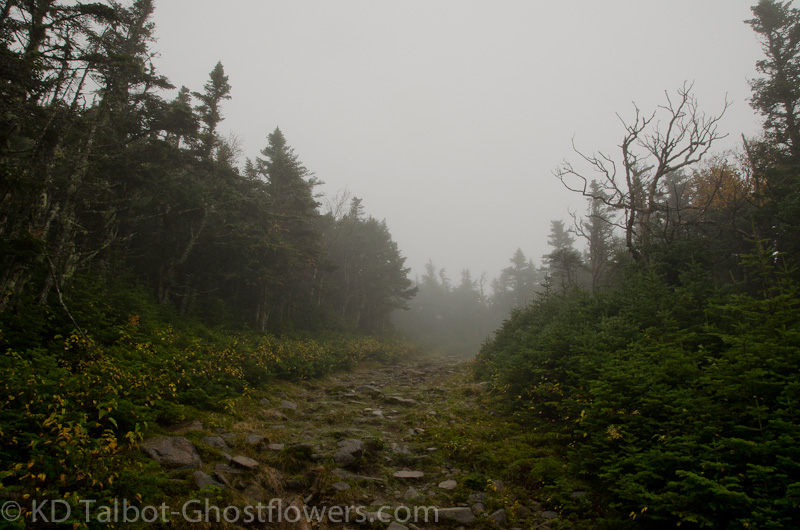
Into the Fog
The name Carriage "Road" is misleading in my mind. I found sections of this steep and taxing as we made our way up to where it levels off along the ridge near South Peak and the junction with the Glencliff Trail. We skipped the trip to South Peak this time as we had been several times before and there would certainly be none of the excellent views to be had from there today in the dense fog. As we made our way along the relatively flat ridge I recalled a trip earlier this year on the 4th of July when the ridge was alive with dozens of butterflies. Today in the heavy mist there were no butterflies and no views further than 100 yds., but many different types of birds flit among the trees along the "road". I thought about the strength of the horses who pulled wagons of supplies and visitors to the slopes of this most excellent hill. I was glad for the horses this method has been abandoned in this part of the world.
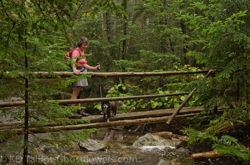
One of Several Bridges Along the Gorge Brook Trail
Ahead we could see the tall cairns appearing out of the mist and knew as we began to rise again that we were on the last leg of the hike to the summit. Sedge grass had turned golden brown and Alpine Bilberry was a beautiful crimson lining the trail on both sides. Voices of those already on the damp summit drifted down through the fog. We clamored up and found a spot among the stones and out of the slight breeze where we could eat. Emma as always ate like a wolf who didn't know when or where her next meal would come from. We stayed for quite awhile in hopes there'd be some clearing and with it some views. The sun threatened to poke through the gray veil above us several times, but the clouds never fully gave way and we eventually picked up our gear and made our way down through the encompassing fog.
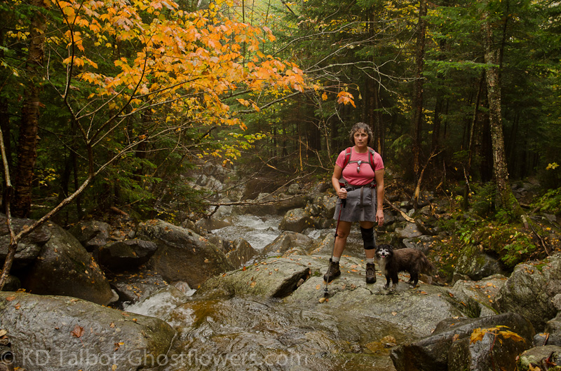
Along Gorge Brook
Despite the gray weather there had been a good crowd on the summit and as we made our way down it was apparent that the numbers would continue to grow as we passed many hikers on their way up. As we made our descent the dark green conifer forest began to slowly turn over to a mix with deciduous trees which brought more and more color to our eyes as we continued down. Eventually we reached the point where the trail meets Gorge Brook and from here it was a nice walk down through the sounds of the gurgling brook. At one point there was a washout in the trail. The trail dropped off to the brook making it necessary to step down and cross on stones placed for this. The trail had been washed out along the steep bank making hiking up and over difficult, leaving the crossing the best way to get around. Having crossed we immediately had to cross again to regain the trail. From here out it was a pretty simple hike and we stopped along the brook several times to enjoy the rushing water and patches of overhanging color. Despite missing our friends it was still a great day to be on the trail!
Along Rte. 118
Full set of pics HERE:
KDT