
Ed'n Lauky
Well-known member
- Joined
- Feb 15, 2007
- Messages
- 1,802
- Reaction score
- 168
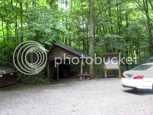
Saturday we drove from our home to Grandfather Mountain. It’s about a 3 ½ hour drive. The plan was to climb Calloway peak the highest on Grandfather Mountain – 5964’. I chose to use the Profile trail partly because I thought I could reach it faster than the trails that start off the Blue Ridge Parkway. It turned out to be the weekend of the Highland games. I was really glad we weren’t planning on going up to the Hanging Bridge as that was impossible this weekend. Grandfather Mountain is now a state park and the small Profile parking lot was manned by a couple of young state park officials who managed parking and made sure that the hiking permits were filled out.
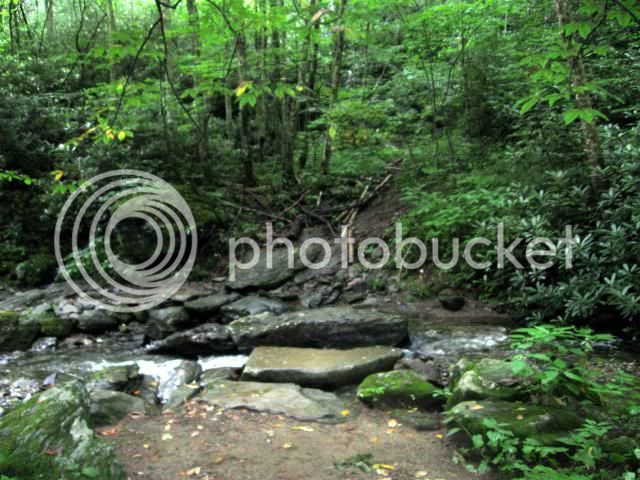
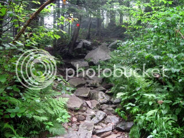
The Profile trail is the most recent of the trails on Grandfather Mountain and it is a work of art. This stream crossing is a case in point. The huge flat stones at the stream crossing obviously did not just happen to be there. Further stream crossings having the same type of flat rocks made it evident that they had been put in place.
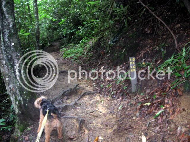
Every half mile on the way up there was a mileage sign making it easy to keep track of your progress. In many places stone steps had been put in place and the trail maintained a steady grade with the good use of switch backs.
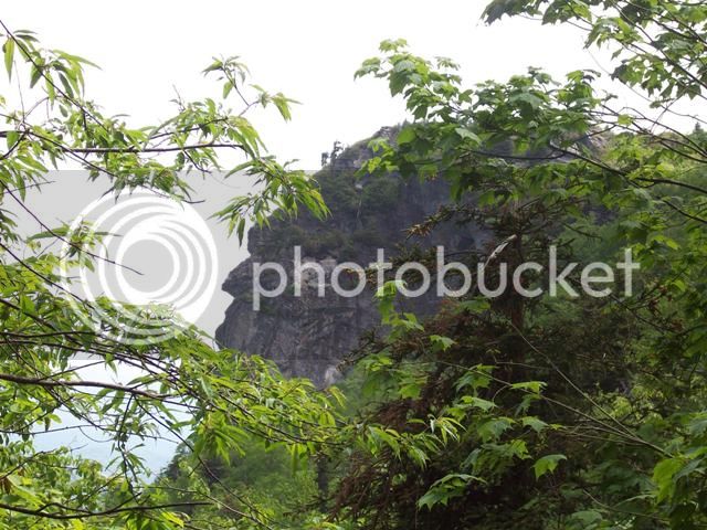
There are a couple of viewpoints on the way up where you come to understand the reason for the trail name. Off in the distance you can see North Carolina’s “Old Man” or “Grandfather”. In other words you could see “profile.”
About three miles into the hike you come to Shanty Spring where the water comes gushing out from the cliff. The water was coming out in numerous places, but there was a pipe with water flowing that made a water refill very easy.
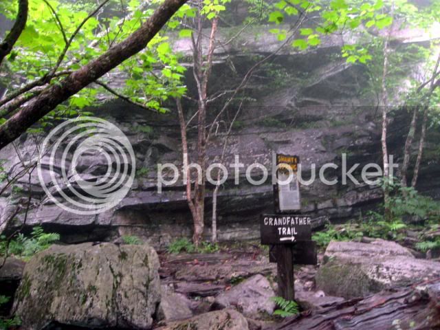
From the spring to the ridge and the junction with the “Grandfather” trail, the trail itself changed dramatically. Just to make those of us from New England feel at home it was completely rocky and went straight up. I don’t know but I suspect that this section of the trail is much older and was originally a spur trail from the Grandfather trail to the spring.
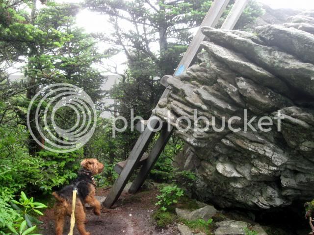
Once on the Grandfather trail we encountered the first of three ladders taking us to the summit. Lauky had never before encountered ladders of this size or type but he learned in a hurry. He went up them pretty much as he does ledges, He jumped from rung to rung. I understand that other trails coming in had other ladders but the Profile trail had none.
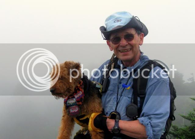
The summit was fogged in and a bit of an anticlimax. Accuweather for the area had predicted a sunny day with an afternoon storm but instead it was rainy and foggy all day. So much for mountain weather predictions. At least it wasn’t hot.

The Profile trail is the most recent of the trails on Grandfather Mountain and it is a work of art. This stream crossing is a case in point. The huge flat stones at the stream crossing obviously did not just happen to be there. Further stream crossings having the same type of flat rocks made it evident that they had been put in place.

Every half mile on the way up there was a mileage sign making it easy to keep track of your progress. In many places stone steps had been put in place and the trail maintained a steady grade with the good use of switch backs.

There are a couple of viewpoints on the way up where you come to understand the reason for the trail name. Off in the distance you can see North Carolina’s “Old Man” or “Grandfather”. In other words you could see “profile.”

About three miles into the hike you come to Shanty Spring where the water comes gushing out from the cliff. The water was coming out in numerous places, but there was a pipe with water flowing that made a water refill very easy.

From the spring to the ridge and the junction with the “Grandfather” trail, the trail itself changed dramatically. Just to make those of us from New England feel at home it was completely rocky and went straight up. I don’t know but I suspect that this section of the trail is much older and was originally a spur trail from the Grandfather trail to the spring.

Once on the Grandfather trail we encountered the first of three ladders taking us to the summit. Lauky had never before encountered ladders of this size or type but he learned in a hurry. He went up them pretty much as he does ledges, He jumped from rung to rung. I understand that other trails coming in had other ladders but the Profile trail had none.

The summit was fogged in and a bit of an anticlimax. Accuweather for the area had predicted a sunny day with an afternoon storm but instead it was rainy and foggy all day. So much for mountain weather predictions. At least it wasn’t hot.

Last edited: