
1HappyHiker
Well-known member
North Conway - More Than Just a Pretty Place to Shop (Middle & Peaked Mtn: 06-Jan-09)
If perhaps you need a break from peakbagging your winter 4K’s (or other lists), then you might want to head to North Conway to hike Middle Mountain (1,857 ft) & Peaked Mountain (1,793 ft). Both are located within the Green Hills Preserve which is practically within walking distance of downtown North Conway.
What these little mountains lack in altitude, they make up for in attitude! Starting at the trailhead on Thompson Road (530 ft), the 5.4 mile loop of both summits provides a 1,750 ft elevation gain. A pretty respectable work-out!
And although these mountains are little, they provide big views from various locations on and near their summits.
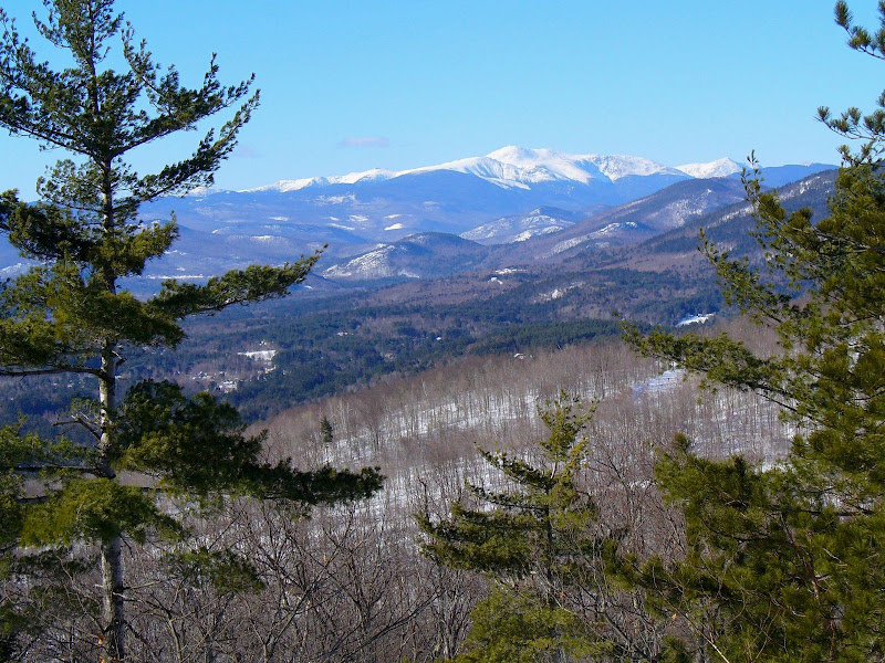
All the photos below were taken on the date of this trip (06-Jan-2009) with the exception of the view toward the Presidentials. Since those guys were pretty much socked in today, I inserted the one photo below which was taken when I did this same hike last year. (Hey, I didn’t want to do an injustice to these little mountains by failing to show ALL that they have to offer!") )
)
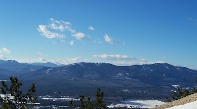
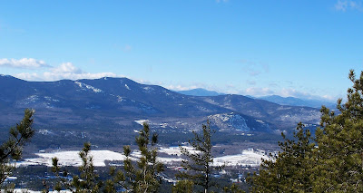
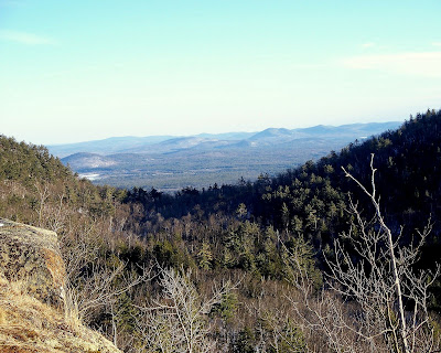
Regarding the 2 photos below, the one on the left features the Moats in the foreground. The one on the right is similar but is looking a bit more northwesterly and shows Mt. Carrigain & surrounding mountains in the background on the horizon.
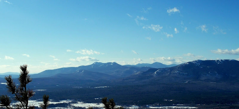
The photo below features Mt. Chocorua, but many other peaks such as Mts. Passaconaway, Paugus, etc can also be seen. And as you’ll recall, Forestgnome was in the Mt. Paugus area the same day as this report. So, if you look very closely at Mt. Paugus, you might see Forestgnome taking photos.
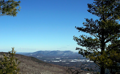
The next 2 photos are looking eastward into Maine. The one on the left features Pleasant Mountain, and the one on the right simply depicts the rolling terrain of western Maine.
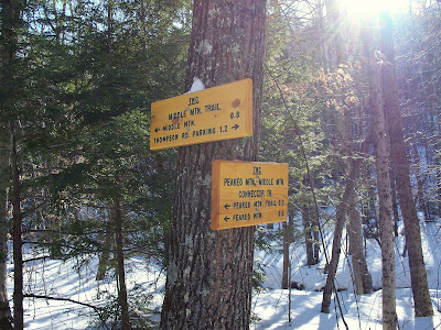
Finally here are the last 2 photos. The photo on the left shows a couple of the brand-new signs in this trail system. Nice!
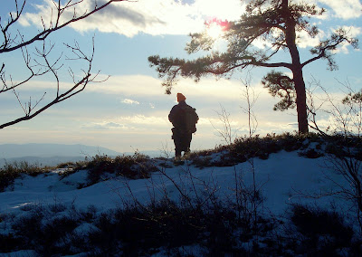
And the photo on the right shows my hiking partner Steve admiring the views toward the end of another great day in the Whites!
BOTTOM LINE TO ALL THIS: Sometimes big things come in small packages.
1HappyHiker
If perhaps you need a break from peakbagging your winter 4K’s (or other lists), then you might want to head to North Conway to hike Middle Mountain (1,857 ft) & Peaked Mountain (1,793 ft). Both are located within the Green Hills Preserve which is practically within walking distance of downtown North Conway.
What these little mountains lack in altitude, they make up for in attitude! Starting at the trailhead on Thompson Road (530 ft), the 5.4 mile loop of both summits provides a 1,750 ft elevation gain. A pretty respectable work-out!
And although these mountains are little, they provide big views from various locations on and near their summits.
All the photos below were taken on the date of this trip (06-Jan-2009) with the exception of the view toward the Presidentials. Since those guys were pretty much socked in today, I inserted the one photo below which was taken when I did this same hike last year. (Hey, I didn’t want to do an injustice to these little mountains by failing to show ALL that they have to offer!
)PRESIDENTIAL VIEW
Regarding the 2 photos below, the one on the left features the Moats in the foreground. The one on the right is similar but is looking a bit more northwesterly and shows Mt. Carrigain & surrounding mountains in the background on the horizon.
The photo below features Mt. Chocorua, but many other peaks such as Mts. Passaconaway, Paugus, etc can also be seen. And as you’ll recall, Forestgnome was in the Mt. Paugus area the same day as this report. So, if you look very closely at Mt. Paugus, you might see Forestgnome taking photos.
The next 2 photos are looking eastward into Maine. The one on the left features Pleasant Mountain, and the one on the right simply depicts the rolling terrain of western Maine.
Finally here are the last 2 photos. The photo on the left shows a couple of the brand-new signs in this trail system. Nice!
And the photo on the right shows my hiking partner Steve admiring the views toward the end of another great day in the Whites!
BOTTOM LINE TO ALL THIS: Sometimes big things come in small packages.
1HappyHiker
Last edited: