Sawtooth #3 – ski, shoe, snow, sun and solo … with pictures

vftt.org

Help Support vftt.org:

This site may earn a commission from merchant affiliate links, including eBay, Amazon, and others.

Doc McPeak

New member
Joined
Sep 3, 2003
Messages
952
Reaction score
71
Location
saratoga springs Avatar: Spring has sprung ... ju
For my once a year trip report, a LONG tale of a long day with many, MANY pictures. Click on any shot for the full size if you like.

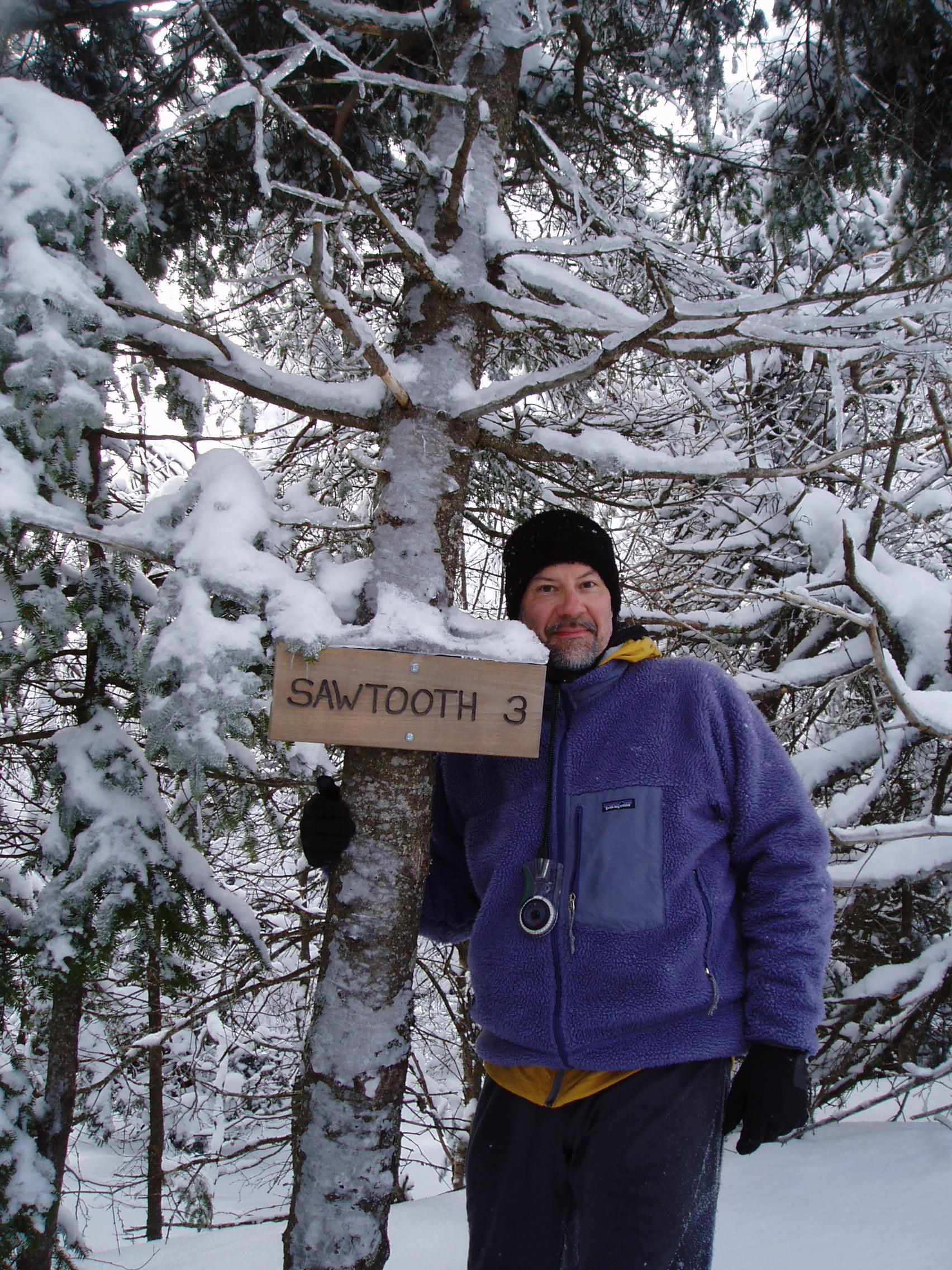
At the beginning of winter I decided I wanted to try a night out backcountry camping at a lean-to, and might as well do a challenging climb while I was at it. Funny how all interested partners winnowed out quickly when they realized I was serious about deciphering the old end to the Northville Placid trail and then continuing on down to the Moose Pond lean-to. Then we’d bust our way up the formidable Sawtooth #3, some seven or eight miles from the nearest outpost of civilization. Yeah, that plan didn’t go over so well.

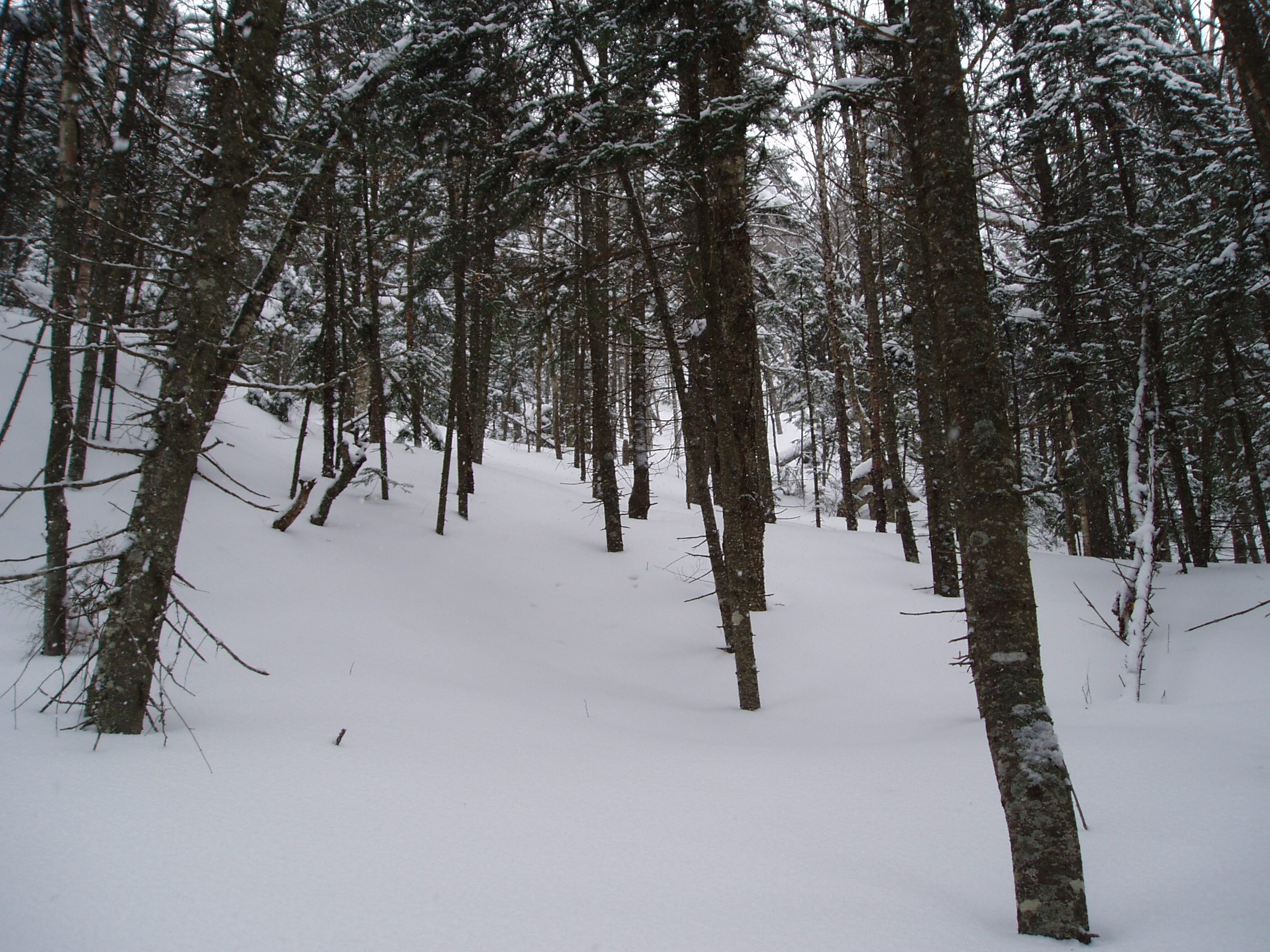
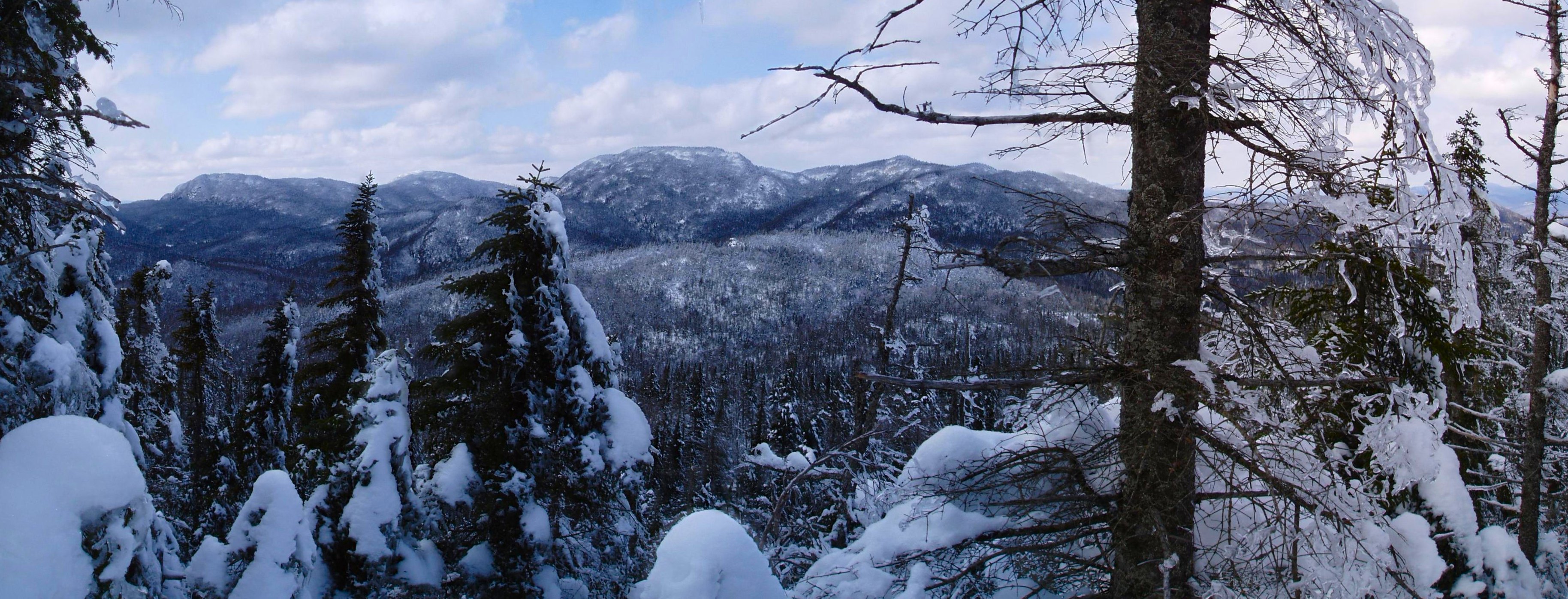
Well, Phase One happened last weekend. After a warm up few days of cabin camping in the East River Club, and a nice climb up Cheney Cobble over perfect late winter boilerplate …


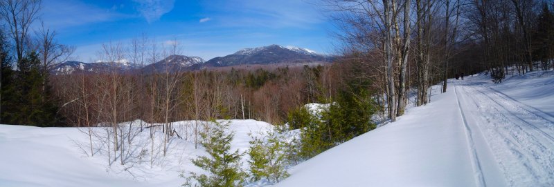
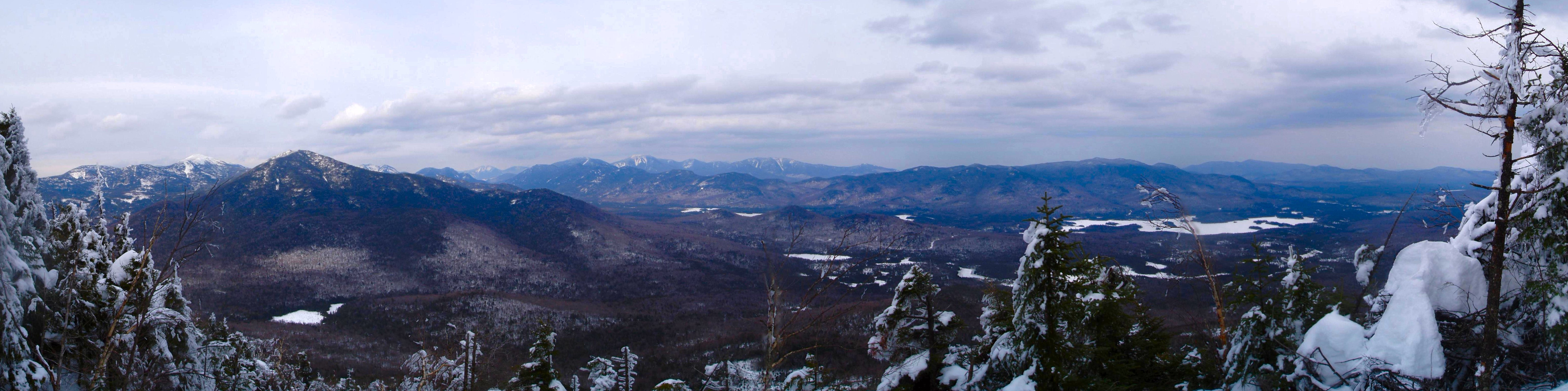
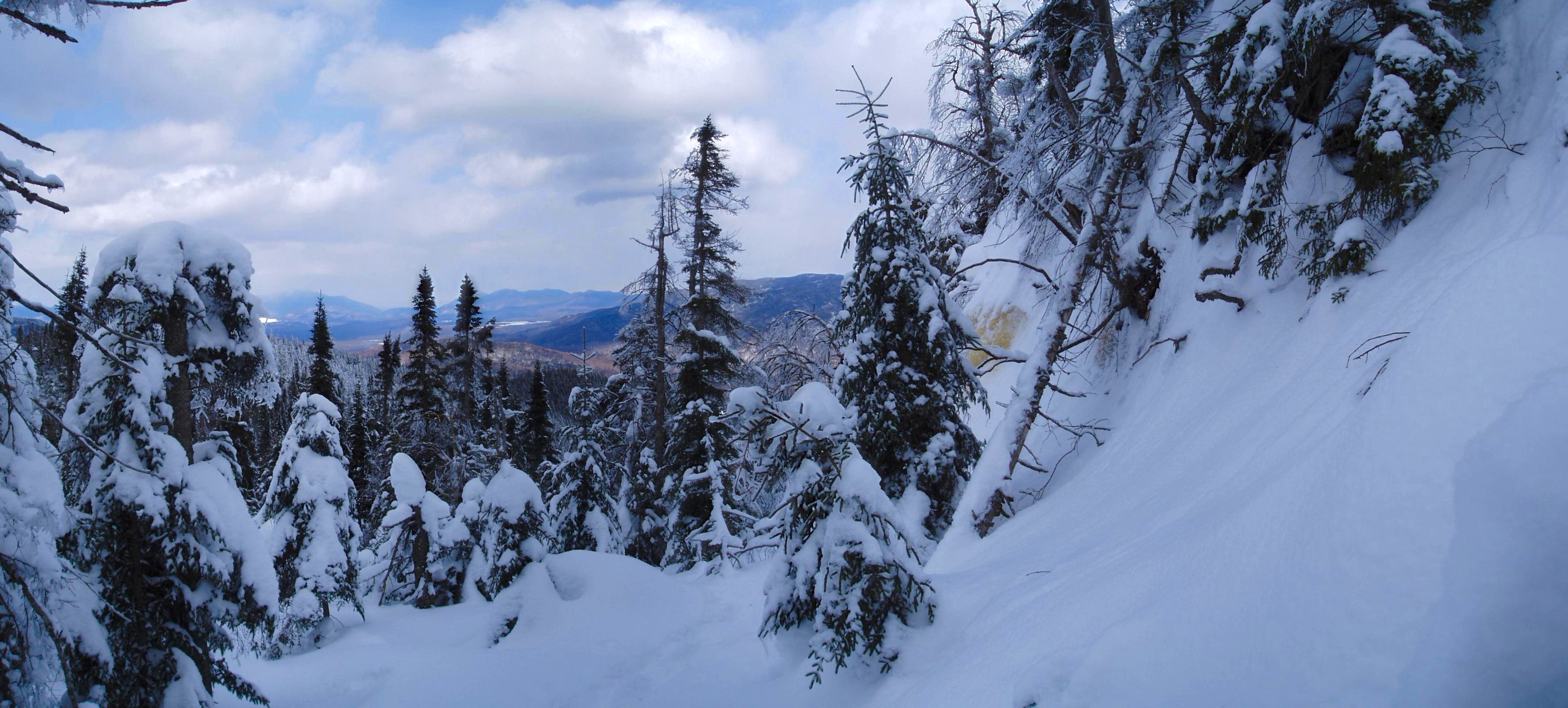
full of great and unique views …


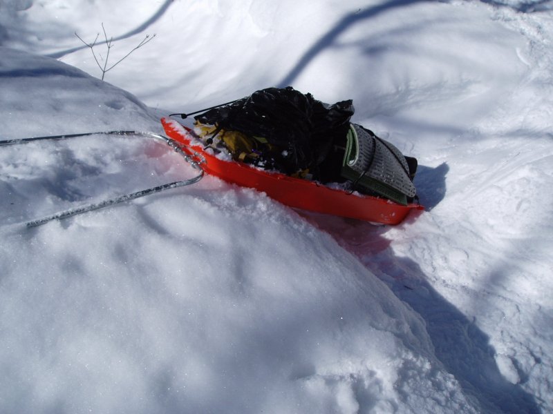
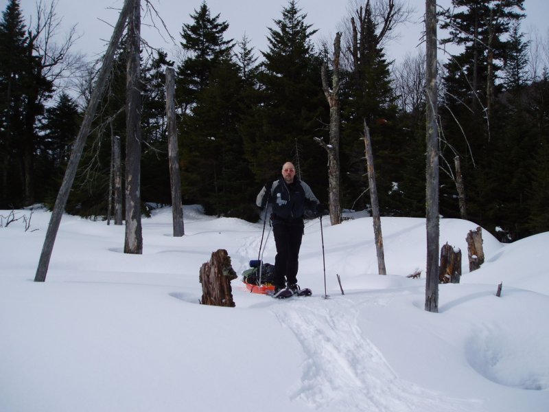
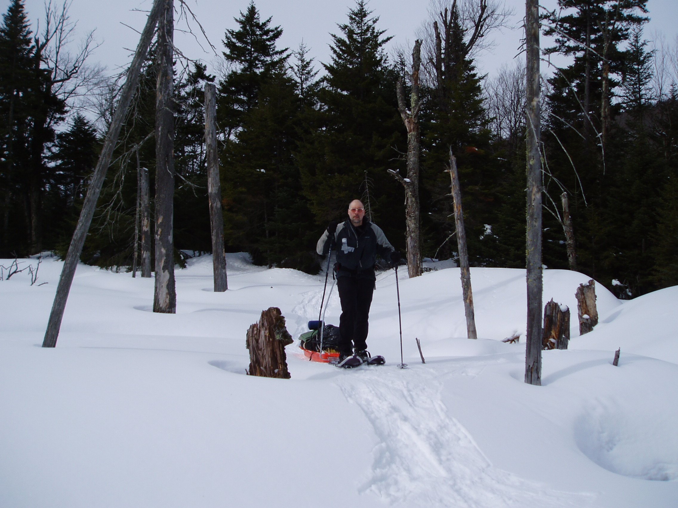
I figured I was game to tackle a whole array of winter firsts. Winter camping, pulk orienteering, solo winter bushwhack of a remote and seldom visited peak. Well, two out of three wasn’t so bad. Actually it was. I learned my Paris Expedition sled was not designed for bushwhacking with a full overstuffed load of winter gear.


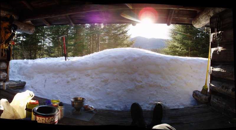
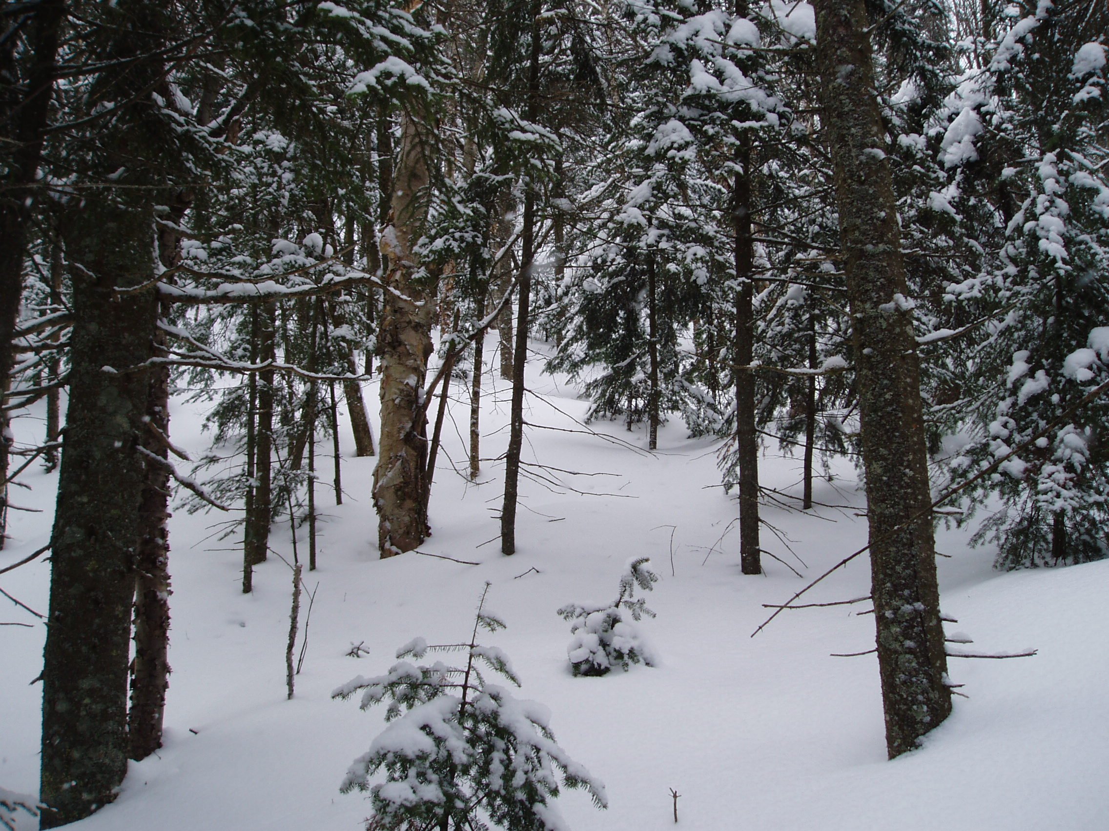
And I learned that several layers of summer weight sleeping bags do not make for a comfortable night in 5 degree cold. They make for a miserable night, even if chillin in the lean-to in the afternoon wane of the sun was a nice, albeit short and false, sense of how sweet the winter camping thing could be.


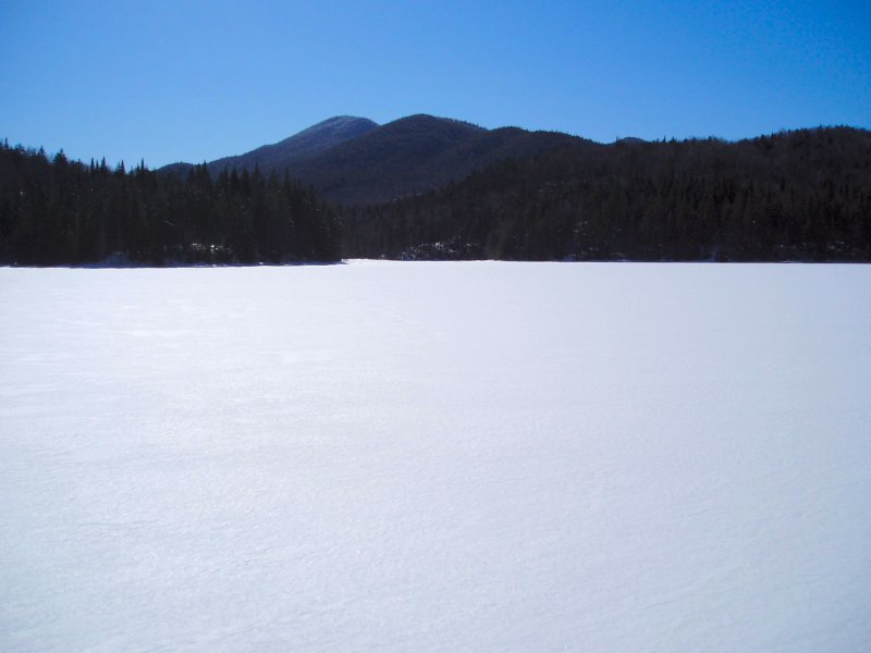
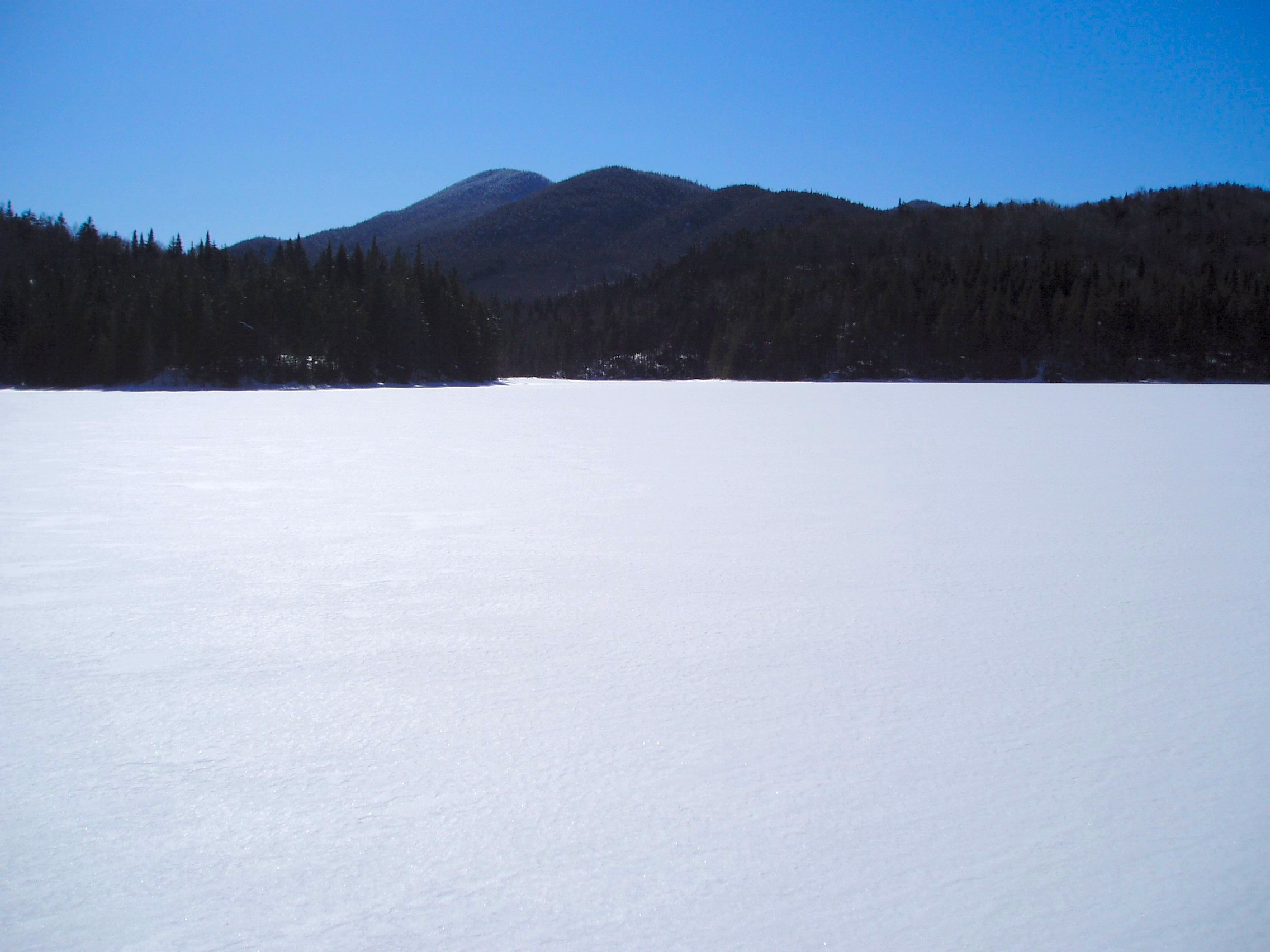
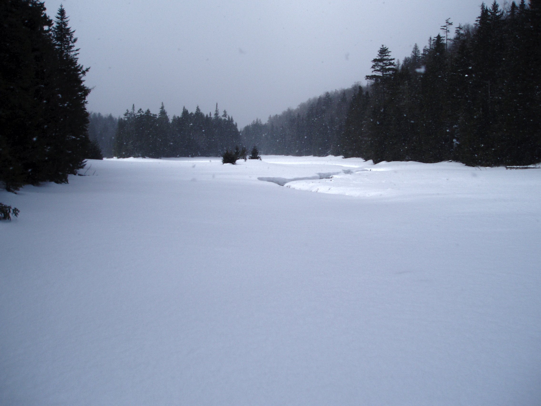
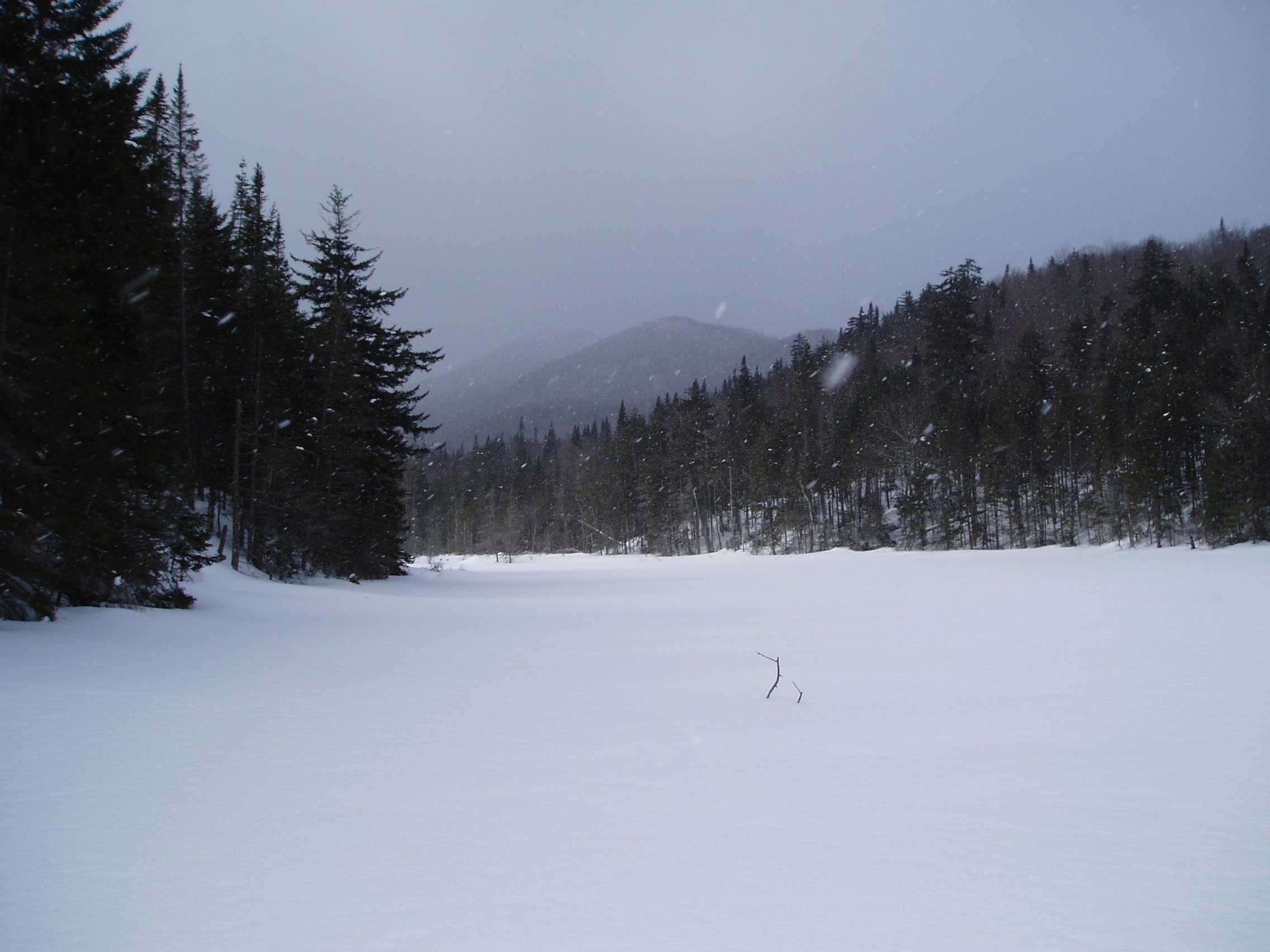
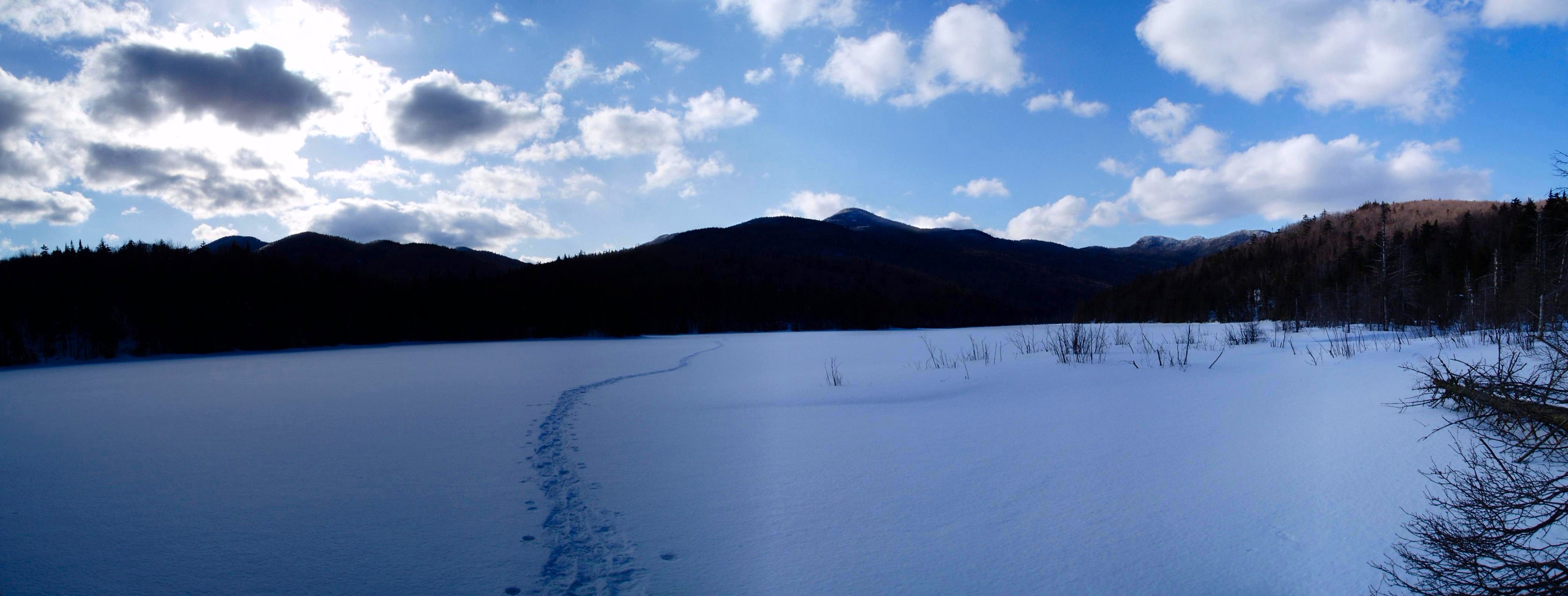
But, cruising around frozen Moose Pond on a glorious day was sublime consolation.


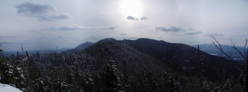
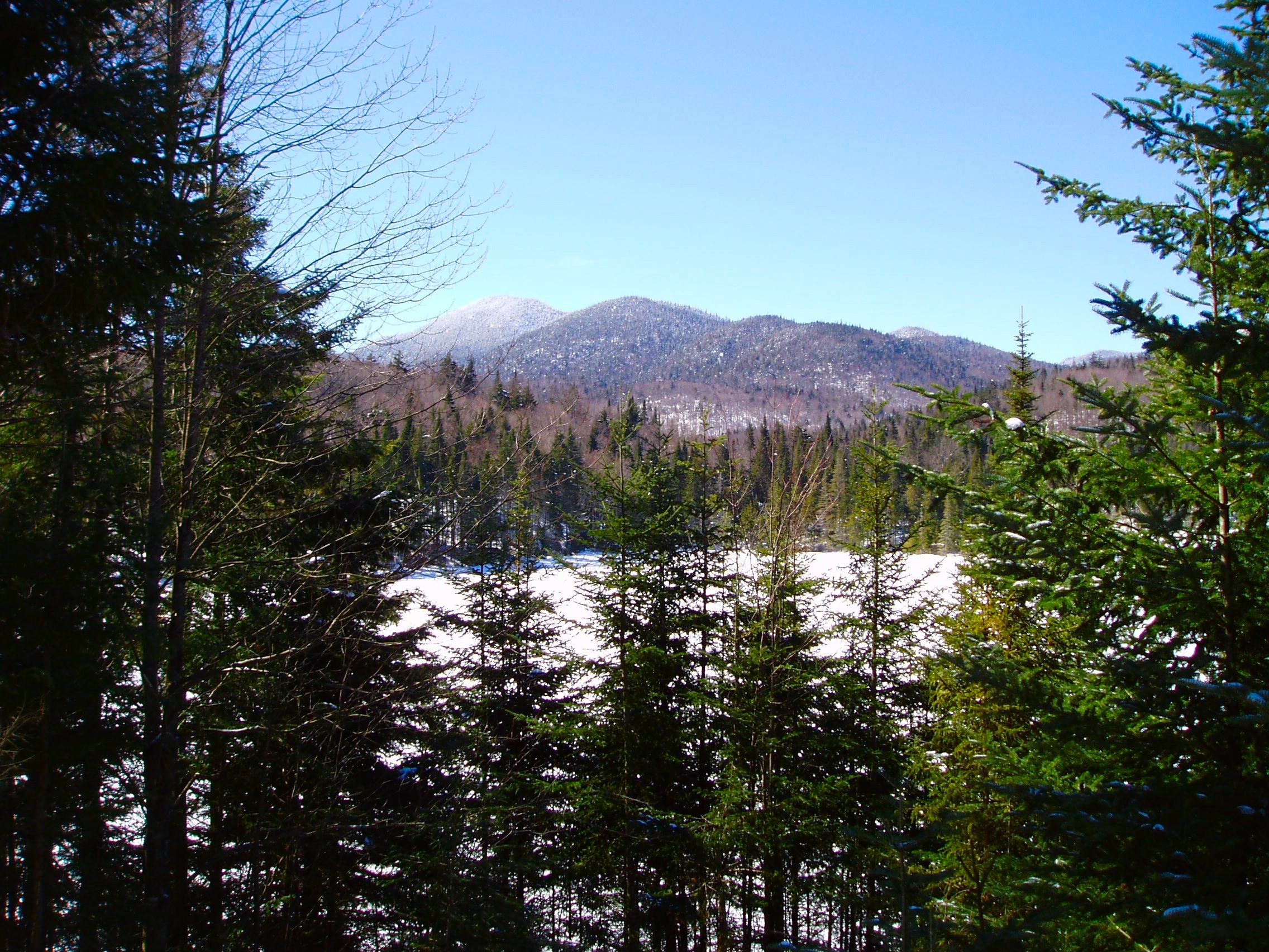
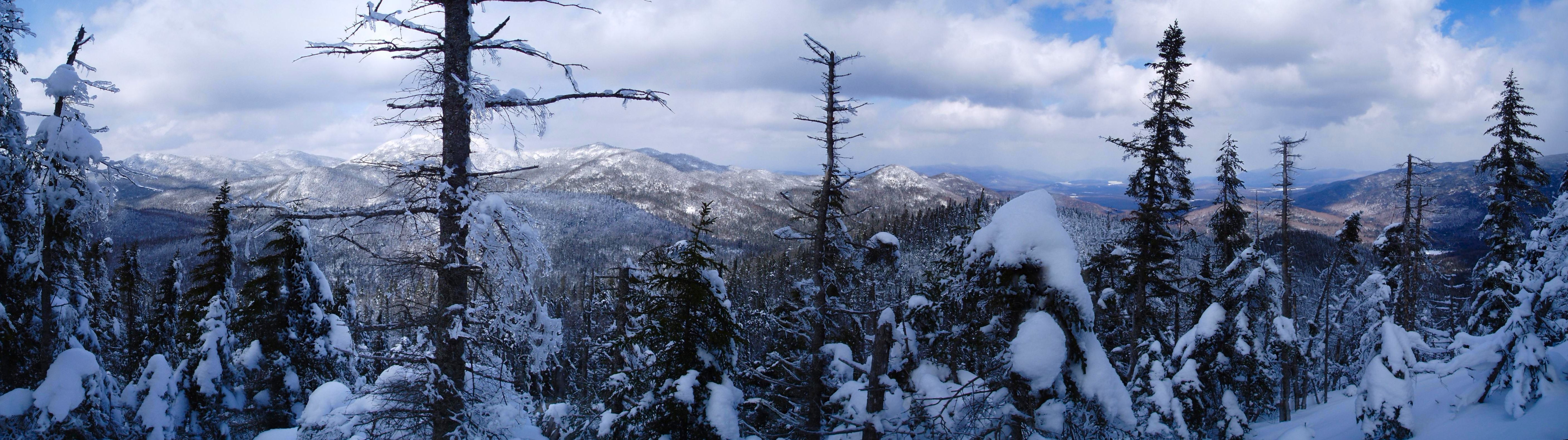
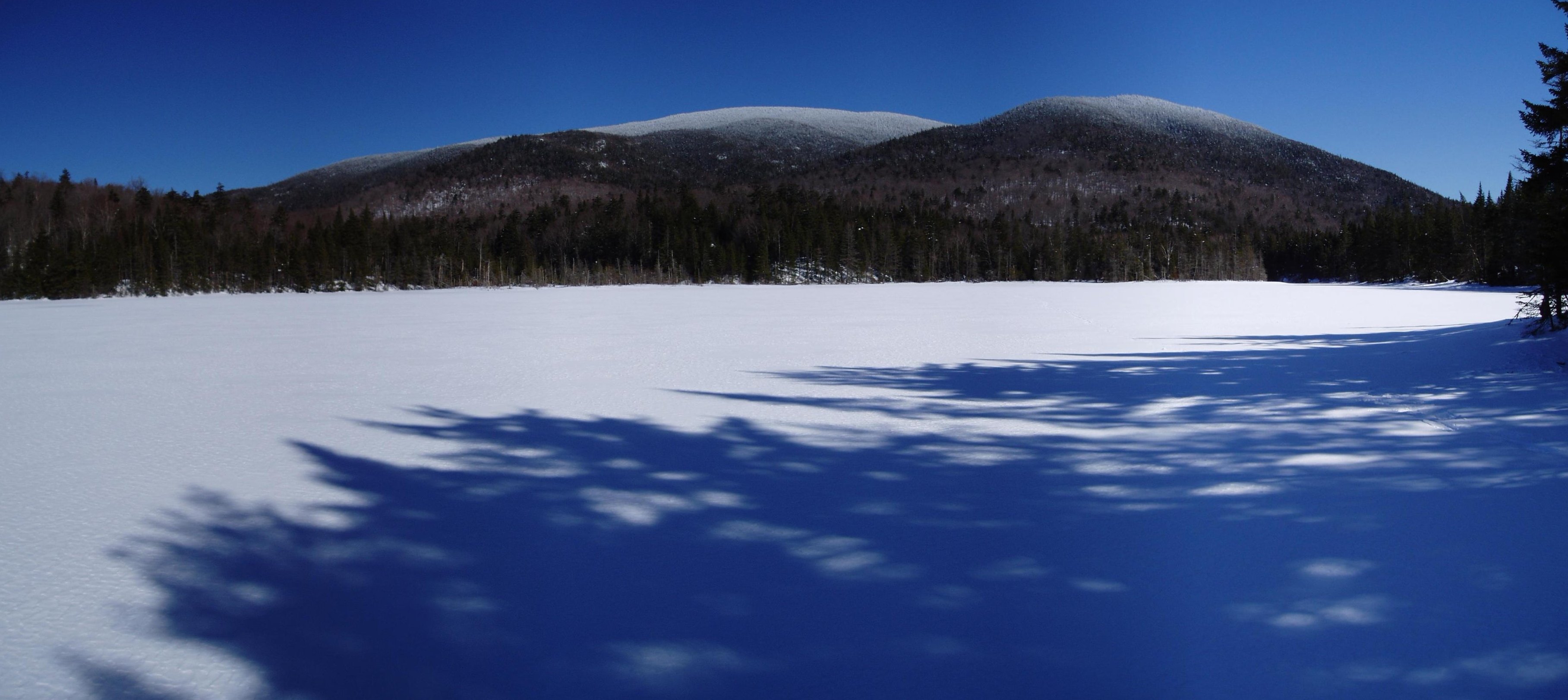
And scouting out a future climb of this peak … oh, so close …


Only made me more determined to return and tackle her. But first I needed to tuck tail and truck back home to civilization and nurse my wounds. Such is life …
 
Into The Wild ...

Now that I knew the trail inside out, I figured a ski and shoe combo would save hours. The day was forecast for mostly sunny skies with perfect snowpack saving temperatures in the mid 20’s. This wasn’t just going to be a fun day in the mountains; it was going to be easy. Too easy. Hmm … Confidence will get you to the top of the hill; overconfidence puts you under it!

When I drove past the entrance to the Loj road and could not see a single mountain (of the dozens one can normally see) I knew my best-laid plans were in jeopardy. Snow began falling soon thereafter, even as blue patches flittered about overhead here and there. Of course, they were more here, and not there, or where I was heading.

That’s okay, I would just outpace the snow shower and be basking under a frosty summit beneath brilliant cerulean skies in no time. After shrugging off setback one, I soon ran aground again. Literally! For the timesaving skis under me were slippery skinnies and the snowshoes, hiking boots, and food, water, and supplies for an epic solo winter bushwhack laden down upon my back made for a disastrous combination.

After a few decades of XC skiing you think I would have conceded that these touring skinnies just will not turn on a dime, or stop on demand no matter how hard I wished it. And I wished it almost as hard as the landings my backside was finding. A twisty turny abandoned trail with blowdown litter and low flung branches had reduced me to a travelling yard sale.

A sprained thumb, torqued knee, and two cheeks of hurt had me whimpering in misery by the time I reached the second beaver swamp, some 2 miles in on my 5 mile approach. At this rate I figured I would be in traction by the time I reached Moose Pond! Okay, stupidest idea I’ve had since … well, last weekend. Creeping across an ice bridge over a frigid icy beaver brook, as the snow came down harder …


Was time for a re-evaluation. Scrap the skis, don the boots and snowshoes, and soldier on was the new plan. I mean, come on, Sawtooth 3 is only considered one of the hardest bushwhacks of the ADK 75 Highest, so this little bit of pain was nothing. I wasn’t doing this old school map and compass to make things easy! GPS back-up, just in case? Ah, no. Pure contour lines, direction points, and visual landmarking. Oh yeah, it was snowing. Again, two out of three shouldn’t be too bad. Luckily my alter-ego partner was stubborn and hell bent on conquering this peak today come hell or high water -- or both -- and I went all in with him.

Now on snowshoes, trying to work out the kinks in my caboose, progress slowed a bit, but morale returned in a big way. The adventure was back on, and there is nothing like being out in the wilderness with a soft snow falling and only your thoughts and the sounds of nature along for the ride. The ski tracks I was following stopped at Wanika Falls and now it was pure untracked landscape ahead.


Well, just me and the dozens of various critter tracks. Spring is definitely here, and the plethora of animals up and prowling about were the proof.


I stayed in the defile and headed for the long swamp that would be fun to cross in its frozen state. This shortcut would save me some up and downs, but also eliminate side-hilling over the boilerplate, even with a touch of new snow to add some grip. The six inches of fresh snow made the going soft and quiet, and soon I broke from the trees and started across the pond. I guess technically I was crossing the last body of water that exited north toward Lake Champlain, for Moose Pond ahead became Moose Creek, which became the Cold River, which flows into the Raquette River, in and out of Long Lake, Forked Lake, and finally into Raquette Lake, where some of it may find its way into the Moose River! Which leads to the Black River, to the West Canada Creek, to the Mohawk River dumping into the Hudson River near Albany, and finally emptying into the Atlantic Ocean after passing the Statue of Liberty.


Rejoining the trail after the ponds and marshes put me minutes away from the Moose Pond lean-to, where it was fun to see the only visitors since last weeks visit (and I was the first to visit since November!) had been various pine martins, squirrels, and even a grouse or some medium sized bird. I went to the opening looking down on the pond, with this great view of Sawtooth 3 I had last week …


And saw this …


Not too enticing. But with more and more glimpses of blue sky overhead – of course none anywhere near S3 – I got ready for the map and compass portion of the trip. And the route finding, and trail breaking. And the climbing … All alone … In the middle of nowhere … Scaling a mountain that gets a couple visitors a year …

Okay, a moment of reflection, and one oh-what-the-hell shrug later, I took 2 pounds of weight off my shoulders in the form of some electrolyte peppermint green tea to stash for the return trip home. I gobbled down a homemade Reeses cup, with mascarpone cheese instead of peanut butter, a handful of cashews, and set out across the pond. Soon I rounded the southern dogleg of Moose Pond and a ghostly apparition of my mountain materialized before my eyes.

 
Although the picture made the two bumps ahead look like separate mountains, I had surveyed various photos I had taken from places like Seymour, Sawtooth 1, Algonquin, and even Marcy, to determine that the first bump wrapped around with little elevation loss to the main summit in a nice circular sweep. From here it just looked plain daunting. Especially knowing I would soon be in the trees near that view blocking lower bump trying to decipher good woods from bad through the falling snow. Ah, bushwhacking in the pure map and compass vein …

So, into the fray I dove. Leaving the pond I was soon forced out of the drainage by its unwieldy winding brook ravine. My first instincts proved wrong as I broke right in an attempt to gain the long ridge early. The woods got thick and inhospitable and I decided I would retreat and try a low traverse to get closer along the main spine before heading uphill. It’s amazing how trusting your instincts in the woods – after plenty of trial and error – often means the great route from the great pain in the ass fiasco.

Minutes later I was back in wide open woods, cruising across a pair of unmarked beaver ponds, and picking out adjacent bumps as landmarks as I plotted my progress with quick furtive glances at both my map and compass. With the little lower bump blocking out most of the ridge and sub summit above, I decided to forge straight up and see if I would get a good vantage point from the top. I would need to head up anyway, no time like the present.


This proved to be wise decision number two. I was on my way to par for the course! Although I had to contour around the first band of cliffs of the day, the bump only dipped about twenty down on the backside toward the main mountain massif. Above was the sub-summit I had planned on attacking directly, but more enticing was a wide flat leading to a drainage from the col beneath the sub and the rest of the ridge heading to the north. Even with the snow falling, the open woods were too inviting to pass up.


And the woods only opened up wider and wider …


With the spirits soaring as only sweet open woods cruising in the midst of a notoriously tough bushwhack can elicit, I quickly climbed the 800 feet to the col. From here it would be only 500 more over the course of a long gentle ridge to the summit. The problem was now I hit some of the higher elevation snowpack conditions. A steep pitch to gain the sub-summit proved the huge difference between gentle cruising along soft snow covered boilerplate, and swimming upstream like the salmons of the Northwest. The crust, noticeably thinner, would shatter in large sheets and the snow beneath was the consistency of sand. Bottomless sand. My pole went through on the first big push and my hand and arm followed up to the shoulder! Hmm, a dive into a spruce trap and I may be living there until May or June!

Progress got a little sketchy, and I found myself diving for any small tree large enough to hold me as I hauled my body up the mountainside, arms and legs squirming like Wily Coyote running through a pit of quicksand. Little by little I blasted through these short but steep sections and gained the sub-summit. Again the terrain was open and smooth sailing ensued once more. Stopping to catch my breath and woof down another dark chocolate and mascarpone treat, I got a little glimpse of the nearby Sawtooth siblings. Behind me was S2, S2 Minor, S1, and S1 Molar. You could also make out a faint outline of S6, and either S9 or S11. Mixed in were S23, S28, S33.271, and S14.459, I believe. Well, here. You figure them out …


Oh, yeah. Still snowing. Well, maybe all this hard work would motivate the weather gods – Zeus or Loki or Anubis – to give me a view or two as a reward. Funny, I usually talk at least somewhat to myself on solo hikes, but this was a bit more than the usual. Even if the snowpack was soft boilerplate, and I was making steady and sure progress toward the summit ridge ahead, I was still on edge waiting for some calamity lurking in the shadows. As I cruised along I knew damn well that I would next end up on the 1050 false summit and a crushing view of a glistening S3 to mock me with the last laugh of the day. Yet, I held out that unrealistic hope that I had been moving faster and higher and had covered more ground than I thought and … Nope …


There was the last big push of the day, and who knew what that little bit of climbing would bring. Hold on. I just realized it had stopped snowing, and there was more blue in the sky than gray. And even a view across the abyss toward the MacIntyres and MacNaughton and Lost Pond Peak.


The initial letdown of seeing the final obstacle gave way to surge of optimism and adrenaline that I would indeed make the summit and might even get some of the views that only winter snowpacks could afford. I headed down off the little false summit and into the first really thick stuff of the day. Three minutes later I was back in the clear, sailing over millions of shards of legendary S3 blowdown hidden beneath my firm carpet of winter cement.

Could it be this simple? A waltz up to the summit through … No. A hundred feet up from the col I ran aground again, and this one threw me for a bit of a loop. Now half a day into this odyssey, fatigue was wearing a bit on the body, but heavily on the mind. I had run into a seemingly impenetrable wall. Not just inside my taxed mind and body, but directly in front of me …

 
I tried to zigzag my way up it. Then went to the edge to test the nearly completely hidden balsams. They were not into giving me any support or passage, and neither were any of the trees in the middle of the steep pitch. I worked my way from one tree to the second, then looked at a huge gap ahead with no help and retreated back down and sidetracked across the wall looking for an opening. For the first time in the day a surge of disappointment rode over me. With some seven or eight rugged miles back to my car, I was not in the mood to crawl up a crazy slope and leave all my reserves on the mountainside just for a summit. Well, okay, I was ready. Just wasn’t looking forward to … hold on, maybe I should just keep contouring around this wall and see if … yeah, there’s a gentle gully that should do the trick …


A couple of breaststrokes later and I was again in the clear. Now it got even more open – I knew this was the summit blowdown party from friends who have been here sans snow – and after a nice stroll higher and higher, admiring the fresh coating of snow under now ever expanding blue skies, I saw a welcome sign …


Sawtooth 3 had been welcomed into spring with a visitor … and maybe even the first of 2008? Whatever the case, it felt great to make it up in almost one piece, and a toast of hot cocoa soon followed. I poked around the summit and found this great vantage looking down on the Preston Ponds and Duck Hole. The Santanonis and Henderson peak beyond them, a cloudy view of the North Rivers and last weekend’s Cheney Cobble climb, MacNaughton on the other side of Preston Pass, the backside of Wallface, Lost Pond Peak, and there was the full breadth of the MacIntyres, struggling to cast off its cloudy overcoat. Somewhere behind the still falling snows of the interior would have been even more peaks, but having sun on my face on the summit was the best view of all!


Layered up, I poked around a bit more, then dove into a smoked salmon and cucumber sandwich on delicious olive bread. Another chocolate mascarpone cup and I was ready for my summit shot, and the road home.


The best thing about winter bushwhacking is that you can put the compass away when you hit the summit on a one-peak excursion. Now it was just Hansel and Gretel time back the eight or so miles to my car! With the sun out and the snow clouds lifting, awesome views of the surrounding Sawtooth range – now with even more members present! – stood out against the sweet winter blue skies.


Just the best looks of the Sawtooth Massif I had seen ...


The way down was a blast, and with the sun and the skies and the thrill of conquest, all was one big happy tramp. I was amazed that my route up had been so fortuitous as thicker woods and steeper slopes seemed to surround my open corridor up to this remote summit. The early pains of the day were forgotten as I snapped one last pic after crossing Moose Pond. The late afternoon clouds gave the scene some nice drama and echoed my feelings about the trek.


All’s well that ends well. Even if the trek out got a little long in the tooth, and strangely when I hoisted the skis and skiboots on to my pack they seemed to dredge back up the pain in my backside, the hurt in my thumb, and the tweak in my knee. Better late than mid summit push! Still sore a few days later, with the snowshoes and skis happily away for the season, the memory burns bright and will always be a reminder of why we put challenges before ourselves and rise to meet them. Twinges of pain, fear, and isolation just seem to be part of the package I guess. Happy Trails ... to you ...
 
OH Sean!!

I only wish you had twisted my arm a bit more, and reminded me of your exquisite menus!! What spectacular pictures (as usual!) and such an adventurous spirit! I am sure that the Hansel/Gretal part was sweeter than ever. Thanks for sharing you report! As always you have a most interesting way of seeing things.

:D When is the next trip
 
Geez- I did't know such a two-try encounter went along with the pix!!

Great to read your wonderful story and still try to understand why you keep coming up with more and more off-the-wall treks. ;) I say lift-assisted and grab a board. You deserve a break!!

(BTW, the part about skiing in, etc. had me howling. Wish I'd have been there for that part!)
 
Now that's what I call a trip. Nice trip, nice report and nice pictures.

Inge, click .-HERE-
 
Yikes Neil!!

You kinda have me scared w/ that Mug! :D

Tooooo bad I have to work this Sat. :rolleyes:

I'll be looking for your trip report!! :)
 
Bravo !!!

Sean,

Just outstanding all the way around. Great plan, execution, summit and photos.
The wall that guards the summit of ST3 is formidable. It took Brian, Spencer, Sunny and I one hour to go the last 1/10 of a mile thru some really heavy stuff. Same experience, contour around the last fortress and up a gully to the ramparts.
Very impressive accomplishment doing this solo.

Alan
 
Neil, the two minors north of S3 (closest to the NPT) both look great. The conical one holds its shape from all sides, and the three headed monster to the north of it looks to have nice open viewing ledges on all three bumps. Great conditions in there. Have fun!

bubba, I can just barely sit still now without flinching ...

Alan, BS told me about the blowdown across the ridge. Not a sign of any now! Just had to figure out the cliff ...

Inge, can't wait for our Spring Outing! ;) (I'll start the menu next week!)
 
Are you REALLY sure that you don't want to guide Gary and I tomorrow (Friday) as we will make an attempt at S3, shamelessly vulturing your tracks?
 
Sean gets the blue ribbon for best report of the year. Excellent descriptive narration puts the reader right there. Fantastic images, too. I could feel myself vicariously clawing my way up that cliff....
From the looks of your positioning with the sign, there must be at least six feet of snow up there. Sans snow I remember the sign being so high that even Shaquille O'Neil would've needed a ladder to nail it up.
Congratulations on perserverance and completing a most difficult ascent!
 
iceNsnow said:
I only wish you had twisted my arm a bit more, and reminded me of your exquisite menus!! What spectacular pictures (as usual!) and such an adventurous spirit! I am sure that the Hansel/Gretal part was sweeter than ever. Thanks for sharing you report! As always you have a most interesting way of seeing things.

:D When is the next trip

I wish my arm got twisted into this meal, uhhh, I mean hike. Would have been happy to help lighten the food bag.


Great report Sean. You should write more of them.
 
Friday March 28, 2008, Gary and I Sawtooth vulturing adventure didn’t go as planned. As we reached the Pine Pond trailhead behind the snowplow we knew that our dream of a “free ride” to Number 3 was history. The 16 miles plus loop took us a mere 11.5 hours, we broke trail every step of the way. Thankfully as it has been the case all of this past winter the hard crust wasn’t 3 feet below. We followed Sean’s very faint tracks all the way to Moose Pond lean-to. The traverse of Three Peaks eastern marsh and Moose Pond were the highlight of our day. It an experience we will repeat next winter as the unbroken landscape was magnificent even in a snowstorm kind of a day. The only tracks came from the wildlife. The beavers seemed very active, probably thinking it’s spring. We were treated to a bouncing Snowshoe Hare (or European Hare as it was so big and not that white?) and a mink both zigzagging on Moose Pond as we made our own traverse in much less style. Coming out of Moose Pond South-West Bay we, again, found faint tracks, till the next swamp, 15 minutes away. Then as we made a bee line for the ridge towards the 850 meters contour line as the snowfall intensified it was just plain hard work but very open. About .3-mile from the summit we found Sean’s faint tracks again and that was a big and needed moral boost. Still we were a bit worried by bare-booters tracks meandering all over the ridge: Sean’s smoked salmon sandwich had awoken a bear or two and they were still out looking for him! We finally reached the beautiful summit sign, now in the middle of snowfield, even though I remembered a spectacular blowdown field. We did enjoy the site less five minutes as the falling snow was just about erasing our deep tracks. So down we went merrily following a faint track again, still much faster as thanks to numerous and long butt slides we were back at our latest swamp of the morning within 60 minutes and at the lean-to in 90. On all the ponds and marshes our morning tracks were already completely erased.

It was a tough but spectacular day, even though we only enjoyed limited views. Thanks Sean for enticing us to vulture your tracks…

Christine
 
Alan,

Gary still needs Number 4 and Number 5. Are you interested in revisiting those two Sawtooth jewels?

These late March conditions vary greatly from one peak to another. Cheney Cobble had shoulder high snow up high, Blue Ridge(Hoffman) was all thick ice and horrendous new blowdown from last icestorm and S3 of all of places, sporting a good crust under a foot of new snow, was every bushwhacker open birch forest dream!

Last Friday, the very last day of winter as Alex, Gary, PinPin, Alan B. and I, accompanied Cory to RPR and Giant for his W finale, we found 18 inches of new snow, blowdown and thick ice above 3000 feet. It was another spectacular sunny day to celebrate a rather daunting accomplishment. Cory climbed all the 35 Catskill and the 46 Adirondack peaks this past winter!

Christine
 
Top