Hawthorne Falls - the perennial questions -? How/where - have they disappeared????

vftt.org

Help Support vftt.org:

This site may earn a commission from merchant affiliate links, including eBay, Amazon, and others.

Becca M

Active member
Joined
Jan 31, 2008
Messages
854
Reaction score
102
Location
Pelham & Bristol, NH
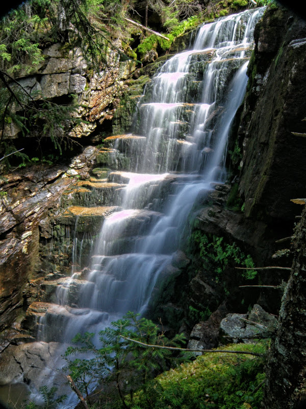
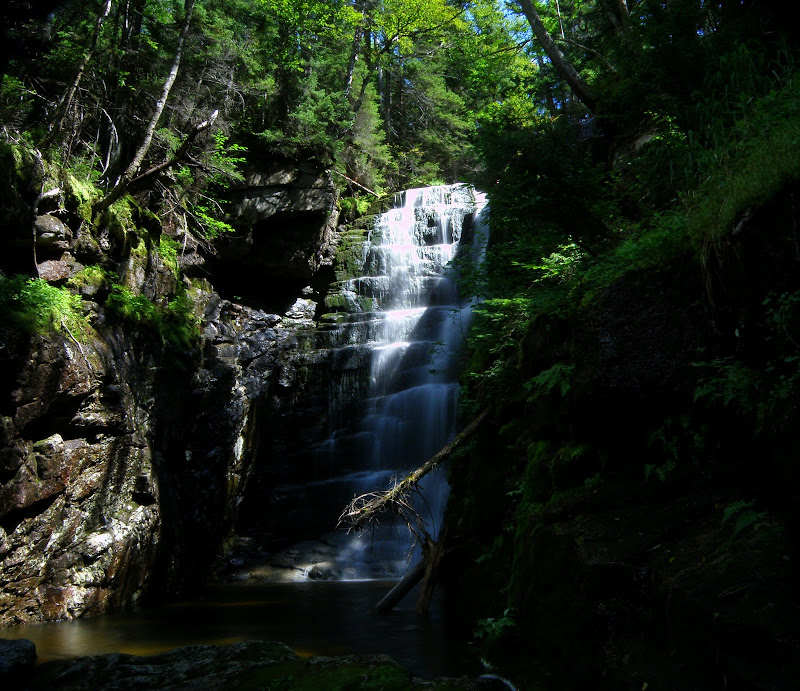
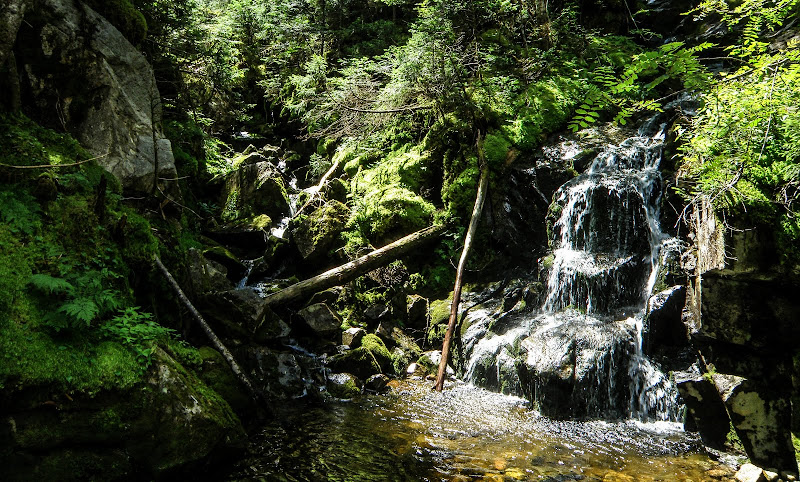
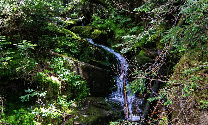
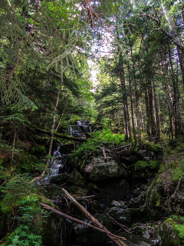
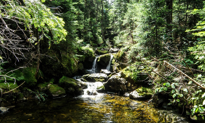
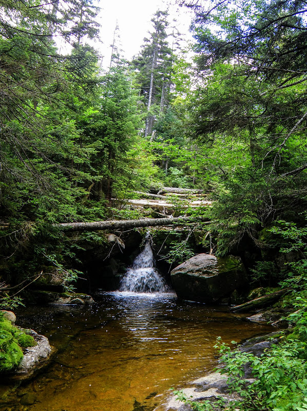
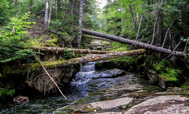
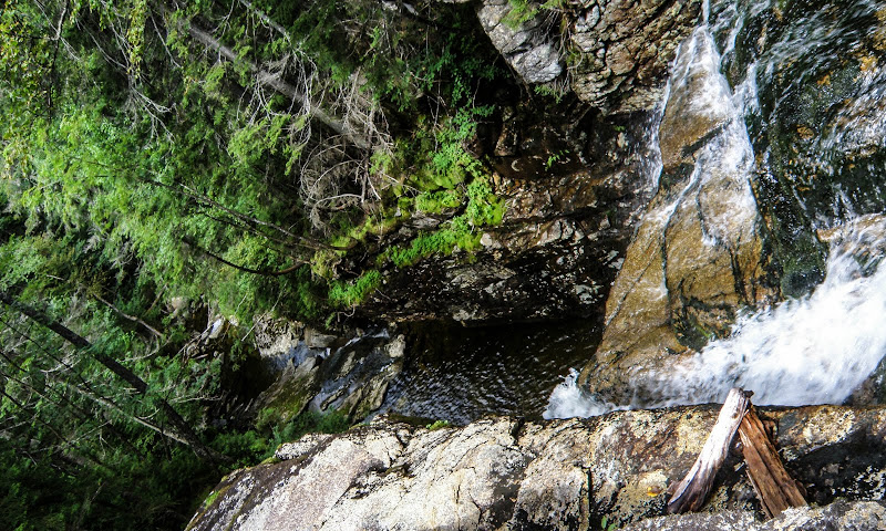
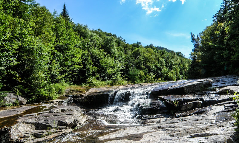
Hi All! I have now tried twice to find Hawthorne Falls. Last weekend I went uphill from the Gale River Trail at the Garfield Stream junction. Many cool cascades and shelves - WOW! AND lots of big rocks with DEEP mossy holes in-between. Around 3200' woods got really thick near the junction with another stream and I cut up to above the box-like canyon. Apparently I missed the big falls in the canyon.

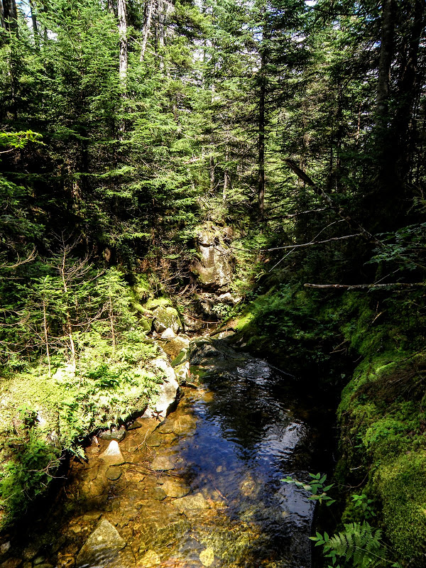
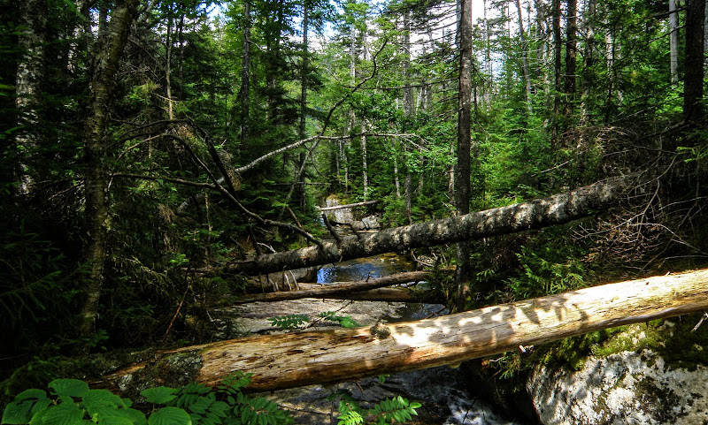
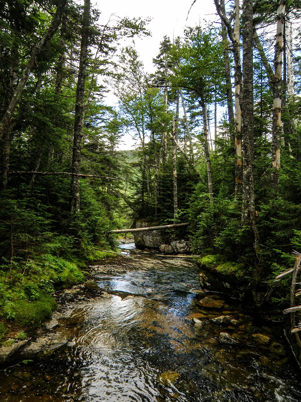
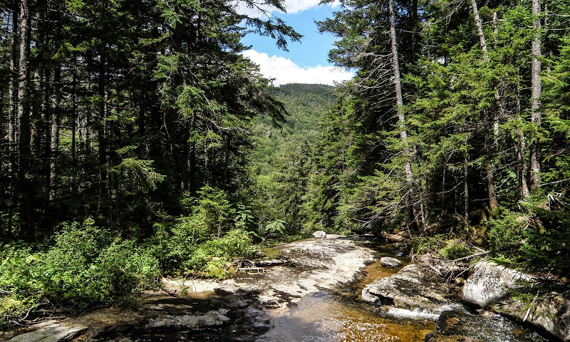
Today, after hitting some other objectives, I began my bushwhack from the Garfield Ridge Trail opposite the Franconia Brook Trail. I headed approximately due north but a little to the west so I could intersect the big curve of the Garfield Stream. Not bad woods getting down to the stream. Very mossy and slippery near the stream, which I did drop into. In what I ASSUMED was the falls area, there were many herd paths up and down the sides of the canyon. I went up and down both sides. There seemed to be two streams that met in there.

I have (of course :0 ) searched the web, youtube, etc., but have reached a dead end. I am VERY certain I have explored, by now, the ENTIRE streambed but my pictures just DON'T look like the pics I keep seeing on the internet. Maybe the water flow is too light?

here is the old topo showing the location of the falls (north of Garfield Ridge) http://docs.unh.edu/NH/frcn32ne.jpg

I am *SURE* I scoured the canyon. I cannot imagine that I missed it!!! Has anyone been in there recently? I hate to say this, but, did they fall down into the canyon? (OK, just kidding there - not really - I mean, the old man fell, maybe the falls did too??? - HAH).

Thanks!!!!
 
I started down from Garfield Ridge, picked up, and followed Garfield Stream. Several cascades and thought I missed it as well but just kept following the stream. It's about .5 miles from Garfield Ridge. Even with low flow, if you found it, you'd know it. It's a stepped fall, about 40' high so pretty hard to miss.

P8120098.JPG


P8120123.JPG
 
Last edited:
HI! Good pics - that's what I was expecting. Any idea how close it is to the junction of the two streams in that same area? I *KNOW* I was .5 miles from the ridge. I don't have any good pics - just some really narrow stepped falls that didn't go as high. I have 2 tracks on my gps and both follow the stream.... grrrrr

THANKS!!!! :(

Here's a combo of my 2 tracks: (note - the stream where the dots are is quite flat - I veered away in the flat sections due to blowdowns - maybe it was hidden?)


Best pic I have - NOTE - this area had MANY herd paths and was basically pretty flat above and below - this was inside the box-type canyon:

 
Last edited:
This is the only stream junction I remember. Just a trickle on the right branch.
P8120074.jpg


Time line from this photo to the first of Hawthorne Falls is 35 minutes. With about 6 other cascades varying in size along the way. Once I picked up Garfield Brook, I never was more than a few feet away the entire trip down to the falls. Of coarse after finding it, then leaving it, it was a different story. Pretty ugly woods until I got to that great open slab area.
 
HI! Good pics - that's what I was expecting. Any idea how close it is to the junction of the two streams in that same area? I *KNOW* I was .5 miles from the ridge. I don't have any good pics - just some really narrow stepped falls that didn't go as high. I have 2 tracks on my gps and both follow the stream.... grrrrr

THANKS!!!! :(

Here's a combo of my 2 tracks: (note - the stream where the dots are is quite flat - I veered away in the flat sections due to blowdowns - maybe it was hidden?)


Best pic I have - NOTE - this area had MANY herd paths and was basically pretty flat above and below - this was inside the box-type canyon:


I am not expert, but comparing the old map to your tracks, it looks like you went just east of the falls both times.
 
the stream where the dots are is quite flat
I believe it is a little N/NW of those dots. If you look at your track where it jogs a little W at a point and then back, my guess is it is just above that. I'd say you were within 30-50 yards.
My Guess.png
 
Last edited:
HI - thanks all! I must have been a little east of the falls but I swear I was on the brook!!!! JustJoe - that's the exact junction I was at from your pic of the cascades- but what's so weird is that the stream seemed flat below the junction. It must not have been. I thought I checked all along the stream. I know my track doesn't look like I was on the stream, but, I was!!! I guess my next strategy is to search at exactly 3000'.
 
Last edited:
JustJoe - that's the exact junction I was at from your pic of the cascades- but what's so weird is that the stream seemed flat below the junction
That was quite a bit upstream, I believe.
 
ND and I attempted to find this about 11 yrs ago.We were at the col after hitting Garfield Ridge west peak.It was May 1 so still some deep snow at the beginning of the wack.Eventually we could hear the falls due to the snow meltage and came upon some large cascades.Judging from that really nice photo Just joe posted,I think we were too far down the stream from the true falls although the ones we saw were quite nice.From there the woods were fairly open back to the river taking us about a half mile from the car.I'm guessing we were close but not there,still a nice way to end the day.Joe if you have other pics of the other cascades it might help figure out where we were.
 
Joe if you have other pics of the other cascades it might help figure out where we were.

This is my progression down the ravine from where I fist picked up Garfield Stream

1.jpg


2.jpg


P8120074.jpg


4.jpg


6.jpg


7.jpg


8.jpg


9.jpg


10.jpg


11.jpg


12.jpg


P8120098.JPG


As you can see, the woods are pretty dense along the stream. So hugging it was a challenge.
 
Do you think this is it? From google earth, following your description and the map.

I might visit some day. I am a sucker for lost places in the mountains...
 

Attachments

  • falls.jpg
    falls.jpg
    118.1 KB · Views: 209
Google maps actually notes where Hawthorne Falls are located (much further upstream than the photo above). Wonder if the notation is accurate.
 
Third photo from the the last nice photo at the bottom is where I think we were at...no blowdowns at all back then so the cascade looked much wider plus much more water ,with the melting snow.Don't how close we were
 
Do you think this is it? From google earth, following your description and the map.

I might visit some day. I am a sucker for lost places in the mountains...

That G.E. image would be this spot. About .5 miles further downstream.

14.jpg
 
That G.E. image would be this spot. About .5 miles further downstream.

14.jpg

Joe is there anywhere you don't have an exact photo of? :) Impressive reference collection you have.
 
Joe is there anywhere you don't have an exact photo of? :) Impressive reference collection you have.

I suppose it could be considered a good thing. Accept when you have to go through 300+ photos on every hike.
 
Top