
sdways01
New member
Mt. Wildcat D Peak & Mt. Wildcat
6-27-13 & 6-28-13
Lost Pond Trail --> Wildcat Ridge Trail --> 19 Mile Brook Trail
Distance: 5.0 mi.(day 1)
3.8 mi.(day 2)
8.8 mi. (total)
Elevation Gain: 2,404 ft. (overall) 3,479 ft. (total)
Time: 3:25 (Wildcat D) 5:51 (Wildcat A) 7:01 (Hut) 9:18 (total)
The plan for this hike originally was to hike up and over the Wildcats on day 1 and to the Carter Notch Hut for the night. Then for day 2, I would continue up over the Carters and to Mt. Moriah. Then back down the Stony Brook Trail to my car where I left it at the start. That was the plan, but not everything goes to plan.
Luckily, I arranged a ride with a fellow hiker from online and was able to spot my car at my planned ending point so I could hike back to it. (Thanks again LeftyE) I got a ride to Pinkham Notch Visitor Center so that I could start off on the Lost Pond Trail. I hadn't hiked this before, so I wanted warm up here before tackling the Wildcat Ridge Trail. I had done an out and back hike of the Wildcats from Glen Ellis Falls before and knew what I was in for. The hike down the Lost Pond Trail went quick and pretty easy, except a few scrambles over some large rocks. It was so foggy when I came through, that you could hardly make out the other side of the pond while right next to it. I thought, "No wonder it's called Lost Pond. I'm right next to it and can hardly even find it."
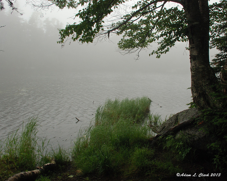
Lost Pond
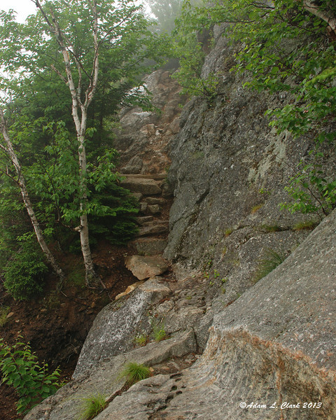
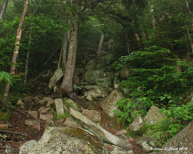
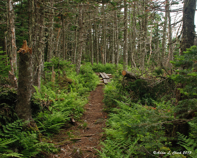
Once at the junction, I knew the real work for the day was about to begin. A short bit of flat ground before a long relentless steep climb up the mountain. Approximately 2,000 feet of gain in 2 miles is steep anywhere in the Whites. I tried to take my time since my pack was heavier than normal with overnight gear and extra clothes. The rocks provide plenty of places to step, but the humidity was already making me sweat more than normal (which is enough anyways). The trail goes over some open areas that didn't provide much for views until higher up and above the fog that lingered all day it seems in the valley. Any decline or level spot in the trail is almost immediately followed by another steep section. On a nice day though, the views are nice along this trail including the Presidentials of course and even a view of Glen Ellis Falls from above.
Open ledge along the trail
Yup, it's steep
Just above the fog in the valley. There was tons of it too
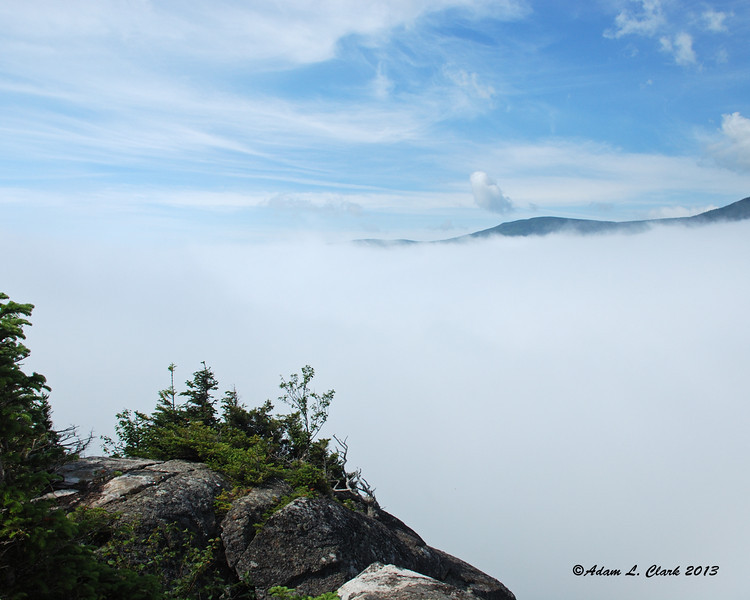
Finally, after a long steady climb, you reach the less than obvious "E" Peak. This leads to a welcome gentle downhill to the top of the ski area. Then it's up just one more steep incline to the summit viewing deck. By the time I got here, I had gone through two quarts of fluid thanks to the humidity. Already time to add more to the camelbak and try to catch up on what I was losing. I changed into a dry shirt and socks here while taking in the views that were starting to get clouded back up again.
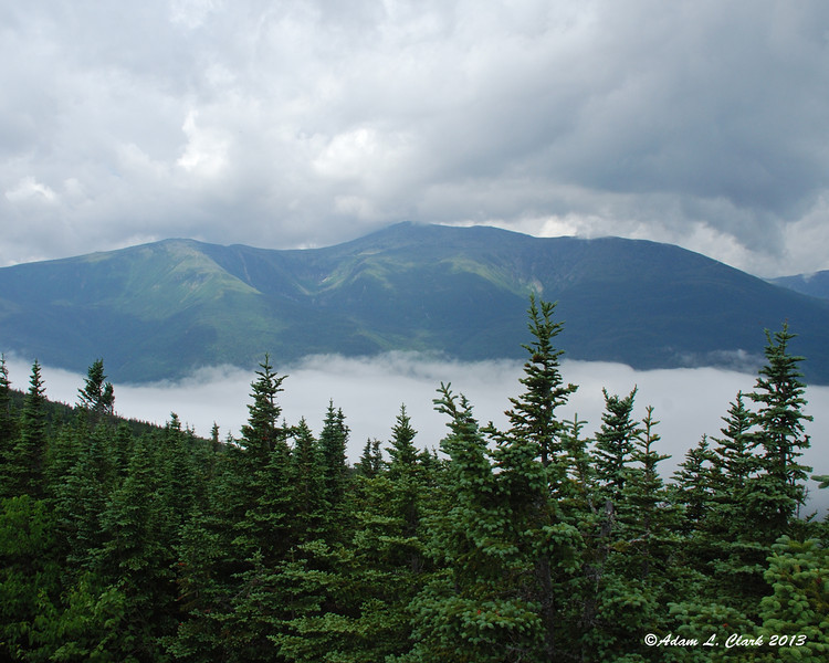
From the summit of D Peak
Coming down off of D Peak is a bit steep down into the saddle between it and C Peak. Once in the bottom, it then goes back up pretty steepily with some breaks of more gradual trail. After C Peak, the trail is more gradual with only brief steep pitches and few ups and downs. I'm still not sure which small hump is B Peak, but eventually you come to A Peak and the view point next to it. This looks down over the hut, into the notch, and across to Carter Dome. But today I couldn't see the hut below as clouds were flowing steadily up through the notch. Even Carter Dome was hard to make out at times. I took a nice break here even despite the flies since my legs were getting sore and a bit cramped. I had a few hours still before I needed to be at the hut, so I tried to drink more since I was getting a bit dehydrated with all the sweating.
On the way to A Peak

A Peak view point
After a while, I started my casual hike down into the notch. The trail was steep to start, but easy to navigate. Rock steps in many places and good footing. Some recent trail work had been done in a small patch that appeared to have gotten a number of blow downs. At the crossing of the slide, I was down into the clouds and couldn't see how much further it would be. Turns out, not too much more. Down in the notch, the Carter Lakes were covered in fog and you could barely make out the other side. I checked into the hut, filled a bottle with water, and went to setup my bed and take a rest before supper.
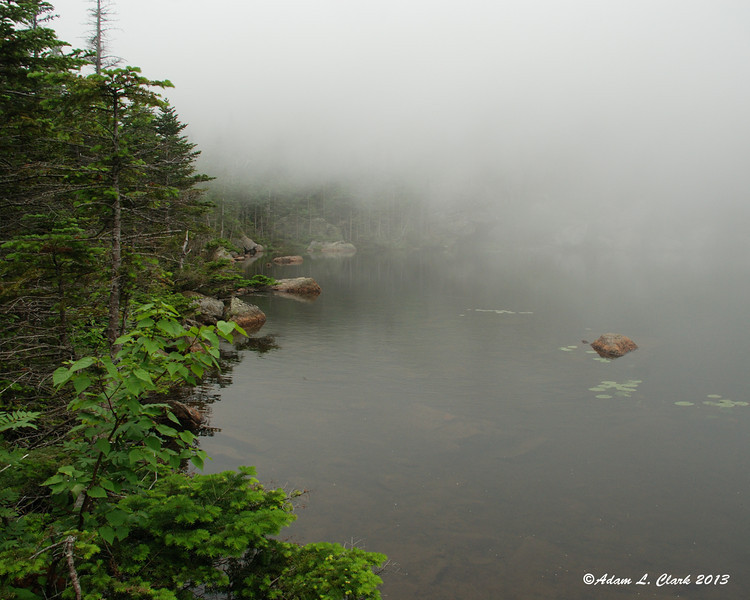
Upper Carter Lake
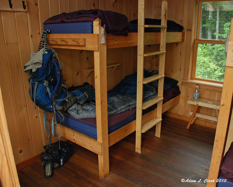
A room to myself
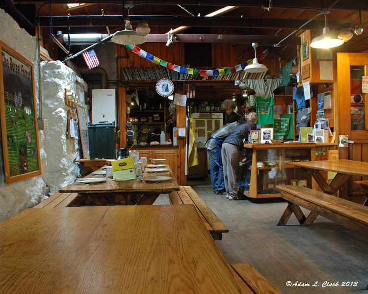
Just before supper
Of course the food was good for supper. I was hungry anyways, but the roast beef was great. There was more than enough for the 6 of us that would be here for the night. It was also funny seeing a croo member jump and scream after a red squirrel ran through the kitchen. After some panicking, he finally found his way back to the main area and out a window.
In the morning, I woke up to rain. After breakfast, we were given the weather report. More rain, heavy at times, windy, and chance of thunderstorms later in the day. Since the weather forecast didn't seem good for hiking the top of a ridge and my legs were more tired than expected, I made the safe decision to hike back to the road along 19 Mile Brook Trail. Turns out, all of us at the hut ditched plans for peaks and hiked out safely in the rain. I was looking forward to the 4 peaks planned for day two, but hiking in the rain isn't as much fun and the weather wasn't really good for being up high. My legs would have allowed me to bag Carter Dome, but since one of the groups at the hut was offering rides back to cars at other trailheads, I just headed down the trail. It was a pleasant but wet hike out. I'll just have to come back again to do the second half of this hike later.
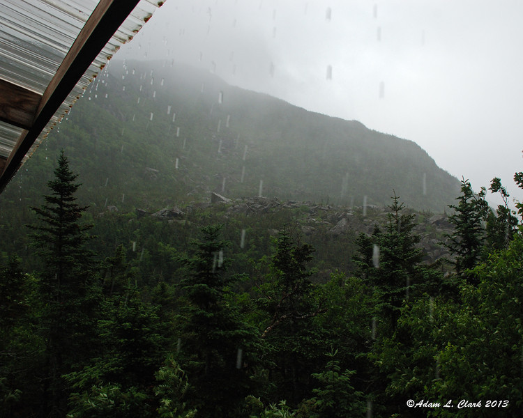
Waking up to rain
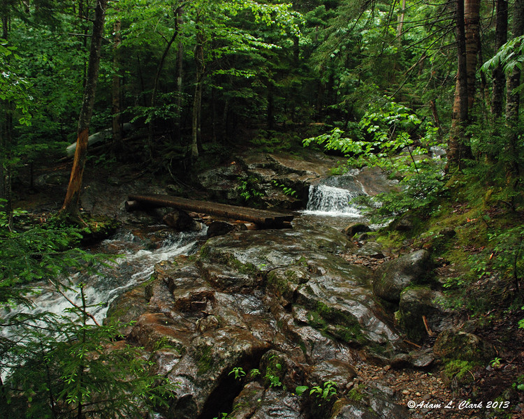
Wet trail down the mountain.
Notice the canoe next to the brook. The hut croo stole it earlier this week from Lonesome Lake Hut and is bringing it up in stages
For all the pictures from the hike, just go HERE
6-27-13 & 6-28-13
Lost Pond Trail --> Wildcat Ridge Trail --> 19 Mile Brook Trail
Distance: 5.0 mi.(day 1)
3.8 mi.(day 2)
8.8 mi. (total)
Elevation Gain: 2,404 ft. (overall) 3,479 ft. (total)
Time: 3:25 (Wildcat D) 5:51 (Wildcat A) 7:01 (Hut) 9:18 (total)
The plan for this hike originally was to hike up and over the Wildcats on day 1 and to the Carter Notch Hut for the night. Then for day 2, I would continue up over the Carters and to Mt. Moriah. Then back down the Stony Brook Trail to my car where I left it at the start. That was the plan, but not everything goes to plan.
Luckily, I arranged a ride with a fellow hiker from online and was able to spot my car at my planned ending point so I could hike back to it. (Thanks again LeftyE) I got a ride to Pinkham Notch Visitor Center so that I could start off on the Lost Pond Trail. I hadn't hiked this before, so I wanted warm up here before tackling the Wildcat Ridge Trail. I had done an out and back hike of the Wildcats from Glen Ellis Falls before and knew what I was in for. The hike down the Lost Pond Trail went quick and pretty easy, except a few scrambles over some large rocks. It was so foggy when I came through, that you could hardly make out the other side of the pond while right next to it. I thought, "No wonder it's called Lost Pond. I'm right next to it and can hardly even find it."
Lost Pond
Once at the junction, I knew the real work for the day was about to begin. A short bit of flat ground before a long relentless steep climb up the mountain. Approximately 2,000 feet of gain in 2 miles is steep anywhere in the Whites. I tried to take my time since my pack was heavier than normal with overnight gear and extra clothes. The rocks provide plenty of places to step, but the humidity was already making me sweat more than normal (which is enough anyways). The trail goes over some open areas that didn't provide much for views until higher up and above the fog that lingered all day it seems in the valley. Any decline or level spot in the trail is almost immediately followed by another steep section. On a nice day though, the views are nice along this trail including the Presidentials of course and even a view of Glen Ellis Falls from above.
Open ledge along the trail
Yup, it's steep
Just above the fog in the valley. There was tons of it too
Finally, after a long steady climb, you reach the less than obvious "E" Peak. This leads to a welcome gentle downhill to the top of the ski area. Then it's up just one more steep incline to the summit viewing deck. By the time I got here, I had gone through two quarts of fluid thanks to the humidity. Already time to add more to the camelbak and try to catch up on what I was losing. I changed into a dry shirt and socks here while taking in the views that were starting to get clouded back up again.
From the summit of D Peak
Coming down off of D Peak is a bit steep down into the saddle between it and C Peak. Once in the bottom, it then goes back up pretty steepily with some breaks of more gradual trail. After C Peak, the trail is more gradual with only brief steep pitches and few ups and downs. I'm still not sure which small hump is B Peak, but eventually you come to A Peak and the view point next to it. This looks down over the hut, into the notch, and across to Carter Dome. But today I couldn't see the hut below as clouds were flowing steadily up through the notch. Even Carter Dome was hard to make out at times. I took a nice break here even despite the flies since my legs were getting sore and a bit cramped. I had a few hours still before I needed to be at the hut, so I tried to drink more since I was getting a bit dehydrated with all the sweating.
On the way to A Peak
A Peak view point
After a while, I started my casual hike down into the notch. The trail was steep to start, but easy to navigate. Rock steps in many places and good footing. Some recent trail work had been done in a small patch that appeared to have gotten a number of blow downs. At the crossing of the slide, I was down into the clouds and couldn't see how much further it would be. Turns out, not too much more. Down in the notch, the Carter Lakes were covered in fog and you could barely make out the other side. I checked into the hut, filled a bottle with water, and went to setup my bed and take a rest before supper.
Upper Carter Lake
A room to myself
Just before supper
Of course the food was good for supper. I was hungry anyways, but the roast beef was great. There was more than enough for the 6 of us that would be here for the night. It was also funny seeing a croo member jump and scream after a red squirrel ran through the kitchen. After some panicking, he finally found his way back to the main area and out a window.
In the morning, I woke up to rain. After breakfast, we were given the weather report. More rain, heavy at times, windy, and chance of thunderstorms later in the day. Since the weather forecast didn't seem good for hiking the top of a ridge and my legs were more tired than expected, I made the safe decision to hike back to the road along 19 Mile Brook Trail. Turns out, all of us at the hut ditched plans for peaks and hiked out safely in the rain. I was looking forward to the 4 peaks planned for day two, but hiking in the rain isn't as much fun and the weather wasn't really good for being up high. My legs would have allowed me to bag Carter Dome, but since one of the groups at the hut was offering rides back to cars at other trailheads, I just headed down the trail. It was a pleasant but wet hike out. I'll just have to come back again to do the second half of this hike later.
Waking up to rain
Wet trail down the mountain.
Notice the canoe next to the brook. The hut croo stole it earlier this week from Lonesome Lake Hut and is bringing it up in stages
For all the pictures from the hike, just go HERE