Papa Bear
New member
Halls Stream, Indian Stream and Perry Stream - an October adventure
After a quick side trip to Milbridge Maine (see This thread), I traveled over to Pittsburg, NH for a weekend of hiking with Nate. We stayed at Tall Timbers Lodge, although we didn't see much of it since we had long days. The plan was to meet at Dube's Pittstop on Saturday morning at 6:00 AM for breakfast, although I planned to arrive Friday. I managed to get there by noon (I started at 5:30 AM in Milbridge) so I had the afternoon to do a little exploring on my own. Oh yeah, it was the last weekend of Moose season. Whatever.
Look at a map of northern NH. Route 3 wanders north through the Connecticut Lakes and Maine is lust a little bit to the east. West and north of Route 3 is a wedge shaped area bounded on the east by the Connecticut (and Route 3), on the north by a wiggly line which goes over the ridge line (called the "Highlands") and on the west by Halls Stream. Halls Stream was chosen after nearly 50 years of bickering between the two nations. Indian Stream, east of Halls was in the running for the boundary for a while and Perry Stream is to the east of that. These 3 streams create 3 wedges of forest lands and these were our targets for the weekend.
I was after peaks involving survey markers and Nate had a few lists (3Ks, NH200s) that were also represented in the area. As a result of a large Nature Conservancy purchase about 5 years back, the whole area is now under easement. Some parts are preserves (owned by TNC) and much is actively logged under easement and a couple of state parks (Deer Mtn and Lake Francis) are thrown in for good measure. It's all called the Connecticut Lakes Headwaters Region and it's very good to know this will remain forest land and is closed to development.
Friday: Halls Stream Road
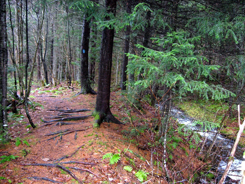
Friday afternoon I decided to drive up Halls Stream Road as far as I could and see if I could get to the boundary where the Highlands section ends and the Halls Stream section begins.

(Click to bring up interactive Google map)
The topo map shows Halls Stream Road at the lower right near the border. The aerial view (click on the map to get the interactive Google map and then use the map selector in the upper right to switch to "Satellite"and zoom in a bit) shows the road continuing on and eventually petering out.
My first problem was a gate about 3.5 miles from the head of Halls Stream. So I walked. When I got about a mile from the head of the stream the road turned to a path and finally to a swamp! Not wearing hip boots, I called the effort off. To get to the west end of the Highlands I figured I would need to 1) try again after a long dry spell (next September?), 2) try from Canada (they like to run their ATVs on the boundary), or 3) whack into the boundary swath further east and hike west along the boundary vista to where the mountains meet the stream.
Halls Stream Road ends in a swamp

(Click for larger image)
Not giving up entirely, I tried to whack the quarter mile of so down to the stream in several places since there were boundary reference monuments set on either side of the stream. No luck. It was wet, wetter and wettest everywhere near the stream. It turns out this section of the boundary was surveyed during the winter months when the boggy areas were frozen (19th century logging was often done in the winter for the same reasons).
But it was a beautiful and remote area and there seemed to be no active logging going on at the moment. So to quote a famous WWII general "I shall return".
Saturday: Perry Stream Road - Prospect and Deer
I met Nate at 6:00 Am at Dube's Pittstop as planned. I was my 3rd predawn drive in so many days so I was feeling groggy in the extreme. Not to be outdone, Nate had worked late on Friday and didn't get going from the Boston area till almost midnight, so he had basically driven all night.
We strategized a bit and decided to head up Perry Stream Road (called "Day Road" where it intersects Route 3) and drive as far as possible and the whack to the boundary and hit the east and west peaks of Prospect Hill.
East and West Prospect
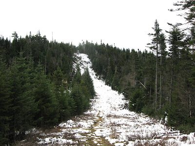
We had both visited these two peaks previously but we were both looking for something on West Prospect we had missed: myself, the survey marker and Nate the NH200 bottle. Nate had scoped out the route last year and had a waypoint at the col on the boundary under East Prospect so it would be a relatively easy whack. We strayed a bit east for a while, but soon got on track following numerous herd paths and foot prints and soon reached the vista. Surprise! Snow! The snow was actually not bad at all and we made our way shortly to East Prospect. The slash was considerably reduced since my last visit here 2 years ago (when they had cut the trees along the vista). The ATVers had also helped, except in the steepest sections.
Snow on the boundary vista
(Click for larger image)
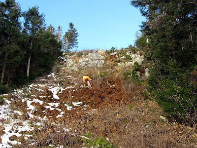
We continued on towards West Prospect and at a certain point reached a fairly tough cliff dropping down perhaps 100 feet. The footprints stopped and seemed to head onto an ATV trail on the Canadian side. There perched on the top of the drop on the Canadian side of the vista, was a small hunting blind with a big face and a little face looking at us as we approached. It was a French Canadian hunter and his 10 or 12 year old son and he did not look amused. The man spoke little English but the son spoke a bit more. We tried to ask if yonder ATV path would take us around the cliff and down to the bottom. Meanwhile he was trying to tell us that we were disturbing his hunting and shouldn't be there. Finally after a conference with his son he blurted out "WHAT ARE YOU DOING HERE??". We said we were hiking but gave up the conversation and headed back to the path, about 10 yards back. Lucikly he didn't soot us") !
!
Looking back up the steep section. The hunting blind is on the top.
(Click for larger image)
We pushed on and were soon on West Prospect. Nate shortly found the register jar he had missed last time but unfortunately I came up empty in my second search for the survey marker. It is located about 80 feet south of the boundary on the US side, mounted on a ledge, but the place was thick with moss, shrubs and blowdowns and the marker was not to be found. We did get some nice views of Mont Megantic about 10 miles away, so marker or no marker, it was a worthwhile trek.
Mont Megantic from West Prospect

(Click for larger image)
We headed back and gave the hunters a wide swath and made good time on the return whack. And hey! I remembered to put a waymark at the car. Then we headed south to whack Deer from the west.
Here's an album of all Maine and NH adventures: Album
(continued on next note)
After a quick side trip to Milbridge Maine (see This thread), I traveled over to Pittsburg, NH for a weekend of hiking with Nate. We stayed at Tall Timbers Lodge, although we didn't see much of it since we had long days. The plan was to meet at Dube's Pittstop on Saturday morning at 6:00 AM for breakfast, although I planned to arrive Friday. I managed to get there by noon (I started at 5:30 AM in Milbridge) so I had the afternoon to do a little exploring on my own. Oh yeah, it was the last weekend of Moose season. Whatever.
Look at a map of northern NH. Route 3 wanders north through the Connecticut Lakes and Maine is lust a little bit to the east. West and north of Route 3 is a wedge shaped area bounded on the east by the Connecticut (and Route 3), on the north by a wiggly line which goes over the ridge line (called the "Highlands") and on the west by Halls Stream. Halls Stream was chosen after nearly 50 years of bickering between the two nations. Indian Stream, east of Halls was in the running for the boundary for a while and Perry Stream is to the east of that. These 3 streams create 3 wedges of forest lands and these were our targets for the weekend.
I was after peaks involving survey markers and Nate had a few lists (3Ks, NH200s) that were also represented in the area. As a result of a large Nature Conservancy purchase about 5 years back, the whole area is now under easement. Some parts are preserves (owned by TNC) and much is actively logged under easement and a couple of state parks (Deer Mtn and Lake Francis) are thrown in for good measure. It's all called the Connecticut Lakes Headwaters Region and it's very good to know this will remain forest land and is closed to development.
Friday: Halls Stream Road
Friday afternoon I decided to drive up Halls Stream Road as far as I could and see if I could get to the boundary where the Highlands section ends and the Halls Stream section begins.
(Click to bring up interactive Google map)
The topo map shows Halls Stream Road at the lower right near the border. The aerial view (click on the map to get the interactive Google map and then use the map selector in the upper right to switch to "Satellite"and zoom in a bit) shows the road continuing on and eventually petering out.
My first problem was a gate about 3.5 miles from the head of Halls Stream. So I walked. When I got about a mile from the head of the stream the road turned to a path and finally to a swamp! Not wearing hip boots, I called the effort off. To get to the west end of the Highlands I figured I would need to 1) try again after a long dry spell (next September?), 2) try from Canada (they like to run their ATVs on the boundary), or 3) whack into the boundary swath further east and hike west along the boundary vista to where the mountains meet the stream.
Halls Stream Road ends in a swamp
(Click for larger image)
Not giving up entirely, I tried to whack the quarter mile of so down to the stream in several places since there were boundary reference monuments set on either side of the stream. No luck. It was wet, wetter and wettest everywhere near the stream. It turns out this section of the boundary was surveyed during the winter months when the boggy areas were frozen (19th century logging was often done in the winter for the same reasons).
But it was a beautiful and remote area and there seemed to be no active logging going on at the moment. So to quote a famous WWII general "I shall return".
Saturday: Perry Stream Road - Prospect and Deer
I met Nate at 6:00 Am at Dube's Pittstop as planned. I was my 3rd predawn drive in so many days so I was feeling groggy in the extreme. Not to be outdone, Nate had worked late on Friday and didn't get going from the Boston area till almost midnight, so he had basically driven all night.
We strategized a bit and decided to head up Perry Stream Road (called "Day Road" where it intersects Route 3) and drive as far as possible and the whack to the boundary and hit the east and west peaks of Prospect Hill.
East and West Prospect
We had both visited these two peaks previously but we were both looking for something on West Prospect we had missed: myself, the survey marker and Nate the NH200 bottle. Nate had scoped out the route last year and had a waypoint at the col on the boundary under East Prospect so it would be a relatively easy whack. We strayed a bit east for a while, but soon got on track following numerous herd paths and foot prints and soon reached the vista. Surprise! Snow! The snow was actually not bad at all and we made our way shortly to East Prospect. The slash was considerably reduced since my last visit here 2 years ago (when they had cut the trees along the vista). The ATVers had also helped, except in the steepest sections.
Snow on the boundary vista

(Click for larger image)
We continued on towards West Prospect and at a certain point reached a fairly tough cliff dropping down perhaps 100 feet. The footprints stopped and seemed to head onto an ATV trail on the Canadian side. There perched on the top of the drop on the Canadian side of the vista, was a small hunting blind with a big face and a little face looking at us as we approached. It was a French Canadian hunter and his 10 or 12 year old son and he did not look amused. The man spoke little English but the son spoke a bit more. We tried to ask if yonder ATV path would take us around the cliff and down to the bottom. Meanwhile he was trying to tell us that we were disturbing his hunting and shouldn't be there. Finally after a conference with his son he blurted out "WHAT ARE YOU DOING HERE??". We said we were hiking but gave up the conversation and headed back to the path, about 10 yards back. Lucikly he didn't soot us
!Looking back up the steep section. The hunting blind is on the top.

(Click for larger image)
We pushed on and were soon on West Prospect. Nate shortly found the register jar he had missed last time but unfortunately I came up empty in my second search for the survey marker. It is located about 80 feet south of the boundary on the US side, mounted on a ledge, but the place was thick with moss, shrubs and blowdowns and the marker was not to be found. We did get some nice views of Mont Megantic about 10 miles away, so marker or no marker, it was a worthwhile trek.
Mont Megantic from West Prospect

(Click for larger image)
We headed back and gave the hunters a wide swath and made good time on the return whack. And hey! I remembered to put a waymark at the car. Then we headed south to whack Deer from the west.
Here's an album of all Maine and NH adventures: Album
(continued on next note)
Last edited: