
MikeB
Member
It's been a while since I've been up Moosilauke, and I've never been up Beaver Brook, so seemed like a good half-day hike. Forecast was for afternoon thunderstorms, so figured we'd get an early start and try to beat the weather. It almost worked...
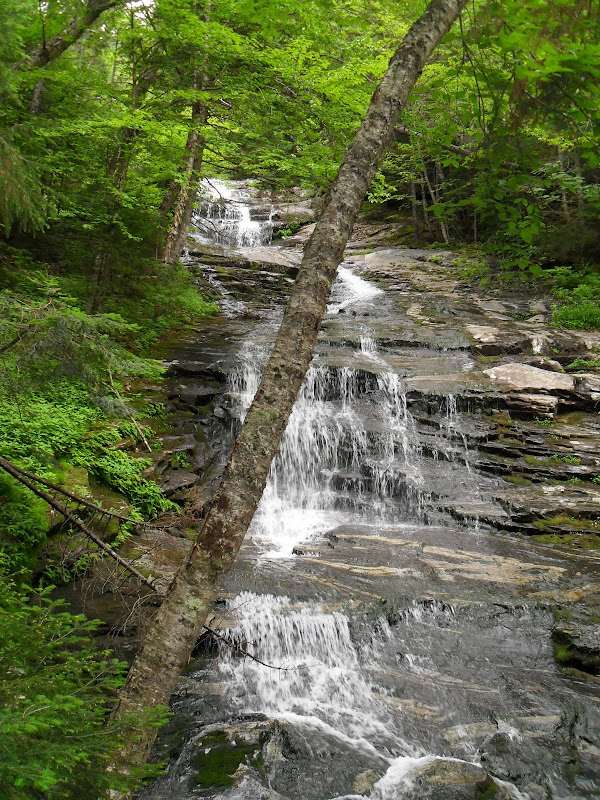
Despite it being a holiday weekend there were only a few cars at the trailhead, and indeed we only saw 10 or 12 people all day (5 were AT thru hikers). Beaver Brook Trail starts by crossing two really robust foot bridges. It looks like they're made from telephone poles, and could probably support the weight of a tank (if the tank were only 2 feet wide). You can smell the creosote well before you see the bridges. Soon after the trail begins to climb along side the Beaver Brook cascades.
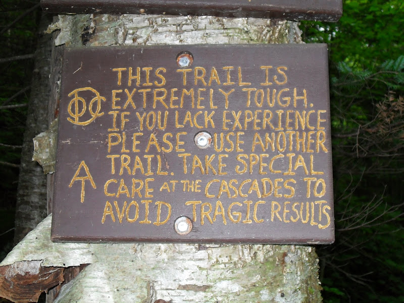
The DOC certainly has a way with signs.
The trail is not as tough as the sign would have you believe. You need to be careful with your footing, but that's true for many trails in the Whites. It is a steep climb for about a mile, but it follows the cascades for most of it, and the views along the way are spectacular!
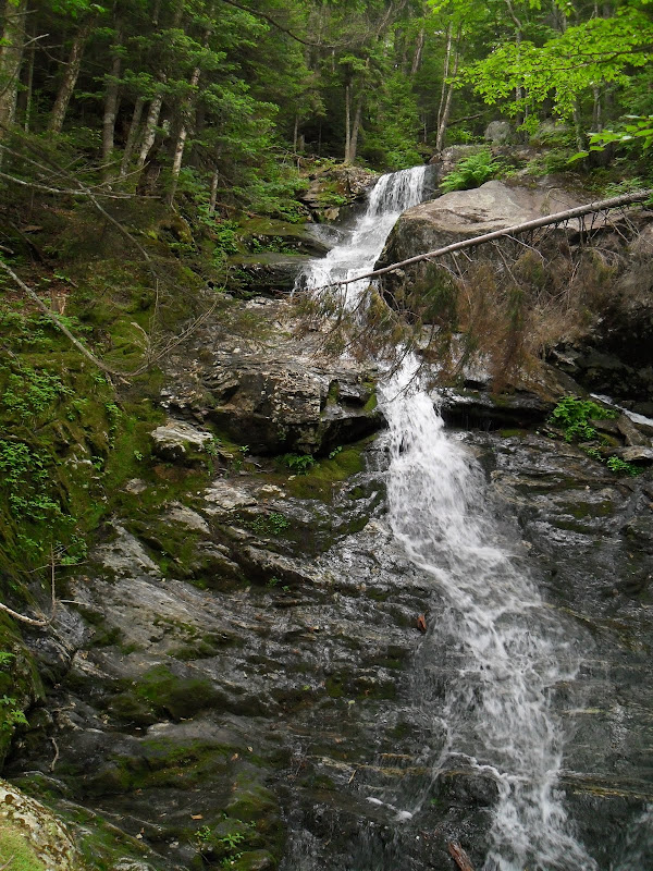
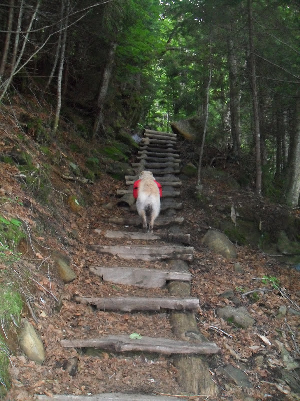
This is a really highly engineered trail. I don't know its history, but it harkens back to trail building from days gone by. Steps chiseled and blasted into the rock, wooden step treads, iron hand railings, even staircases. I have mixed feelings about this, but it is what it is and I enjoyed it. I also think it isn't really necessary.
Once you get to the Beaver Brook Shelter the trail steepness mellows out and the rest of the trip is an easy walk through the woods.
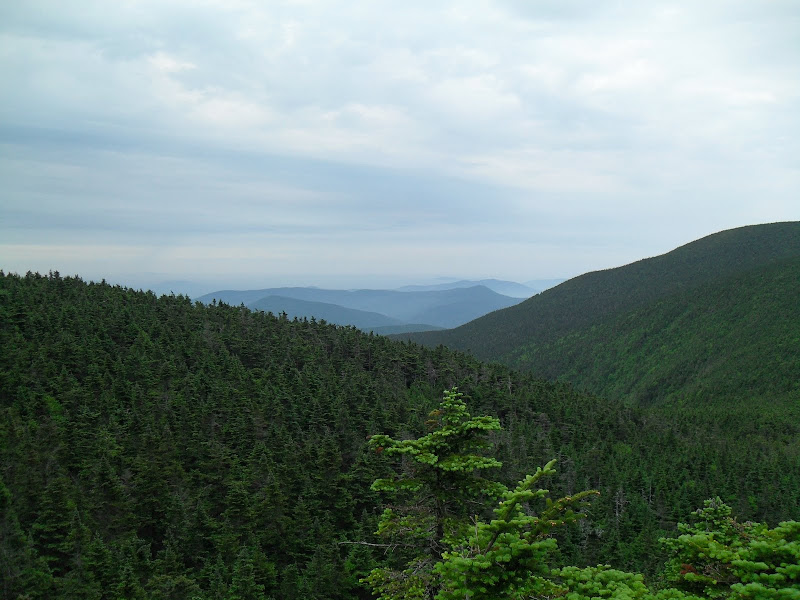
Nice view from the shoulder of Mt Blue.
Shared the summit with a thru hiker and had a nice chat. Just a couple of other people came and went while we were there - weird for such a popular mountain. Maybe the weather report scared people away.
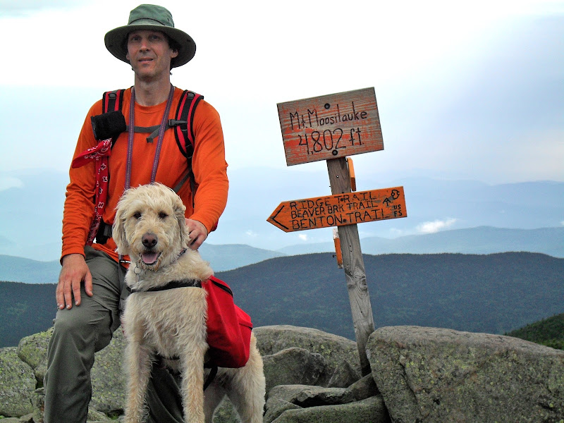
Number 26 for Mia!
The sky held a million shades of gray.
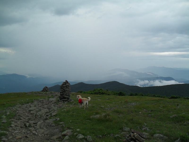
That's rain between us and Kinsman Ridge. Time to skedaddle.
The rain started about 15 minutes after we started the return leg. Never heavy but off and on for the rest of the trip so I wore rain gear the whole way down. We were extra careful picking our way down the steep spots along the cascades, but it wasn't bad at all.
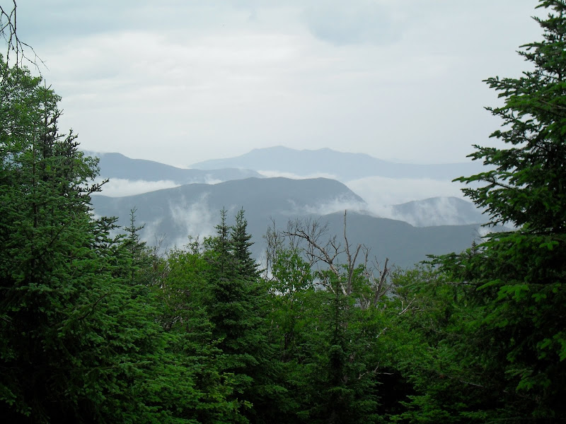
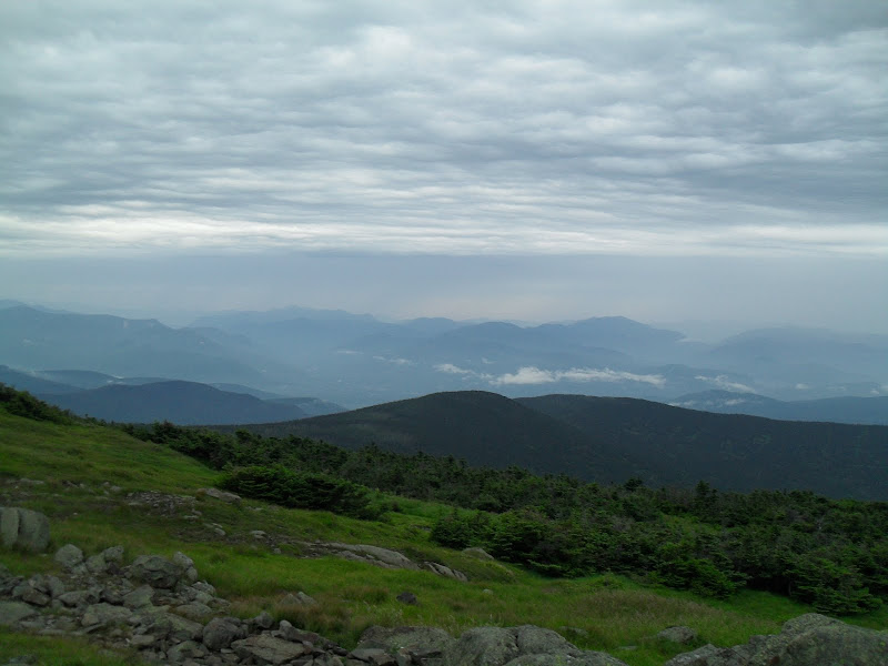
View from the Beaver Brook Shelter.
Got back to the car in no time. Got caught in a heavy downpour driving back up the Kanc, but it was still sunny on the east side of the Whites so we went for a swim to cool off and de-grime, capping off a pleasant morning. A highly recommended, hiker-doodle approved hike!
Despite it being a holiday weekend there were only a few cars at the trailhead, and indeed we only saw 10 or 12 people all day (5 were AT thru hikers). Beaver Brook Trail starts by crossing two really robust foot bridges. It looks like they're made from telephone poles, and could probably support the weight of a tank (if the tank were only 2 feet wide). You can smell the creosote well before you see the bridges. Soon after the trail begins to climb along side the Beaver Brook cascades.
The DOC certainly has a way with signs.
The trail is not as tough as the sign would have you believe. You need to be careful with your footing, but that's true for many trails in the Whites. It is a steep climb for about a mile, but it follows the cascades for most of it, and the views along the way are spectacular!
This is a really highly engineered trail. I don't know its history, but it harkens back to trail building from days gone by. Steps chiseled and blasted into the rock, wooden step treads, iron hand railings, even staircases. I have mixed feelings about this, but it is what it is and I enjoyed it. I also think it isn't really necessary.
Once you get to the Beaver Brook Shelter the trail steepness mellows out and the rest of the trip is an easy walk through the woods.
Nice view from the shoulder of Mt Blue.
Shared the summit with a thru hiker and had a nice chat. Just a couple of other people came and went while we were there - weird for such a popular mountain. Maybe the weather report scared people away.
Number 26 for Mia!
The sky held a million shades of gray.
That's rain between us and Kinsman Ridge. Time to skedaddle.
The rain started about 15 minutes after we started the return leg. Never heavy but off and on for the rest of the trip so I wore rain gear the whole way down. We were extra careful picking our way down the steep spots along the cascades, but it wasn't bad at all.
View from the Beaver Brook Shelter.
Got back to the car in no time. Got caught in a heavy downpour driving back up the Kanc, but it was still sunny on the east side of the Whites so we went for a swim to cool off and de-grime, capping off a pleasant morning. A highly recommended, hiker-doodle approved hike!