Avalanche Trap Dyke

vftt.org

Help Support vftt.org:

This site may earn a commission from merchant affiliate links, including eBay, Amazon, and others.

yvon

Active member
Joined
Mar 11, 2005
Messages
872
Reaction score
154
Location
Montreal, Quebec, Canada
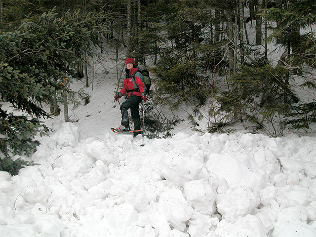
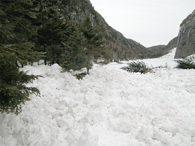
Today I passed in front of Trap Dyke, there was an avalanche precisely at this place. I do not when it append. All the trees have been swept in front of it.
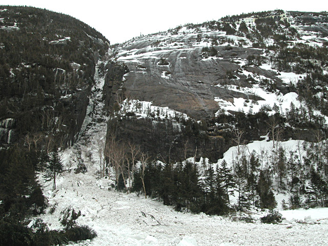
Here is two pics of that avalanche.


16-03-2007-2345-640x.jpg


16-03-2007-2320-640x.jpg
 
WOW! Neat pictures Yvon. Glad it happened before you arrived on the scene. Could you imagine the noise and power if that had come down while you were standing there?
 
Wow :eek: Nice Photos...Did the deposition zone come all the way across the Lake towards the Summer Trail? Sounds like the folks camped out up there were lucky to get out.
 
skiguy said:
Wow :eek: Nice Photos...Did the deposition zone come all the way across the Lake towards the Summer Trail? Sounds like the folks camped out up there were lucky to get out.

Yes, It was strong, and some trees are down even on the other side of the lake. We had to climb over packed snow made by the avalanche to follow the trail. It is incredible how strong it should be.
 
yvon said:
It is incredible how strong it should be.
Avalanched snow sets up very hard very quickly. The friction melts some of the snow and the resultant water freezes up. Makes it hard to dig out buried victims, too--metal shovels are often required to dig efficiently.

Doug
 
ok i have to ask, how did this avalanche cause a flash flood at lake colden?
avalanche lake is frozen still ? was the force that strong that it pushed the ice down and caused the water underneath to overflow onto lake colden? kinda like stepping on a plastic water bottle. is lake colden also still frozen? Did the water flash flood on top of the ice here?
 
I was out snowshoeing on Friday and ended up heading up to Slant Rock and then up over the Brothers and back to the Garden and was amazed at what I saw at each stream crossing. I can only imagine what it must've been like but each stream bank had large blocks of ice and snow deposited up to 10-15' in some areas from where the water was. On top of that the banks of the rivers looked like a torrent of water had carved them out. It definitely made for some "fun" crossings as every snow bridge is now gone. The photos of the deposition zone looked almost exactly the same as the edges of all the streams/rivers that I had seen on Fri. I'm guessing a similar torrent of water (due to the rapid melt) was responsible for the avalanche.
 
Yvon, Judging from that last picture it looks as though the Avalanche took a left turn at the bottom of the Dyke and ended up on the trail at the SW end of the lake? Thats quite a distance and an odd flow line or am I mistaken?

Look forward to seeing you at the pub night tomorrow.
-Phil
 
Its been several years since I have hiked below the Dyke, but it sounds like a good sized avalanche if it also crossed the valley below--hope no one was caught.

Doug
 
Spoke with a ranger. It occured on Wednesday morning, 3/14. No one was near it. Good thing I didn't go up there on Saturday before... could have triggered it! We voted 4 Gos to 1 No Go on friday night, it had to be unanimous. We owe the No Go several beers!
 
This incident highlights the need to be aware of avalanche terrain, especially during and after periods of heavy snowfall. Note that large, mature trees were taken down. This is an avalanche path that probably does not run very frequently.

It's a mistake to rely on the presence of trees to rule out avalanches. Ask instead, "What if?"
 
What was the approximate height of the snow/debris field across the lake?

It's hard to gauge from the pictures.

Any more pictures from the weekend?
 
I forgot to mention, the snow debris field was measured to be 14 feet deep.
 
Top