
Kevin Judy and Emma
Well-known member
Prologue: I've set up an account at:
http://ghostflowers.smugmug.com/gallery/6271217_udqA6#395720740_L2nHK
I would appreciate any feed back, positive or otherwise. My personal site was becoming very large and hard to maintain. This also gives the ability of viewing my photos at your own pace or if you prefer using a full screen slideshow by clicking the slideshow option in the upper right hand corner of the page.
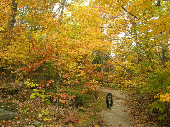
Emma along the Welch Dickey Loop Trail
10/13/08
Dickey Mountain 2734' and Welch Mountain 2605'
(The Welch Dickey Loop Trail)
4.4 Miles 1800' Elevation gain
Kevin, Judy and Emma
My mom's been having a tough year so we've been keeping our trips down to two days and staying a little closer to home. It still leaves a lot of room to explore and enjoy. One of our old favorites is the Welch/Dickey Loop near Waterville Valley. We headed north on Monday and watched the throngs heading south as we drove along Rte. 93. Things eased up as we got onto Rte. 49 and made our way towards Waterville. We set up camp at Waterville Valley CG and had the place to ourselves. I think even the host stayed somewhere else that night. After we got everything settled we headed out to make the traverse over these two small but wonderful hills. Each time we go we try to go the opposite way as the time before. This time we went clockwise, up the ledges to Dickey Mountain then down the col and up to Welch. There are plenty of ledges to hike along on both mountains with the ones on Welch probably being the steeper. When we arrived in the parking lot there were plenty of cars, but as we ascended to Dickey Mountain we passed enough people to fill almost all of them so all concern of crowded trails and summits soon passed. After we came out onto the ledges we only saw a handful of people the rest of the hike so it was quite quiet considering the time of year and it being a holiday. Although some of the color had washed off the trees by now there was still excellent foliage viewing to be had around us on the hike up and below us when we reached the ledges.
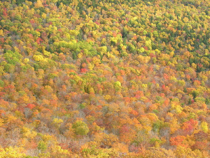
Foliage below us
An approaching cold front made for some interesting skies to our west and added to the all around excellence of this hike. Temps were warm enough for shorts and tank-tops while you were moving, but we had to pull on the polar-tec when we stopped to eat and enjoy the views. It was hard to pull ourselves away and return to the valley though the sun was sinking and the temps were dropping. On the way back to the campground we picked up some subs and ate some supper as we watched the full moon rise and disappear into the cloud bank which had now taken over the sky. As evening approached the fog rolled in and quickened the darkness. We climbed in the tent and listened as the Mad River rolled by our campsite. Very peaceful and the white noise of the river brought sleep on sooner than usual. There was a sprinkle or two overnight but not enough to bother a couple of old campers. In the morning we awoke to damp fog and the nearby summits were invisible.
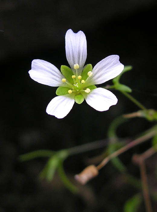
Mountain Sandwort Minuartia groenlandica
KDT
http://ghostflowers.smugmug.com/gallery/6271217_udqA6#395720740_L2nHK
I would appreciate any feed back, positive or otherwise. My personal site was becoming very large and hard to maintain. This also gives the ability of viewing my photos at your own pace or if you prefer using a full screen slideshow by clicking the slideshow option in the upper right hand corner of the page.
Emma along the Welch Dickey Loop Trail
10/13/08
Dickey Mountain 2734' and Welch Mountain 2605'
(The Welch Dickey Loop Trail)
4.4 Miles 1800' Elevation gain
Kevin, Judy and Emma
My mom's been having a tough year so we've been keeping our trips down to two days and staying a little closer to home. It still leaves a lot of room to explore and enjoy. One of our old favorites is the Welch/Dickey Loop near Waterville Valley. We headed north on Monday and watched the throngs heading south as we drove along Rte. 93. Things eased up as we got onto Rte. 49 and made our way towards Waterville. We set up camp at Waterville Valley CG and had the place to ourselves. I think even the host stayed somewhere else that night. After we got everything settled we headed out to make the traverse over these two small but wonderful hills. Each time we go we try to go the opposite way as the time before. This time we went clockwise, up the ledges to Dickey Mountain then down the col and up to Welch. There are plenty of ledges to hike along on both mountains with the ones on Welch probably being the steeper. When we arrived in the parking lot there were plenty of cars, but as we ascended to Dickey Mountain we passed enough people to fill almost all of them so all concern of crowded trails and summits soon passed. After we came out onto the ledges we only saw a handful of people the rest of the hike so it was quite quiet considering the time of year and it being a holiday. Although some of the color had washed off the trees by now there was still excellent foliage viewing to be had around us on the hike up and below us when we reached the ledges.
Foliage below us
An approaching cold front made for some interesting skies to our west and added to the all around excellence of this hike. Temps were warm enough for shorts and tank-tops while you were moving, but we had to pull on the polar-tec when we stopped to eat and enjoy the views. It was hard to pull ourselves away and return to the valley though the sun was sinking and the temps were dropping. On the way back to the campground we picked up some subs and ate some supper as we watched the full moon rise and disappear into the cloud bank which had now taken over the sky. As evening approached the fog rolled in and quickened the darkness. We climbed in the tent and listened as the Mad River rolled by our campsite. Very peaceful and the white noise of the river brought sleep on sooner than usual. There was a sprinkle or two overnight but not enough to bother a couple of old campers. In the morning we awoke to damp fog and the nearby summits were invisible.
Mountain Sandwort Minuartia groenlandica
KDT
Last edited: