Ed'n Lauky
Well-known member
- Joined
- Feb 15, 2007
- Messages
- 1,802
- Reaction score
- 168
Two days later, Saturday 11/27 we headed off to Rhode Island for some highpointing
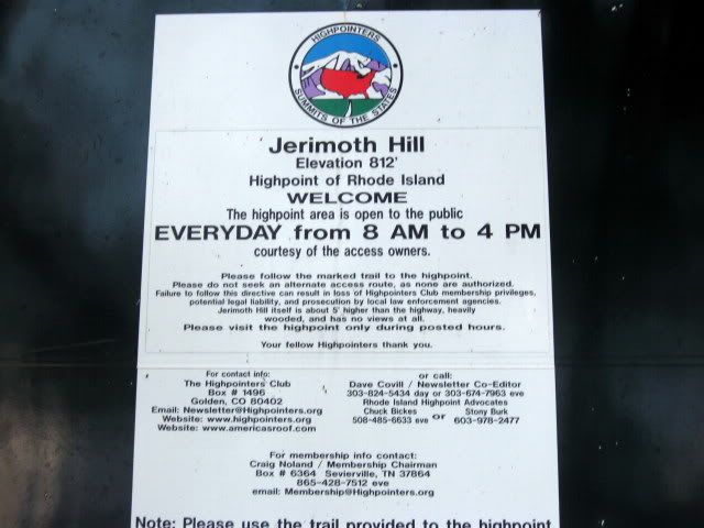
on Jermoth Hill. The sign on the top of the hill on Rt. 101 was easy to find.
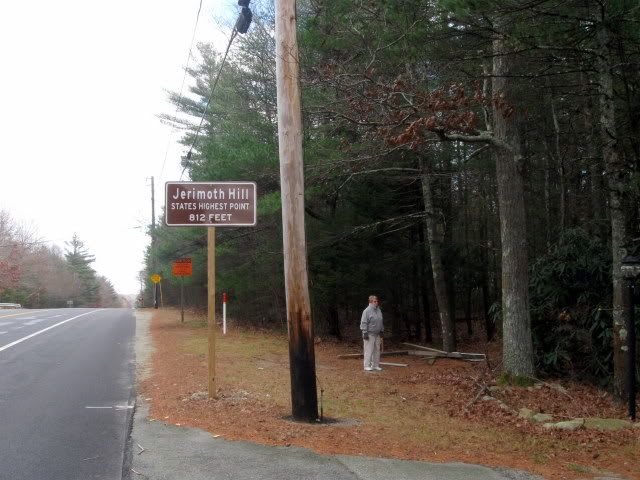
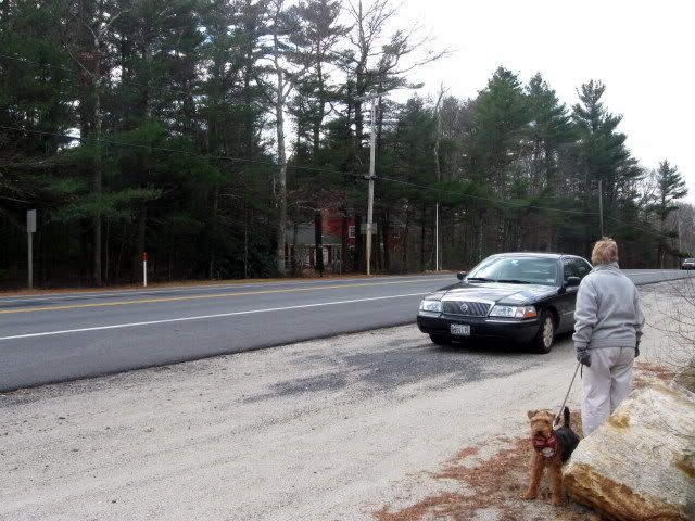
We parked across the road in an area laid out for highpointers.
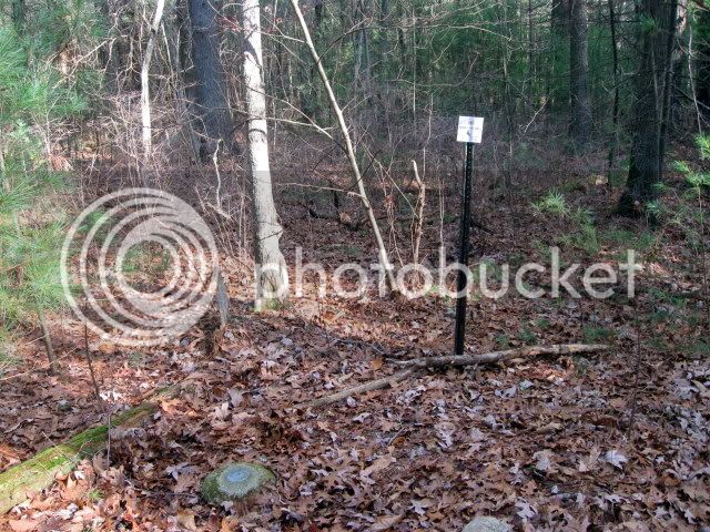
The trail sign had fallen down perhaps from the wind.
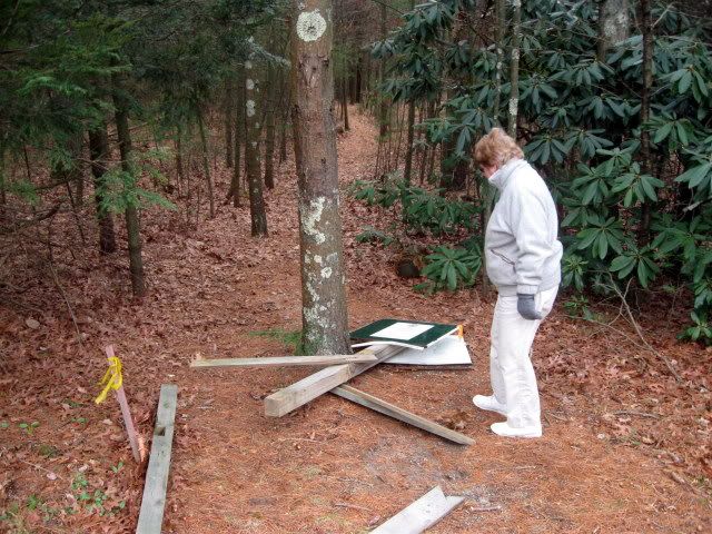
The sign was still intact.
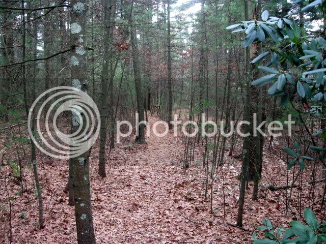
A trail has been laid out along side of the access road which you are not supposed
to use out by the highway.
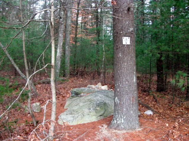
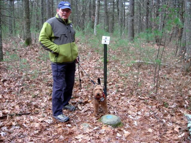
After a couple of minutes walk a small sign points you across the access road to
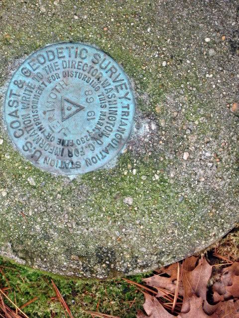
a survey marker. This one would suppose is the high point.
However, a few paces farther down the road another trail heads into the woods
on the other side of the road. There you find a second survey marker. This one
according to my GPS topo map is a couple of feet higher than the first.
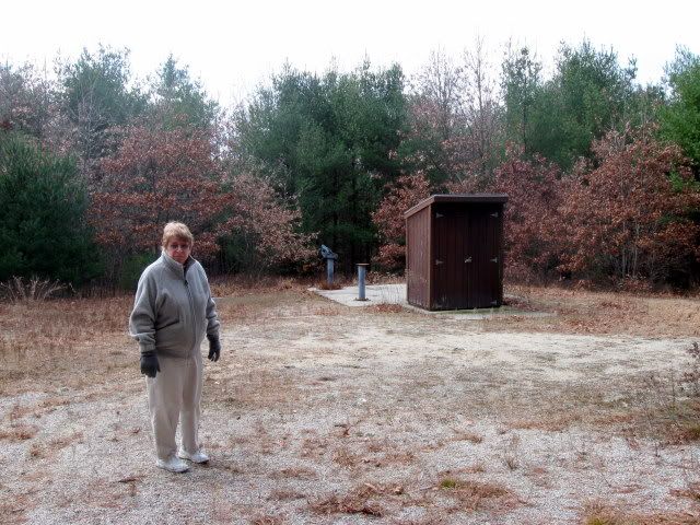
Continuing down the road we came to the clearing owned by Brown University
there are a few rundown buildings here which don’t appear to have been recently
used. The elevation here was the same as the first marker.
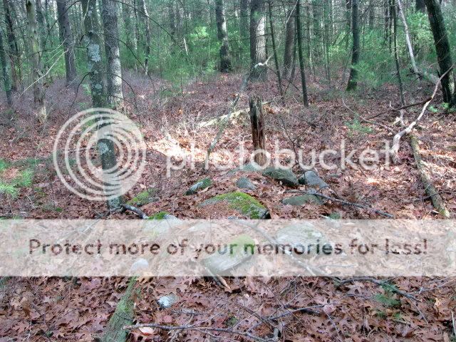
On the way back to the car I noticed that my GPS gives another location for Jerimoth Hill.
Lauky and I headed into the woods to the spot indicated on the GPS and we found this
rundown, overgrown cairn. Certainly at one point this was considered the highpoint, and
indeed the GPS topomap (my GPS can read the elevation from the map) indicates that it is
one foot higher than the second survey marker. I would be interested to know the
history of this cairn.
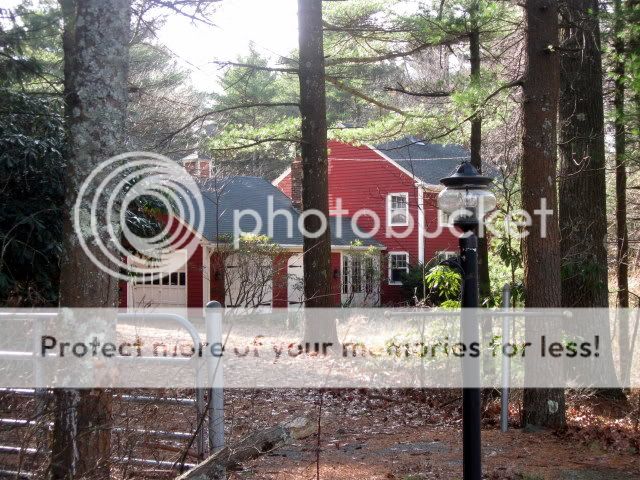
The reason we headed down there today was that someone had posted here that
the house appeared to be empty and I wanted to get there before someone bought it
and closed the trail down again. Anyway, the house does have that “foreclosure” look about it although I have no idea what the situation is.
One of the neat things about highpointing is that it gets you places you otherwise would never
go. This was indeed a really nice day—away from the snow.")
on Jermoth Hill. The sign on the top of the hill on Rt. 101 was easy to find.
We parked across the road in an area laid out for highpointers.
The trail sign had fallen down perhaps from the wind.
The sign was still intact.
A trail has been laid out along side of the access road which you are not supposed
to use out by the highway.
After a couple of minutes walk a small sign points you across the access road to
a survey marker. This one would suppose is the high point.
However, a few paces farther down the road another trail heads into the woods
on the other side of the road. There you find a second survey marker. This one
according to my GPS topo map is a couple of feet higher than the first.
Continuing down the road we came to the clearing owned by Brown University
there are a few rundown buildings here which don’t appear to have been recently
used. The elevation here was the same as the first marker.
On the way back to the car I noticed that my GPS gives another location for Jerimoth Hill.
Lauky and I headed into the woods to the spot indicated on the GPS and we found this
rundown, overgrown cairn. Certainly at one point this was considered the highpoint, and
indeed the GPS topomap (my GPS can read the elevation from the map) indicates that it is
one foot higher than the second survey marker. I would be interested to know the
history of this cairn.
The reason we headed down there today was that someone had posted here that
the house appeared to be empty and I wanted to get there before someone bought it
and closed the trail down again. Anyway, the house does have that “foreclosure” look about it although I have no idea what the situation is.
One of the neat things about highpointing is that it gets you places you otherwise would never
go. This was indeed a really nice day—away from the snow.
Last edited: