
TEO
Well-known member
It was a day minutes in the planning. I called Jeff up Saturday evening asking him if he was still game for a hike. Indeed he was, and he thought that Cube and Smarts would be a wise choice for the sunny Sunday forecasted. Not bothering to look at a map or my outdated White Mountain Guide, I assented. Without doing any research, I ascertained that there was no Fastest Known Time. History was within our grasp.
After spotting a car at the Lambert Ridge/Ranger Trail trailhead, we drove around to the Mt. Cube Trail/AT trailhead on 25A and at sometime between 9:50 a.m. and 10 a.m.--let's say 9:55ish a.m.--we were on our way. To the best of my recollection, this was the trail that was used on my first backpacking trip at age 11ish, the one summer that I went to camp, Camp Billings, when we did an overnight atop Cube. This was my first time back. The ascent of mighty Cube was pleasant and we maintained an enjoyable pace, arriving at the North summit five minutes behind book time, I think.
There we enjoyed some GORP and cheese, water, and conversation with a fellow hiker who was from Jeff's hometown. After our leisurely rest, we continued on to the South summit of Cube, where we enjoyed another leisurely break, soaking in the views that deservedly place Cube on the 52 With A View list.
Then it was onto Smarts via the Kodak Trail. At the next set of ledges, we paused for lunch before continuing down to the intersection with Jacobs Brook Road. At the road, we paused again for a snack and to check our map and the WMG. It was now about 2:30 p.m. and Smarts still seemed a good ways off. Much to our chagrin, here with a more in-depth reading of the guidebook, we discovered that our route for the day was not 12 miles, but a little over 14, and we still had about 8 miles to go.
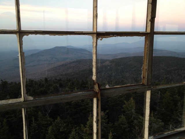
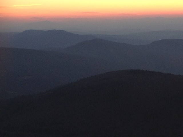
Onward we pushed, up the J Trail, as the shadows grew and the temperature fell. It's a quite a pleasant stretch of woods to stroll, and though we pushed the pace ever so slightly, we did enjoy the quietness of the mostly open woods. Save for a couple of blowdowns, our way was unimpeded. As sunset neared, so too did the summit of Smarts and its famed Firetower. In hopes of catching the sunset, I pushed forward at a quickish walk, and as the western sky turned orange, I reached the Firetower's base.
Not hesitating a moment, I climbed its stairs, and halfway up, I saw the last fiery sliver of sun disappear behind the distant Green Mountains. Upward I continued 'til I reached the tower's cab, and with some effort, I pushed open the heavy trap-door and climbed up inside.
Delighted to reach the top of the tower before dark, I soaked in the wondrous views all around. A light, but chilling wind buffeted the tower. My Dachstein mittens, L.L.Bean down vest, and Peruvian alpaca hat kept me warm, with a little help from some hot tea sweetened with Slopeside Syrup. A minute or two later Jeff arrived.
After more food and drink, we began our last descent of the day, at about 5 p.m., our headlamps showing the way. The way was steep and the rock slabs were covered with ice flows, which we skirted with care. Some of the infamous iron rungs were almost entirely buried in ice. Where the Lambert Ridge Trail and the Smarts Ranger Trail go their separate ways, we chose the latter, given its more direct nature and lack of positive vertical.
The upper steep section held less ice than what we'd encountered above--fortunately--and our joints were grateful to reach the old road at the decrepit Ranger's garage. At 6:42 or 6:43ish p.m. we reached the trailhead and my waiting Honda Civic. By my trusty Timex Ironman, we clocked our surely record-setting traverse at 8 hours, 50ish minutes. The gauntlet has been thrown.
Pictures:
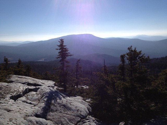
Smarts Mountain from Mt. Cube
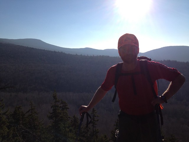
The Author
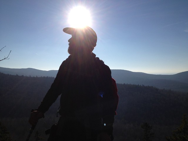
His Hiking Companion
A Look Back at Mt. Cube
Looking toward the Dartmouth Skiway
After spotting a car at the Lambert Ridge/Ranger Trail trailhead, we drove around to the Mt. Cube Trail/AT trailhead on 25A and at sometime between 9:50 a.m. and 10 a.m.--let's say 9:55ish a.m.--we were on our way. To the best of my recollection, this was the trail that was used on my first backpacking trip at age 11ish, the one summer that I went to camp, Camp Billings, when we did an overnight atop Cube. This was my first time back. The ascent of mighty Cube was pleasant and we maintained an enjoyable pace, arriving at the North summit five minutes behind book time, I think.
There we enjoyed some GORP and cheese, water, and conversation with a fellow hiker who was from Jeff's hometown. After our leisurely rest, we continued on to the South summit of Cube, where we enjoyed another leisurely break, soaking in the views that deservedly place Cube on the 52 With A View list.
Then it was onto Smarts via the Kodak Trail. At the next set of ledges, we paused for lunch before continuing down to the intersection with Jacobs Brook Road. At the road, we paused again for a snack and to check our map and the WMG. It was now about 2:30 p.m. and Smarts still seemed a good ways off. Much to our chagrin, here with a more in-depth reading of the guidebook, we discovered that our route for the day was not 12 miles, but a little over 14, and we still had about 8 miles to go.
Onward we pushed, up the J Trail, as the shadows grew and the temperature fell. It's a quite a pleasant stretch of woods to stroll, and though we pushed the pace ever so slightly, we did enjoy the quietness of the mostly open woods. Save for a couple of blowdowns, our way was unimpeded. As sunset neared, so too did the summit of Smarts and its famed Firetower. In hopes of catching the sunset, I pushed forward at a quickish walk, and as the western sky turned orange, I reached the Firetower's base.
Not hesitating a moment, I climbed its stairs, and halfway up, I saw the last fiery sliver of sun disappear behind the distant Green Mountains. Upward I continued 'til I reached the tower's cab, and with some effort, I pushed open the heavy trap-door and climbed up inside.
Delighted to reach the top of the tower before dark, I soaked in the wondrous views all around. A light, but chilling wind buffeted the tower. My Dachstein mittens, L.L.Bean down vest, and Peruvian alpaca hat kept me warm, with a little help from some hot tea sweetened with Slopeside Syrup. A minute or two later Jeff arrived.
After more food and drink, we began our last descent of the day, at about 5 p.m., our headlamps showing the way. The way was steep and the rock slabs were covered with ice flows, which we skirted with care. Some of the infamous iron rungs were almost entirely buried in ice. Where the Lambert Ridge Trail and the Smarts Ranger Trail go their separate ways, we chose the latter, given its more direct nature and lack of positive vertical.
The upper steep section held less ice than what we'd encountered above--fortunately--and our joints were grateful to reach the old road at the decrepit Ranger's garage. At 6:42 or 6:43ish p.m. we reached the trailhead and my waiting Honda Civic. By my trusty Timex Ironman, we clocked our surely record-setting traverse at 8 hours, 50ish minutes. The gauntlet has been thrown.
Pictures:
Smarts Mountain from Mt. Cube
The Author
His Hiking Companion
A Look Back at Mt. Cube
Looking toward the Dartmouth Skiway
Last edited: