
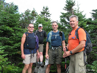
While planning this week, I notice that Eddie (here on VFTT, from Pennsylvania) was planning to be up here this week with his brother-in-law, son, and nephew. We exchanged phone numbers then and got in touch last night and planned on Crockers and Redington for today (turns out they were at the Bigelows yesterday, but skipped South Horn.) Both vehicles (Bob in the Suburban and Eddie in the Forerunner) made it to the AT crossing. The CVR has deteriorated some, according to Bob, but your average clearance vehicle should still make it to the steel grate bridge. Watch the culvert near the start - that's the biggest dip both wheels on the axle will take together.
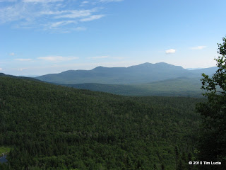
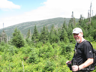
View from South Crocker Slide (AT), Bob, Ed, Tim, Eddie on South Crocker
With the two teenagers, Bob was right at home and immediately challenged the younger one to a foot race back on the CVR, several miles and hours later. Still the youngest two exploded up the trail, steep parts and all, topping out on South Crocker in about 65 minutes. The more experienced of us stopped and took in some views from the slide on the AT where it ascends South Crocker, but eventually caught up to them resting in the flat spot immediately below. Trail was dry, and good steps made for sure footing. We tagged it while we were here, although we'd be back shortly. Off to North Crocker.
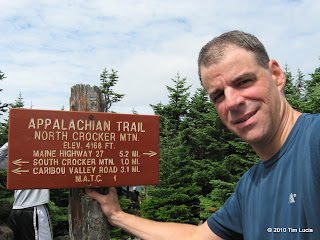
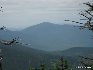
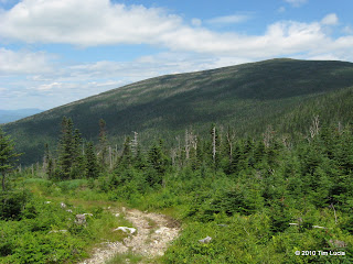
Tim on North Crocker, Saddleback from the viewpoint
The trip to North Crocker is about 1 mile and 600 feet (each way of course.) Good footing made this stretch go by quickly and we topped out there in about 1 hour 40 minutes. Time for lunch. Eddie left some stuff for a through-hiker that got left in his car from the previous day, along with some trail magic After chowing, it was back to South Crocker where the herd path was quite clear. It was mostly easy to follow, although I took the left branch of a split because it looked more well-worn, which led very quickly to the AT corridor and no path beyond. Part of the distraction was that there were piles (nearly steaming piles) of fresh moose droppings and we heard, but never saw, the dropper. Bob and Ed figured out the mistake and we followed the corridor until the herd path re-appeared.
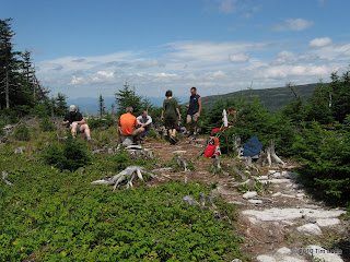
Ed in the clear-cut, Logging road to the top left
The clear cut had some nice views of South Crocker and more. It is growing in fast though with trees in the 6-10 foot range. Huge fields of raspberry bushes were picked clean here. The return to the herd path was marked with tape and shortly the herd path dropped us onto the "trail" to the summit. The tower has been removed, but some of the anchor points are intact. With the summit clear-cut, there were nice views from here. In the summit register (dates back to June 2009) we found some motel neighbors who were tagging the Bigelows to finish the 115 today. The most recognizable entry was "Ed Hawkins, 21st time".
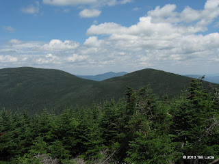
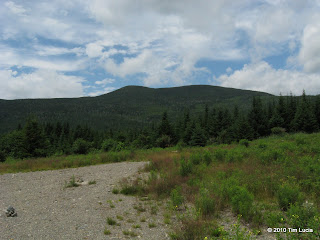
Gang on Redington, Crockers with Bigelows nestled in between.
If you look over your left should on the way there, you will come to a fairly obvious Y junction (it was a bit rocky) - note this spot for the return. Following the right turn on the way back will take you to a very obvious tractor road - it was gravel and had tall brush/short trees on either side. Simply follow this until it ends at a very open spot, which looks like a hilltop (again see below), where you turn right down the hill. At the bottom of the hill, turn left (it is obvious) and simply follow the road out.
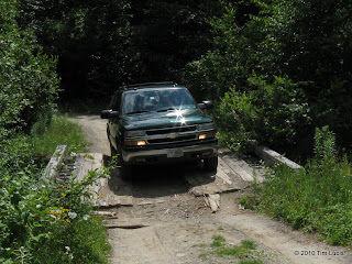
Redington from the left turn onto the CVR, The Hayesmobile crossing the wooden bridge.
All photos
Tim
View from South Crocker Slide (AT), Bob, Ed, Tim, Eddie on South Crocker
With the two teenagers, Bob was right at home and immediately challenged the younger one to a foot race back on the CVR, several miles and hours later. Still the youngest two exploded up the trail, steep parts and all, topping out on South Crocker in about 65 minutes. The more experienced of us stopped and took in some views from the slide on the AT where it ascends South Crocker, but eventually caught up to them resting in the flat spot immediately below. Trail was dry, and good steps made for sure footing. We tagged it while we were here, although we'd be back shortly. Off to North Crocker.
Tim on North Crocker, Saddleback from the viewpoint
The trip to North Crocker is about 1 mile and 600 feet (each way of course.) Good footing made this stretch go by quickly and we topped out there in about 1 hour 40 minutes. Time for lunch. Eddie left some stuff for a through-hiker that got left in his car from the previous day, along with some trail magic
After chowing, it was back to South Crocker where the herd path was quite clear. It was mostly easy to follow, although I took the left branch of a split because it looked more well-worn, which led very quickly to the AT corridor and no path beyond. Part of the distraction was that there were piles (nearly steaming piles) of fresh moose droppings and we heard, but never saw, the dropper. Bob and Ed figured out the mistake and we followed the corridor until the herd path re-appeared.
Ed in the clear-cut, Logging road to the top left
The clear cut had some nice views of South Crocker and more. It is growing in fast though with trees in the 6-10 foot range. Huge fields of raspberry bushes were picked clean here. The return to the herd path was marked with tape and shortly the herd path dropped us onto the "trail" to the summit. The tower has been removed, but some of the anchor points are intact. With the summit clear-cut, there were nice views from here. In the summit register (dates back to June 2009) we found some motel neighbors who were tagging the Bigelows to finish the 115 today. The most recognizable entry was "Ed Hawkins, 21st time".
Gang on Redington, Crockers with Bigelows nestled in between.
If you look over your left should on the way there, you will come to a fairly obvious Y junction (it was a bit rocky) - note this spot for the return. Following the right turn on the way back will take you to a very obvious tractor road - it was gravel and had tall brush/short trees on either side. Simply follow this until it ends at a very open spot, which looks like a hilltop (again see below), where you turn right down the hill. At the bottom of the hill, turn left (it is obvious) and simply follow the road out.
Redington from the left turn onto the CVR, The Hayesmobile crossing the wooden bridge.
All photos
Tim
Last edited: