
Tuesday was the perfect example of Indian Summer. It also was a convenient day for me to take off from work. I labored over where to go and in the end, the peakbagging gene won out. I drove 380 miles round-trip (almost 7 hours) to hike almost 4 hours, and picked up numbers 81 and 82 on the NEHH - Jay Peak and Big Jay.
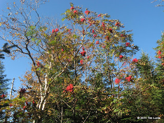
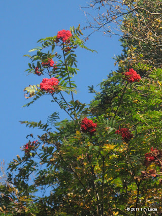
Mountain Ash Berries provided many splashes of bright red
After a 10-minute construction delay by Cannon Mountain (Franconia Notch Parkway), and another construction delay between Jay Peak Resort and Jay Pass, I found myself parked at the LT lot on 242, along with construction equipment and materials, but no other cars. I headed off in a sleeveless shirt and shorts and was up to temp in less than five minutes. The most remarkable thing about the LT below Jay Peak was the abundance of mountain ash, with plentiful bright-red berries. The wax wings will surely find good pickings here over the next few months.
Big Jay (LT/ski trail jct.), Tram ascending Jay Peak
The LT showed only minor signs of erosion from Irene. Down low, it is slowly becoming covered with fallen leaves. There were two dominant sounds today - that of falling leaves, almost sounding like rain, and that of the construction equipment working below on either side of Jay Pass. The 1.7 miles and 1800 feet went by quickly and I found myself on a ski trail below the summit in 50 minutes, and scrambled to the actual summit in under an hour. The foliage looks nearly peak and although the distant peaks were a hazy, the nearby ones showed a lot of red and yellow.
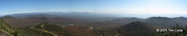
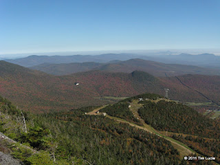
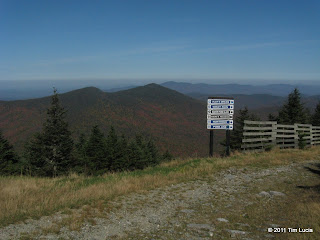
Jay Peak panorama
You can see why Jay Peak makes the New England Fifty Finest (at #8 with 2975 feet of prominence.) Without the restaurant, the views would be 360.
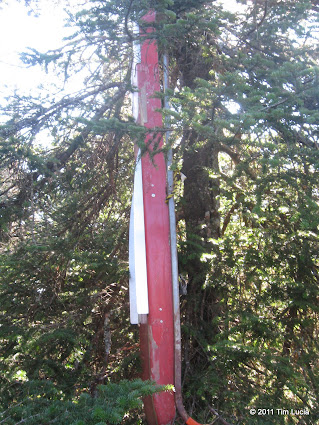
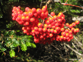
More mountain ash, Big Jay summit marker - a rescue toboggan
I followed the LT down the ski trail NW of the summit. At the boundary fence, go right for a few steps, and then turn left through the gap. Here you enter the Jay State Forest, and the LT continues on. Within a 100 feet or so, the herd path to Big Jay splits left (pretty obvious Y). This is the Cadillac of herd paths, and it even has its own herd paths around some of the blowdowns and muddy spots. There are plenty of cleanly sawed stumps, so it obviously gets plenty of use. Maybe twice there was some question about which way to go, but if the route isn't painfully obvious, look around some more, because it never petered out at all. In fact, I wore shorts and a sleeveless shirt and really didn't get scratched at all. You'll know you are at the summit when you see the toboggan in the trees.
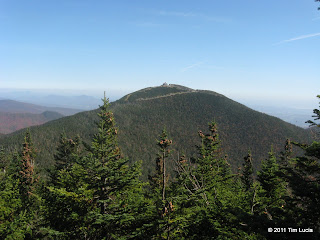
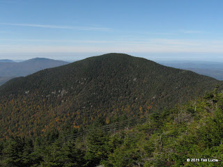
Jay Peak from Big Jay, North Jay from Jay Peak (ski trail/LT jct.)
Back at Jay, I saw two other hikers on the summit. I went around the summit on my way back, taking the ski trail to the right once off the herd path and LT. On the way down, I met the only person I would talk to all day. On the drive home, it was just warm enough to keep all four windows wide open and enjoy the breeze and foliage.
All Photos
Tim
Mountain Ash Berries provided many splashes of bright red
After a 10-minute construction delay by Cannon Mountain (Franconia Notch Parkway), and another construction delay between Jay Peak Resort and Jay Pass, I found myself parked at the LT lot on 242, along with construction equipment and materials, but no other cars. I headed off in a sleeveless shirt and shorts and was up to temp in less than five minutes. The most remarkable thing about the LT below Jay Peak was the abundance of mountain ash, with plentiful bright-red berries. The wax wings will surely find good pickings here over the next few months.
Big Jay (LT/ski trail jct.), Tram ascending Jay Peak
The LT showed only minor signs of erosion from Irene. Down low, it is slowly becoming covered with fallen leaves. There were two dominant sounds today - that of falling leaves, almost sounding like rain, and that of the construction equipment working below on either side of Jay Pass. The 1.7 miles and 1800 feet went by quickly and I found myself on a ski trail below the summit in 50 minutes, and scrambled to the actual summit in under an hour. The foliage looks nearly peak and although the distant peaks were a hazy, the nearby ones showed a lot of red and yellow.
Jay Peak panorama
You can see why Jay Peak makes the New England Fifty Finest (at #8 with 2975 feet of prominence.) Without the restaurant, the views would be 360.
More mountain ash, Big Jay summit marker - a rescue toboggan
I followed the LT down the ski trail NW of the summit. At the boundary fence, go right for a few steps, and then turn left through the gap. Here you enter the Jay State Forest, and the LT continues on. Within a 100 feet or so, the herd path to Big Jay splits left (pretty obvious Y). This is the Cadillac of herd paths, and it even has its own herd paths around some of the blowdowns and muddy spots. There are plenty of cleanly sawed stumps, so it obviously gets plenty of use. Maybe twice there was some question about which way to go, but if the route isn't painfully obvious, look around some more, because it never petered out at all. In fact, I wore shorts and a sleeveless shirt and really didn't get scratched at all. You'll know you are at the summit when you see the toboggan in the trees.
Jay Peak from Big Jay, North Jay from Jay Peak (ski trail/LT jct.)
Back at Jay, I saw two other hikers on the summit. I went around the summit on my way back, taking the ski trail to the right once off the herd path and LT. On the way down, I met the only person I would talk to all day. On the drive home, it was just warm enough to keep all four windows wide open and enjoy the breeze and foliage.
All Photos
Tim