Neil
Well-known member
- Joined
- Apr 26, 2004
- Messages
- 3,434
- Reaction score
- 487
I decided to do this hike for my dad, as a Father’s Day gift. I’m going to prepare a special report just for him with pictures, a narrative report, maps, and elevation profiles and have it all made into a hard-cover photo book.
As I hiked I thought a lot about fatherhood and what my father did that contributed towards me becoming a hiker.
The Blake slide is between Blake and Blake South facing the Dix Range and you can see it plainly from Nippletop and Dix and probably from most of the Dix peaks. Parts of it have grown in, especially the middle section but it’s a very worthwhile objective. The views of Nipletop and the Dix Range from the slide are as good as they get.
Timmus and I did the slide 2 (or was it 3? ) years ago. Besides wanting to iron out a few wrinkles in the route we took I wanted to summit Blake South for one of my lists. The slide tops out only 200 feet from the summit of Blake South (if that) but we didn’t think of climbing it the first time around.
It was already noon when I struck off into the underbrush from Elk Pass. The first ½ mile of bushwhacking leads you to the foot of the Nippletop Slide. I have made the 500 foot descent twice previously (once each for the Ntop and Blake slides) and decided to stick to the drainage like glue. It’s strangely easy to drift away from it so this time I made a conscious effort to stay right next to running water. It turns out that this offers the best route of the three I have taken and it only took me 30 minutes to reach the base of the Nip slide.
After that, I rock-hopped in the blazing sun, losing more elevation. After about 30 minutes I entered the woods on the left side and made better time in the fairly open forest. There were no human signs whatsoever and all I heard were the birds, the creek and the whispering breezes...until Sylvie called me up on my radio to say she was on top of Nippletop. I had just turned it on but thought there would be no contact until I got up onto the slide. However, she came in loud and clear.
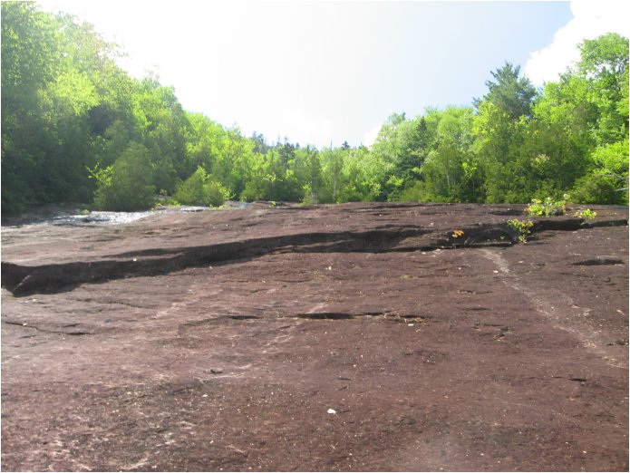
As you descend below Colvin, and then Blake you arrive at a beautiful waterfall. Through the sparse woods you see you are in a horseshoe of 100 foot high slabs of steep rock. The creek runs through the middle of it , having cut away a valley (or following a geological fault?) and makes a drop of about 30 feet.
0.20 miles of rockhopping leads to a well-maintained and well-travelled trail that comes up from Elk Lake. I followed the trail for 50 feet until a drainage crosses from the Blake side and headed up. 2 years earlier, Timmus and I headed up somewhat closer to the falls and I found it to be a thick and difficult whack. I figured that following the drainage that is clearly marked on the map would be a no-brainer and would lead me right to the slide.
However, the drainage quickly broke apart into several dry, rubbly creek beds and I chose the one that looked the most promising and that kept me more or less on a 300 degree magnetic course. The bushwhacking was much better and even after erroneously following the drainage 300 feet away from the slide I made it from the Elk Pass-Elk Lake creek to there in only 45 minutes. Total time from Elk Pass to the slide was 2h15min.
I had put 3 fresh litres into my hydration unit before heading up and I was guzzling it like there was no tomorrow. Next water hole: Gill Brook. Once on the slide I called Sylvie and we had perfect radio reception. She and Annick stood up and waved something red. I might have seen them but at 1.6 miles in the blazing sun it was hard to tell. They said they could see the slide and that they were going back to their summit snoozing.
I sat down, removed my long pants and changed into my sticky-soled shoes. The slide was dry and very grippy. I carried shorts but elected to continue in my boxer shorts. There were some hungry flies but nothing too bad. I took pictures and more pictures. I had been taking pictures all day for my Father's day project. I was trying out a polarizing filter on my Canon P&S A540 camera but it was impossible to tell if it doing anything.
The views of Nippletop (and slide) and the Dix Range right down to Sunrise were stupendous. Right next to me the views of Blake were excellent. Blake is very steep and cliffy on that side.
After a while the slide seems to peter out into a spindly Spruce-Fir forest and somehow I lost all trace of it and found myself bushwhacking in my underwear through a very thick and gnarly forest. I got back on track within 20 minutes and ascended the middle section, which was composed of very narrow rocky slabs that angle downwards into a tiny slit that acts as a drainage. Most of the trees that are growing up are cedars.
The pitch increases steadily as you climb and I was glad to be wearing approach shoes. For the grand finale the slide opens right up again and is pretty steep. Under dry and grippy conditions it wasn’t a problem getting up it. One hell of a workout but no more. Finally I was at the top and I sat down and put my pants on.
Upon departing Elk Pass I had told Sylvie I would be on top of Blake at 4 and back at the gate by 7pm. It was about 3:30 now and I wanted to do Blake South so once on the Pinnacle Ridge trail I dropped my pack and made the 10 minute RT to Blake South. The lighting was mellowing and walking on the soft trail upon the narrow ridge there was the Great Range on one side and the Dix Range on the other. I was on top of Blake at 4:10 after missing Outlook Rock in spite of keeping an eye out for it. The feeling in my legs as I climbed those steep 250 feet up Blake made me think about the 600 foot climb up Colvin and my off-hand 3 hour estimate from Blake to the gate.
The views of Basin and Gothics through the trees were superb and I kept taking more pictures. It was my 4th descent off of Blake and each time it seems steeper than the preceding . 25 minutes to the col and I was out of water, which is about what I expected after filling up below the slide.
No water in the col and I adjusted my pace to slow and steady and 30 minutes later was on top of Colvin snapping pictures (wearing a head net and getting my hands stung over and over again).
Pushing the pace but being careful I made it from Colvin to the Elk Pass junction in 30 minutes and as the trail flattened out I progeressively increased my pace. It became a game to see if I could make it out by 7:30 (7 was impossible, the views up on the ridges were too good to pass up.)
I stopped to take on water at Artist's Falls and once on the road maintained a 3.5 mph pace. Sylvie called me up on the radio and we had fun talking until I got out. While I was shlepping my tired bag of bones she bragged to me that she and Annick had gotten a lift from the Gill Brook trail to the gate. That’s twice now in only 4 hikes she’s had a lift on that road. I know that in my lifetime I will never get a lift on the AMR Lake Road. If I lay down in the middle of it I might get a pair of tire tracks across my back.
I will be going back to the Blake Slide one last time next summer in order to do Blake as a bushwhack hike. I scoped it out and (of course) took pictures of the route.
(I made it out at 7:20, if not for the unplanned bushwhacking in my boxer shorts I would have been out at 7, right on the dot.)
As I hiked I thought a lot about fatherhood and what my father did that contributed towards me becoming a hiker.
The Blake slide is between Blake and Blake South facing the Dix Range and you can see it plainly from Nippletop and Dix and probably from most of the Dix peaks. Parts of it have grown in, especially the middle section but it’s a very worthwhile objective. The views of Nipletop and the Dix Range from the slide are as good as they get.
Timmus and I did the slide 2 (or was it 3? ) years ago. Besides wanting to iron out a few wrinkles in the route we took I wanted to summit Blake South for one of my lists. The slide tops out only 200 feet from the summit of Blake South (if that) but we didn’t think of climbing it the first time around.
It was already noon when I struck off into the underbrush from Elk Pass. The first ½ mile of bushwhacking leads you to the foot of the Nippletop Slide. I have made the 500 foot descent twice previously (once each for the Ntop and Blake slides) and decided to stick to the drainage like glue. It’s strangely easy to drift away from it so this time I made a conscious effort to stay right next to running water. It turns out that this offers the best route of the three I have taken and it only took me 30 minutes to reach the base of the Nip slide.
After that, I rock-hopped in the blazing sun, losing more elevation. After about 30 minutes I entered the woods on the left side and made better time in the fairly open forest. There were no human signs whatsoever and all I heard were the birds, the creek and the whispering breezes...until Sylvie called me up on my radio to say she was on top of Nippletop. I had just turned it on but thought there would be no contact until I got up onto the slide. However, she came in loud and clear.
As you descend below Colvin, and then Blake you arrive at a beautiful waterfall. Through the sparse woods you see you are in a horseshoe of 100 foot high slabs of steep rock. The creek runs through the middle of it , having cut away a valley (or following a geological fault?) and makes a drop of about 30 feet.
0.20 miles of rockhopping leads to a well-maintained and well-travelled trail that comes up from Elk Lake. I followed the trail for 50 feet until a drainage crosses from the Blake side and headed up. 2 years earlier, Timmus and I headed up somewhat closer to the falls and I found it to be a thick and difficult whack. I figured that following the drainage that is clearly marked on the map would be a no-brainer and would lead me right to the slide.
However, the drainage quickly broke apart into several dry, rubbly creek beds and I chose the one that looked the most promising and that kept me more or less on a 300 degree magnetic course. The bushwhacking was much better and even after erroneously following the drainage 300 feet away from the slide I made it from the Elk Pass-Elk Lake creek to there in only 45 minutes. Total time from Elk Pass to the slide was 2h15min.
I had put 3 fresh litres into my hydration unit before heading up and I was guzzling it like there was no tomorrow. Next water hole: Gill Brook.
Once on the slide I called Sylvie and we had perfect radio reception. She and Annick stood up and waved something red. I might have seen them but at 1.6 miles in the blazing sun it was hard to tell. They said they could see the slide and that they were going back to their summit snoozing.I sat down, removed my long pants and changed into my sticky-soled shoes. The slide was dry and very grippy. I carried shorts but elected to continue in my boxer shorts. There were some hungry flies but nothing too bad. I took pictures and more pictures. I had been taking pictures all day for my Father's day project. I was trying out a polarizing filter on my Canon P&S A540 camera but it was impossible to tell if it doing anything.
The views of Nippletop (and slide) and the Dix Range right down to Sunrise were stupendous. Right next to me the views of Blake were excellent. Blake is very steep and cliffy on that side.
After a while the slide seems to peter out into a spindly Spruce-Fir forest and somehow I lost all trace of it and found myself bushwhacking in my underwear through a very thick and gnarly forest. I got back on track within 20 minutes and ascended the middle section, which was composed of very narrow rocky slabs that angle downwards into a tiny slit that acts as a drainage. Most of the trees that are growing up are cedars.
The pitch increases steadily as you climb and I was glad to be wearing approach shoes. For the grand finale the slide opens right up again and is pretty steep. Under dry and grippy conditions it wasn’t a problem getting up it. One hell of a workout but no more. Finally I was at the top and I sat down and put my pants on.
Upon departing Elk Pass I had told Sylvie I would be on top of Blake at 4 and back at the gate by 7pm. It was about 3:30 now and I wanted to do Blake South so once on the Pinnacle Ridge trail I dropped my pack and made the 10 minute RT to Blake South. The lighting was mellowing and walking on the soft trail upon the narrow ridge there was the Great Range on one side and the Dix Range on the other. I was on top of Blake at 4:10 after missing Outlook Rock in spite of keeping an eye out for it. The feeling in my legs as I climbed those steep 250 feet up Blake made me think about the 600 foot climb up Colvin and my off-hand 3 hour estimate from Blake to the gate.
The views of Basin and Gothics through the trees were superb and I kept taking more pictures. It was my 4th descent off of Blake and each time it seems steeper than the preceding . 25 minutes to the col and I was out of water, which is about what I expected after filling up below the slide.
No water in the col and I adjusted my pace to slow and steady and 30 minutes later was on top of Colvin snapping pictures (wearing a head net and getting my hands stung over and over again).
Pushing the pace but being careful I made it from Colvin to the Elk Pass junction in 30 minutes and as the trail flattened out I progeressively increased my pace. It became a game to see if I could make it out by 7:30 (7 was impossible, the views up on the ridges were too good to pass up.)
I stopped to take on water at Artist's Falls and once on the road maintained a 3.5 mph pace. Sylvie called me up on the radio and we had fun talking until I got out. While I was shlepping my tired bag of bones she bragged to me that she and Annick had gotten a lift from the Gill Brook trail to the gate. That’s twice now in only 4 hikes she’s had a lift on that road. I know that in my lifetime I will never get a lift on the AMR Lake Road. If I lay down in the middle of it I might get a pair of tire tracks across my back.
I will be going back to the Blake Slide one last time next summer in order to do Blake as a bushwhack hike. I scoped it out and (of course) took pictures of the route.
(I made it out at 7:20, if not for the unplanned bushwhacking in my boxer shorts I would have been out at 7, right on the dot.)