Trail Boss
New member
Photos: https://flic.kr/s/aHskNRXEQm
My day started at the Loj's busy trailhead. The weather forecast called for a snowstorm the next day so everyone was here today. I had the MacIntyre Range on my to-do list (specifically Wright, Algonquin, and Iroquois).
Shortly before MacIntyre Falls, I passed a large group responsible for the groomed trail left in their wake. Beyond them, I followed the tracks of a lone hiker shod in crampons.
The hiker's divots gradually increased in depth to post-holes in the deeper drifts. Upon reaching the junction for Wright Peak, I noticed the balance of the trail up Algonquin was untracked. Anticipating it would be a challenging day, I decided to head directly to Algonquin and Iroquois and then tackle Wright on the return.
The snow depth varied from half to a foot deep (drifts). I plodded along, listening to a podcast. The windchill became difficult to ignore so I paused to don a hardshell and overmitts, stow the ear buds, batten down the hatches, and down a mouthful of Skittles. My first sight of the treeless alpine zone was ... almost no sight at all. Visibility was less than 50 feet.
I've been above treeline in poor visibility but this was a new level of poor. The stiff westerly wind carried an icy mist that frosted my glasses and chilled my face. I stopped to pocket the glasses and put on a facemask. Mating the facemask's two halves of Velcro behind my head, while wearing bulky mitts, was a frustrating exercise. After about a dozen failed attempts I finally succeeded and continued up the barren slope.
My ability to navigate by landmarks was hamstrung by the combination of near-sightedness, flat lighting, enveloping fog, and driving ice mist. I followed the Law of Up and was occasionally rewarded by sighting a cairn. Most of the time I was looking at my feet and watching where I stepped. Algonquin was sheathed in hard rippled ice and I wished I had switched to my Trail Crampons. However, fat chance I was going to stop for a swap. Suck it up, buttercup.
I sensed I was near the top (the slope began to level out) and, more by instinct than sight, curled to the right towards the invisible summit. I recognized the two frosted boulders and paused to snap a selfie. Naturally, I stood with my back to the wind thereby causing the blowing ice mist to cloud the camera lens. I looked at my clothing and saw it was coated in rime, notably on the windward side.
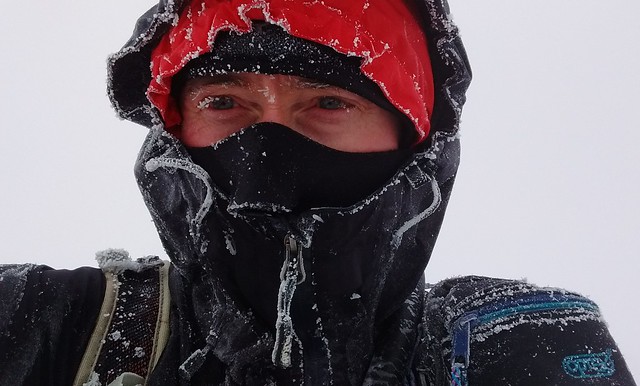
Stay frosty!
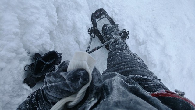
I need de-icing.
I headed southwest in search of a cairn. I paused in the lee of a particularly large one about 70 feet from the summit. At times, I couldn't see farther than 20 feet. So, when you're in a bowl of chowder, what do you do next?
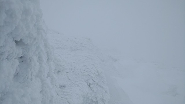
What 25-foot visibility looks like. Not much.
I chose to discover how well I could navigate visually. I turned downhill, found 3 more cairns, and then ... bupkis. I encountered terrain that was inconsistent with what I knew of the marked route. Convinced I was off-route, I pulled out my phone and took a peek at my location. I had descended 150 feet and 0.13 miles but 25 degrees too far to the west! Ha! I turned hard-left and continued walking, slightly uphill, until I spotted a cairn.
I wasn't ready to give up yet. I turned right and continued down, threading 3 more cairns. At the third one I stopped to assess the situation. This is the easy part of the route to Iroquois. The real challenge will begin at the unmarked trail and it will undoubtedly be buried in several feet of snow, and replaced with a foggy mine-field of spruce traps. Doubt pees in my pool of confidence.
As much as I dislike turning back, the conditions felt too risky for lonesome little me. I turned uphill and immediately felt conflicted; I'm both disappointed and relieved. I returned to the summit and then, facing east, curled left to pick up the descent route to the Loj. Within moments, ghostly forms take shape in the fog.
I ask the group of 4 hikers if they're heading to Iroquois and they confirm. I ask if I can join them and they agree. A smile forms under my facemask.
I've now been above treeline for over half an hour and my clothes are plastered in rime. Fortunately, the group doesn't dawdle and we leave promptly. After completing Iroquois, they all planned to descend to Lake Colden via the Algonquin Trail. I explained I would return over Algonquin because I intended to climb Wright.
One of the group had worked as a trail-crew member and said he was very familiar with the route down Algonquin's southwest side. I too am familiar with it but our combined experience didn't guarantee success.
Having already done some reconnaissance earlier, I led the initial descent but explained everyone is free to chime in. Things went well until 4875' and then we went off-route to the west. With the terrain becoming increasingly unfamiliar (too steep, too many trees), I checked my phone and discovered we were not just a little "off" but a full 140 degrees off! Later, I reviewed our track and our fateful inflection point coincided with a natural split in the terrain.
We turned hard to the east and drifted down to about 4760' where we could see the col (more like a crease) between Algonquin and Boundary. We found a trail marker, continued for about 70 feet and then realized we were on the Algonquin Trail and had passed the junction.
We opted to tack to the west in order to pick up some vestige of the unmarked trail to Iroquois. A few minutes later, I checked our location and discovered we overshot it by several yards. We corrected again but it was becoming obvious the trail was truly invisible, buried several feet below us, and attempts to find traces of it were a fool's errand. However, who else would be out in these conditions if not fools?
Our track now looked like a "drunkard's walk". It crossed and re-crossed the invisible trail. We discovered a thick layer of ice, under the snow, prevented us from springing the spruce traps. However, that's not to say we didn't find a few. Fortunately most were at the northern end and only 3-feet deep.
We faced a slope and surmised we were about to ascend Boundary. We followed the Law of Up and found the summit cairn. We continued in this manner, choosing the best line across the terrain, checking our location when in doubt (or things "felt wrong"), correcting our wanderings, and confirming we were still together. All the teamwork paid off and we arrived at the base of Iroquois. The final ascent was complicated by ice but we managed to zig-zag our way up in snowshoes.
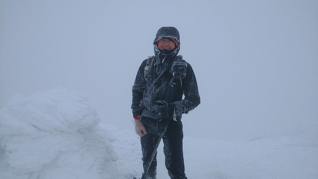
Iroquois. Happy to be here!
After a few pics to celebrate our success we retraced our steps. We tried to correct our initial mistake and exit at the trail junction but failed; we returned to where we started.
I thanked everyone for their help. Before leaving, the group crowded around my phone to see our precise current location. The terrain was a smooth bowl and heavily obscured by fog. There was little to suggest we were standing on the trail. We wished one another luck and went our separate ways.
I returned to what I now knew to be the junction. I looked uphill and spotted a soft-focus cairn. I began ascending and minutes later met a large group of descending hikers. I described my morning and explained they should avoid our initial tracks which wandered all over hell's half-acre.
The visibility had not improved but it didn't feel nearly as cold as it did earlier. I couldn't tell for sure because my pocket thermometer had iced up. Navigating the ascent was simplified by the marks left by the large group (made by crampons, poles, snowshoes, and microspikes). I followed their "herd path" and threaded the cairns.
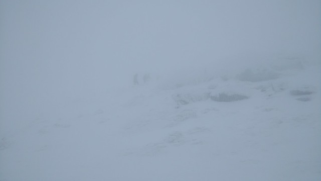
Disappearing into the icy mist.
Beyond the summit, during my descent, I caught up to two young men from Clarkson and we struck up a conversation. We continued together, moving from one cairn to another (more or less). Algonquin's icy armor gave our snowshoes a hard time.
Below treeline, the trail was now a hard-packed superhighway. I arrived at the Wright junction and was soon joined by the Clarkson students. One of them was wearing half an MSR snowshoe. Both clevis pins failed and let the entire binding detach from the snowshoe. He switched into microspikes and I convinced them to join me for Wright.
Traction proved to be necessary on the icy rock above treeline. The temperature was noticeably warmer and Wright's summit was far more pleasant than Algonquin. We carefully descended the slick rock and then sped back to the junction. We said our goodbyes and parted company. I stripped down to a baselayer and made short work of the descent. The sighting of a pine marten was the only special moment along the way.
I reached the trailhead shortly after 4:00 PM and just under 8 hours from departure. It had been my third and most challenging winter trip to Iroquois but it was very rewarding. I won't forget it.
My day started at the Loj's busy trailhead. The weather forecast called for a snowstorm the next day so everyone was here today. I had the MacIntyre Range on my to-do list (specifically Wright, Algonquin, and Iroquois).
Shortly before MacIntyre Falls, I passed a large group responsible for the groomed trail left in their wake. Beyond them, I followed the tracks of a lone hiker shod in crampons.
The hiker's divots gradually increased in depth to post-holes in the deeper drifts. Upon reaching the junction for Wright Peak, I noticed the balance of the trail up Algonquin was untracked. Anticipating it would be a challenging day, I decided to head directly to Algonquin and Iroquois and then tackle Wright on the return.
The snow depth varied from half to a foot deep (drifts). I plodded along, listening to a podcast. The windchill became difficult to ignore so I paused to don a hardshell and overmitts, stow the ear buds, batten down the hatches, and down a mouthful of Skittles. My first sight of the treeless alpine zone was ... almost no sight at all. Visibility was less than 50 feet.
I've been above treeline in poor visibility but this was a new level of poor. The stiff westerly wind carried an icy mist that frosted my glasses and chilled my face. I stopped to pocket the glasses and put on a facemask. Mating the facemask's two halves of Velcro behind my head, while wearing bulky mitts, was a frustrating exercise. After about a dozen failed attempts I finally succeeded and continued up the barren slope.
My ability to navigate by landmarks was hamstrung by the combination of near-sightedness, flat lighting, enveloping fog, and driving ice mist. I followed the Law of Up and was occasionally rewarded by sighting a cairn. Most of the time I was looking at my feet and watching where I stepped. Algonquin was sheathed in hard rippled ice and I wished I had switched to my Trail Crampons. However, fat chance I was going to stop for a swap. Suck it up, buttercup.
I sensed I was near the top (the slope began to level out) and, more by instinct than sight, curled to the right towards the invisible summit. I recognized the two frosted boulders and paused to snap a selfie. Naturally, I stood with my back to the wind thereby causing the blowing ice mist to cloud the camera lens. I looked at my clothing and saw it was coated in rime, notably on the windward side.

Stay frosty!

I need de-icing.
I headed southwest in search of a cairn. I paused in the lee of a particularly large one about 70 feet from the summit. At times, I couldn't see farther than 20 feet. So, when you're in a bowl of chowder, what do you do next?

What 25-foot visibility looks like. Not much.
I chose to discover how well I could navigate visually. I turned downhill, found 3 more cairns, and then ... bupkis. I encountered terrain that was inconsistent with what I knew of the marked route. Convinced I was off-route, I pulled out my phone and took a peek at my location. I had descended 150 feet and 0.13 miles but 25 degrees too far to the west! Ha! I turned hard-left and continued walking, slightly uphill, until I spotted a cairn.
I wasn't ready to give up yet. I turned right and continued down, threading 3 more cairns. At the third one I stopped to assess the situation. This is the easy part of the route to Iroquois. The real challenge will begin at the unmarked trail and it will undoubtedly be buried in several feet of snow, and replaced with a foggy mine-field of spruce traps. Doubt pees in my pool of confidence.
As much as I dislike turning back, the conditions felt too risky for lonesome little me. I turned uphill and immediately felt conflicted; I'm both disappointed and relieved. I returned to the summit and then, facing east, curled left to pick up the descent route to the Loj. Within moments, ghostly forms take shape in the fog.
I ask the group of 4 hikers if they're heading to Iroquois and they confirm. I ask if I can join them and they agree. A smile forms under my facemask.
I've now been above treeline for over half an hour and my clothes are plastered in rime. Fortunately, the group doesn't dawdle and we leave promptly. After completing Iroquois, they all planned to descend to Lake Colden via the Algonquin Trail. I explained I would return over Algonquin because I intended to climb Wright.
One of the group had worked as a trail-crew member and said he was very familiar with the route down Algonquin's southwest side. I too am familiar with it but our combined experience didn't guarantee success.
Having already done some reconnaissance earlier, I led the initial descent but explained everyone is free to chime in. Things went well until 4875' and then we went off-route to the west. With the terrain becoming increasingly unfamiliar (too steep, too many trees), I checked my phone and discovered we were not just a little "off" but a full 140 degrees off! Later, I reviewed our track and our fateful inflection point coincided with a natural split in the terrain.
We turned hard to the east and drifted down to about 4760' where we could see the col (more like a crease) between Algonquin and Boundary. We found a trail marker, continued for about 70 feet and then realized we were on the Algonquin Trail and had passed the junction.
We opted to tack to the west in order to pick up some vestige of the unmarked trail to Iroquois. A few minutes later, I checked our location and discovered we overshot it by several yards. We corrected again but it was becoming obvious the trail was truly invisible, buried several feet below us, and attempts to find traces of it were a fool's errand. However, who else would be out in these conditions if not fools?
Our track now looked like a "drunkard's walk". It crossed and re-crossed the invisible trail. We discovered a thick layer of ice, under the snow, prevented us from springing the spruce traps. However, that's not to say we didn't find a few. Fortunately most were at the northern end and only 3-feet deep.
We faced a slope and surmised we were about to ascend Boundary. We followed the Law of Up and found the summit cairn. We continued in this manner, choosing the best line across the terrain, checking our location when in doubt (or things "felt wrong"), correcting our wanderings, and confirming we were still together. All the teamwork paid off and we arrived at the base of Iroquois. The final ascent was complicated by ice but we managed to zig-zag our way up in snowshoes.

Iroquois. Happy to be here!
After a few pics to celebrate our success we retraced our steps. We tried to correct our initial mistake and exit at the trail junction but failed; we returned to where we started.
I thanked everyone for their help. Before leaving, the group crowded around my phone to see our precise current location. The terrain was a smooth bowl and heavily obscured by fog. There was little to suggest we were standing on the trail. We wished one another luck and went our separate ways.
I returned to what I now knew to be the junction. I looked uphill and spotted a soft-focus cairn. I began ascending and minutes later met a large group of descending hikers. I described my morning and explained they should avoid our initial tracks which wandered all over hell's half-acre.
The visibility had not improved but it didn't feel nearly as cold as it did earlier. I couldn't tell for sure because my pocket thermometer had iced up. Navigating the ascent was simplified by the marks left by the large group (made by crampons, poles, snowshoes, and microspikes). I followed their "herd path" and threaded the cairns.

Disappearing into the icy mist.
Beyond the summit, during my descent, I caught up to two young men from Clarkson and we struck up a conversation. We continued together, moving from one cairn to another (more or less). Algonquin's icy armor gave our snowshoes a hard time.
Below treeline, the trail was now a hard-packed superhighway. I arrived at the Wright junction and was soon joined by the Clarkson students. One of them was wearing half an MSR snowshoe. Both clevis pins failed and let the entire binding detach from the snowshoe. He switched into microspikes and I convinced them to join me for Wright.
Traction proved to be necessary on the icy rock above treeline. The temperature was noticeably warmer and Wright's summit was far more pleasant than Algonquin. We carefully descended the slick rock and then sped back to the junction. We said our goodbyes and parted company. I stripped down to a baselayer and made short work of the descent. The sighting of a pine marten was the only special moment along the way.
I reached the trailhead shortly after 4:00 PM and just under 8 hours from departure. It had been my third and most challenging winter trip to Iroquois but it was very rewarding. I won't forget it.
