IQuest
New member
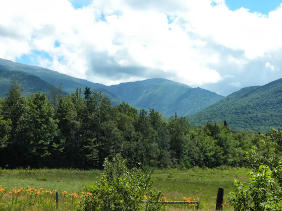
After an expensive breakdown and waiting for a "Presi Day" Sunday arrived with what looked to be a spectacular day above treeline. MWO forecasted mostly clear under mostly clear skies, highs near 50, light winds, and low humidity.
Marlie and I arrived at the Castle Tr in Bowman at 5:20am. That meant a 2:30am wake up :twisted: and after a buy one get one free breakfast sandwich at McDonalds in Plymouth I was already tired and ready for a nap.
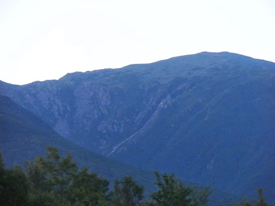
We had boots/paws on trail at 5:30 and headed up the Castle Tr with our destination in sight. The sun was just peeking over the horizon.
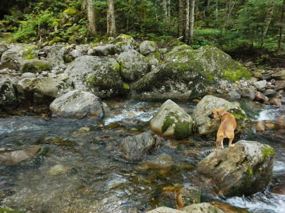
We made our way up to the Isreal Ridge Path then on to the Castle Ravine Tr. Both of the lower crossings were rock hoppable but stepping in an inch or 2 of water made things much easier. If the water were a few inches higher it would have been a challenge. I have had my eye on Castle Ravine since my trip up Madison and Adams in May. Until the bottom of the headwall it follows the remnants of an old road. It is lightly used and by the time we hit treeline we had made 11 notable water crossings. Most of which were marked well with white diamonds marked "Path". The footig was never too roung and the grade was nice.
One of the 16 crossings.
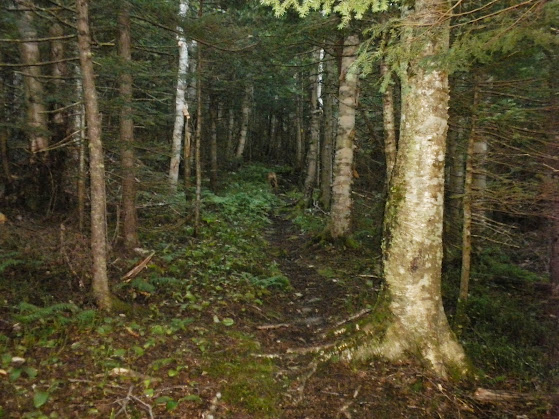
Lightly used trail.
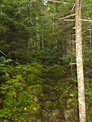
Remnants of an old road.
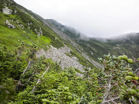
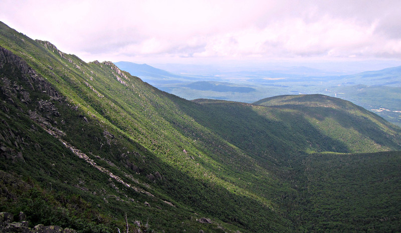
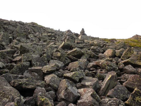
There were also some nice cascades and small falls along the way as well as lots of debris washed up on the brook banks from heavy rains. We soon passed Roof Rock and as I went through, Marlie decided to go around. I guess she is done with caves for a while. Shortly after that we hit the alpine zone and began the climb of the headwall. It was almost all talus and boulders the whole way up zig zaging it's way. Several rocks were loose so I had to be aware of where Marlie was.
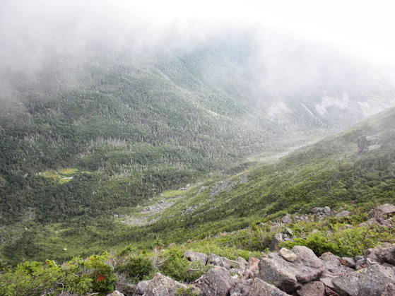
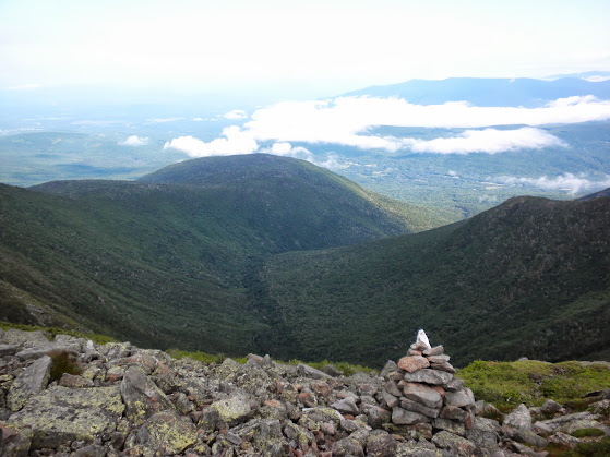
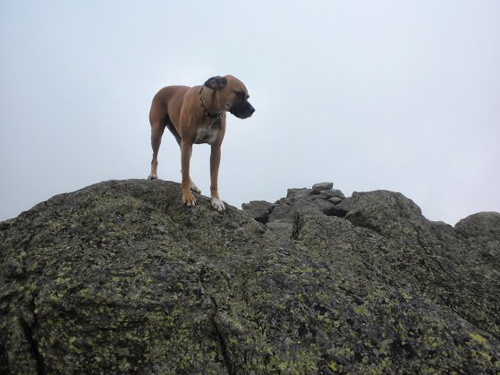
It was a stiff climb up to Edmands Col, but this was probably the easiest ascent of a ravine for me. The views back towards the ravine were awesome as was the grassy alpine zone that we passed through.
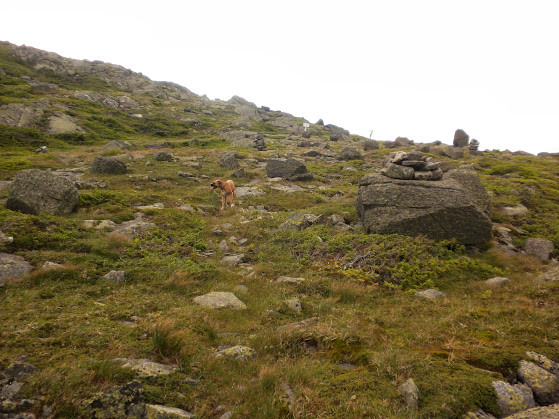
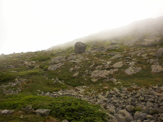
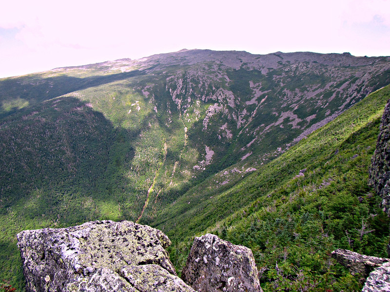
At Edmands Col we were only a half mile from the summit but what was the rush when we could traverse this?
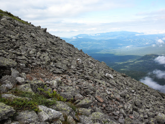
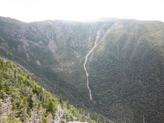
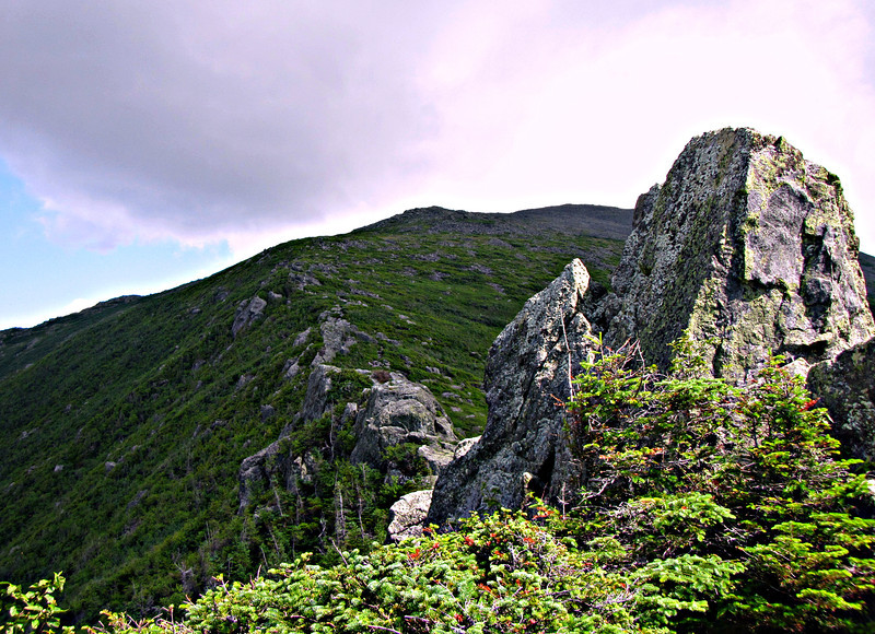
We followed The Cornice south, passing Castle Tr and Caps Ridge Tr where I had a glimpse of the southern Presis until the clouds rolled in. I never even had a chance to take a picture. Less than an hour later we were at the foggy junction of the Gulfside Tr. Where we met our first hikers of the day.
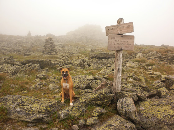
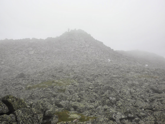
From here the Mt Jefferson Loop starts not too far away, and leads .3 miles to the summit but why would we do that when we could follow the Gulfside Tr back to Edmands Col, completey circling the peak. Besides, the summit was in the clouds. Once at the north end of the Mt Jefferson Loop we ascended to the foggy summit and took a well deserved rest. It was 10:05.
Marlie and I arrived at the Castle Tr in Bowman at 5:20am. That meant a 2:30am wake up :twisted: and after a buy one get one free breakfast sandwich at McDonalds in Plymouth I was already tired and ready for a nap.
We had boots/paws on trail at 5:30 and headed up the Castle Tr with our destination in sight. The sun was just peeking over the horizon.
We made our way up to the Isreal Ridge Path then on to the Castle Ravine Tr. Both of the lower crossings were rock hoppable but stepping in an inch or 2 of water made things much easier. If the water were a few inches higher it would have been a challenge. I have had my eye on Castle Ravine since my trip up Madison and Adams in May. Until the bottom of the headwall it follows the remnants of an old road. It is lightly used and by the time we hit treeline we had made 11 notable water crossings. Most of which were marked well with white diamonds marked "Path". The footig was never too roung and the grade was nice.
One of the 16 crossings.
Lightly used trail.
Remnants of an old road.
There were also some nice cascades and small falls along the way as well as lots of debris washed up on the brook banks from heavy rains. We soon passed Roof Rock and as I went through, Marlie decided to go around. I guess she is done with caves for a while. Shortly after that we hit the alpine zone and began the climb of the headwall. It was almost all talus and boulders the whole way up zig zaging it's way. Several rocks were loose so I had to be aware of where Marlie was.
It was a stiff climb up to Edmands Col, but this was probably the easiest ascent of a ravine for me. The views back towards the ravine were awesome as was the grassy alpine zone that we passed through.
At Edmands Col we were only a half mile from the summit but what was the rush when we could traverse this?
We followed The Cornice south, passing Castle Tr and Caps Ridge Tr where I had a glimpse of the southern Presis until the clouds rolled in. I never even had a chance to take a picture. Less than an hour later we were at the foggy junction of the Gulfside Tr. Where we met our first hikers of the day.
From here the Mt Jefferson Loop starts not too far away, and leads .3 miles to the summit but why would we do that when we could follow the Gulfside Tr back to Edmands Col, completey circling the peak. Besides, the summit was in the clouds. Once at the north end of the Mt Jefferson Loop we ascended to the foggy summit and took a well deserved rest. It was 10:05.