1HappyHiker
Well-known member
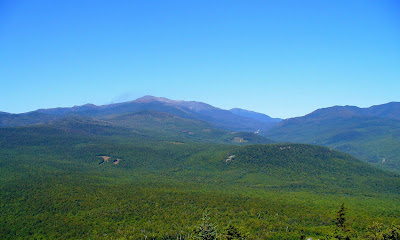
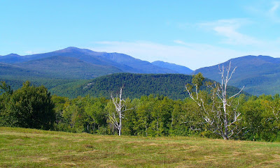
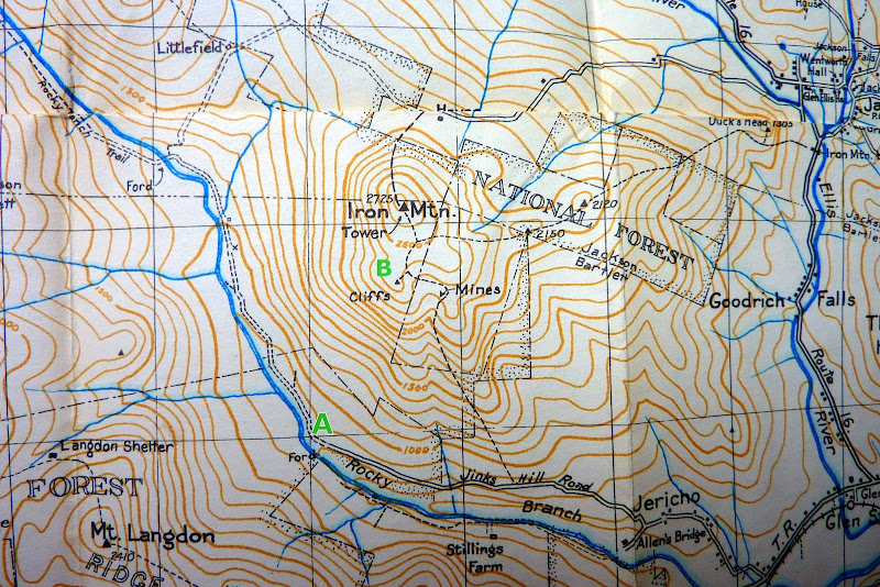
This might be old news to many, but possibly new information for some. Anyone who has hiked the Iron Mountain Trail knows that there is a view of Mt. Washington from the north side of Iron Mountain. But possibly what isn't as well known is that there is also a nice view of Mt. Washington on the far western end of the South Cliffs viewpoint. I don't think this view is available if you limit your wanderings to the general vicinity of where the trail dumps you out onto the South Cliffs viewpoint. (If it is, then I've missed it! ).
).
Below is a snapshot of the view I'm talking about. It's not a "knock your socks off" view, but a nice view nonetheless.
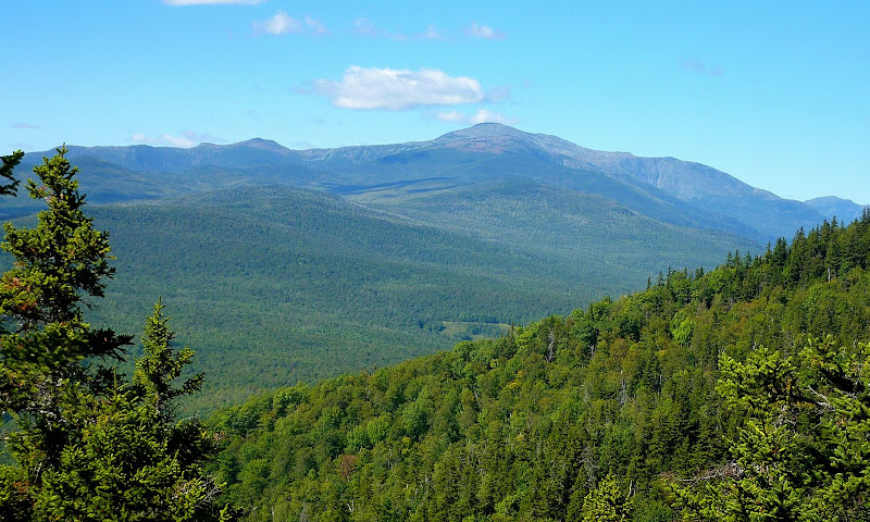
To reach the far western end of the cliffs, it's about a 0.2 mile trek from the end of the Iron Mountain Trail. There are traces of a very faint path that leads over to this area. However, you mostly just need to follow your nose since the faint path disappears when crossing large patches of bare rock.
Just as a side note, I accessed the South Cliff area of Iron Mountain by bushwhacking up from Jericho Road. It was merely something different to do. It didn't save any time. It took just over an hour for the bushwhack which is comparable to the book time of 1 hr 15 min that is listed in the WMG for hiking to the South Cliffs by trail.
So, during the summer months, it would seem that reaching the South Cliffs via bushwhacking offers no particular advantage over accessing this spot via the Iron Mountain Trail. However, even though it's unlikely that many folks would want to do this, I wonder if there's possibly some useful information here for anyone who might have a burning desire to access the South Cliffs during winter?
Although I've never been on Jericho Road in the winter, I do know that during winter months the road is gated at a certain point beyond the residential area. I'm assuming there is a place to park at the gate? If so, then a route similar to mine could be taken by parking where Jericho Road is gated, and then road-walk for about a mile before heading off into the woods in an easterly direction.
The route I took was moderately steep, but it was through open hardwoods for the entire distance. Plus, shortly after leaving Jericho Road, I came upon a dry brook bed that led nearly all the way to the top. It was a nice corridor that was almost like hiking a trail!
1HappyHiker
).Below is a snapshot of the view I'm talking about. It's not a "knock your socks off" view, but a nice view nonetheless.
To reach the far western end of the cliffs, it's about a 0.2 mile trek from the end of the Iron Mountain Trail. There are traces of a very faint path that leads over to this area. However, you mostly just need to follow your nose since the faint path disappears when crossing large patches of bare rock.
Just as a side note, I accessed the South Cliff area of Iron Mountain by bushwhacking up from Jericho Road. It was merely something different to do. It didn't save any time. It took just over an hour for the bushwhack which is comparable to the book time of 1 hr 15 min that is listed in the WMG for hiking to the South Cliffs by trail.
So, during the summer months, it would seem that reaching the South Cliffs via bushwhacking offers no particular advantage over accessing this spot via the Iron Mountain Trail. However, even though it's unlikely that many folks would want to do this, I wonder if there's possibly some useful information here for anyone who might have a burning desire to access the South Cliffs during winter?
Although I've never been on Jericho Road in the winter, I do know that during winter months the road is gated at a certain point beyond the residential area. I'm assuming there is a place to park at the gate? If so, then a route similar to mine could be taken by parking where Jericho Road is gated, and then road-walk for about a mile before heading off into the woods in an easterly direction.
The route I took was moderately steep, but it was through open hardwoods for the entire distance. Plus, shortly after leaving Jericho Road, I came upon a dry brook bed that led nearly all the way to the top. It was a nice corridor that was almost like hiking a trail!
1HappyHiker
Last edited: