
grouseking
Well-known member
Why don't we start with a smiley face?
Seeing this made me believe this would be a great day of snowshoeing. The original itinerary was to check out Ethan Pond, and possibly go to Shoal Pond if we were feeling up to it, and if the trail was broken. While we didn't end up going to Shoal, there were a few other surprises to come our way.
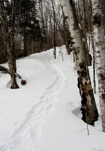
The hike started down on Rt 302, up 1/3 of a mile on the summer access rd, which is way easier when you drive. But in quick order, we made it to the summer trailhead, and were ready to head out.
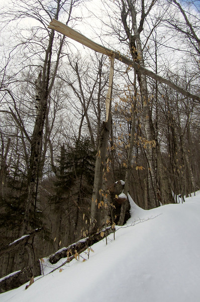
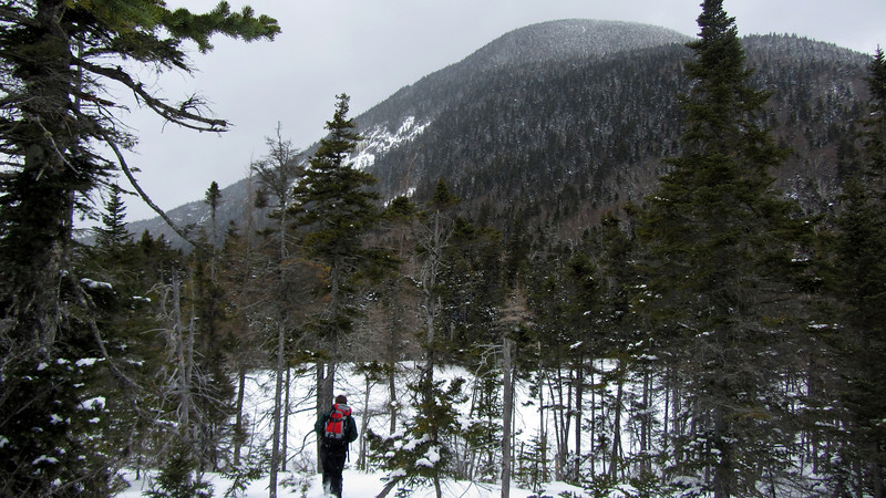
The trail was somewhat broken, but MattL and I completed the task. I hadn't hiked that section of trail in about 7 or 8 years, but the first 1/2 mile is a stiff of a climb as I remember. So it was a slow climb, but neither of us minded. The deep snow and occasional splashes of sunshine lifted our spirits. We also had to keep our eyes open, because there were several "widow makers" scattered along the trail. This one was prob the worst.
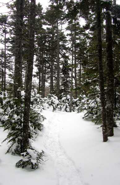
After the Willey Range trail junction, the Ethan Pond trail climbs up towards the height of land on the "Pemi Plateau." Here, the snow depth increased dramatically from 1-2 feet, to 4-5 feet. This area is probably my favorite part of the white mtns outside of the higher peaks. There is a great feeling of solitude is there, especially during the winter when there are no AT hikers.
Near the height of land, we noticed an opening to the right, and wondered if it was the elusive "Lucy" Pond. A very short bushwhack revealed our suspicions...yes it was! This short side trip made the hike a success, no matter what else happened.
Walking down to the pond
Would like to see it in warmer weather-
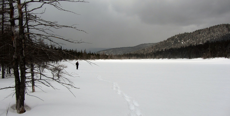
After spending a good 10-15 min there, we resumed our trek to Ethan Pond. By then, we made a decision to not push on to Shoal Pond because it was already about 1:30pm, and we wanted to hang out at Ethan for awhile. The fact that the trail was not broken beyond Ethan Pond made us realize our decision was a wise one.
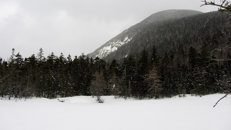
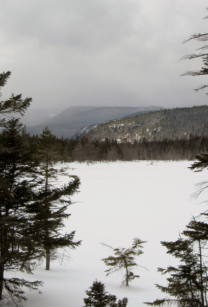
The sun was in and out at the pond, with occasional snow showers in the air.
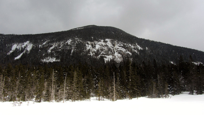
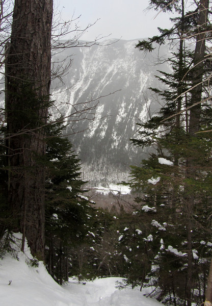
Impressive Mt Willey cliffs
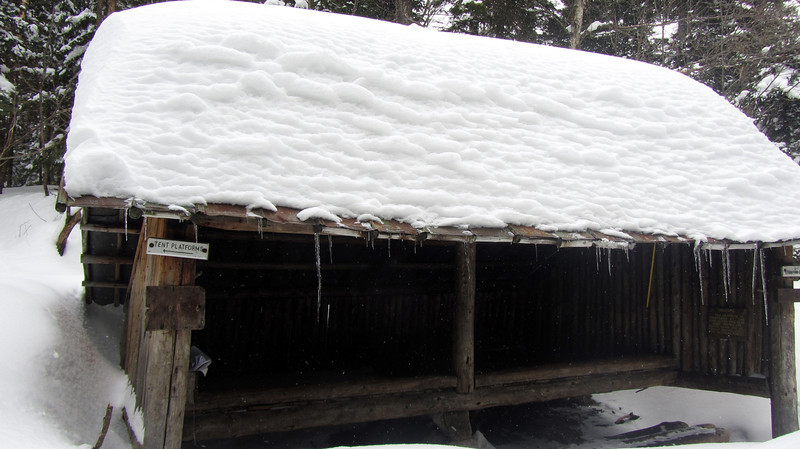
Next, it was off to the shelter, and that had to be broken out. Glancing at the log book showed that someone hadn't been there in 10 days. There was a good 4 feet of snow on the roof.
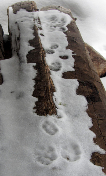
This snowshoe hare was too early for our lunch party.
One more for the road-
While eating lunch, I, in my infinite wisdom, suggested we hike down the Kedron Flume trail and walk the road back to the car. I've been on a kick of trying to redline as many trails as possible. So I thought, why not? I knew it was steep, but I figured we could butt slide down the rough parts. Then I thought it would be smooth sailing back to Rt 302.
Well, as my father used to say, "look what thought did." The butt sliding part was easy enough. It was a steep section, but there was enough snow to slide down at a slow and cautious pace. Then things started to get a little hairy when we had to cross the flume. There was some open water and randomly placed blowdowns covered in snow, that were over the water. We broke thru a few times but never lost our footing completely, and the snow bridge mostly held for the actual crossing. I only took a couple pics on the trail because I was concentrating so much. Here is one.
Then the trail became extremely difficult. It wasn't steep at all. In fact there were long switchbacks that should have made for an easy decent down to the road. But the entire section was a very treacherous "side trail" with a steep slope on our right. The snow was deep and unconsolidated, and the consistency varied between pure powder and a slight crust. All this added to a very tedious and time consuming snowshoe down. The snow would randomly give way and it nearly sent the both of us in an uncontrolable fall down the steep hill. Luckily, we were both able to grab a hold of a tree to keep from falling.
I don't think I've ever used as much energy as I did on that section. I was jamming the snowshoes and walking sideways just to keep from falling. Once we got to a somewhat safer area, we both said "to hell with this," and found a relatively safe area, and buttslid/bushwhacked down to the railroad tracks, and eventually down to Rt 302. We popped out no more than 100 feet from the Willey House parking lot..not bad!
I continue to learn about winter hiking, and hope to actually become skilled at it some day. While I don't regret going down the Kedron flume trail, it definitely wasn't the smartest idea. But, you live and you learn...
Hope you enjoyed the report. http://grouseking.smugmug.com/New-H...-Pond/28579899_P5rtHr#!i=2423215818&k=GzC4jdJ
Seeing this made me believe this would be a great day of snowshoeing. The original itinerary was to check out Ethan Pond, and possibly go to Shoal Pond if we were feeling up to it, and if the trail was broken. While we didn't end up going to Shoal, there were a few other surprises to come our way.
The hike started down on Rt 302, up 1/3 of a mile on the summer access rd, which is way easier when you drive. But in quick order, we made it to the summer trailhead, and were ready to head out.
The trail was somewhat broken, but MattL and I completed the task. I hadn't hiked that section of trail in about 7 or 8 years, but the first 1/2 mile is a stiff of a climb as I remember. So it was a slow climb, but neither of us minded. The deep snow and occasional splashes of sunshine lifted our spirits. We also had to keep our eyes open, because there were several "widow makers" scattered along the trail. This one was prob the worst.
After the Willey Range trail junction, the Ethan Pond trail climbs up towards the height of land on the "Pemi Plateau." Here, the snow depth increased dramatically from 1-2 feet, to 4-5 feet. This area is probably my favorite part of the white mtns outside of the higher peaks. There is a great feeling of solitude is there, especially during the winter when there are no AT hikers.
Near the height of land, we noticed an opening to the right, and wondered if it was the elusive "Lucy" Pond. A very short bushwhack revealed our suspicions...yes it was! This short side trip made the hike a success, no matter what else happened.
Walking down to the pond
Would like to see it in warmer weather-
After spending a good 10-15 min there, we resumed our trek to Ethan Pond. By then, we made a decision to not push on to Shoal Pond because it was already about 1:30pm, and we wanted to hang out at Ethan for awhile. The fact that the trail was not broken beyond Ethan Pond made us realize our decision was a wise one.
The sun was in and out at the pond, with occasional snow showers in the air.
Impressive Mt Willey cliffs
Next, it was off to the shelter, and that had to be broken out. Glancing at the log book showed that someone hadn't been there in 10 days. There was a good 4 feet of snow on the roof.
This snowshoe hare was too early for our lunch party.
One more for the road-
While eating lunch, I, in my infinite wisdom, suggested we hike down the Kedron Flume trail and walk the road back to the car. I've been on a kick of trying to redline as many trails as possible. So I thought, why not? I knew it was steep, but I figured we could butt slide down the rough parts. Then I thought it would be smooth sailing back to Rt 302.
Well, as my father used to say, "look what thought did." The butt sliding part was easy enough. It was a steep section, but there was enough snow to slide down at a slow and cautious pace. Then things started to get a little hairy when we had to cross the flume. There was some open water and randomly placed blowdowns covered in snow, that were over the water. We broke thru a few times but never lost our footing completely, and the snow bridge mostly held for the actual crossing. I only took a couple pics on the trail because I was concentrating so much. Here is one.
Then the trail became extremely difficult. It wasn't steep at all. In fact there were long switchbacks that should have made for an easy decent down to the road. But the entire section was a very treacherous "side trail" with a steep slope on our right. The snow was deep and unconsolidated, and the consistency varied between pure powder and a slight crust. All this added to a very tedious and time consuming snowshoe down. The snow would randomly give way and it nearly sent the both of us in an uncontrolable fall down the steep hill. Luckily, we were both able to grab a hold of a tree to keep from falling.
I don't think I've ever used as much energy as I did on that section. I was jamming the snowshoes and walking sideways just to keep from falling. Once we got to a somewhat safer area, we both said "to hell with this," and found a relatively safe area, and buttslid/bushwhacked down to the railroad tracks, and eventually down to Rt 302. We popped out no more than 100 feet from the Willey House parking lot..not bad!
I continue to learn about winter hiking, and hope to actually become skilled at it some day. While I don't regret going down the Kedron flume trail, it definitely wasn't the smartest idea. But, you live and you learn...
Hope you enjoyed the report. http://grouseking.smugmug.com/New-H...-Pond/28579899_P5rtHr#!i=2423215818&k=GzC4jdJ
Last edited:
")