
1HappyHiker
Well-known member
Trail conditions for the Nancy Pond Trail don't seem to be posted as frequently as the conditions for some of the more popular trails to the high peaks. Therefore, I was uncertain what would be encountered on a trek to Nancy/Norcross Ponds. It was a pleasant surprise to find the trail well broken out and in fine shape all the way from the trailhead to Norcross Pond. Even the steep section of switchbacks above Nancy Cascade was in good shape with excellent traction.
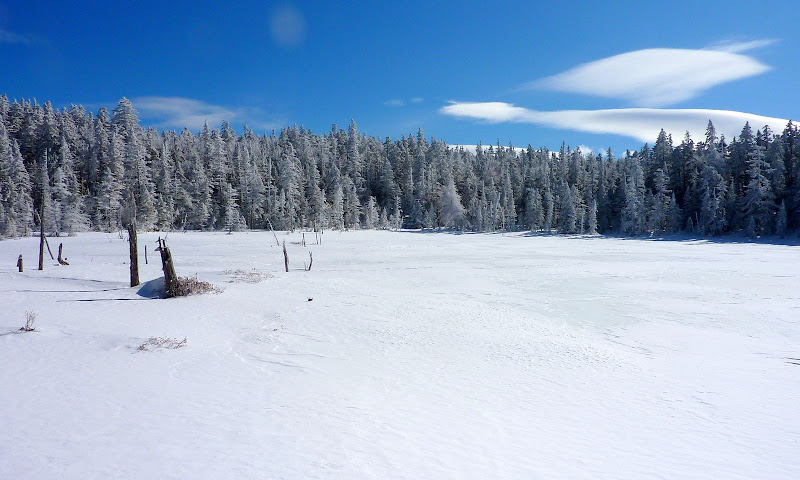
Because of the terrific trail conditions, the trek up to the ponds went smoothly and quickly. Upon arrival at the Nancy Ponds area, there were brilliant blue sky conditions when looking eastward. However, the westward view was the polar opposite with gray, dark clouds!
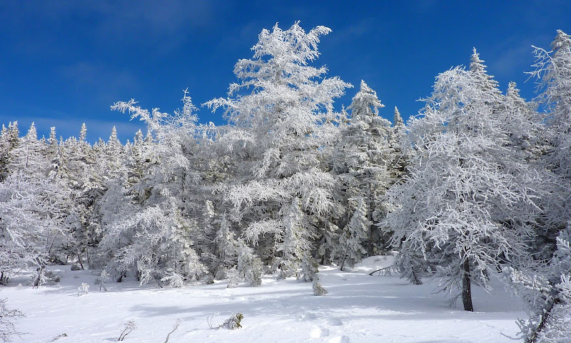
(Below are two photos showing the sunny eastern side of the pond.)
View of Nancy Pond's Sunny East Side
Frosted Trees along Nancy Pond's Sunny Eastern Shoreline
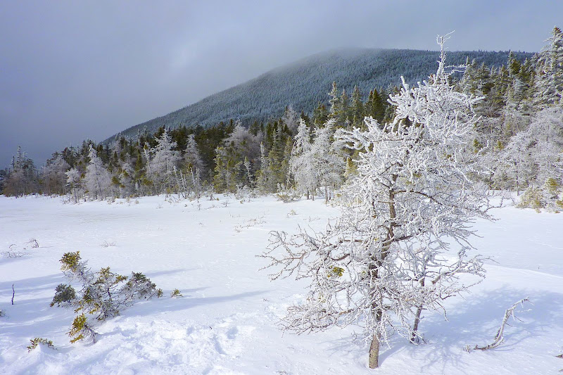
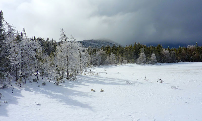
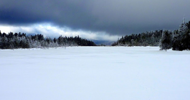
And now for something completely different, below are photos showing the stormy western side of the pond!
Nancy Pond's Stormy Side (Looking Toward Mt Nancy)
Nancy Pond's Stormy Side (Looking Toward Mt Anderson)
By the time I arrived at the east end of Norcross Pond, the clouds were really thickening (as seen in the photo below)!
And, by the time I arrived at the west end of the pond, the cloud cover was so thick that it wasn't even worth pulling out the camera. Yeah, it would have been nice to have seen that magnificent view overlooking the Pemi with the spectacular backdrop of the Bond-Twin Range on the horizon. But, at least there was the consolation of having seen it before and having photographed it on previous trips.
Westward View Over Norcross Pond
In addition to visiting Nancy and Norcross Ponds, I had hoped to also do a bushwhack to that little body of water named Duck Pond that resides just to the south of the Nancy/Norcross Pond area. However, I'd spent more time hanging out at Nancy/Norcross Ponds than anticipated. My available time was rapidly running out, and viewing conditions were rapidly deteriorating. So, I decided to call it a day and forego the bushwhack (this time around!") ).
).
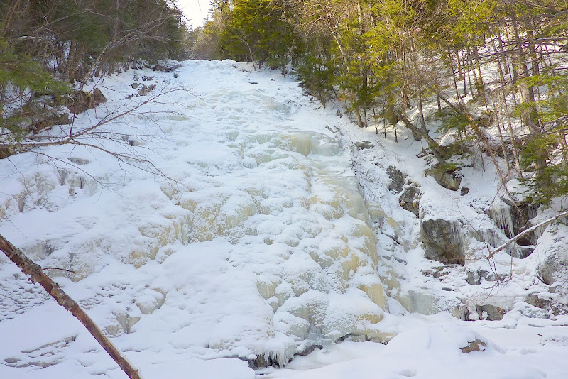
Besides taking some snapshots around the ponds, I also took a photo of Nancy Cascade (shown below).
Not much "cascading" going on there!
Nancy Cascade
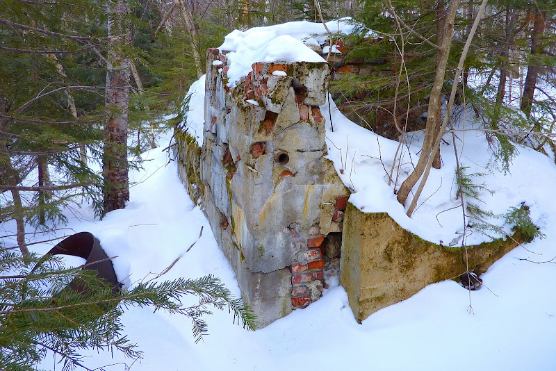
I also snapped a photo of the crumbling Lucy Mill structure. Probably many of you have seen those remains on the south side of the trail at a spot about 1.8 miles from the trailhead. According to Steve Smith's book entitled "Ponds & Lakes of the White Mountains", this mill was used by the Lucy family of Conway for timber salvage following the 1938 hurricane that devastated this and many other regions of the Whites. It was also interesting to read in Steve's book that the Nancy Pond Trail was first opened in 1938, but it was obliterated that very same year by the huge hurricane. Bummer! The trail wasn't re-opened until 1960!
Remains of Lucy Mill
Some might consider a hike to a pond to be less interesting than a hike to a high peak. However, when conditions are right, I think certain pond hikes can provide vistas that rival those from some of the high peaks. And although I didn't get the type of views that I had hoped for on this particular trip, they were overall quite unique and satisfying!
1HappyHiker
Because of the terrific trail conditions, the trek up to the ponds went smoothly and quickly. Upon arrival at the Nancy Ponds area, there were brilliant blue sky conditions when looking eastward. However, the westward view was the polar opposite with gray, dark clouds!
(Below are two photos showing the sunny eastern side of the pond.)
View of Nancy Pond's Sunny East Side
Frosted Trees along Nancy Pond's Sunny Eastern Shoreline
And now for something completely different, below are photos showing the stormy western side of the pond!
Nancy Pond's Stormy Side (Looking Toward Mt Nancy)
Nancy Pond's Stormy Side (Looking Toward Mt Anderson)
By the time I arrived at the east end of Norcross Pond, the clouds were really thickening (as seen in the photo below)!
And, by the time I arrived at the west end of the pond, the cloud cover was so thick that it wasn't even worth pulling out the camera. Yeah, it would have been nice to have seen that magnificent view overlooking the Pemi with the spectacular backdrop of the Bond-Twin Range on the horizon. But, at least there was the consolation of having seen it before and having photographed it on previous trips.
Westward View Over Norcross Pond
In addition to visiting Nancy and Norcross Ponds, I had hoped to also do a bushwhack to that little body of water named Duck Pond that resides just to the south of the Nancy/Norcross Pond area. However, I'd spent more time hanging out at Nancy/Norcross Ponds than anticipated. My available time was rapidly running out, and viewing conditions were rapidly deteriorating. So, I decided to call it a day and forego the bushwhack (this time around!
).Besides taking some snapshots around the ponds, I also took a photo of Nancy Cascade (shown below).
Not much "cascading" going on there!
Nancy Cascade
I also snapped a photo of the crumbling Lucy Mill structure. Probably many of you have seen those remains on the south side of the trail at a spot about 1.8 miles from the trailhead. According to Steve Smith's book entitled "Ponds & Lakes of the White Mountains", this mill was used by the Lucy family of Conway for timber salvage following the 1938 hurricane that devastated this and many other regions of the Whites. It was also interesting to read in Steve's book that the Nancy Pond Trail was first opened in 1938, but it was obliterated that very same year by the huge hurricane. Bummer!
The trail wasn't re-opened until 1960!Remains of Lucy Mill
Some might consider a hike to a pond to be less interesting than a hike to a high peak. However, when conditions are right, I think certain pond hikes can provide vistas that rival those from some of the high peaks. And although I didn't get the type of views that I had hoped for on this particular trip, they were overall quite unique and satisfying!
1HappyHiker
Last edited: