
Jimmy Legs and Little D
New member
On Saturday May 8th we decided to do a late hike on the Appalachian Trail in Western Maryland. The forecast called for early morning thunderstorms with high winds all during the day with the approaching cold front.
Reaching the trailhead around 11:50 am, we flipped a coin to see which way we would go; North towards Black Rock Cliffs or South to the Dahlgren Church. Either way we hoped to do about 10 miles. We’ve done this hike several times; beginning at Route 40 and stopping at Alternate 40, 4.9 miles away. We call this route our “Cherry Pie Hike” because years ago the Department of Natural Resources of Maryland would have people park their vehicles at the Washington Monument State Park and then shuttle them to the trailhead at Route 40. The people would then walk the 3 miles back to the monument and be rewarded with hot chocolate and a small cherry pie. This would take place the weekend closest to Washington’s Birthday.
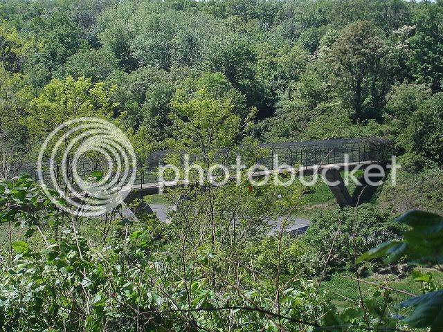
Deciding to go south from the Route 40 trailhead, the spur path divides after a slight descent to Interstate 70. Our route took us over both the east and west bound lanes of Interstate 70. The bridge spanning the col created by construction of the highway is a concrete and steel structure, with the walkway encased in black arched chain link fence.
When we reached the bridge there were about 20 boy scouts on the bridge urging vehicles passing below on I-70 to blow their horns; many did.
Passing through private land, the trail soon crosses Boonsboro Mountain Road.
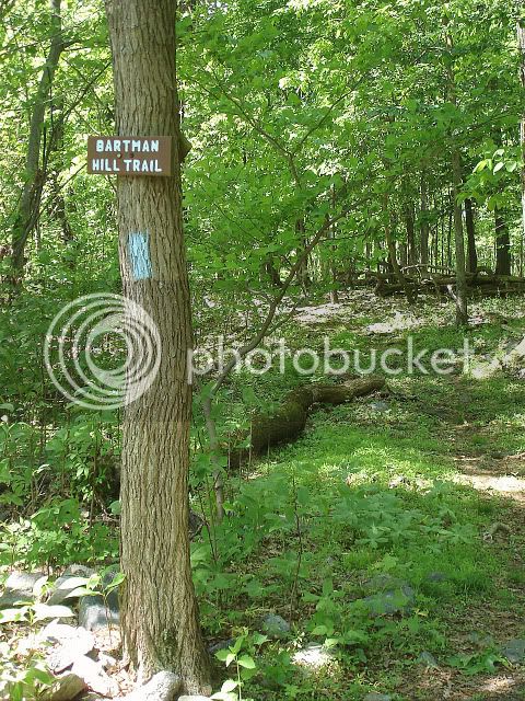
About 200 yards in, the Bartman Hill trail enters to the right and leads west for a half mile to Greenbrier State Park which has a 42 acre manmade lake.
http://www.dnr.state.md.us/publiclands/western/greenbrier.asp
We however continued left and again cross Boonsboro Mountain Road and soon after cross an open area (a power line) which was covered with ferns.
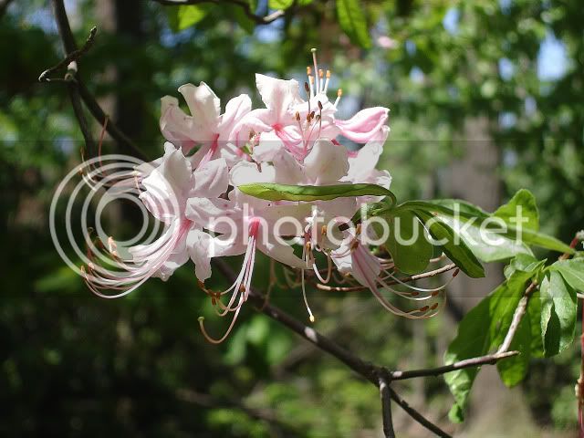
The woods was filled with Rhododendrons (past peak) and Mountain Laurel (just starting to bloom).

Roughly 1 mile past the power line there is an unmarked herd path on the left leading to an eastern viewpoint. We stayed there for approximately 20 minutes while we ate our bagels and drank some homemade “Gatorade”.
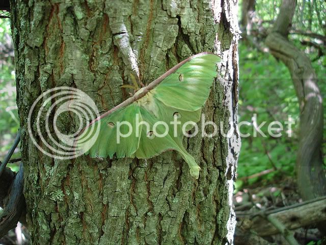
Continuing south another half mile, we reached a second power line; again this one also was covered in ferns. Just before the power line we noticed a Luna moth on a tree.
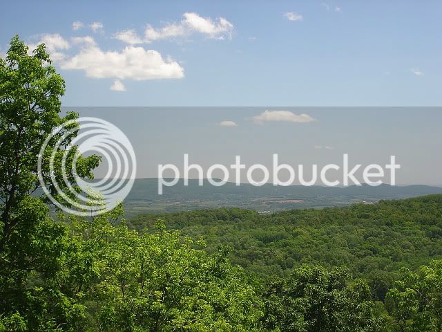
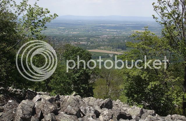
Up to this point the trail was relatively level with few ups and downs; but now a steady moderate climb was up ahead. Although (by White Mountain standards) this hill was relatively easy, it was the first challenging elevation gain of the day. We took another short break to take in the view at a small boulder field just (a short bushwack) below where the Washington Monument rests on the top of South Mountain. The view looked west towards Boonsboro and the surrounding countryside.
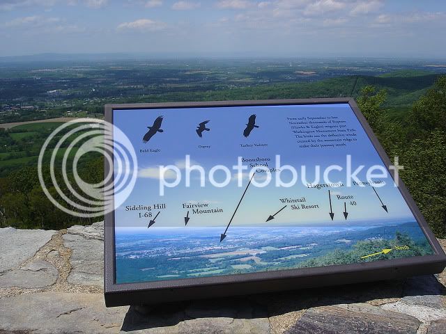
Continuing on to the spur trail up to the summit of South Mountain (elevation 1,500 ft.) and the Washington Monument we encountered the full force of the 30 to 40 mph winds. Up to this point we were pretty much sheltered by the trees. We climbed the rocky spiral stairs to the top of the 30 foot stone structure, where we were greeted by a birdwatcher counting how many different species (of birds) soared by on the wind currents.
After a brief stay we continued on; down past the red wooden plaques depicting the life of George Washington from his marriage to Martha Custis (January 6, 1759), to being named Commander In Chief, to being president and then his death in 1799.
The Appalachian Trail passes through Washington Monument State Park which has two pavilion shelters a multi-purpose field and a playground as well as picnic tables and camping area.
http://www.dnr.state.md.us/publiclands/western/washington.asp
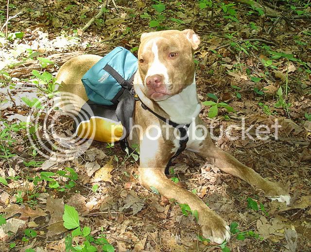
Just as we reached the boundary to the park we ran into Dan and his dog.
It turned out that he had just recently moved to Abington, Maryland from Henniker, New Hampshire. Naturally, Donna started to talk about all our hikes (we’ve done) in New Hampshire and that New Hampshire is our favorite place to hike.
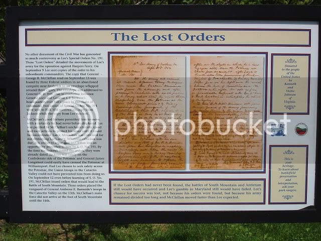
After saying goodbye to Dan we continued up and over an unnamed hill and down via switch backs to Alternate 40. Crossing the road we read several plaques explaining different aspects of this historic area; such as: the equipment which the civil war soldiers had in their possession, battle maneuvers and an explanation of the “Lost Order” of Robert E. Lee.
Once again crossing the road we took a short break and had a bite to eat where we saw Wild Red Poppys.

We relaxed by taking our boots off and lying in the freshly mowed grass.
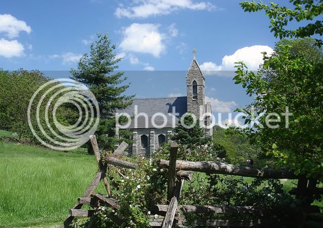
Relaxed and ready to go we walked through a Civil War era type fence and admired the gothic structure of the Dahlgren Chapel.
http://www.cmhl.org/chapel.html
We headed back up the seemingly endless hill with all its switchbacks and sawed up blow downs. Reaching the top of the hill the trail then meanders through the forest until it drops at a steady grade over some newly installed water bars. The descent on this small portion of the trail is a little unusual in that it is in a straight line for approximately a hundred yards.
The rest of the trip was uneventful except for when we were about a half mile from the end. It was here that I stopped and waited for Donna and just a few yards ahead of me a large branch fell onto the middle of the trail as a result of the high winds. If I hadn’t of stopped who knows; maybe I would have been clobbered by that very branch.
The total mileage for the day was 10 miles and now it’s off to the Barbara Fritchie Restaurant for some good old fashion comfort food.
http://www.frederick.com/index.php?action=sponsor&id=3067
Mike and Donna
Straight to slideshow: http://jimmylegs.smugmug.com/photos...rail-Hike-5810/12113970_e2my9#861039842_taYTF
Reaching the trailhead around 11:50 am, we flipped a coin to see which way we would go; North towards Black Rock Cliffs or South to the Dahlgren Church. Either way we hoped to do about 10 miles. We’ve done this hike several times; beginning at Route 40 and stopping at Alternate 40, 4.9 miles away. We call this route our “Cherry Pie Hike” because years ago the Department of Natural Resources of Maryland would have people park their vehicles at the Washington Monument State Park and then shuttle them to the trailhead at Route 40. The people would then walk the 3 miles back to the monument and be rewarded with hot chocolate and a small cherry pie. This would take place the weekend closest to Washington’s Birthday.
Deciding to go south from the Route 40 trailhead, the spur path divides after a slight descent to Interstate 70. Our route took us over both the east and west bound lanes of Interstate 70. The bridge spanning the col created by construction of the highway is a concrete and steel structure, with the walkway encased in black arched chain link fence.
When we reached the bridge there were about 20 boy scouts on the bridge urging vehicles passing below on I-70 to blow their horns; many did.
Passing through private land, the trail soon crosses Boonsboro Mountain Road.
About 200 yards in, the Bartman Hill trail enters to the right and leads west for a half mile to Greenbrier State Park which has a 42 acre manmade lake.
http://www.dnr.state.md.us/publiclands/western/greenbrier.asp
We however continued left and again cross Boonsboro Mountain Road and soon after cross an open area (a power line) which was covered with ferns.
The woods was filled with Rhododendrons (past peak) and Mountain Laurel (just starting to bloom).
Roughly 1 mile past the power line there is an unmarked herd path on the left leading to an eastern viewpoint. We stayed there for approximately 20 minutes while we ate our bagels and drank some homemade “Gatorade”.
Continuing south another half mile, we reached a second power line; again this one also was covered in ferns. Just before the power line we noticed a Luna moth on a tree.
Up to this point the trail was relatively level with few ups and downs; but now a steady moderate climb was up ahead. Although (by White Mountain standards) this hill was relatively easy, it was the first challenging elevation gain of the day. We took another short break to take in the view at a small boulder field just (a short bushwack) below where the Washington Monument rests on the top of South Mountain. The view looked west towards Boonsboro and the surrounding countryside.
Continuing on to the spur trail up to the summit of South Mountain (elevation 1,500 ft.) and the Washington Monument we encountered the full force of the 30 to 40 mph winds. Up to this point we were pretty much sheltered by the trees. We climbed the rocky spiral stairs to the top of the 30 foot stone structure, where we were greeted by a birdwatcher counting how many different species (of birds) soared by on the wind currents.
After a brief stay we continued on; down past the red wooden plaques depicting the life of George Washington from his marriage to Martha Custis (January 6, 1759), to being named Commander In Chief, to being president and then his death in 1799.
The Appalachian Trail passes through Washington Monument State Park which has two pavilion shelters a multi-purpose field and a playground as well as picnic tables and camping area.
http://www.dnr.state.md.us/publiclands/western/washington.asp
Just as we reached the boundary to the park we ran into Dan and his dog.
It turned out that he had just recently moved to Abington, Maryland from Henniker, New Hampshire. Naturally, Donna started to talk about all our hikes (we’ve done) in New Hampshire and that New Hampshire is our favorite place to hike.
After saying goodbye to Dan we continued up and over an unnamed hill and down via switch backs to Alternate 40. Crossing the road we read several plaques explaining different aspects of this historic area; such as: the equipment which the civil war soldiers had in their possession, battle maneuvers and an explanation of the “Lost Order” of Robert E. Lee.
Once again crossing the road we took a short break and had a bite to eat where we saw Wild Red Poppys.
We relaxed by taking our boots off and lying in the freshly mowed grass.
Relaxed and ready to go we walked through a Civil War era type fence and admired the gothic structure of the Dahlgren Chapel.
http://www.cmhl.org/chapel.html
We headed back up the seemingly endless hill with all its switchbacks and sawed up blow downs. Reaching the top of the hill the trail then meanders through the forest until it drops at a steady grade over some newly installed water bars. The descent on this small portion of the trail is a little unusual in that it is in a straight line for approximately a hundred yards.
The rest of the trip was uneventful except for when we were about a half mile from the end. It was here that I stopped and waited for Donna and just a few yards ahead of me a large branch fell onto the middle of the trail as a result of the high winds. If I hadn’t of stopped who knows; maybe I would have been clobbered by that very branch.
The total mileage for the day was 10 miles and now it’s off to the Barbara Fritchie Restaurant for some good old fashion comfort food.
http://www.frederick.com/index.php?action=sponsor&id=3067
Mike and Donna
Straight to slideshow: http://jimmylegs.smugmug.com/photos...rail-Hike-5810/12113970_e2my9#861039842_taYTF