Bar Island summit

vftt.org

Help Support vftt.org:

This site may earn a commission from merchant affiliate links, including eBay, Amazon, and others.

Ed'n Lauky

Well-known member
Joined
Feb 15, 2007
Messages
1,802
Reaction score
168
Location
Blairsville GA ......... Avatar-- On top of S
My wife and I had a special treat as my employer gave us a weekend at Bar Harbor.
The fact that it was suggested that we take the trip during hurricane season didn’t faze us a bit.
Nevertheless, we decided to take the trip on Memorial Day weekend. My wife isn’t a hiker
so we drove up Cadillac Mt. but we decided to make an attempt on the summit of Bar Island.
The Island is connected to the mainland by a sand bar during low tide.

030-6.jpg


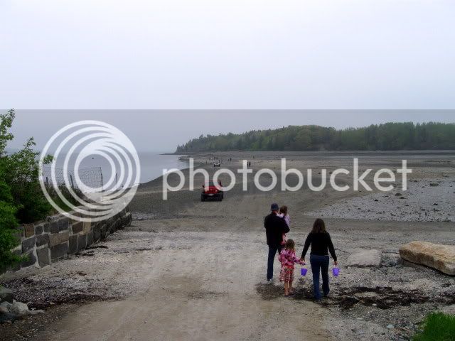
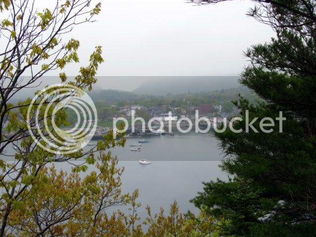
We started out and looked over at the majestic peak we would attempt.
068.jpg


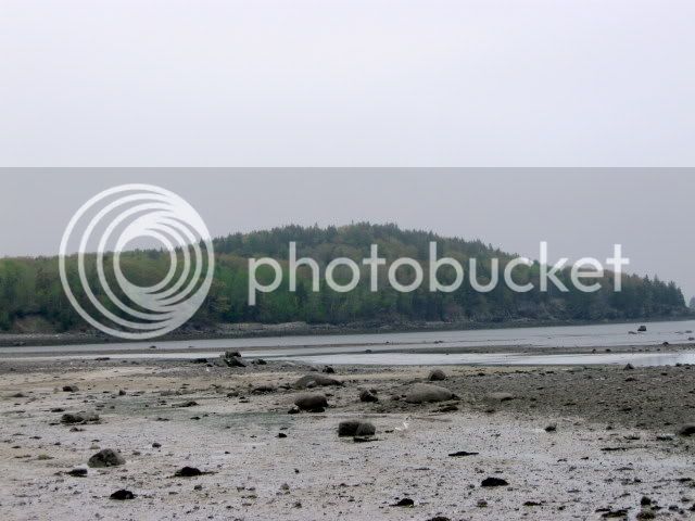
The views were quite different from the typical White Mt. trail.
037-3.jpg


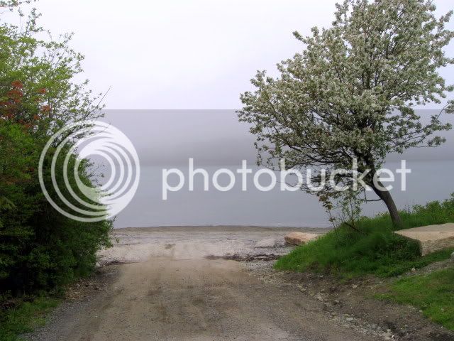
After a half mile crossing it was time for a rest.
035-2.jpg


We then headed off and up to the top of the island
054-2.jpg


Shortly before the summit the trail steepened. My wife, as she paused to catch her
breath, mumbled something about it being more difficult than Everest. I wasn’t sure
how she knew how difficult Everest was but let it go.
043-1.jpg


Finally we reached the summit. My GPS registered 131’
045-2.jpg


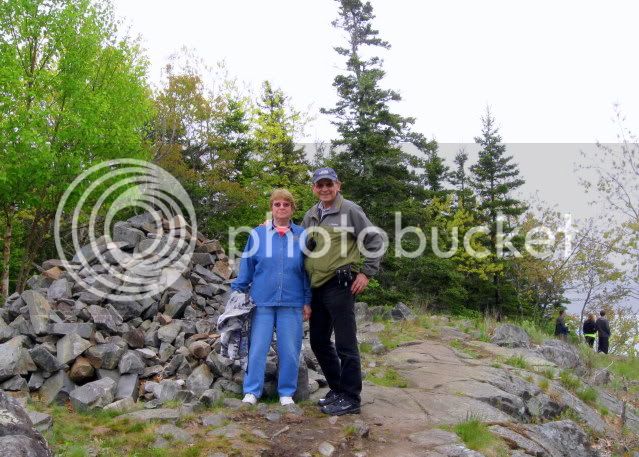
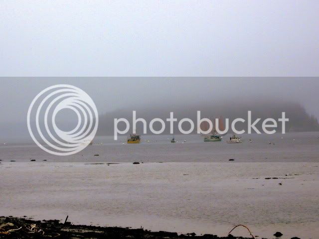
We spent some time at the view point then headed down]
048.jpg


There were no Gray Jays out today, but the Sea Gulls entertained us by picking up
shells and dropping them to the ground to break open the shells. :)
062.jpg


If you were wondering about the water crossings on this hike. I would suggest that you don't wait until the last minute before trying to start your car
069.jpg


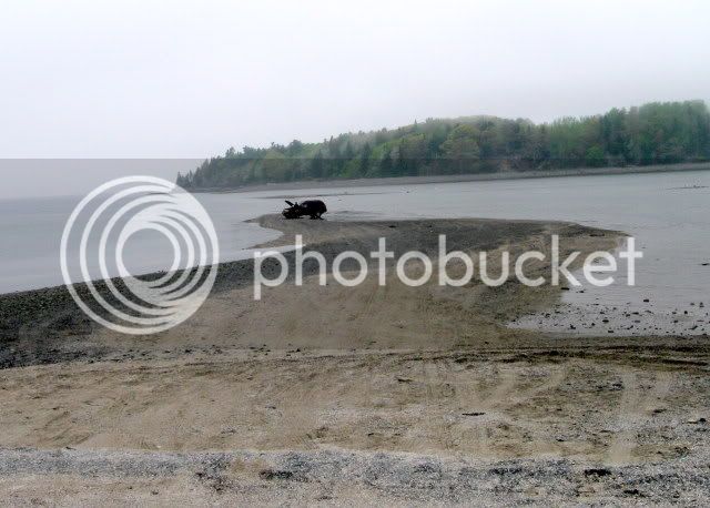
My advice would also be not to take this hike during high tide unless you’re equipped with a kayak
073.jpg


Total miles 2
Total elevation gain about 150’
Zero black flies
 
Nice report Ed!
Two questions:
1. Does Lauky know yet that he missed this trip?
2. Could you see Spain or France from the island summit?
 
A couple of minor factoids:
* Summit altitude is 173' (from the USGS topo).
* The tidal range at Bar Harbor is ~12 ft.

Doug

Your figure of 173 is very close to what the sats were giving on my GPS. Interestingly, the GPS read the topo software at 131' What fascinated me was that while the topo gave the road out to the island it did not show the island. However, as we walked the altitude went up. That led to a number of interesting comments about our ability to walk not only on water but also in the air.

As we walked out to the island the topo read 0'. That led to an extended discussion about what actually constitutes sea-level. It certainly is the mean level, but our question is, is the mean level the same around the globe? Also, if the polar caps melt and the mean sea-level rises by x number of feet, does that mean that Mt. Everest will be x number of feet lower. Wouldn't that in fact take a few of the NH 48 off the list? Our new slogan is: Melt the polar caps, climb the 45 NH 4000 footers. ;)

As you can see, my wife and I have really great romantic conversations.:rolleyes:
 
Nice report Ed!
Two questions:
1. Does Lauky know yet that he missed this trip?
2. Could you see Spain or France from the island summit?

Rick:
I was told when I picked up Lauky late this afternoon that he met a cute little girl--doggie, and I don't think that he thinks that he missed anything. He always takes over wherever he goes so he doesn't seem to get lonely.

As for seeing France, it's interesting you ask. It was so foggy it was hard to see across the bay, but I did suggest to my wife that since we had had such great success in walking that far that we just continue on to France. Needless to say she didn't really go for that idea. :)
 
Your figure of 173 is very close to what the sats were giving on my GPS. Interestingly, the GPS read the topo software at 131' What fascinated me was that while the topo gave the road out to the island it did not show the island. However, as we walked the altitude went up. That led to a number of interesting comments about our ability to walk not only on water but also in the air.
You didn't say what model GPS you were using. GPS altitudes have a nominal error of 95% probability of being within ~20 meters. If it had a well-calibrated barometric altimeter the vert accuracy would be ~3 meters. (The GPSes that I am familiar with use the GPS or barometric altitudes rather than the map altitude.) It is also possible that the topo map figure of 173 ft isn't very accurate either... (USGS topos have an accuracy of 90% probability of being within a half contour line, or 10 ft in this 24K quad.)

GPS positions and altitudes often drift with time--long term averaging can reduce the error significantly.

As we walked out to the island the topo read 0'. That led to an extended discussion about what actually constitutes sea-level. It certainly is the mean level, but our question is, is the mean level the same around the globe? Also, if the polar caps melt and the mean sea-level rises by x number of feet, does that mean that Mt. Everest will be x number of feet lower. Wouldn't that in fact take a few of the NH 48 off the list? Our new slogan is: Melt the polar caps, climb the 45 NH 4000 footers. ;)
A more precise definition of 0 altitude is the constant gravity surface (equipotential surface) known as the geoid that corresponds to mean sea level. Its distance from the earth's CG varies, being generally greater near the equator than near the poles due to centrifugal force of the earth's rotation. It is also affected by local mass concentrations.

Datums must have a date because the land moves, geoids must also have a date because both the sea and land change.

Doug
 
You didn't say what model GPS you were using. GPS altitudes have a nominal error of 95% probability of being within ~20 meters. If it had a well-calibrated barometric altimeter the vert accuracy would be ~3 meters. (The GPSes that I am familiar with use the GPS or barometric altitudes rather than the map altitude.) It is also possible that the topo map figure of 173 ft isn't very accurate either... (USGS topos have an accuracy of 90% probability of being within a half contour line, or 10 ft in this 24K quad.)

GPS positions and altitudes often drift with time--long term averaging can reduce the error significantly.


A more precise definition of 0 altitude is the constant gravity surface (equipotential surface) known as the geoid that corresponds to mean sea level. Its distance from the earth's CG varies, being generally greater near the equator than near the poles due to centrifugal force of the earth's rotation. It is also affected by local mass concentrations.

Datums must have a date because the land moves, geoids must also have a date because both the sea and land change.

Doug

My GPS is a Magellan Triton. The normal reading is the satellite fix, but with the push of a button it will give you your exact location from the topo software map including the altitude. It's a fun gimmick to play with and it is, from time to time, useful.

Your comments pretty well confirm what we were thinking. It would seem that determining mean sea level from a given point would be called for, but I'm not sure how the different nations would agree on that spot.
 
My GPS is a Magellan Triton. The normal reading is the satellite fix, but with the push of a button it will give you your exact location from the topo software map including the altitude. It's a fun gimmick to play with and it is, from time to time, useful.
The altitude data that comes with digital topo maps is often a shuttle radar derived DEM (digital elevation map) with the altitude given for 30 or 90 meter squares. So the position resolution is rather coarse... http://en.wikipedia.org/wiki/Shuttle_Radar_Topography_Mission

Your comments pretty well confirm what we were thinking. It would seem that determining mean sea level from a given point would be called for, but I'm not sure how the different nations would agree on that spot.
Since MSL varies with the location over water you simply measure it from the local ocean (it only takes 18 years to do a proper job...) and over land it is the equivalent as if you dug a canal to the ocean. http://principles.ou.edu/earth_figure_gravity/geoid/index.html http://en.wikipedia.org/wiki/Geoid

MSL over the ocean can be measured directly or from satellite altimeters. Over land or ocean, it can be estimated by gravity measurements. The large scale MSL can also be derived from analysis of satellite orbits.

The GPS altitude reported by a GPS is the distance from the CG of the earth minus the geoid height. Topo maps do the same (although they may use a different geoid model). Obviously, one can get different altitudes if one uses different geoid models. (A vertical datum is a form of geoid model).

Doug
 
Last edited:
The altitude data that comes with digital topo maps is often a shuttle radar derived DEM (digital elevation map) with the altitude given for 30 or 90 meter squares. So the position resolution is rather coarse... http://en.wikipedia.org/wiki/Shuttle_Radar_Topography_Mission


Since MSL varies with the location over water you simply measure it from the local ocean (it only takes 18 years to do a proper job...) and over land it is the equivalent as if you dug a canal to the ocean. http://principles.ou.edu/earth_figure_gravity/geoid/index.html http://en.wikipedia.org/wiki/Geoid

MSL over the ocean can be measured directly or from satellite altimeters. Over land or ocean, it can be estimated by gravity measurements. The large scale MSL can also be derived from analysis of satellite orbits.

The GPS altitude reported by a GPS is the distance from the CG of the earth minus the geoid height. Topo maps do the same (although they may use a different geoid model). Obviously, one can get different altitudes if one uses different geoid models. (A vertical datum is a form of geoid model).

Doug

Thanks Doug, that's all very interesting, fascinating really.
 
Top