
SpencerVT
Member
***I have recently found out that evidently the whole north approach is private land, which I was unaware of, so you'd want to get permission from the hunting club before heading to the Blue Ridges from the Blue Ridge road***
I parked on the Blue Ridge Road to approach both of these peaks from the north. Immediately I got thrown into the fire because in order to skirt around private property I had to whack through a bog which was a snarled tangled mess with plenty of foot traps to immerse you into the muck. This took a half hour just to navigate across. Then I had to cross a river, where I probably should have taken off my boots, but I said "screw it" and just trapsed through since it was so hot I didn't mind if my feet were a bit wet.
It took me 3 solid hours to get to the top of the Blue Ridge west peak. Not a bad whack and not too thick, but a lot of elevation gain. The hike begins around 1,000 feet and goes to 3,451' so it was 2,451 of vertical which took some time. But as I said, not too thick and a relatively straight forward bushwhack without too many dense spots.
That whack over to Blue Ridge was overall, very easy. I was astonished to find the ridge fairly open matchstick forest where I made good time getting over to Blue Ridge.
However, on the descent of Blue Ridge is where I discovered why Blue Ridge has its reputation. Descending down to the Aber Brook was dense thick spruce where you could only see a foot in front of you. Slow going and extremely thick to get through. I was so glad to be descending through this as opposed to going upward through it. There were a couple peek-outs on the way down where I was able to get some good photos. I made it back to my truck on the Blue Ridge Road at 7pm. The whole hike for both peaks took 8 hours. Beautiful weather and not terribly hot up there - thank God!
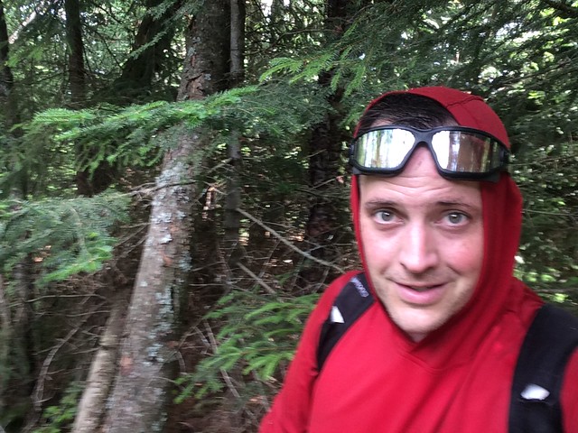
Atop Blue Ridge west peak.
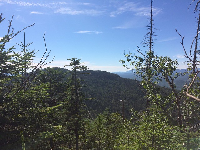
View of Blue Ridge west Peak from Blue Ridge
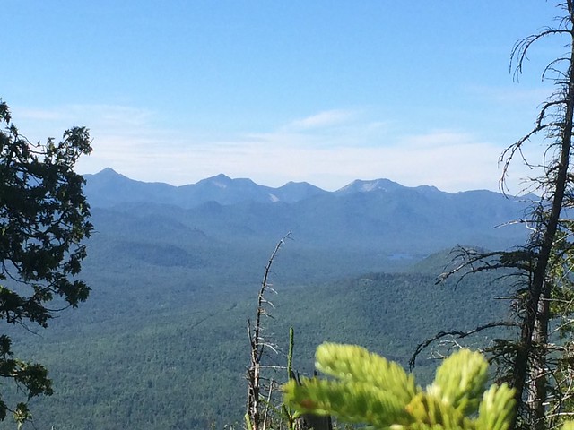
High Peaks looking northwesterly from Blue Ridge
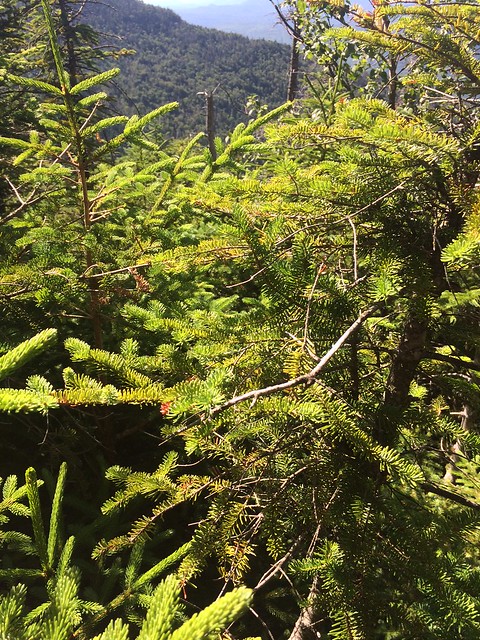
ACHE's (Adirondack Conifer Hell) on the way down Blue Ridge. As thick as it gets!
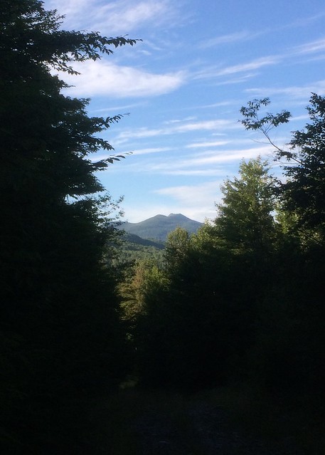
Photo looking north just before descending into the Aber Book ravine.
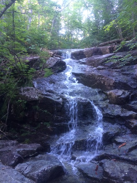
I actually created this waterfall. There was a log dam up above it. When I stepped on one of the logs, it cause the log to move and break free the dam. This sent a torrent of water down the brook and over the falls. If this photo had been taken 10 minutes earlier, it would have shown a nearly dry brook!!
I parked on the Blue Ridge Road to approach both of these peaks from the north. Immediately I got thrown into the fire because in order to skirt around private property I had to whack through a bog which was a snarled tangled mess with plenty of foot traps to immerse you into the muck. This took a half hour just to navigate across. Then I had to cross a river, where I probably should have taken off my boots, but I said "screw it" and just trapsed through since it was so hot I didn't mind if my feet were a bit wet.
It took me 3 solid hours to get to the top of the Blue Ridge west peak. Not a bad whack and not too thick, but a lot of elevation gain. The hike begins around 1,000 feet and goes to 3,451' so it was 2,451 of vertical which took some time. But as I said, not too thick and a relatively straight forward bushwhack without too many dense spots.
That whack over to Blue Ridge was overall, very easy. I was astonished to find the ridge fairly open matchstick forest where I made good time getting over to Blue Ridge.
However, on the descent of Blue Ridge is where I discovered why Blue Ridge has its reputation. Descending down to the Aber Brook was dense thick spruce where you could only see a foot in front of you. Slow going and extremely thick to get through. I was so glad to be descending through this as opposed to going upward through it. There were a couple peek-outs on the way down where I was able to get some good photos. I made it back to my truck on the Blue Ridge Road at 7pm. The whole hike for both peaks took 8 hours. Beautiful weather and not terribly hot up there - thank God!
Atop Blue Ridge west peak.
View of Blue Ridge west Peak from Blue Ridge
High Peaks looking northwesterly from Blue Ridge
ACHE's (Adirondack Conifer Hell) on the way down Blue Ridge. As thick as it gets!
Photo looking north just before descending into the Aber Book ravine.
I actually created this waterfall. There was a log dam up above it. When I stepped on one of the logs, it cause the log to move and break free the dam. This sent a torrent of water down the brook and over the falls. If this photo had been taken 10 minutes earlier, it would have shown a nearly dry brook!!
Last edited: