
IQuest
New member
Marlie and I decided to hike Mt Isolation this past weekend for a few various reasons. My original plan was to follow the Davis Path from US302 all the way to Mt Isolation and back, taking the spurs to Mt Crawford, Stairs Mtn, and Mt Davis along the way. A healthy 21.4 mile 5755' elev+. :evil: But...after working 117 hrs over the last two weeks and only getting 4 hrs of sleep Friday night, I decided that the Rocky Branch approach from NH116 would be the better choice. About 10 years ago I had travelled north along the Davis Path and missed the Mt Davis Spur so that was objective #2. Redlining is just as fun as peak bagging and even more fun when you can combine them. It makes every hike unique.  After studying the map I noticed that Mt Davis' summit was only about a mile from the junction of the Rocky Branch Tr and Isolation Tr. I could save 4.4 miles by bushwhacking down from the summit. I took note of a 115' compass bearing and made that the plan.
We hit the road at 4:15 am and arrived at the TH at 6:35. I was pretty tired, having to pull over to let two cars pass on the way up, so I took a 5 minute siesta before getting ready and hitting the trail. At 6:50 am it was just light enough to see in the woods.
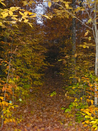
Rocky Branch Tr
We made good time up over Engine Hill, deep leaves made footing interesting, where I finally located the start of the winter bushwhack. The trail had the usual water running down it, most of which can be avoided by staying on the rocks. We crossed the Rocky Branch easily and stopped at the junction of the Isolation Tr.
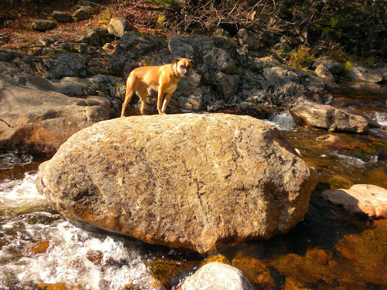
Rocky Branch Crossing near the junction of Isolation Tr.
This was the target for the bushwack to I decided to head south to Rocky Branch Shelter #2 to scope out the trail incase we missed our mark. There I met the first three people of the day. They had stayed there the night before and were heading in to Mt Isolation.
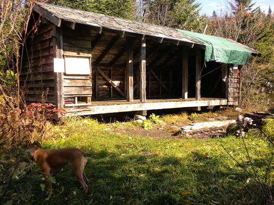
Rocky Branch Shelter #2
We the headed up the Isolation Tr to the Davis Path and onto the summit of Mt Isolation. Near the junction of Isolation Tr and Davis Path there were some large blowdown areas that had me wondering about the line I had chosen down from Mt Davis. I kept my fingers crossed.
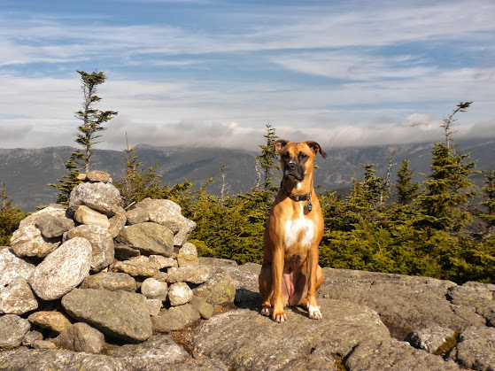
Marlie on Mt Isolation
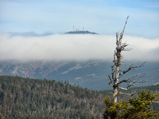
Mt Washington from Davis Path.
After a short break at the summit, which we had to ourselves, we headed south along the Davis Path. This was a very nice walk through the woods and I soon reached the junction of the Mt Davis Spur. There are two signs now but even without signs it seemed obvious. I'm not sure how I missed it before.
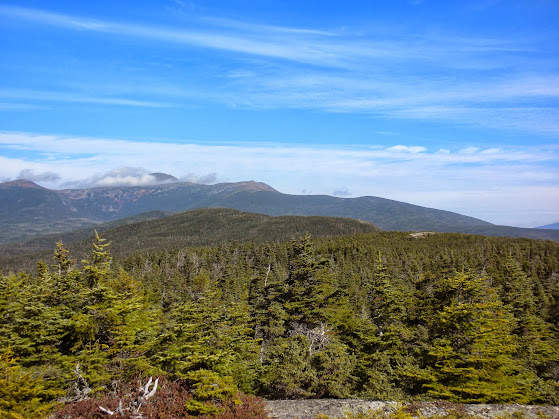
.2 miles later and we were on the south ledges where the trail stops. The views were excellent.
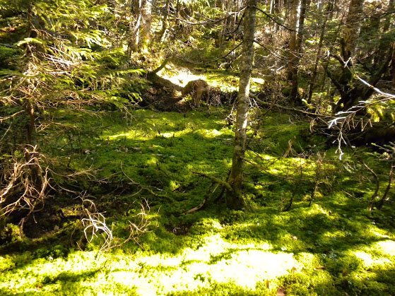
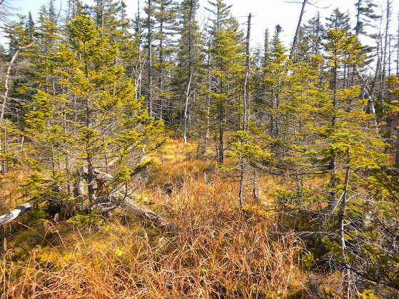
At the middle right of the above picture you can see a little open ledge which is the true summit of Mt Davis. That is where I planned to get to and start my whack but my plans were thwarted. There was no obvious herd path between them so I followed a faint one which dropped off a 6 foot ledge under some scrub with no definite direction afterward. Marlie wanted nothing to do with this so I climbed back out. My second attempt was to find a spot without a drop and plow through the scrub. 12 inches in and I couldn't budge the scrub. :x My third attempt brought me a little further north on some ledges but an 8 foot drop into 6 foot trees and lots of soft moss on the rocks told me that was not the way. I believe that I may have had a shot if I descended back down the spur trail to some open woods and circled around but I easily gave up and started looking for a spot to get below the scrub and start my whack. Just to the SE of the cairn I found a hole in the scrub and ducked into the woods. I adjusted the compass to 114' to try and compensate and began the descent. The woods were a mix of steep mossy terrain, and flat marshy areas. Not the easiest going but I have seen much worse so I'm not complaining.
After about an hour we poped out on the Rocky Branch TR just south of RB Shelter #2, we missed our mark of the junction by about 200 yds. :roll: After shaking off the pine needles at the the shelter we headed back to NH16 along the Rocky Branch Tr, seeing only 2 other people near the wilderness boundary. Total trip was about 13.5 miles and took about 7 hours. I would probably do this route again under the same conditions. It was great time out with just me and my pup.
The Pics: https://plus.google.com/photos/117581678131843187857/albums/5936606341322139921
NETC: http://www.newenglandtrailconditions.com/nh/viewreport.php?entryid=14275
After studying the map I noticed that Mt Davis' summit was only about a mile from the junction of the Rocky Branch Tr and Isolation Tr. I could save 4.4 miles by bushwhacking down from the summit. I took note of a 115' compass bearing and made that the plan.We hit the road at 4:15 am and arrived at the TH at 6:35. I was pretty tired, having to pull over to let two cars pass on the way up, so I took a 5 minute siesta before getting ready and hitting the trail. At 6:50 am it was just light enough to see in the woods.
Rocky Branch Tr
We made good time up over Engine Hill, deep leaves made footing interesting, where I finally located the start of the winter bushwhack. The trail had the usual water running down it, most of which can be avoided by staying on the rocks. We crossed the Rocky Branch easily and stopped at the junction of the Isolation Tr.
Rocky Branch Crossing near the junction of Isolation Tr.
This was the target for the bushwack to I decided to head south to Rocky Branch Shelter #2 to scope out the trail incase we missed our mark. There I met the first three people of the day. They had stayed there the night before and were heading in to Mt Isolation.
Rocky Branch Shelter #2
We the headed up the Isolation Tr to the Davis Path and onto the summit of Mt Isolation. Near the junction of Isolation Tr and Davis Path there were some large blowdown areas that had me wondering about the line I had chosen down from Mt Davis. I kept my fingers crossed.
Marlie on Mt Isolation
Mt Washington from Davis Path.
After a short break at the summit, which we had to ourselves, we headed south along the Davis Path. This was a very nice walk through the woods and I soon reached the junction of the Mt Davis Spur. There are two signs now but even without signs it seemed obvious. I'm not sure how I missed it before.
.2 miles later and we were on the south ledges where the trail stops. The views were excellent.
At the middle right of the above picture you can see a little open ledge which is the true summit of Mt Davis. That is where I planned to get to and start my whack but my plans were thwarted. There was no obvious herd path between them so I followed a faint one which dropped off a 6 foot ledge under some scrub with no definite direction afterward. Marlie wanted nothing to do with this so I climbed back out. My second attempt was to find a spot without a drop and plow through the scrub. 12 inches in and I couldn't budge the scrub. :x My third attempt brought me a little further north on some ledges but an 8 foot drop into 6 foot trees and lots of soft moss on the rocks told me that was not the way. I believe that I may have had a shot if I descended back down the spur trail to some open woods and circled around but I easily gave up and started looking for a spot to get below the scrub and start my whack. Just to the SE of the cairn I found a hole in the scrub and ducked into the woods. I adjusted the compass to 114' to try and compensate and began the descent. The woods were a mix of steep mossy terrain, and flat marshy areas. Not the easiest going but I have seen much worse so I'm not complaining.
After about an hour we poped out on the Rocky Branch TR just south of RB Shelter #2, we missed our mark of the junction by about 200 yds. :roll: After shaking off the pine needles at the the shelter we headed back to NH16 along the Rocky Branch Tr, seeing only 2 other people near the wilderness boundary. Total trip was about 13.5 miles and took about 7 hours. I would probably do this route again under the same conditions. It was great time out with just me and my pup.
The Pics: https://plus.google.com/photos/117581678131843187857/albums/5936606341322139921
NETC: http://www.newenglandtrailconditions.com/nh/viewreport.php?entryid=14275
Last edited: