
Jazzbo
Well-known member
- Joined
- Jan 1, 2005
- Messages
- 1,197
- Reaction score
- 163
I’m sure everyone can relate to having a obsession to hike a certain peak or route. I’ve had this obsession to hike to Lost Pass and to see for myself certain abandoned trails Cascade Brook Trail and Snows Brook Trail. This outing also provided an opportunity to really try out my new Garmin 60 CSX. I put in a waypoint for Lost Pass.
I decided to hike up Snows Brook Trail since it offered the most direct route to Lost Pass. I parked at the parking lot at the athletic club and Coyote Grill on Rt. 49. I was on trail at 9:00. Temps were nice and cool. My new Ex-Officio hiking shirt felt great. The haze from the Canadian Wildfires was obscuring the views of Tripyramids and Osceolas one gets from this parking lot so I felt no regrets doing a viewless hike today.
I followed ski trails on the south side of Snows Brook as far up as I could. I crossed Snows Brook and Voila! There was the old logging road which was old Snows Brook Trail.
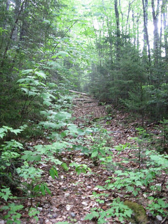
The road bed was very smooth with good footing although it did have frequent blow downs laying across the trail. None were particularly difficult to surmount or bypass. I made great time until the trail entered a boggy meadow at 2700’ which caused me to head for higher ground. I re-entered the boggy meadow at a less boggy point and rejoined the logging road. I think loggers must have corduroyed the road in this spot or they would never have gotten through here.
I continued to follow the trail until it pooped out in a shallow dip after which the terrain started to climb again. I noticed a herd path that headed at right angles to my route in heading in a southerly direction and followed it briefly.
This must be Lost Pass! The GPS confirmed this and the herd path must lead down to Flat Mountain Pond. It looked inviting, but was not part of my plan. I later checked Google Earth and noticed a large boggy meadow just a few tenths of mile down from this point. This was more likely simply a moose path leading to the boggy meadow (not necessarily Flat Mt Pond). If I’d known of it, I certainly would have checked out this meadow. Definitely worth checking out should I ever go back.
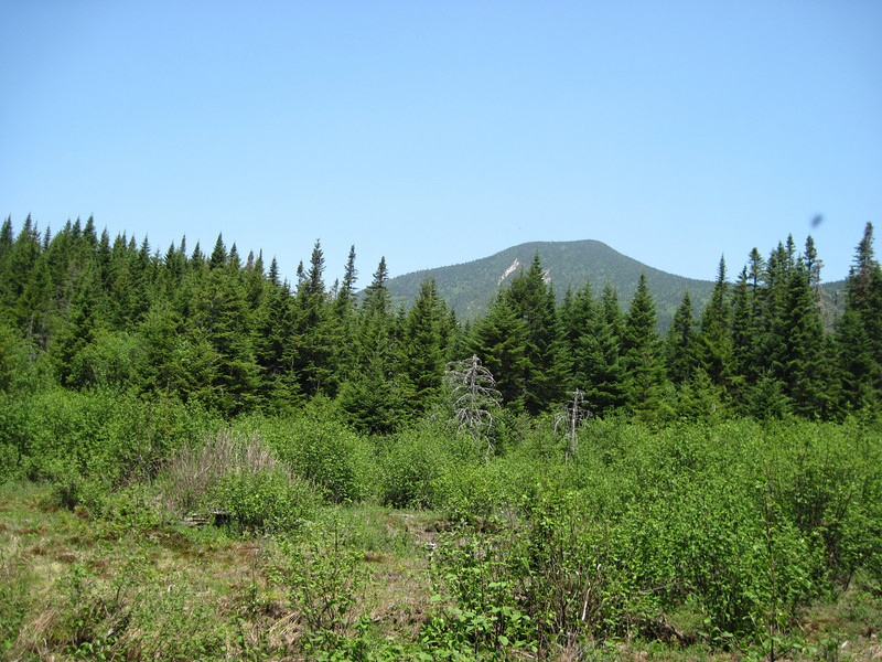
I continued heading east with a idea of getting to West Spur of Whiteface, but trail was gone and I was getting into thick spruce riddled with blow-downs. It occurred to me “What is the point?” So I decided to head north to try to get into Cascade Brook drainage and find the old Cascade Brook Trail. The woods proved to be much nicer here. I soon found a wooded knob that offered a nice view of South Slide and South Tripyramid
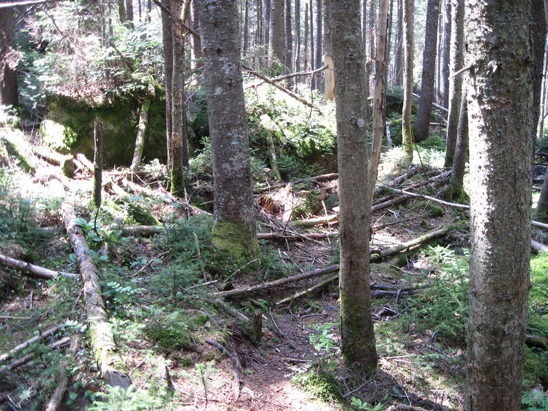
from which I noticed a boggy meadow which must have been the headwaters of Cascade Brook. I headed for it and found an old road in the meadow. This must have been the Cascade Brook Trail. I was thinking how nice it was to find it so quickly when I lost it. I not only lost the road, but I lost the brook. I didn’t think this would be a problem as I’ll just rejoin the brook further downhill. But then the terrain became an awful mixture of boulders and blow-downs. I tried working right to get back to the brook, but I was separated from it by steep slope that looked even more unattractive. It was so bad I resorted to using my saw to cut branches to enable climbing over tree trunks.
I found my way down to Cascade Brook which I crossed right away and was back on the Cascade Brook Trail. I followed the trail back to the boggy meadow and located the point where I lost the trail. The brook crossing has grown in and is easy to miss coming from other direction. The 1931 USGS map printout I was carrying plainly showed it crossing at just this point.
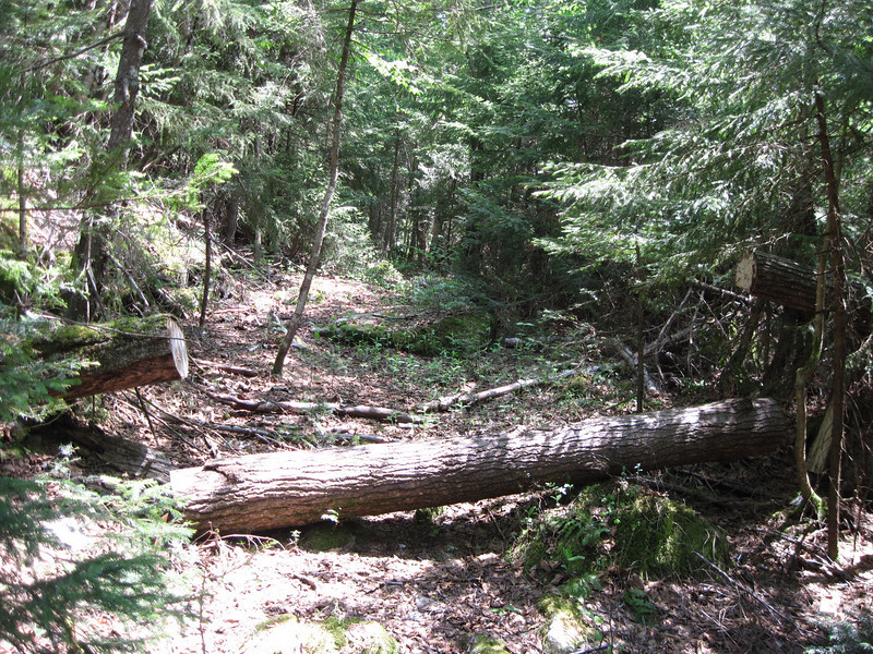
The trail turned out to be in remarkably good condition. There were still plenty of blow-downs on the trail, but it did seem people do come through from time to time to cut them.
If I’d cared to count I would guess I would have seen 50+ saw cuts and numerous brush cuts. This is in contrast to Snows Brook Trail on which I only observed only one saw cut. I expect skiers must be principal maintainers of this trail. Linking Cascade and Snows Brook Trails might make an interesting ski loop. Both trails follow old logging road with mellow grades that would make for fairly easy skiing (think Blue). Getting from one to the other might be a challenge in deep snow and snow laden trees, but could be pretty neat in the right conditions.
Having figured that out I turned around and began my uneventful hike out. The trail has a mellow easy grade. I connected up with the main Cascade Brook Ski Trail which I found pretty boring. I crossed Cascade Brook and went up and over Snows Mountain passing by the ski lift which was in operation. I passed through a golf course on my way back to the car. The sight of people riding ski lifts and quietly sinking putts on putting greens seemed somehow incongruous after struggling through thick blow-down patches.
My new GPS was lots of fun and really made a big difference having on this bushwhack. Total trip distance was 9.7 miles. I’m not sure what the big draw is about Lost Pass. I didn’t find the forest particularly unique or interesting. There was lots of deep moss and spruce in places. It did offer a sense of remoteness. I don’t think a trip report by me in VFTT will be attracting hordes of hikers anytime soon particularly as it doesn’t lead to any list peaks. Well maybe East Sleeper.
I decided to hike up Snows Brook Trail since it offered the most direct route to Lost Pass. I parked at the parking lot at the athletic club and Coyote Grill on Rt. 49. I was on trail at 9:00. Temps were nice and cool. My new Ex-Officio hiking shirt felt great. The haze from the Canadian Wildfires was obscuring the views of Tripyramids and Osceolas one gets from this parking lot so I felt no regrets doing a viewless hike today.
I followed ski trails on the south side of Snows Brook as far up as I could. I crossed Snows Brook and Voila! There was the old logging road which was old Snows Brook Trail.
The road bed was very smooth with good footing although it did have frequent blow downs laying across the trail. None were particularly difficult to surmount or bypass. I made great time until the trail entered a boggy meadow at 2700’ which caused me to head for higher ground. I re-entered the boggy meadow at a less boggy point and rejoined the logging road. I think loggers must have corduroyed the road in this spot or they would never have gotten through here.
I continued to follow the trail until it pooped out in a shallow dip after which the terrain started to climb again. I noticed a herd path that headed at right angles to my route in heading in a southerly direction and followed it briefly.
This must be Lost Pass! The GPS confirmed this and the herd path must lead down to Flat Mountain Pond. It looked inviting, but was not part of my plan. I later checked Google Earth and noticed a large boggy meadow just a few tenths of mile down from this point. This was more likely simply a moose path leading to the boggy meadow (not necessarily Flat Mt Pond). If I’d known of it, I certainly would have checked out this meadow. Definitely worth checking out should I ever go back.
I continued heading east with a idea of getting to West Spur of Whiteface, but trail was gone and I was getting into thick spruce riddled with blow-downs. It occurred to me “What is the point?” So I decided to head north to try to get into Cascade Brook drainage and find the old Cascade Brook Trail. The woods proved to be much nicer here. I soon found a wooded knob that offered a nice view of South Slide and South Tripyramid
from which I noticed a boggy meadow which must have been the headwaters of Cascade Brook. I headed for it and found an old road in the meadow. This must have been the Cascade Brook Trail. I was thinking how nice it was to find it so quickly when I lost it. I not only lost the road, but I lost the brook. I didn’t think this would be a problem as I’ll just rejoin the brook further downhill. But then the terrain became an awful mixture of boulders and blow-downs. I tried working right to get back to the brook, but I was separated from it by steep slope that looked even more unattractive. It was so bad I resorted to using my saw to cut branches to enable climbing over tree trunks.
I found my way down to Cascade Brook which I crossed right away and was back on the Cascade Brook Trail. I followed the trail back to the boggy meadow and located the point where I lost the trail. The brook crossing has grown in and is easy to miss coming from other direction. The 1931 USGS map printout I was carrying plainly showed it crossing at just this point.
The trail turned out to be in remarkably good condition. There were still plenty of blow-downs on the trail, but it did seem people do come through from time to time to cut them.
If I’d cared to count I would guess I would have seen 50+ saw cuts and numerous brush cuts. This is in contrast to Snows Brook Trail on which I only observed only one saw cut. I expect skiers must be principal maintainers of this trail. Linking Cascade and Snows Brook Trails might make an interesting ski loop. Both trails follow old logging road with mellow grades that would make for fairly easy skiing (think Blue). Getting from one to the other might be a challenge in deep snow and snow laden trees, but could be pretty neat in the right conditions.
Having figured that out I turned around and began my uneventful hike out. The trail has a mellow easy grade. I connected up with the main Cascade Brook Ski Trail which I found pretty boring. I crossed Cascade Brook and went up and over Snows Mountain passing by the ski lift which was in operation. I passed through a golf course on my way back to the car. The sight of people riding ski lifts and quietly sinking putts on putting greens seemed somehow incongruous after struggling through thick blow-down patches.
My new GPS was lots of fun and really made a big difference having on this bushwhack. Total trip distance was 9.7 miles. I’m not sure what the big draw is about Lost Pass. I didn’t find the forest particularly unique or interesting. There was lots of deep moss and spruce in places. It did offer a sense of remoteness. I don’t think a trip report by me in VFTT will be attracting hordes of hikers anytime soon particularly as it doesn’t lead to any list peaks. Well maybe East Sleeper.
Last edited:
")