
Guthook
New member
- Joined
- Jan 19, 2009
- Messages
- 401
- Reaction score
- 28
Hello again. This will be the final installment of the trip report from the trip in October. Now that I'm done with this, I've got to come up with something new to do.
Well, I hope you enjoy these. If anyone has a crazy notion to try a similar hike, I have plenty of ideas that might make the trip more easier to plan (first of all, go Northbound rather than Southbound!). But in the meantime, enjoy the report")
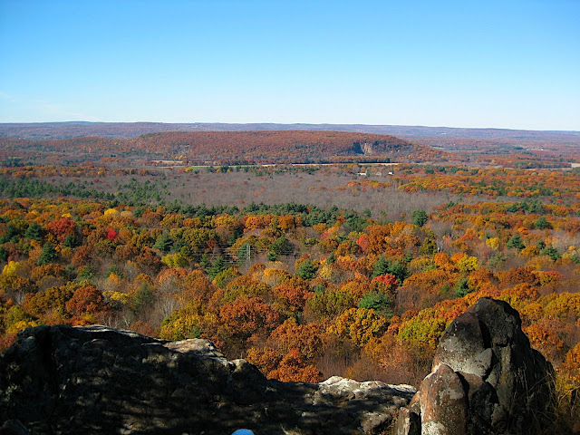
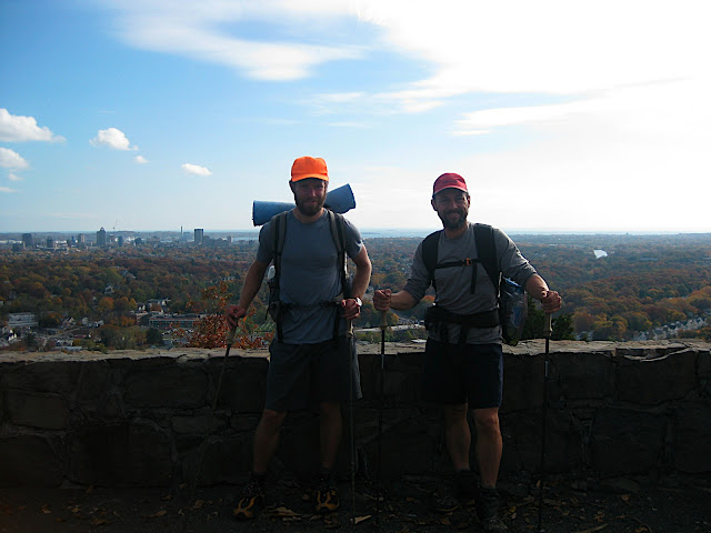
We entered Connecticut with sunny skies, cool weather, and a long road walk on a road that was not friendly to pedestrians at all. By this point in the trip we were basically ready to go home, and two miles of stomping on pavement didn't help to motivate us at all. Luckily, once we got back onto a trail our feet were happy again, and we made our way to several nice cliffs with views of the Connecticut countryside. We were surprised to see so much forest out there, but within a day we would be in a much more populated area.
After several nice views from the cliffs, we crossed the Farmington River and walked into the town of Tariffville for the night. We camped out in the town park, right by the tennis courts, and went into the town for a dinner in the local pub. It was a bizarre camping situation at the time, but it turned out to be one of the best in the entire state.
A weather forecast we'd looked at a few days earlier had said we would have fine weather all the way until the end of the hike, but as we left Tariffville there were thick clouds in the sky. Then it started to drizzle, and didn't stop until late the next night. The first day of wetness was okay, although it continued to sap our motivation. There were no views, the trail was muddy and slick, and underneath the thick layer of fallen leaves were jagged rocks reminiscent of the Pennsylvania section of the Appalachian Trail. To make a long story short, it was hell for the feet.
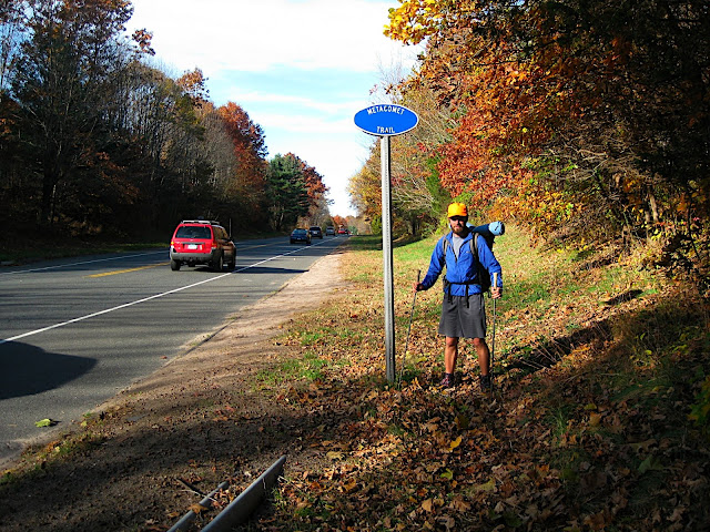
The other part of the trail that started to wear on us was that the trail had us wandering through suburban backyards and between mansions that looked anything but friendly. Since the Metacomet Trail passes very close to Hartford, and neither are protected with any kind of public land (aside from a few state parks they pass through), the trails are almost constantly being relocated and forced to find a route that is less than ideal. So we ended up sandwiched between electric fences, No Trespassing signs, paved driveways, and interstate onramps for a major part of the trail. With few views, two days of increasing rain, and some pretty terrifying road crossings, we began to wish the trail would just end.
By Wednesday afternoon, as we neared the end of the Metacomet trail, it seemed the trail had been completely abandoned. We walked a few miles following nearly invisible blazes through a maze of fallen trees and ankle-deep swamp, and finally pushed through a thick wall of brambles into a natural gas line clearing. It had been raining steadily all day, and the gas line had been recently mowed, so there was no path across it– just an extremely muddy wasteland, churned into a hazardous soup by the heavy machinery that had cleared the area no more than a few days earlier. We spent over half an hour wandering up and down the clearing in an attempt to find anything resembling a trail. Eventually, Gary found the trail, which continued only a few hundred yards to a road where the blazes ended entirely, but luckily the map guided us from there.
That night we were soaked to the bone, dispirited, tired, and ready to go home. But the skies cleared in the middle of the night, and a strong wind managed to dry us out, although the ground was still pretty soggy.
On Thursday morning, the clouds were still thick, but we could see breaks in them as we moved along. Soon after the sun came out, we happened upon a diner where the trail crossed a major road. It was exactly noon, so we stopped for burgers and shakes, relieved to have good weather for the last few days of the trail. And the trail had been easy to follow all morning, unlike the scary moments the day before. It looked like things might end well.
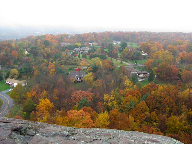
We continued in sunny weather with few views except for a few cliffs behind major suburban developments. It was a bit nightmarish for me, although Gary was more used to this kind of area. We ended the day with a quick shuttle to Sleeping Giant State Park from one of Gary's coworkers. My extensive planning in the beginning of the trip had completely missed the 8 to 10 mile road walk between the Mattabesett Trail and Sleeping Giant. We stopped at a Subway and grabbed some extra snacks and sandwiches (one for dinner, one for lunch the next day), and finished the day at one of our best campsites so far.
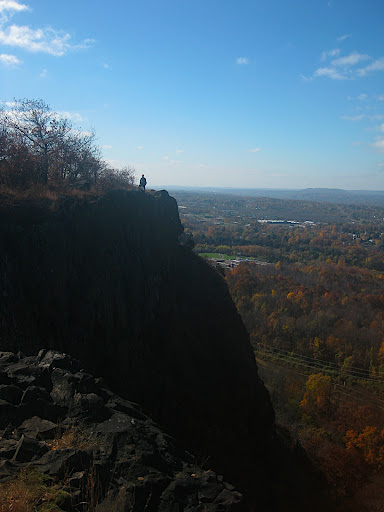
Friday was easy as pie. We practically ran along the Quinnipiac Trail and the Regicides Trail, going over Sleeping Giant and West Rock Ridge. Besides our first day in Connecticut, those two hills were the most scenic and well-maintained as far as the trails go. Otherwise, there's not much to say about our last day on the trail. We got to the end of the Regicides Trail at 1:30 and sat down to eat our sandwiches. They may have been cheap Subway subs, but they tasted like manna from heaven, with the knowledge that we would soon be home. We didn't even care that our little picnic area was scattered with broken beer bottles and full of city noises from New Haven below us.
We took the access trail from West Rock down to a city park with a baseball field and some park benches, where I called my friend who was on his way through New Haven to pick me up, and Gary tried to call for a cab to the train station. That wasn't quite the end of the adventure, but we were done hiking, ready to go home.
Well, I hope you enjoy these. If anyone has a crazy notion to try a similar hike, I have plenty of ideas that might make the trip more easier to plan (first of all, go Northbound rather than Southbound!). But in the meantime, enjoy the report
We entered Connecticut with sunny skies, cool weather, and a long road walk on a road that was not friendly to pedestrians at all. By this point in the trip we were basically ready to go home, and two miles of stomping on pavement didn't help to motivate us at all. Luckily, once we got back onto a trail our feet were happy again, and we made our way to several nice cliffs with views of the Connecticut countryside. We were surprised to see so much forest out there, but within a day we would be in a much more populated area.
After several nice views from the cliffs, we crossed the Farmington River and walked into the town of Tariffville for the night. We camped out in the town park, right by the tennis courts, and went into the town for a dinner in the local pub. It was a bizarre camping situation at the time, but it turned out to be one of the best in the entire state.
A weather forecast we'd looked at a few days earlier had said we would have fine weather all the way until the end of the hike, but as we left Tariffville there were thick clouds in the sky. Then it started to drizzle, and didn't stop until late the next night. The first day of wetness was okay, although it continued to sap our motivation. There were no views, the trail was muddy and slick, and underneath the thick layer of fallen leaves were jagged rocks reminiscent of the Pennsylvania section of the Appalachian Trail. To make a long story short, it was hell for the feet.
The other part of the trail that started to wear on us was that the trail had us wandering through suburban backyards and between mansions that looked anything but friendly. Since the Metacomet Trail passes very close to Hartford, and neither are protected with any kind of public land (aside from a few state parks they pass through), the trails are almost constantly being relocated and forced to find a route that is less than ideal. So we ended up sandwiched between electric fences, No Trespassing signs, paved driveways, and interstate onramps for a major part of the trail. With few views, two days of increasing rain, and some pretty terrifying road crossings, we began to wish the trail would just end.
By Wednesday afternoon, as we neared the end of the Metacomet trail, it seemed the trail had been completely abandoned. We walked a few miles following nearly invisible blazes through a maze of fallen trees and ankle-deep swamp, and finally pushed through a thick wall of brambles into a natural gas line clearing. It had been raining steadily all day, and the gas line had been recently mowed, so there was no path across it– just an extremely muddy wasteland, churned into a hazardous soup by the heavy machinery that had cleared the area no more than a few days earlier. We spent over half an hour wandering up and down the clearing in an attempt to find anything resembling a trail. Eventually, Gary found the trail, which continued only a few hundred yards to a road where the blazes ended entirely, but luckily the map guided us from there.
That night we were soaked to the bone, dispirited, tired, and ready to go home. But the skies cleared in the middle of the night, and a strong wind managed to dry us out, although the ground was still pretty soggy.
On Thursday morning, the clouds were still thick, but we could see breaks in them as we moved along. Soon after the sun came out, we happened upon a diner where the trail crossed a major road. It was exactly noon, so we stopped for burgers and shakes, relieved to have good weather for the last few days of the trail. And the trail had been easy to follow all morning, unlike the scary moments the day before. It looked like things might end well.
We continued in sunny weather with few views except for a few cliffs behind major suburban developments. It was a bit nightmarish for me, although Gary was more used to this kind of area. We ended the day with a quick shuttle to Sleeping Giant State Park from one of Gary's coworkers. My extensive planning in the beginning of the trip had completely missed the 8 to 10 mile road walk between the Mattabesett Trail and Sleeping Giant. We stopped at a Subway and grabbed some extra snacks and sandwiches (one for dinner, one for lunch the next day), and finished the day at one of our best campsites so far.
Friday was easy as pie. We practically ran along the Quinnipiac Trail and the Regicides Trail, going over Sleeping Giant and West Rock Ridge. Besides our first day in Connecticut, those two hills were the most scenic and well-maintained as far as the trails go. Otherwise, there's not much to say about our last day on the trail. We got to the end of the Regicides Trail at 1:30 and sat down to eat our sandwiches. They may have been cheap Subway subs, but they tasted like manna from heaven, with the knowledge that we would soon be home. We didn't even care that our little picnic area was scattered with broken beer bottles and full of city noises from New Haven below us.
We took the access trail from West Rock down to a city park with a baseball field and some park benches, where I called my friend who was on his way through New Haven to pick me up, and Gary tried to call for a cab to the train station. That wasn't quite the end of the adventure, but we were done hiking, ready to go home.