
The Hikers
New member
Joyce had been bringing up the Percys many times in the past,since she kept reading about spectacular views, but I had always reminded her of the distance involved from our home to the trailhead. It would require a stay-over up in the north country to do them properly. So finally we made time for this trip. At first we checked out campsites,but then we decided it really wasn't worth setting up the camper for a couple of days, so we booked a stay in Colebrook.
We got up REAL early on the first day and were on the road by 5:00 A.M. This got us (with a couple of rest stops) to the traihead for the Percys by 8:00.
Now, having read the write-up in the AMC guide, we were expecting a slightly dangerous climb. The trail, however turned out to be in pretty good condition. There were many ribbons hanging from areas where drainage was going to be added, and about a mile into the climb we met the crew that was working on this project.The infamous slabs were not all that bad, although I could see how it could be scary in the wet.
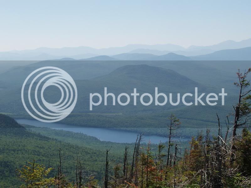
The views on the top were fantastic, although the low-hanging clouds gave evrything a kind of mysterious feeling
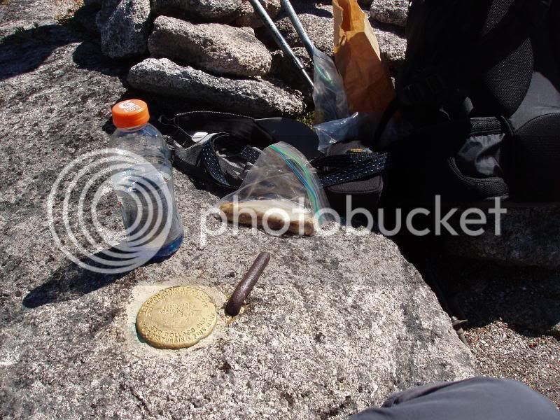
Lunch on the summit
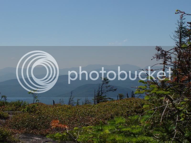
Christine Lake
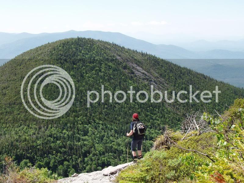
We headed carefully back down the slabs viewing South Percy on the way
We decided to make a loop hike of it, so we turned left and decended by the Percy Loop Trail. This trail was a lot wetter, and rougher,being on the North side of the mountain. At the end was a mile walk on the Nash Steam Road back to the car.
From there we made it back down to Colebrook, checked in and took a tour of the town. Colebrook is another of those towns hard-hit by the closing of paper mills. We saw many empty businesses and homes for sale. We did discover the best place to eat which was Howard's Restaurant . Home cooked food and good prices.
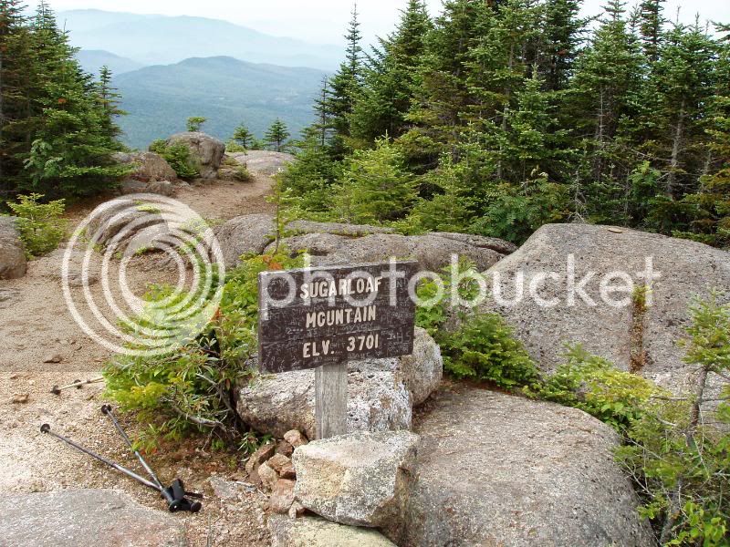
The next morning we made it back to the Nash Stream to the traihead for Sugarloaf.Now, the Sugarloaf Trail is an old logging road almost all the way to the top. It gains 2200 feet in the 2.1 miles, so it is a good work-out, but kind of boring.
The summit, however, pesented us with sweeping views and we were happy we chose this climb.


On the way back down I stopped to photo an full can of Bud that someone had left (for us?) right in the middle of the trail.
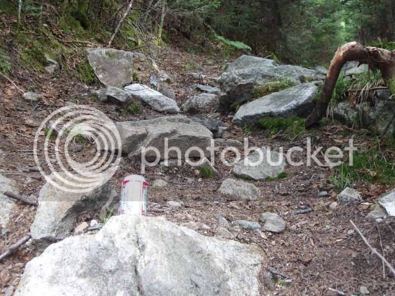
We left it as we found it, but had it been a Guiness...........
We returned to our Hotel for the night. The Weather forecast was for rain, clearing in the morning. We hoped we could catch one more mountain the next day by going up and climbing Magalloway. The Rain didn't cooperate with the forecast unfortunately so we headed home slowly playing sight-seers and stopping at a few stores in North Conway.
I must say We LOVED the Great North Woods. The hikes were quite different from the Whites, especially because of all the hardwoods which we don't see much where we live. I think a camping trip back to this area is a real possibility in the future.
We got up REAL early on the first day and were on the road by 5:00 A.M. This got us (with a couple of rest stops) to the traihead for the Percys by 8:00.
Now, having read the write-up in the AMC guide, we were expecting a slightly dangerous climb. The trail, however turned out to be in pretty good condition. There were many ribbons hanging from areas where drainage was going to be added, and about a mile into the climb we met the crew that was working on this project.The infamous slabs were not all that bad, although I could see how it could be scary in the wet.
The views on the top were fantastic, although the low-hanging clouds gave evrything a kind of mysterious feeling
Lunch on the summit
Christine Lake
We headed carefully back down the slabs viewing South Percy on the way
We decided to make a loop hike of it, so we turned left and decended by the Percy Loop Trail. This trail was a lot wetter, and rougher,being on the North side of the mountain. At the end was a mile walk on the Nash Steam Road back to the car.
From there we made it back down to Colebrook, checked in and took a tour of the town. Colebrook is another of those towns hard-hit by the closing of paper mills. We saw many empty businesses and homes for sale. We did discover the best place to eat which was Howard's Restaurant . Home cooked food and good prices.
The next morning we made it back to the Nash Stream to the traihead for Sugarloaf.Now, the Sugarloaf Trail is an old logging road almost all the way to the top. It gains 2200 feet in the 2.1 miles, so it is a good work-out, but kind of boring.
The summit, however, pesented us with sweeping views and we were happy we chose this climb.
On the way back down I stopped to photo an full can of Bud that someone had left (for us?) right in the middle of the trail.
We left it as we found it, but had it been a Guiness...........
We returned to our Hotel for the night. The Weather forecast was for rain, clearing in the morning. We hoped we could catch one more mountain the next day by going up and climbing Magalloway. The Rain didn't cooperate with the forecast unfortunately so we headed home slowly playing sight-seers and stopping at a few stores in North Conway.
I must say We LOVED the Great North Woods. The hikes were quite different from the Whites, especially because of all the hardwoods which we don't see much where we live. I think a camping trip back to this area is a real possibility in the future.
Last edited: