grouseking
Well-known member
Sunday Mtn from Cross Rivendell Trail
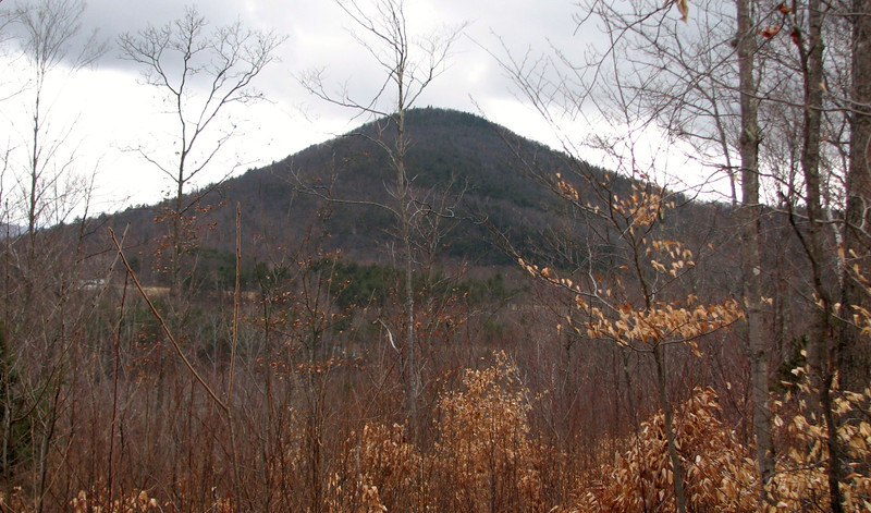
On Thursday, I took a hike along the Cross Rivendell trail in Orford NH, from the foot of Mt Cube, west through the forest, eventually up and down Sunday Mtn (1,823 ft) then along some back roads, across a couple more trails which led me to the town of Orford and then stopped at the bridge over the Connecticut River. The entire trail is about 37 miles long, and I am almost done traversing it...just 7 or 8 miles to go.
This was my first hike in about a month, thanks to persistent sickness and lovely knee tendonitis. But after awhile I said "screw it" and just went for it. Cabin fever was killing me.
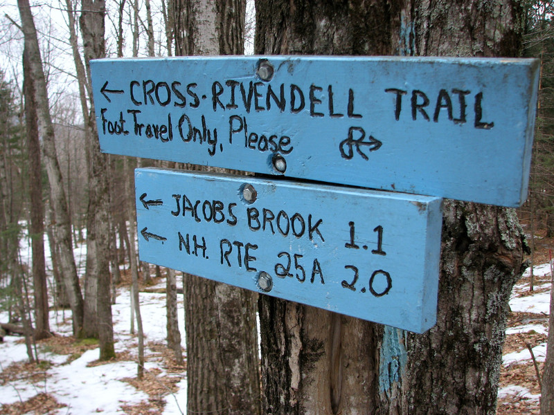
First sign at the trailhead.
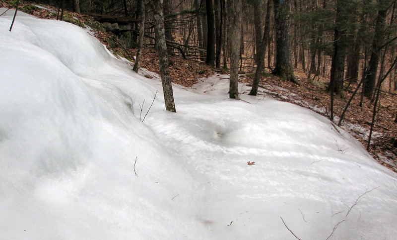
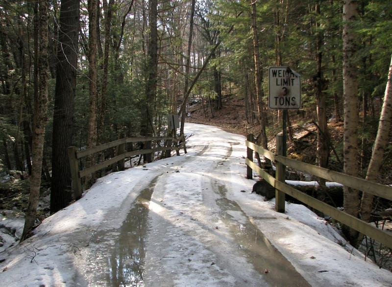
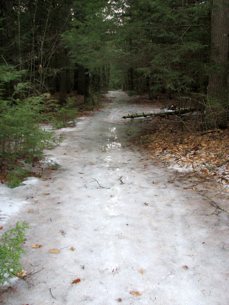
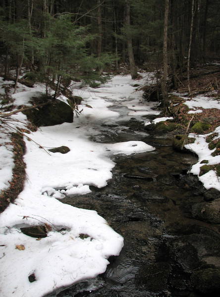
This section of trail was fairly uneventful, and probably the least interesting section of the day. I wore microspikes the vast majority of the hike, and here was no exception. The ice was incredible in some sections...probably some of the worst ice I have seen at such a low elevation. Even in areas where there was no snow, the trail had hidden ice that could easily make one fall. Plus, there were two minor stream crossings. One was a tiny bit sketchy because the ice was hollow and made a bunch of noise as I crossed. The other, which was a tributary of Jacobs Brook, was open and easy.
Jacobs Brook
After a little over an hour I reached Rt 25A, crossed the road and headed over to Dame Hill Rd and Indian Pond Rd, where a short walk led me to the next section of trail which headed up Sunday Mtn. I've been wanting to hike this short yet steep looking mountain for a couple years now. so I was excited to give it a try. I heard the views weren't the best, but I still had high hopes.
Despite not being on a trail in a month, I made easy work of Sunday Mtn, and before long I was within the final 1/3 of a mile from the summit. And much to my surprise, the sun decided to come out! It kept with me for the rest of the hike.
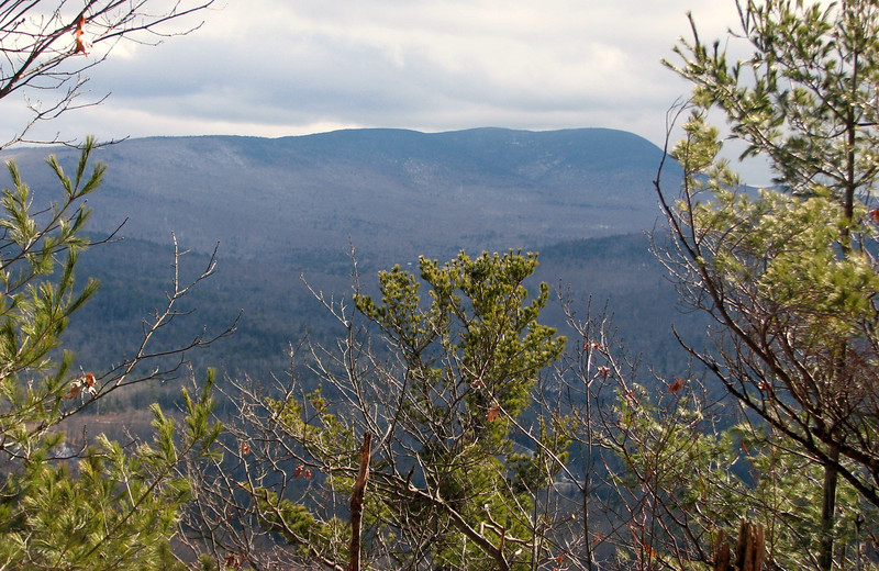
Soon, I started getting a few unique views. Nothing sweeping, but enough to keep this an interesting trek.
Smarts Mtn
Mt Cube
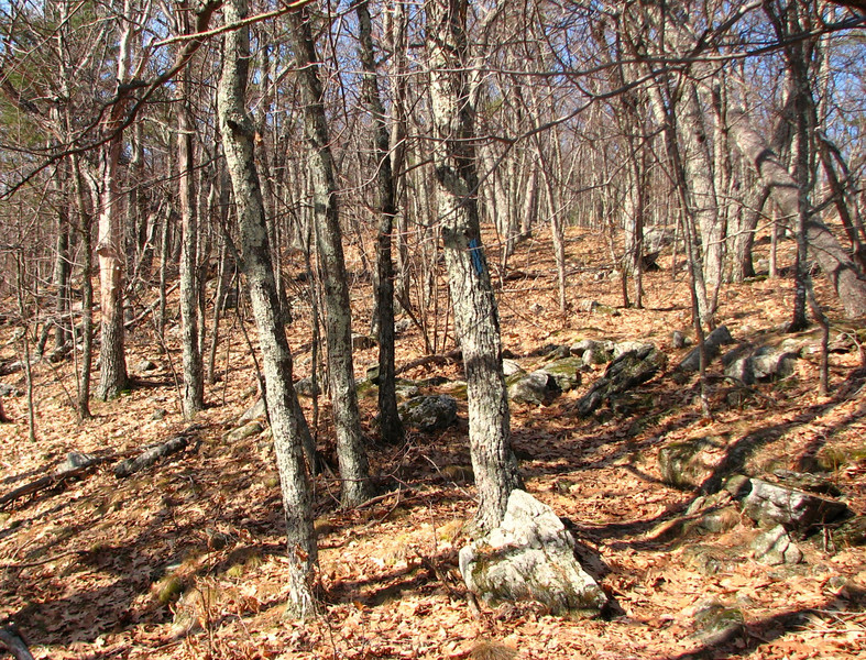
The summit area was interesting. It was an area of hardwood forest, with no snow on the ground. This winter has been very unkind to this section of New England. Thankfully the forecast over the next couple weeks could show more snow.
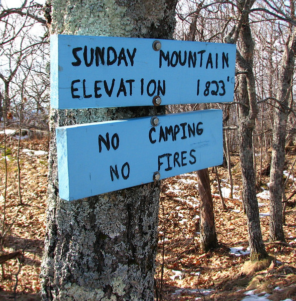
I arrived at the summit of Sunday Mtn at around 1:30ish, still plenty of time to make it to the CT River before dark. I sat down, ate my lunch, and looked for a view. There was next to nothing to look at from the top, sadly. There could be an area where you can see Moosiluake, but the view was obscured by clouds. So I'll just show a sign of the summit.
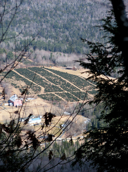
While hiking back along the spur trail to the main trail, I found this sneak a view down to a farm.
I started heading down the mtn, somewhat disappointed that there were no true views from the summit. On the Cross Rivendell trail map, there was a binocular picture from the top of Sunday Mtn, which means there should have been a real view. Oh well, so much for that.
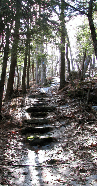
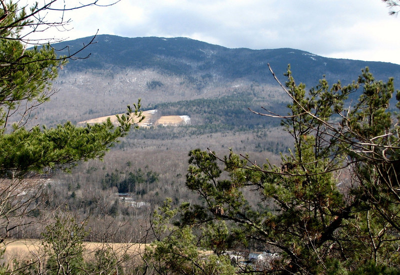
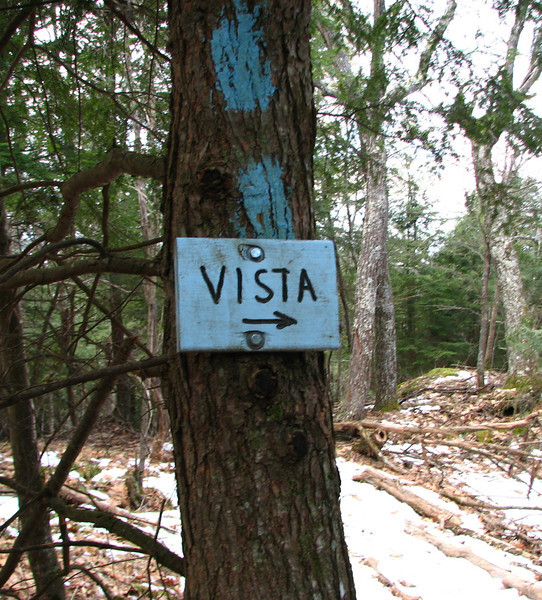
On my way down, the trail conditions changed from snow and ice covered, to nothing, back to ice, to nothing, etc etc. This was the theme for the day. Before long, I just said screw it, and kept the microspikes on. About a 1/2 mile from the summit, I came across a sign. Perhaps this was where the view was supposed to be?
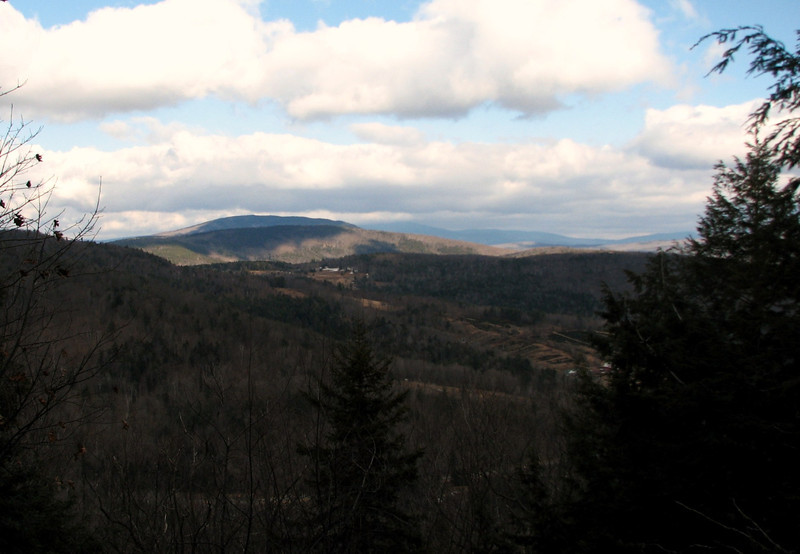
It wasn't a bad view either. I think this was Piermont Mtn? Not sure exactly....I believe Moosilauke is behind it, covered in cloud.
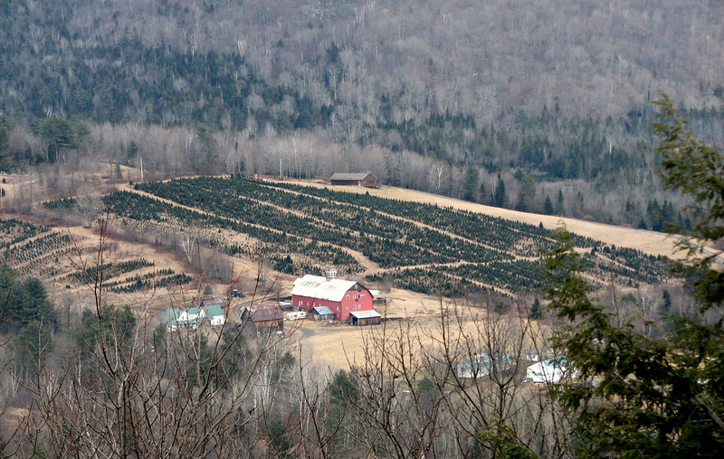
A better shot of that farm
Cont in a min
On Thursday, I took a hike along the Cross Rivendell trail in Orford NH, from the foot of Mt Cube, west through the forest, eventually up and down Sunday Mtn (1,823 ft) then along some back roads, across a couple more trails which led me to the town of Orford and then stopped at the bridge over the Connecticut River. The entire trail is about 37 miles long, and I am almost done traversing it...just 7 or 8 miles to go.
This was my first hike in about a month, thanks to persistent sickness and lovely knee tendonitis. But after awhile I said "screw it" and just went for it. Cabin fever was killing me.
First sign at the trailhead.
This section of trail was fairly uneventful, and probably the least interesting section of the day. I wore microspikes the vast majority of the hike, and here was no exception. The ice was incredible in some sections...probably some of the worst ice I have seen at such a low elevation. Even in areas where there was no snow, the trail had hidden ice that could easily make one fall. Plus, there were two minor stream crossings. One was a tiny bit sketchy because the ice was hollow and made a bunch of noise as I crossed. The other, which was a tributary of Jacobs Brook, was open and easy.
Jacobs Brook
After a little over an hour I reached Rt 25A, crossed the road and headed over to Dame Hill Rd and Indian Pond Rd, where a short walk led me to the next section of trail which headed up Sunday Mtn. I've been wanting to hike this short yet steep looking mountain for a couple years now. so I was excited to give it a try. I heard the views weren't the best, but I still had high hopes.
Despite not being on a trail in a month, I made easy work of Sunday Mtn, and before long I was within the final 1/3 of a mile from the summit. And much to my surprise, the sun decided to come out! It kept with me for the rest of the hike.
Soon, I started getting a few unique views. Nothing sweeping, but enough to keep this an interesting trek.
Smarts Mtn
Mt Cube
The summit area was interesting. It was an area of hardwood forest, with no snow on the ground. This winter has been very unkind to this section of New England. Thankfully the forecast over the next couple weeks could show more snow.
I arrived at the summit of Sunday Mtn at around 1:30ish, still plenty of time to make it to the CT River before dark. I sat down, ate my lunch, and looked for a view. There was next to nothing to look at from the top, sadly. There could be an area where you can see Moosiluake, but the view was obscured by clouds. So I'll just show a sign of the summit.
While hiking back along the spur trail to the main trail, I found this sneak a view down to a farm.
I started heading down the mtn, somewhat disappointed that there were no true views from the summit. On the Cross Rivendell trail map, there was a binocular picture from the top of Sunday Mtn, which means there should have been a real view. Oh well, so much for that.
On my way down, the trail conditions changed from snow and ice covered, to nothing, back to ice, to nothing, etc etc. This was the theme for the day. Before long, I just said screw it, and kept the microspikes on. About a 1/2 mile from the summit, I came across a sign. Perhaps this was where the view was supposed to be?
It wasn't a bad view either. I think this was Piermont Mtn? Not sure exactly....I believe Moosilauke is behind it, covered in cloud.
A better shot of that farm
Cont in a min