
SpencerVT
Member
EDIT UPDATE: GUESS THIS IS NOT A 3000'ER: DOH! Evidently I was absent on "contour line counting" day in school. Yes, people are correct, it's 20 foot contours not 30', therefore I am wrong and the highest line is indeed 2,960'.
It is interesting that GPS put it higher though, but it definitely seems that 2,972 is a pretty accurate measurement for this peak. Dammit, I was hoping I stumbled upon something. I'm still working on that "learning to count" concept....hahahaha")
-----
For a long time I had suspected that an unnamed peak exactly on the border of Lemington and Averill in Vermont was a 3000'er, because it was just so damn close on the map. So this past weekend, my wife and I went to check it out. It was freezing cold and snowy. A fun bushwhack to the summit. My wife and I were back to my truck at the end of the logging access road off of East Branch road by 5. East Branch road is seasonal - the VAST trail in winter.
In my opinion, this is likely a 3000'er that's yet to be recognized as such.
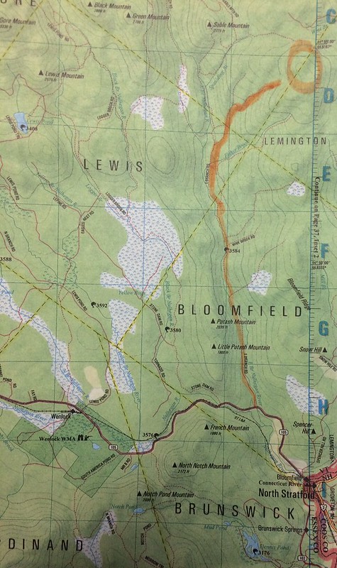
Photo of Gazetteer showing route highlighted in orange we took going in from East Branch Road with the summit circled in orange. I was able to drive my truck almost the entire way in that is shown highlighted in orange, stopping just before the summit circled:
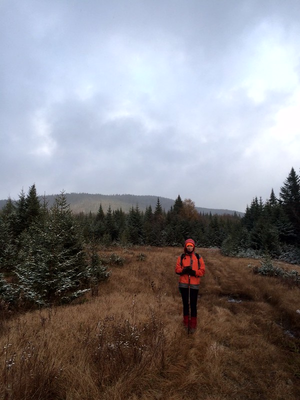
My wife at a clearing with the mountain in the background:
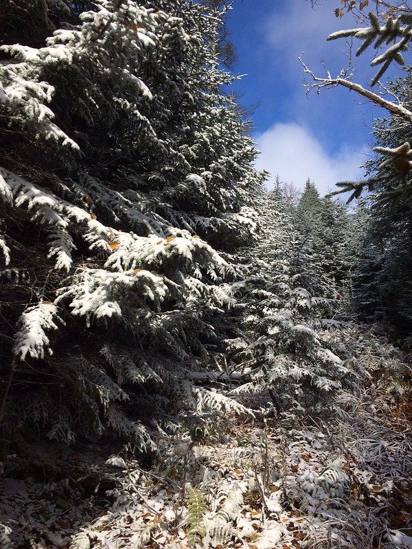
The snowy ascent up to the ridge:
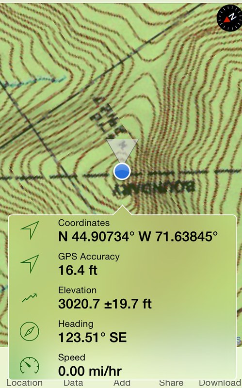
My GPS program showing the elevation. When I first arrived at the canister it read 3003 feet. If you look on the map it says 2,912' a couple contour lines down. (it's upside down in the photo). If you count the 30' increments, then the last established topo line is 2,990. Which means there only has to be 10 feet beyond that to make it a 3000'er, and still another 20' to go before another contour line would be put on the topo map. It definitely seemed to reach over 3000'.
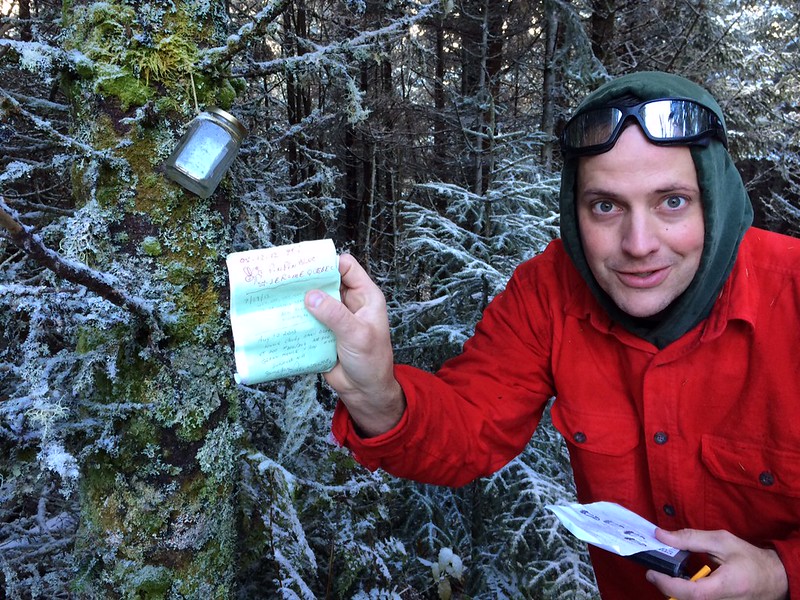
The canister at the top. Only a couple names had signed in. Sure enough, Pin Pin was one of them!
It is interesting that GPS put it higher though, but it definitely seems that 2,972 is a pretty accurate measurement for this peak. Dammit, I was hoping I stumbled upon something. I'm still working on that "learning to count" concept....hahahaha
-----
For a long time I had suspected that an unnamed peak exactly on the border of Lemington and Averill in Vermont was a 3000'er, because it was just so damn close on the map. So this past weekend, my wife and I went to check it out. It was freezing cold and snowy. A fun bushwhack to the summit. My wife and I were back to my truck at the end of the logging access road off of East Branch road by 5. East Branch road is seasonal - the VAST trail in winter.
In my opinion, this is likely a 3000'er that's yet to be recognized as such.
Photo of Gazetteer showing route highlighted in orange we took going in from East Branch Road with the summit circled in orange. I was able to drive my truck almost the entire way in that is shown highlighted in orange, stopping just before the summit circled:
My wife at a clearing with the mountain in the background:
The snowy ascent up to the ridge:
My GPS program showing the elevation. When I first arrived at the canister it read 3003 feet. If you look on the map it says 2,912' a couple contour lines down. (it's upside down in the photo). If you count the 30' increments, then the last established topo line is 2,990. Which means there only has to be 10 feet beyond that to make it a 3000'er, and still another 20' to go before another contour line would be put on the topo map. It definitely seemed to reach over 3000'.
The canister at the top. Only a couple names had signed in. Sure enough, Pin Pin was one of them!
Last edited: