Webster Slide, Wachipauka and some exploring..

vftt.org

Help Support vftt.org:

This site may earn a commission from merchant affiliate links, including eBay, Amazon, and others.

grouseking

Well-known member
Joined
Feb 20, 2005
Messages
2,023
Reaction score
272
Location
Lebanon, NH Avatar: Philosopher?
986506663_debb4-L.jpg


This trip was a near last minute trek. My friend wanted to know where I wanted to go, and I suggested either Black Mtn in Benton, or Webster Slide Mtn and Wachipauka Pond. We chose the latter because there was a nice and refreshing pond to jump into if we wanted.

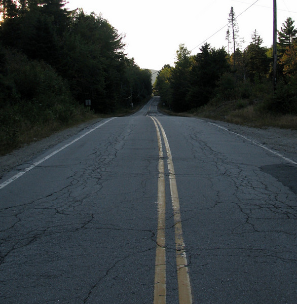
We started at Rt 25C along the power lines near the Warren/Piermont line. It brought back memories for me because I worked at Camp Walt Whitman, which was only a couple miles away.

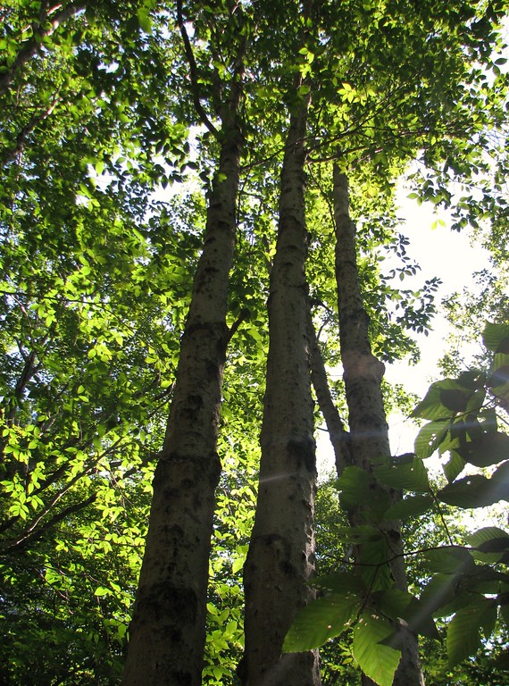
The hike was quite eventful, and I will describe thru the report. First off, I was delighted by the gorgeous mixed forest we were walking thru, as we ascended slowly towards Mt Mist

These beeches def had that bark disease, but they still made for a lovely photo.
986501735_nfi92-XL.jpg


After about a half an hour, we heard a bunch of loud barking dogs and saw them tear thru the woods. Soon thereafter, we saw the owner, who was bushwhacking around. He stated that they were chasing a bear!!! Well I'm glad they didn't chase the bear down the trail! That would have made for an interesting couple of seconds...

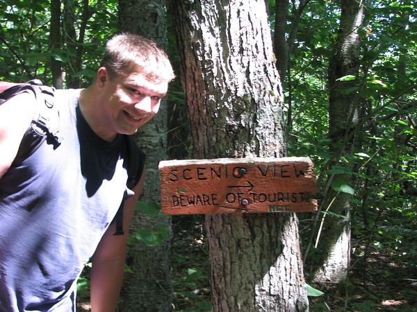
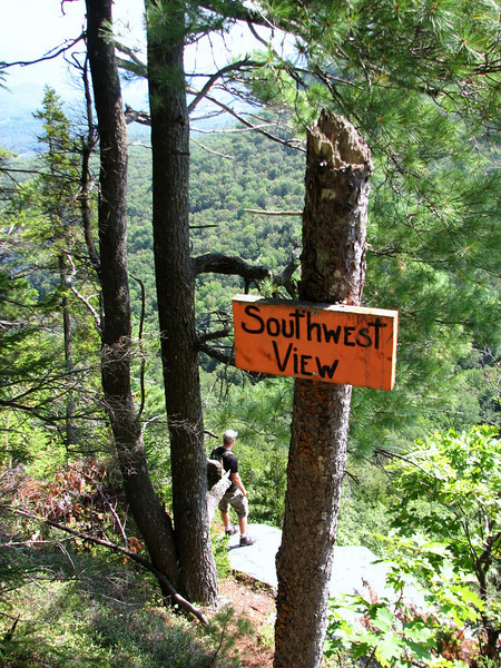
Anyways, after about an hour, we made it to the summit of Mt Mist, then descended down to the fun signs along the way.
986502730_oz6gc-M.jpg


The actual view was all right, but I'm not posting any pics of it, but they are in the photo album. We met a couple thru hikers there, and I gave one half my turkey sub. He accepted it with open arms. He said that it had been months since he had any deli meats! I can't imagine....

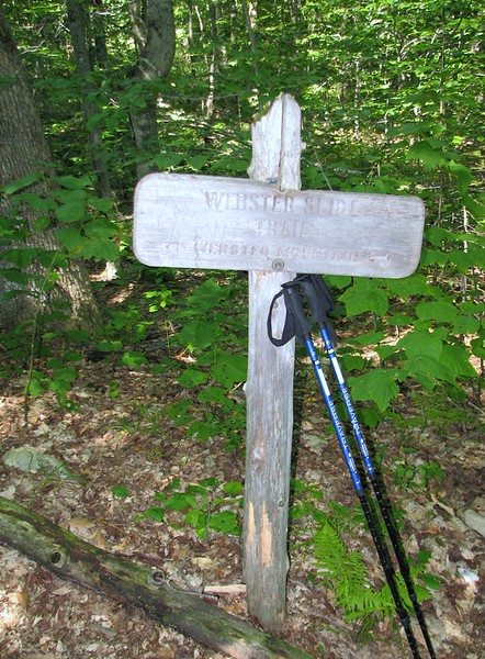
Before too long we made it to the trail junction of Webster Slide Mtn. The sign says one mile to the summit, and the map says 0.7 miles. I say, average the two.
986503542_RGzpv-L.jpg


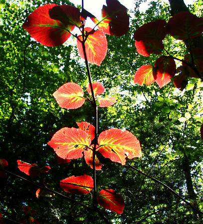
The lower section was also a lovely stretch of mixed forest and hobblebush, which is beginning to change color!
986505216_gVtPR-M.jpg


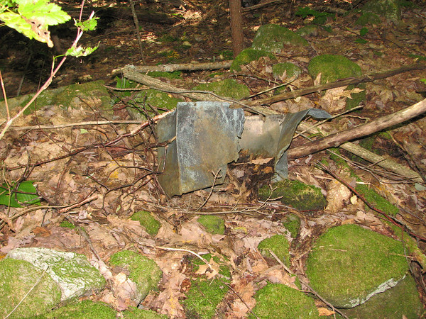
In my travels slightly off trail, I noticed some old stuff, which appeared to be part of a stove, and something that looked like a sap bucket, but it was connected to a striped maple. Here is the stove thingy....
986504715_LnkHx-M.jpg


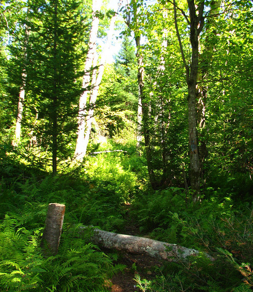
Further down trail, just before the steep rise, we noticed a trail that veered off to the left. It seemed well beaten, but then had a bunch of hobblebush growing in the middle. I wonder if that trail is the old AT, or it leads to the powerlines? Another adventure for another day...

So now the trail gets mighty steep! And there was a section that was quite eroded, but we were both still in good spirits and made it to the summit area in a relatively short amount of time. My fav part besides the views was a section of tall ferns just prior to the summit sign.
986505756_BbEr7-L.jpg


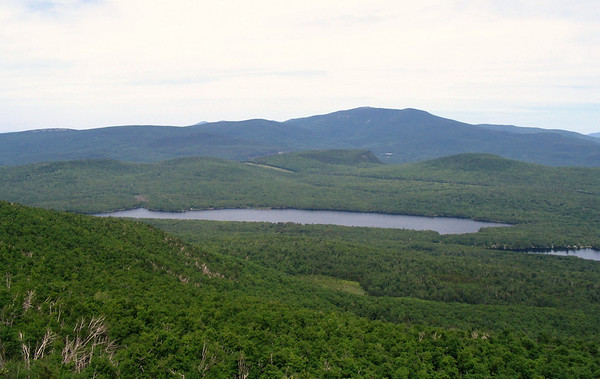
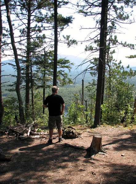
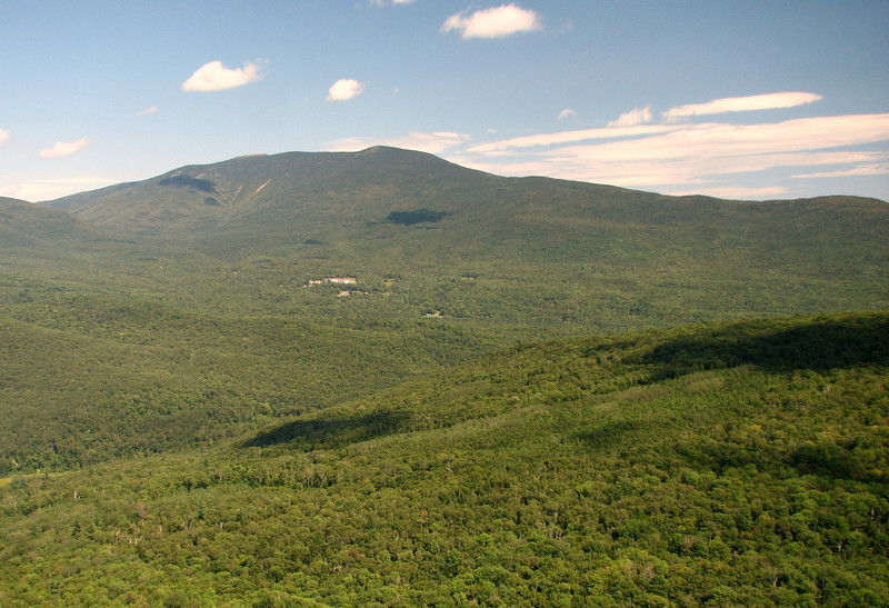
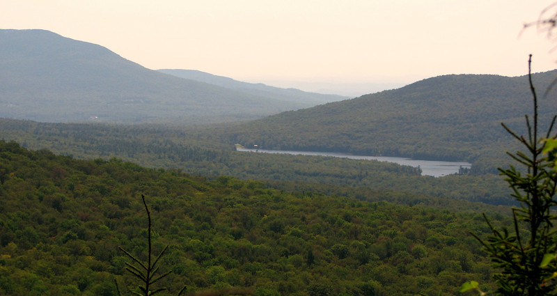
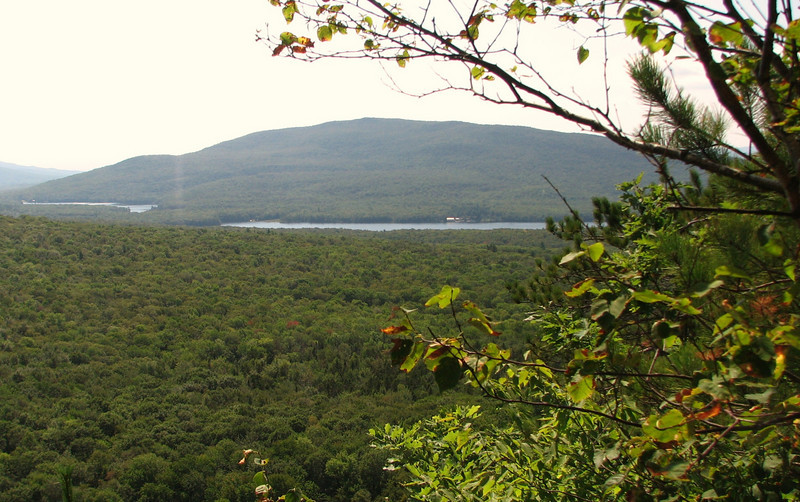
And now, onto the summit view points. This was the beginning of the next interesting part of my trip. We liked the view from the top near the make shift benches.
986506570_bxwWi-L.jpg


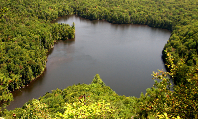
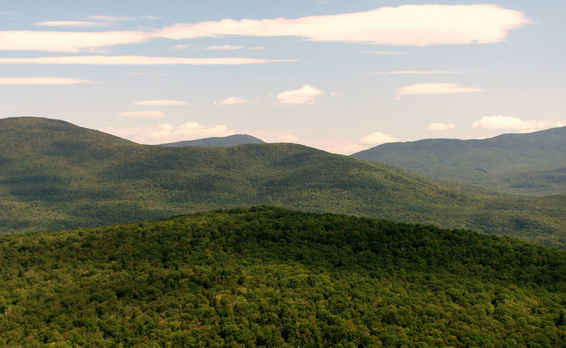
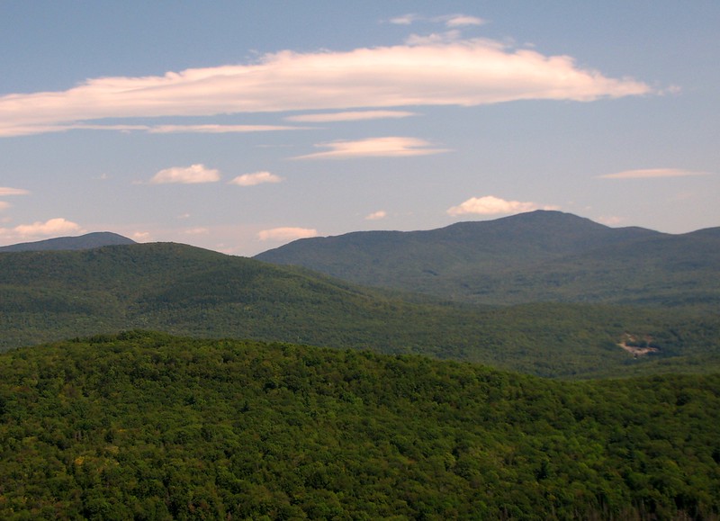
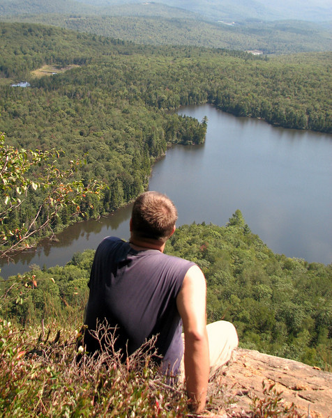
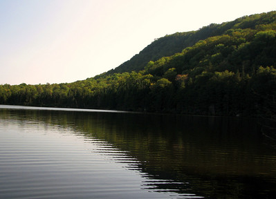
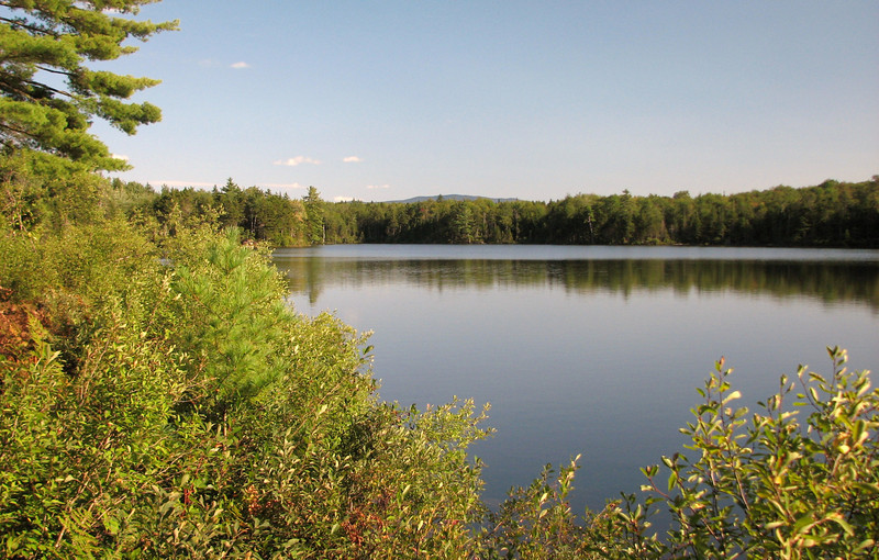
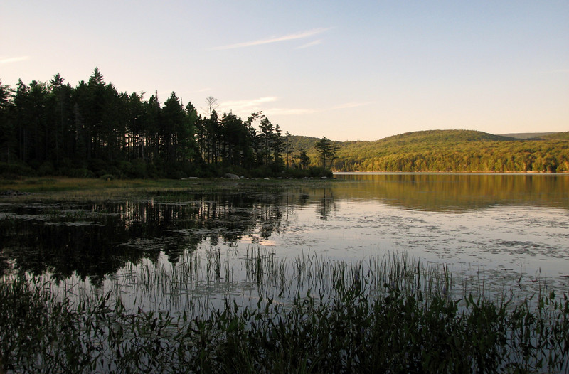
But we wanted more. So now we explored around, and went left. From here we VERY CAREFULLY, and I cannot stress this enough...very carefully made our way down a steep and loose section, to the point where we decided to stop. Any further and it would have been tough to survive a fall, haha. From there, it was a jaw dropping, breathtaking view down to Wachipauka Pond and the surrounding mountains.
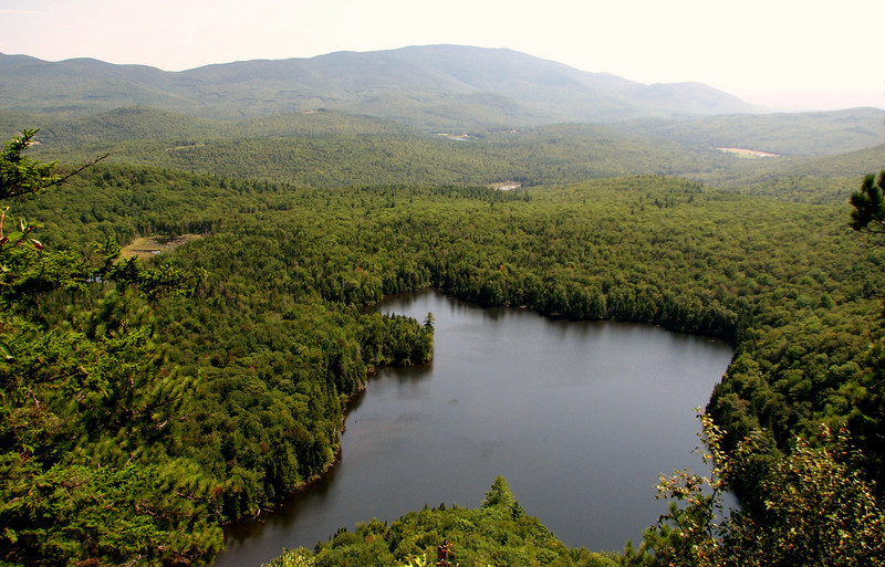
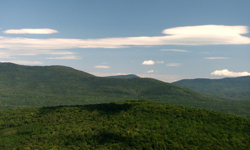
Slight zoom
986506769_4TWZn-L.jpg


986506930_HNizX-L.jpg


986508570_3rLiw-L.jpg


In this pic, I was in the brush, on the side of a very steep rock face, a rock face that there was nooo way I was going to touch.

986509291_VfHbJ-L.jpg


continued in a few min
 
Last edited:
part two

Interesting part of the trip starts....

We wanted a really nice view of Moosilauke...so we kept going left, and found some really nice rocks to stand on...still very exposed on one side, but it felt more sturdy, so it wasn't bad. The reward for hoping over there, was an absolutely dazzling view of the Moose and what appears to be Glencliff.
986509613_3LX7q-L.jpg


neat lenticular clouds on saturday
986509941_cDtWf-L.jpg


AFter a few minutes, I noticed an awful smell around the rocks, and then on my hands. It took a second to realize it crap, of some sort. Then I looked around and saw lots of little nooks underneath the rocks, and feathers galore. Earlier in the day, we saw a Peregrine falcon land on a rock and fly away just as fast. So I immediately got nervous, thinking we possibly were in a nesting area, and hightailed it out. Now, I have not seen any literature on falcon nesting on Webster Slide Mtn, but I do know that they nest on Holts Ledge to the south, and on Owls Head above Oliverian Notch just a few miles north, so it is entirely possible. Even if they were not the falcons, it was something else, and there was no way I was hanging out up there anymore!!!

After that silly mistake, we followed a very well beaten path towards the southwest...ish, and before we knew it the path ended and we stumbled upon the southwest view!
986511005_amd5P-L.jpg


views across to Cube, and Lake Armington. The further end is where I worked at the summer camp. This is one of the most unique views I have seen anywhere in the White Mtns
986510371_sSeSS-L.jpg


And a view of the "trailless" Piermont Mountain and Lake Tarelton. (its def not trailless, but nothing AMC...nice view though
986510616_pgUoa-L.jpg


So now its time to head down to the pond and take a swim. FOr some reason I was out of it by this time, and it was slow going down the steep stuff, and to the pond. Still, I made it without too many problems, and basked under the late afternoon sunshine.
986512522_bWKT4-S.jpg


986513089_UgMJ9-L.jpg


986513938_jRpFw-L.jpg


All I can say is, this view of the pond was MUCH calmer and quieter than my first visit, back in Feb of 2009. A snow storm was underway that day.
736925494_xrnaA-L.jpg


Allright, now its time to head back. The reclimb of Mt Mist...well the peak just shouldn't be there. Ok, it was only like 700 feet of gain, but it absolutely killed me. I remember thinking I saw an orange sign for the summit, but I was seeing things, and it wasnt for a bit further. This did me in sadly and I was running on fumes the rest of the way, even on the descent. Normally I'm fine heading down, but I was draggin my feet the whole way...luckily I didn't fall. But like always, one foot in front of the other gets you to your destination, and we eventually got back out!
986514969_2awfW-L.jpg


On the way back we stopped at Lake Tarelton...such a beautiful lake. There were quite a few people there, but oh well.
evening on the lake
986515117_gntN3-L.jpg


pretending to own a kayak, towards the moose
986515840_xseUY-L.jpg


enjoy all!
http://grouseking.smugmug.com/New-H...Slide-and-Visc/13537519_aDmJc#986501599_3VuK6

grouseking
 
Probably not Peregrines

That mountain is a real gem. There's so many special places in NH. I'm no expert, but I've always heard of peregrines nesting in May and June and trail closures usually go away by July. There's another predator that nests on cliffs though. The turkey vulture! And I seem to recall their nests can be pretty stinky. I love all the home grown signage.
 
We met a couple thru hikers there, and I gave one half my turkey sub. He accepted it with open arms. He said that it had been months since he had any deli meats!
Phil, that was so nice of you to give half of your turkey sub to the AT thru-hiker. You're a good man!
Also, I want to compliment you on getting an excellent view of Moosilauke. Your maneuvering around really paid off!
 
Nice. I enjoyed the same trip with my family in fall of '08... My sister-in-law has a camp on Lake Armington, across the lake from Walt Whitman in fact. Paddling out from her dock there is a nice view of The Moose.

from Fall 2008, the unmistakable shape of Wachipauka Pond


Tim
 
That mountain is a real gem. There's so many special places in NH. I'm no expert, but I've always heard of peregrines nesting in May and June and trail closures usually go away by July. There's another predator that nests on cliffs though. The turkey vulture! And I seem to recall their nests can be pretty stinky. I love all the home grown signage.

It is a gem, and I think I will be visiting it in different seasons, especially fall. The amount of deciduous (plus seeing Tim's fall shot...) makes me want to return. I hope you are right about them not being falcons. Still, the thought of me being literally inches from some sort of nest, like a turkey vulture, kind of creeps me out!!!

Phil, that was so nice of you to give half of your turkey sub to the AT thru-hiker. You're a good man!
Also, I want to compliment you on getting an excellent view of Moosilauke. Your maneuvering around really paid off!

I don't think I was thinking...when I was maneuvering. :) I knew I just wanted to see the Moose, and I found it! It is a shame I was near/on some sort of wild birds nest area, because I would have stayed longer. As for the AT sandwich...I've been reading lots of thru hikers books, and it makes me want to get out there and complete a hike from GA to ME. Since I cannot (at least right now), I feel like I should give back any way I can. So whenever possible, I try to give someone something, whether its a power bar, water, or deli meat. haha

Nice. I enjoyed the same trip with my family in fall of '08... My sister-in-law has a camp on Lake Armington, across the lake from Walt Whitman in fact. Paddling out from her dock there is a nice view of The Moose.

from Fall 2008, the unmistakable shape of Wachipauka Pond


Tim

That is a beautiful shot Tim, makes me wish I waited another month to check out the views. Lake Armington and Tarelton certainly are interesting areas, and are up pretty high relatively speaking. Tareleton is my favorite. Have you ever hiked up Piermont Mtn? There isnt an "officially" maintained trail, but there are at least two ways to get up there..I think they are both from summer camps.
 
Tareleton is my favorite. Have you ever hiked up Piermont Mtn? There isnt an "officially" maintained trail, but there are at least two ways to get up there..I think they are both from summer camps.

No, not yet. Piermont is the mountain right behind her camp. I haven't brought the camera out on the lake itself so I have no photos of either Moosilauke or Piermont.

Tim
 
Top