grouseking
Well-known member
My exploration of new parts of NH continues...with a trip into the Cockermouth Forest, where my two main objectives were the low, ledgy peaks of Bald Knob, and Mt Crosby. Then, if time allowed, I would take a trip over to Sculptured Rocks a few miles away.
This forest is located in the towns of Hebron and Groton, just a few miles from the north side of Newfound Lake. It was a very warm, sunny, and hazy day with gusty winds up on the mtn peaks, but not windy enough to keep those bugs at bay. I, the one and only Grouseking, declare that it is officially deer fly season. Blech! So there wasn't that much time to chill out and relax. Bald Knob had enough wind to keep the bugs at bay, but Mt Crosby did not. Here is a map of the area, in case you are interested.
http://hebronnh.org/Cockermouth_WebMap.pdf
This was a trip I did not want to do alone, because I expected the trails to be tough to follow. I also expected a quiet walk into the woods, and that was what I got. The downside to the trip was, we were hiking thru a bunch of logged areas for the first mile, which took away from the trail feeling. Plus, you really needed to pay attention to where the paths went, in order to go the right way. And all that newly logged area made for a ridiculously buggy situation...though it really wasn't much better away from the cut trees. It was just a rough day with all those biting mosquiters, something my 25 percent deet was no match too. I need to buy some of that 100 percent poison again....
But overall, it was a good little trip that we definitely earned. Pictures below....
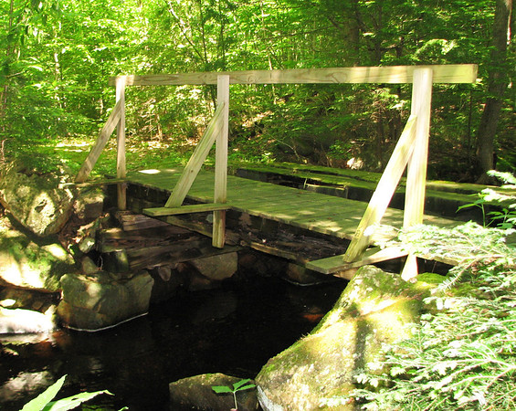
Nice footbridge along the way
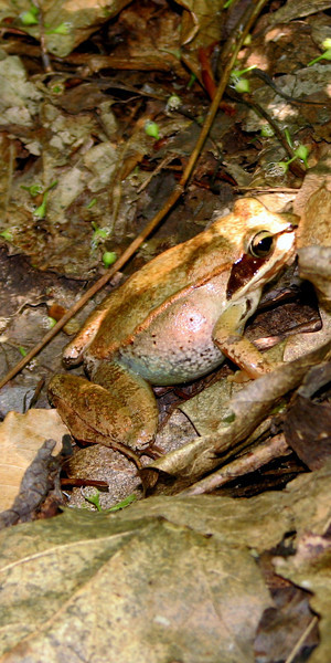
Such to my dismay, I was told not to lick him.
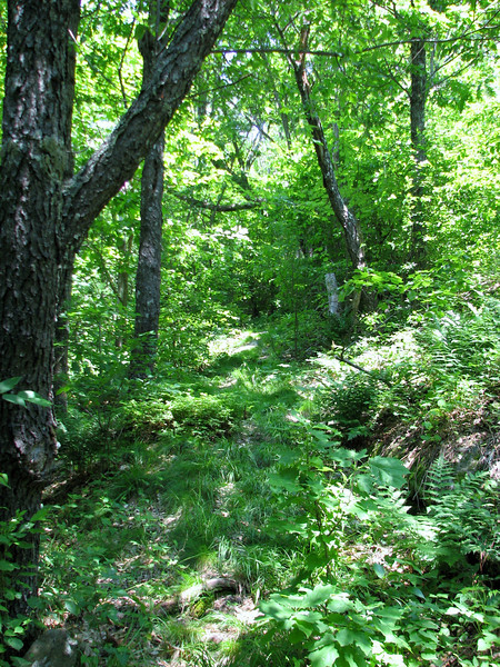
I dunno if this might persuade many to hike this, but this was the trail treadway most of the time....fairly easy to follow, but just difficult enough to have to pay attention.
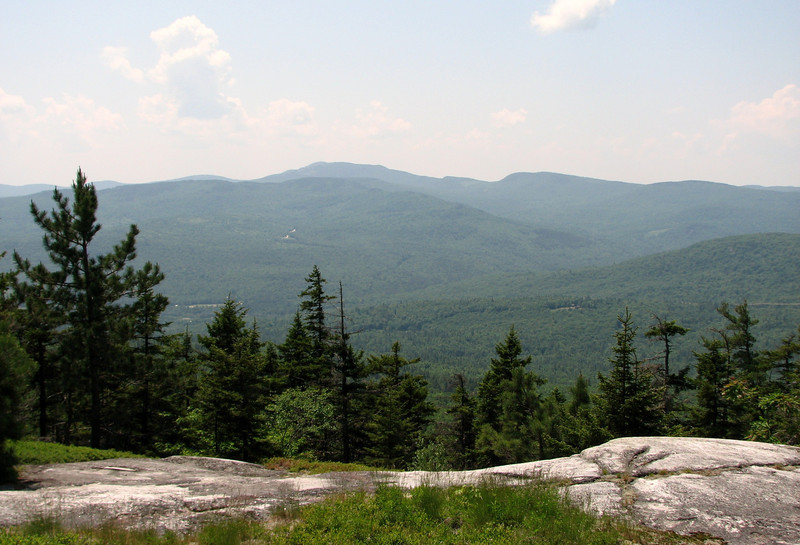
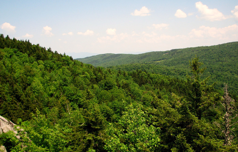
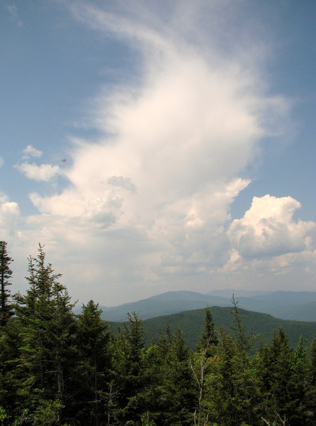
Bald Knob had some nice views over to Cardigan and elsewhere..though it was really hazy.
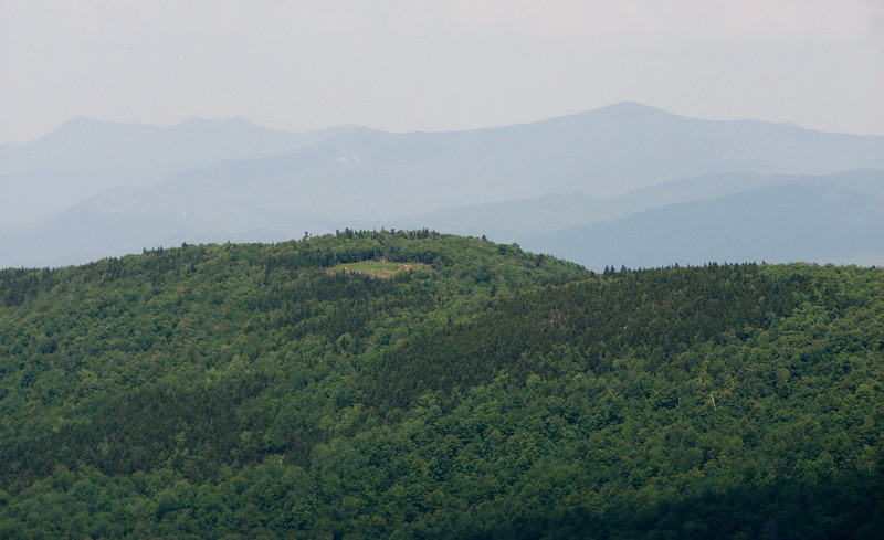
Neat view in between Mt Crosby and Tenney Mtn..not a side that I am used to seeing.
After a nice stay it was time to head over to Mt Crosby, where a supposed grander view awaited. The side trail over to peak was relatively easy to find...just walk along the rocks to the north till you find a tiny cairn that leads to a well beaten path straight down into the woods. It was about 1/2 mile to the summit of Crosby, and it lead us thru some nice, "out there" woods, complete with moose dingleberries to add to the feeling. The summit of Crosby does have very nice views, but they were not quite as open as I thought. Plus there was next to no wind there, so the bugs were legendary.
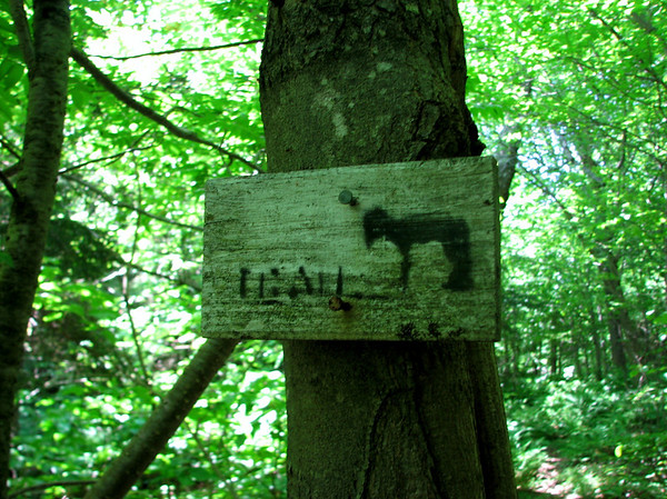
Camp Mowglis trail signs!! Some of the more unique trail signs I've seen..haven't seen these since I was along the Elwell trail.
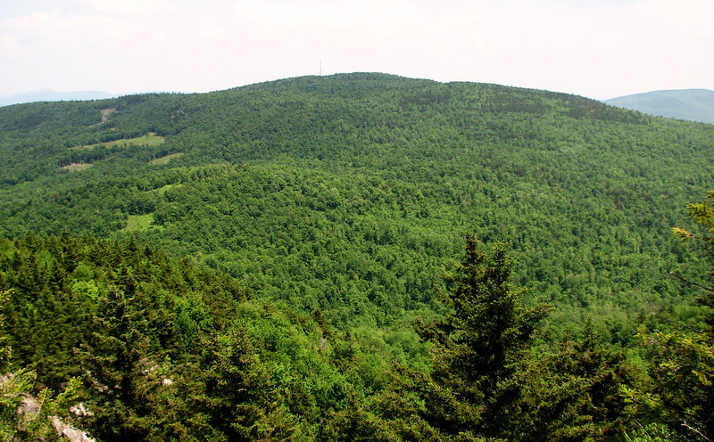
Another view over to Tenney, I really liked this...never seen it from the back side before..you'd never know there is a ski area on the other side.
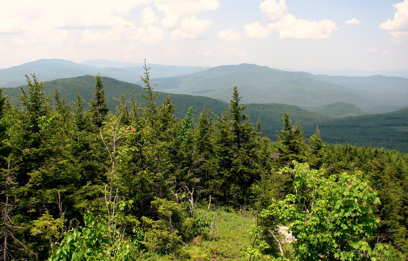
Hazy view north to the Stinson, Carr, Kineo, Moosilauke region...
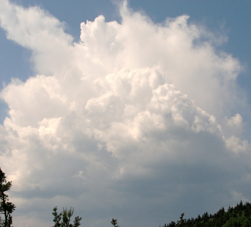
Watching, (and listening) to a weak thunderstorm pass to our north. Looks like it was getting sheared apart....
My only attempt at getting a zoom shot...Tri's, Sandwich Dome...things like that.
At that point, it was time to get going because the bugs were bad, so we headed back to Bald Knob for a stay where there was a lot of wind, and more sunshine. While there, I watched another shower try to get going, and it was also passing to our north.
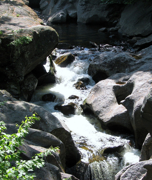
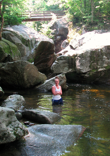
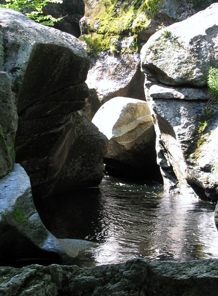
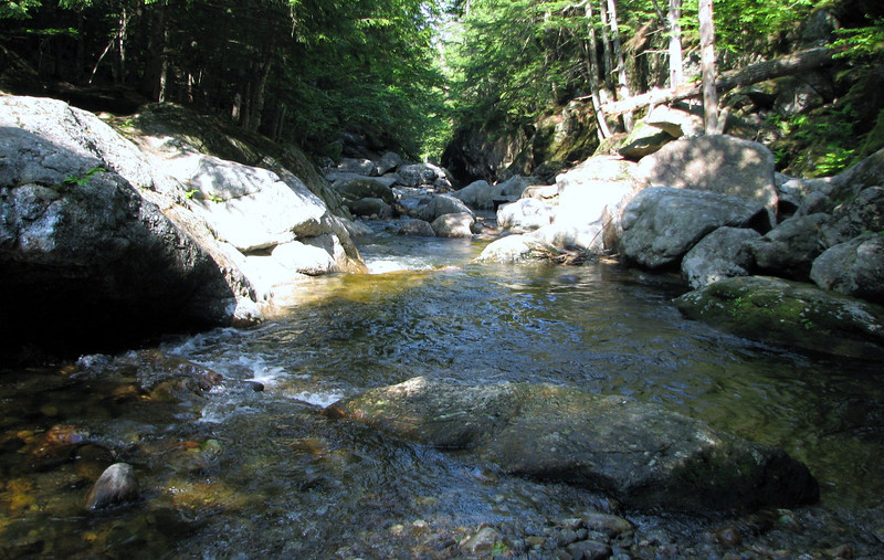
Then it was time to head back, down the bug trail, in through the bug tunnel, and back to the car. Really, people who don't like being in the woods, sometimes I can understand...because it was just rough yesterday, haha. But that doesn't stop me! After the relentless onslaught, and a quick scare from a natural helicopter (ruffed grouse), we made it back to home base, and decided to take a quick trip over to Sculptured Rocks for a quick dip. I haven't been there in several years, and I was hoping to get a picture or two. I wasn't very successful with good pics, but I got a few anyways.
And since I have run out of room for pics in this post...I will put them in part 2.")
This forest is located in the towns of Hebron and Groton, just a few miles from the north side of Newfound Lake. It was a very warm, sunny, and hazy day with gusty winds up on the mtn peaks, but not windy enough to keep those bugs at bay. I, the one and only Grouseking, declare that it is officially deer fly season. Blech! So there wasn't that much time to chill out and relax. Bald Knob had enough wind to keep the bugs at bay, but Mt Crosby did not. Here is a map of the area, in case you are interested.
http://hebronnh.org/Cockermouth_WebMap.pdf
This was a trip I did not want to do alone, because I expected the trails to be tough to follow. I also expected a quiet walk into the woods, and that was what I got. The downside to the trip was, we were hiking thru a bunch of logged areas for the first mile, which took away from the trail feeling. Plus, you really needed to pay attention to where the paths went, in order to go the right way. And all that newly logged area made for a ridiculously buggy situation...though it really wasn't much better away from the cut trees. It was just a rough day with all those biting mosquiters, something my 25 percent deet was no match too. I need to buy some of that 100 percent poison again....
But overall, it was a good little trip that we definitely earned. Pictures below....
Nice footbridge along the way
Such to my dismay, I was told not to lick him.
I dunno if this might persuade many to hike this, but this was the trail treadway most of the time....fairly easy to follow, but just difficult enough to have to pay attention.
Bald Knob had some nice views over to Cardigan and elsewhere..though it was really hazy.
Neat view in between Mt Crosby and Tenney Mtn..not a side that I am used to seeing.
After a nice stay it was time to head over to Mt Crosby, where a supposed grander view awaited. The side trail over to peak was relatively easy to find...just walk along the rocks to the north till you find a tiny cairn that leads to a well beaten path straight down into the woods. It was about 1/2 mile to the summit of Crosby, and it lead us thru some nice, "out there" woods, complete with moose dingleberries to add to the feeling. The summit of Crosby does have very nice views, but they were not quite as open as I thought. Plus there was next to no wind there, so the bugs were legendary.
Camp Mowglis trail signs!! Some of the more unique trail signs I've seen..haven't seen these since I was along the Elwell trail.
Another view over to Tenney, I really liked this...never seen it from the back side before..you'd never know there is a ski area on the other side.
Hazy view north to the Stinson, Carr, Kineo, Moosilauke region...
Watching, (and listening) to a weak thunderstorm pass to our north. Looks like it was getting sheared apart....
My only attempt at getting a zoom shot...Tri's, Sandwich Dome...things like that.
At that point, it was time to get going because the bugs were bad, so we headed back to Bald Knob for a stay where there was a lot of wind, and more sunshine. While there, I watched another shower try to get going, and it was also passing to our north.
Then it was time to head back, down the bug trail, in through the bug tunnel, and back to the car. Really, people who don't like being in the woods, sometimes I can understand...because it was just rough yesterday, haha. But that doesn't stop me! After the relentless onslaught, and a quick scare from a natural helicopter (ruffed grouse), we made it back to home base, and decided to take a quick trip over to Sculptured Rocks for a quick dip. I haven't been there in several years, and I was hoping to get a picture or two. I wasn't very successful with good pics, but I got a few anyways.
And since I have run out of room for pics in this post...I will put them in part 2.