
John in NH
Member
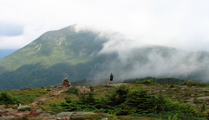
Hikers on the slopes of Eisenhower
Earlier this summer I had plans with a buddy to try the one day Presi Traverse. I figured after running a respectable sub 4 marathon this spring and getting more into trail running, this might be the summer to use that conditioning and do it. But my friend ended up bailing for personal reasons and I never did it.
Then I started thinking, maybe that was a good thing. I did the math out and you’d have to keep up quite the pace to do the 23 miles 9000ish gain within daylight hours. Plus the Northern Presi have awful footing. It seems the Presi Traverse is no big deal for many on this board. But how do they pull it off?
My normal hiking style would have to be altered. Even though I keep much faster than book time, I also take way too many pictures, eat exclusively solid foods instead of GU type products, and drink from water bottles. Oh and I like to spend a little time on each summit too. This style won’t work on big endurance hikes. So I set off last Saturday July 30 on a windy/ foggy day above treeline to see what I could do.
My route: Ammonoosuc Ravine Trail, going over all of the summits from Monroe to Webster and down the Webster Jackson Trail for an estimated total of 14.8 mi and 4300’ gain. In many ways this would be an ideal route for someone looking to test themselves on something smaller scale…you can bail down Crawford Path on Pierce or the Jackson branch to get back to your car at the Highland Center if needed.
My goals: 1. 8 hours elapsed time including all breaks
2. Take fewer pictures
3. Have fun
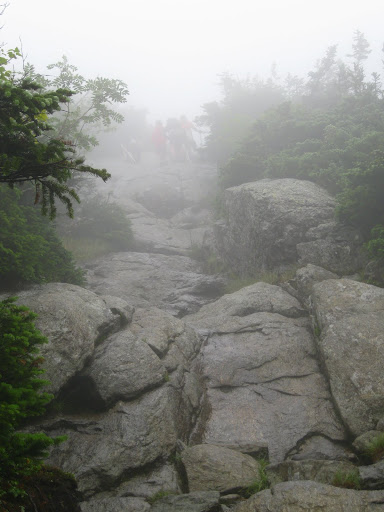
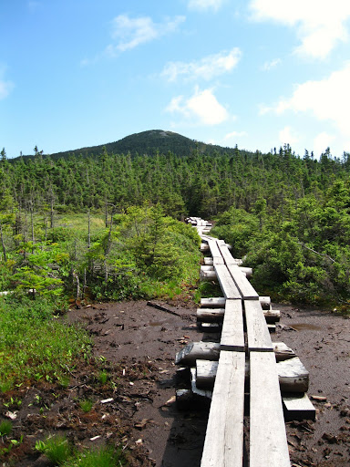
Doing this solo meant having only one car, shelling out $17 for the AMC shuttle between trailheads, and waiting until about 9:25 to actually start hiking. The Ammo was wet, completely fogged in, and absolutely mobbed with freaked out sneaker clad folks. This slowed my ascent, making it 1 hr 50minutes to the hut.
Ghosts of the Ammonoosuc
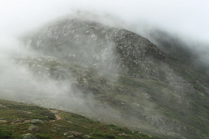
On the ridge going over Monroe was fast, though the talus fields going down it are much like the northern Presi’s and slowed me down quickly. Visibility remained about 20 feet. Hikers would seeming pop out of nowhere. I started thinking these conditions were a good thing. It would prevent me from taking pictures. Also it was cool to be hiking in conditions that are the norm for the Presi’s, its helps you understand the conditions that create those beautiful alpine areas we love so much on the blue skies of our “Presi Days.”
Shortly before Eisenhower, I started getting breaks in the clouds in the most ethereal formations.
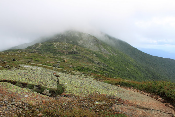
I stopped and pulled out my DSLR. Hmm, maybe carrying two cameras (I had one small one in my hip pouch) doomed me from the start towards fulfilling goal #2.
Hit Pierce at 4:45 elapsed time I chatted with a couple of thru hikers, this one told me just a minute before that he had no views in the Whites. Guess this was his first one:
I took too much time on this summit.
I pushed on, stopping at Mizpah Hut for water and a sit down food break.
The skies cleared on the wet, boggy trail over to Jackson
I realized that I was actually enjoying moving relatively quickly over rough terrain but was still able to appreciate my surroundings.
Blue skies on the summit of Jackson and Webster, though I reach the latter at the 7:15 elapsed mark. Umm, I definitely wasn’t going to make my time goal. Oh well, may as well relax and take some more pics.
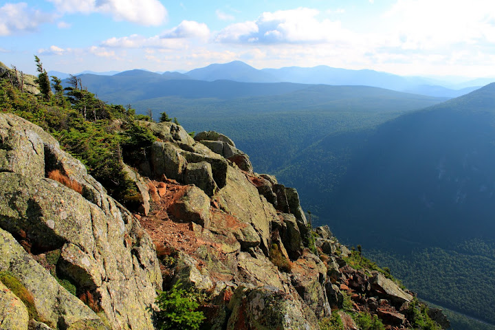
Looking off Webster's cliffs toward Mt. Carrigain
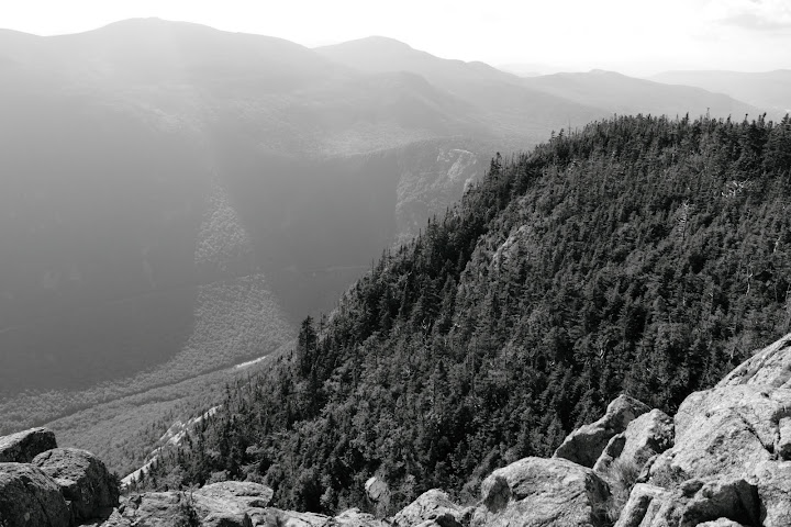
Awesome late day shadows made for good B&W shots
Stopped at Bugle Cliff, Elephant Head spur .2 each way, and spotted beaver while on the Saco Lake Trail which I used to avoid the road walk.
How did I do on my goals?
#1 fail, 9 hr 30 min elapsed time. I am no speed hiker/trail runner I guess. I certainly will never make a bid on an FKT. Oh well. I added up my break and picture time, it was too much, 1 hr 50 mins. I spent at least 10 minutes on each summit. Could have made the 8 hr mark if I compromised the 100 photos I took and yummy peanut butter and honey sandwiches. Oh well.
#2 fail, 100 photos
#3 achieved! I had a wonderful time and an ear to ear grin as I lay in the back of my truck staring up at the pink/orange clouds in the sky at the end of the day.
I may not pull off an epic endurance hike, but I found a pace and style that allows me to visit many beautiful places in a single day and enjoy each and every one of them.
John
