
PETCH
New member
Gettin' Isolated, the true Winter edition, 01/08/2011
Peaks/Trails Mt Isolation via Rocky Branch Trail, Engine Hill bushwack, Isolation Trail, Davis Path, Isolation Spur. On the way back- Isolation Spur, Davis Path, Isolation Trail, Rocky Branch Trail.
Trail Conditions: Rocky Branch and Engine Hill bushwack: a dusting of snow over hard packed trail. Isolation Trail and Davis Path: up to 2” of snow over hard packed trail.
Special Equipment: Light traction and snowshoes.
Cast of Characters: CrazyBob and Petch.
Commentary:
Well, this is the second time CrazyBob and I have tagged Isolation. The last time was the last day of Winter last March in a kitten-killing, post-holing, snow melting extravaganza. We hit the summit prior to the solstice, but didn’t complete the hike on time. So, it didn’t count as a Winter peak. We knew that going in, and enjoyed the hike and knew we would be back next winter. I think Isolation is a very under rated peak, and have enjoyed both trips to date.
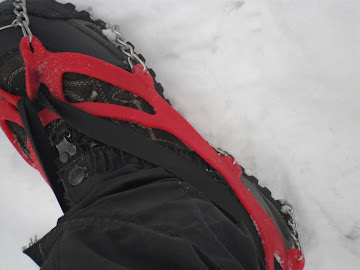
Saturday was looking like a decent weather day, and we decided to give it a go. We got a non-gentlemen’s start time of about 7:50am. A 8’F cool morning as we began barebooting up the Rocky Branch Trail. Only one other car in the parking lot. A dusting of snow over a mostly snow covered, hard packed, uneven trail. Bob was “Spikeless in Seattle” leaving his microspikes at home. So, I decided to hold off on putting my spikes on for a little while. But, with ice on the trail and my knee issues, I felt some light traction was in order. So, about ½ hour in, I spiked up.
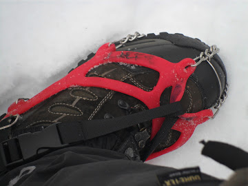
I have been having some issues with my microspikes moving around on my boots. They were fine the first 2 years I owned them. But I think the rubber has stretched. So, I decided to add a strap from the heel to toe to help tighten things up. Time will tell.
Microspike mod 101
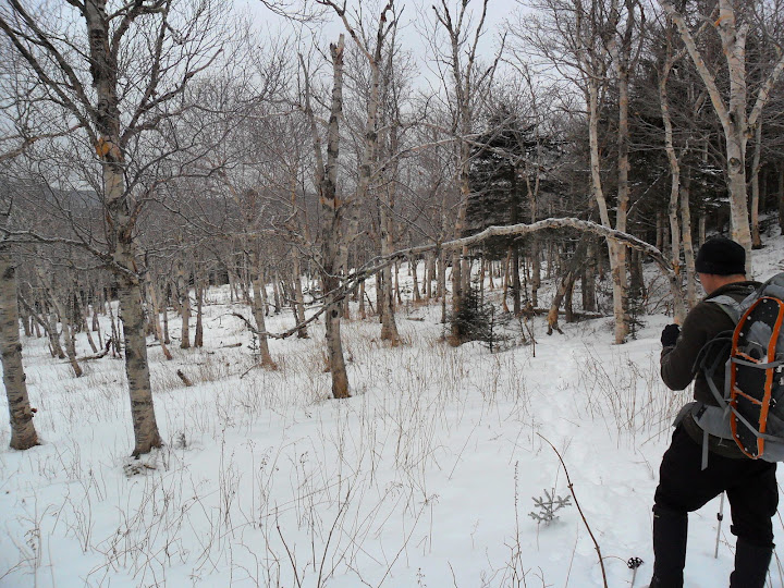
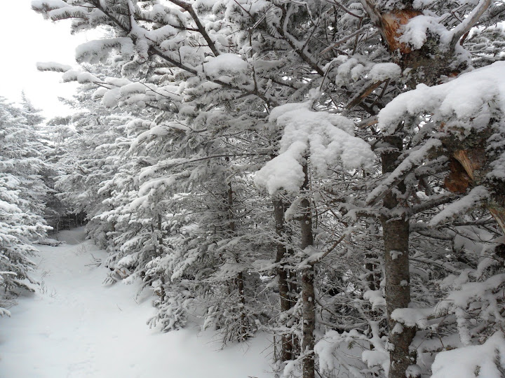
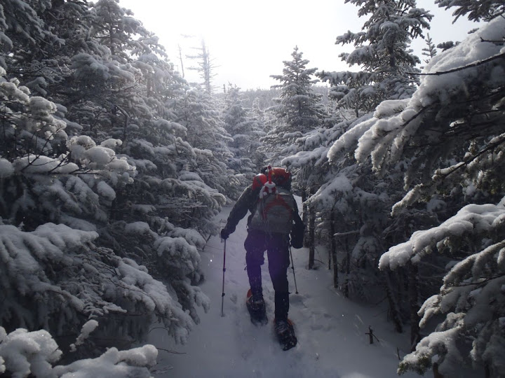
We continued on up to the height of the land and began the Engine Hill bushwack. We continued without snowshoes as the ground had a dusting on top of hard pack. Once we hit the Isolation Trail, we put on snowshoes for the remainder of the hike. The spruce trees were holding a couple inches of fresh powder, which provided a picturesque landscape as we continued on with the second half of the ascent.
Some just Birchin’ Glades
A fresh dusting of snow
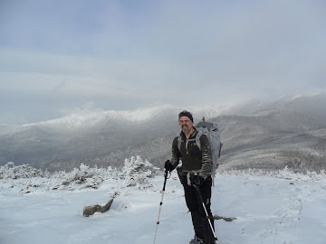
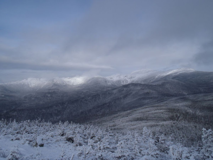
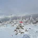
We continued on following the footprints of the prior day or so. Towards the end of the Isolation Trail, there was a small bushwack that went to the left of the tentsite. It shaved a little distance and met up with the Davis Path a little closer towards Isolation. Onward up the Davis Path we traveled with light snow flurries and the the sun trying to peak through. Finally we hit the Isolation spur and climbed the final yards to the summit, tagging it 4 hours after we started. We were treated to some milky sun and a low cloud ceiling that was lifting, awarding us with some views towards the Presidential Range.
Heading towards the summit
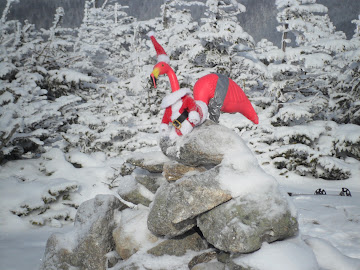
Some summit pics
The Presendenta's
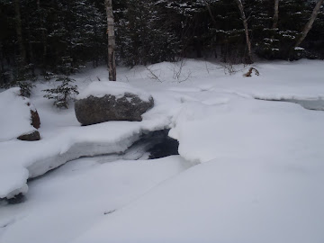
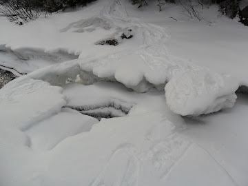
We began our descent at 12pm, and quickly ran into a group of 6 or so that had started after us. At the last stream crossing we ran into 2 guys who had started before us and had gone to the Rocky Branch Shelter#2, before coming up the Isolation Trail. They said all the stream crossings on the Isolation Trail were snow bridged. We’d never been that way, had some extra time, and decided to “Supertramp it” and take the long way home.
The Snow Bridges of Isolation County
So, we stayed on the Isolation Trail instead of taking the bushwack and went to check out the shelter. Then up the Rocky Branch Trail back towards the vehicle. We decided to keep the snowshoes on, being the “Trail preservationists” we are. It was a long slog back, but we made good time and were back at the truck at 3:20pm. And it was nice to see that no one had stolen the catalytic converter from Bob’s truck. Enough time for some chili and a cold one. The Moat was mobbed, so we stopped in Fryeburg at the 302 West Smokehouse.
Trip stats: 13.3 miles, 3400ft of elevation, 7 ½ hours.
Slideshow ^
GPSTracks: http://www.wikiloc.com/wikiloc/view.do?id=1392400
Hiking Pictures:http://picasaweb.google.com/mpetcher
Ascent List:http://peakbagger.com/climber/climblistc.aspx?cid=1767
Peaks/Trails Mt Isolation via Rocky Branch Trail, Engine Hill bushwack, Isolation Trail, Davis Path, Isolation Spur. On the way back- Isolation Spur, Davis Path, Isolation Trail, Rocky Branch Trail.
Trail Conditions: Rocky Branch and Engine Hill bushwack: a dusting of snow over hard packed trail. Isolation Trail and Davis Path: up to 2” of snow over hard packed trail.
Special Equipment: Light traction and snowshoes.
Cast of Characters: CrazyBob and Petch.
Commentary:
Well, this is the second time CrazyBob and I have tagged Isolation. The last time was the last day of Winter last March in a kitten-killing, post-holing, snow melting extravaganza. We hit the summit prior to the solstice, but didn’t complete the hike on time. So, it didn’t count as a Winter peak. We knew that going in, and enjoyed the hike and knew we would be back next winter. I think Isolation is a very under rated peak, and have enjoyed both trips to date.
Saturday was looking like a decent weather day, and we decided to give it a go. We got a non-gentlemen’s start time of about 7:50am. A 8’F cool morning as we began barebooting up the Rocky Branch Trail. Only one other car in the parking lot. A dusting of snow over a mostly snow covered, hard packed, uneven trail. Bob was “Spikeless in Seattle” leaving his microspikes at home. So, I decided to hold off on putting my spikes on for a little while. But, with ice on the trail and my knee issues, I felt some light traction was in order. So, about ½ hour in, I spiked up.
I have been having some issues with my microspikes moving around on my boots. They were fine the first 2 years I owned them. But I think the rubber has stretched. So, I decided to add a strap from the heel to toe to help tighten things up. Time will tell.
Microspike mod 101
We continued on up to the height of the land and began the Engine Hill bushwack. We continued without snowshoes as the ground had a dusting on top of hard pack. Once we hit the Isolation Trail, we put on snowshoes for the remainder of the hike. The spruce trees were holding a couple inches of fresh powder, which provided a picturesque landscape as we continued on with the second half of the ascent.
Some just Birchin’ Glades
A fresh dusting of snow
We continued on following the footprints of the prior day or so. Towards the end of the Isolation Trail, there was a small bushwack that went to the left of the tentsite. It shaved a little distance and met up with the Davis Path a little closer towards Isolation. Onward up the Davis Path we traveled with light snow flurries and the the sun trying to peak through. Finally we hit the Isolation spur and climbed the final yards to the summit, tagging it 4 hours after we started. We were treated to some milky sun and a low cloud ceiling that was lifting, awarding us with some views towards the Presidential Range.
Heading towards the summit
Some summit pics
The Presendenta's
We began our descent at 12pm, and quickly ran into a group of 6 or so that had started after us. At the last stream crossing we ran into 2 guys who had started before us and had gone to the Rocky Branch Shelter#2, before coming up the Isolation Trail. They said all the stream crossings on the Isolation Trail were snow bridged. We’d never been that way, had some extra time, and decided to “Supertramp it” and take the long way home.
The Snow Bridges of Isolation County
So, we stayed on the Isolation Trail instead of taking the bushwack and went to check out the shelter. Then up the Rocky Branch Trail back towards the vehicle. We decided to keep the snowshoes on, being the “Trail preservationists” we are. It was a long slog back, but we made good time and were back at the truck at 3:20pm. And it was nice to see that no one had stolen the catalytic converter from Bob’s truck. Enough time for some chili and a cold one. The Moat was mobbed, so we stopped in Fryeburg at the 302 West Smokehouse.
Trip stats: 13.3 miles, 3400ft of elevation, 7 ½ hours.
Slideshow ^
GPSTracks: http://www.wikiloc.com/wikiloc/view.do?id=1392400
Hiking Pictures:http://picasaweb.google.com/mpetcher
Ascent List:http://peakbagger.com/climber/climblistc.aspx?cid=1767
Last edited:
