Kevin Judy and Emma
Well-known member
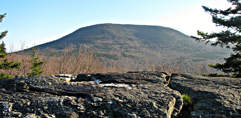
On North Cube
Mount Cube 2909'
Quinttown Road/Kodak Trail/ North Cube Spur
8.4 Miles 2200' Elevation gain
Kevin and Judy
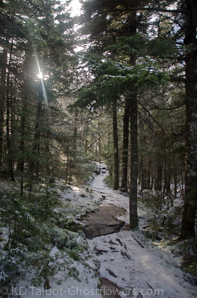
On a gray, drab day we journeyed to Orford to hike Mount Cube. We hiked the Kodak Trail from the locked gate on Quinttown Road. This trail is part of the Appalachian Trail and includes the Hexacube Shelter for thru-hikers along their way. After a quick half mile of road walking we soon turned north into the woods along the Kodak Trail. Rising moderately through mostly deciduous forest it was not long before we reached the Eastman Ledges and began to have views to our south and east. To our east the mass of Smart's Mountain filled the view which on this gray day had its head in the clouds. As is usual, the higher we went along the trail, the more snow we encountered, though it varied from none to only a few inches. Patches of ice along the trail were easily negotiated, though I wore microspikes and Judy didn't until we scrambled up icy ledges above the shelter.
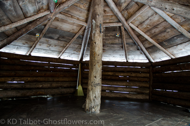
Hexacube Shelter
Tricky
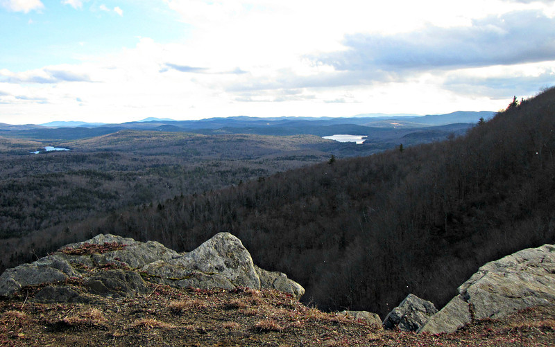
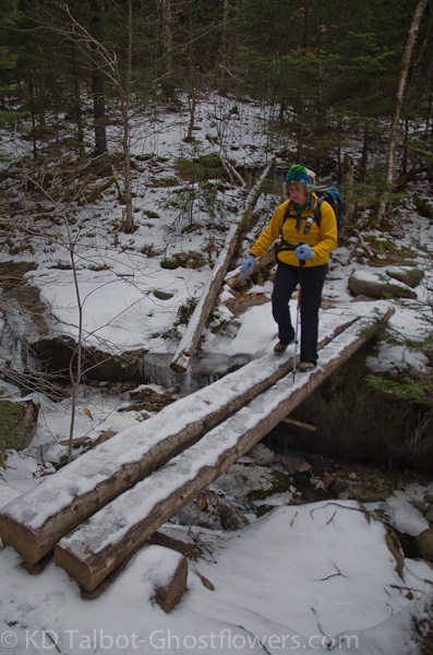
From the lower ledges we could easily see the line of Quinttown Road as it wound east through the forest below. To our south and west views were limited on this dismal, low ceiling day, but we could make out open fields and nearby hills in the surrounding landscape. We turned north and continued on, first through forest, then out onto open ledges again, passing a massive cliff wall. Above this the trees were now mostly spruce. The trail dipped down into a gully at the bottom of which ran the North Branch of Jacob's Brook where there was a slightly tricky crossing. Beyond this we soon came to the spur path to Hexacube Shelter, so named because the open-faced shelter is shaped in a hexagon, unusual for shelters I have seen. We had a quick lunch and moved along.
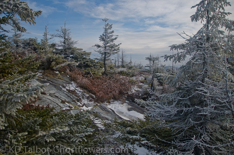
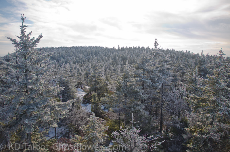
Almost immediately the trail again crossed the brook, this time on two puncheons which were several feet above the brook. I crossed the icy boards with ease in my micros, and turned to see if Jude would don hers. She did not, but moved warily across the bridge and we continued on. The trail soon rose to more ledges which afforded more views. We crossed from snow to rock to ice and back again as we made our way along, sometimes dipping back down into the woods and through Christmas tree corridors, then rising back up to ledges which gave views of the trail ahead. As we rose further up the hillside the trees began to show signs of rime which had formed overnight as low clouds passed the summit and left their moisture, now a frozen coating on their branches. Gray, featureless skies continued to hang low around us.
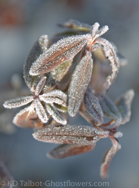
Frosted Rhodora Leaves
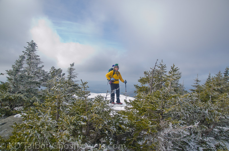
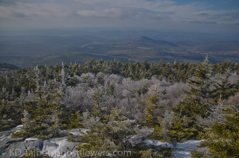
As we continued to rise up and onto open ledges we could now look down upon the trees resplendent in their rime coats below us. Above us the sun was burning through the thick overcast and patches of blue were appearing where before there was a void of gray nothingness. As if we had planned it this way, the sun made its appearance as we reached the summit. Dissipating clouds around and above us gave way to azure skies and the sun felt warm as we sat down to enjoy a windless snack. Somewhat reenergized by the change from gloomy conditions to one of sparkling beauty we decided to continue on to North Peak, a short hike described in the White Mountain Guide as "along an obscure side trail from the col just north of the summit of Cube". This trail is no longer obscure and is well marked and maintained. It offers some quick scrambling over ledgy trail to an outlook to the north which includes a good view of Mount Moosilauke whose summit remained obscured by low hanging clouds. There were some beautiful quartzite outcrops nestled in beds of Rhodora which must be exceptionally beautiful while the Rhodora is in bloom late May and early June. I think a return trip at that time is in order!
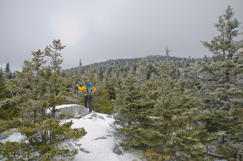
On North Cube
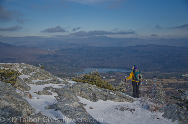
Looking Towards Mount Moosilauke
The views distant and near along the trail back to Mount Cube were mindful of a trip to an enchanted Christmas land with the trees decked out in white and shining tinsel. Once again the beauty of the forest engulfed us as we again rose along the trail up to the ledgy summit of Mount Cube, then began the icy descent along the southern ledges. Throughout the day we had flushed many grouse, and found their tracks along with turkey, fox and coyote along the trail. It was a wonderful hike as the murky day had given way to the sunlight and surrounding beauty and made us look forward to more hikes like this as winter descends upon the hills.
Full set of pics HERE:
KDT
Last edited: