
Becca M
Active member
November 17, 2012: Hiking my way through trails in the Wild River area, my plan was Mt Meader Tr (including Brickett Falls), Basin Rim Trail, Black Angel (including Basin Trail Connector), Wild River, Eagle Link, Baldface Circle. I was actually hoping to hike Meader Ridge Trail but I changed my plans based on how long the hike was taking so far.
When I was getting ready to begin, I decided to go with the bigger pack and boots for more gear – it was reasonably cold out so I wanted to carry more cold-weather gear. I hated to give up the trailrunning shoes for the year but I needed more rugged shoes.
I decided to do the roadwalk first and then I headed up the Mt Meader Trail. Right away I felt I was going slower than usual because of my boot selection – they just weren’t built for speed!!!!
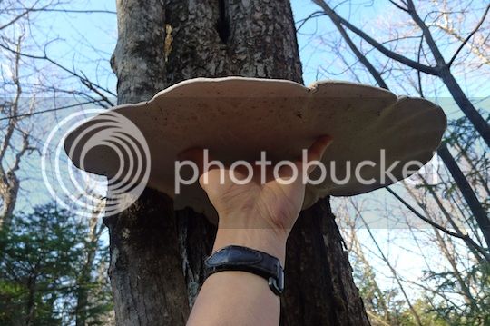
Anyway, along the way up the pleasant Mt Meader Trail, I saw this huge fungus – so big it seemed you could stand under it in a rainstorm. You get an idea how big it is when you see my hand there – I have big hands!!!
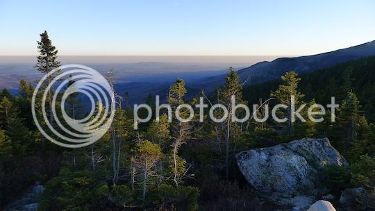
Not much to mention along that stretch of the way – bluebird skies and lots of sun through the trees – I kept regretting my winter fleece pants – it seemed so warm though it was probably in the 40’s most of the day. Once up to the Basin Rim Trail, I enjoyed the pretty views off to the sides.
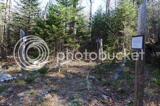
Next, I took the turn at the Rim Junction and headed down the Black Angel Trail. I had been on the portion of the Black Angel running up to Carter Dome but had never been on this stretch. First thing I came upon was the Blue Brook Tentsite – former shelter location. It was amazing how many signs for “revegetation” I caught in just one picture:
I wandered around the tentsites, the connector trails, and then headed on down the Black Angel… and WAY back uphill around 600’ – not a big deal but my boots were starting to hurt – blistered heels and all despite taping them with duct tape. There were some HUGE blowdowns that looked pretty old and had no evidence of people cutting limbs off – guess not too many people headed out this way!!!
The bottom 1.5 miles of the Black Angel down to the Wild River were really nice – a typical old skidder path clear of most blowdowns – nice pleasant stroll in the middle of the woods – so cool to see!!!
OK, so, then it was down to the Wild River…. I was thinking it might be a little dicey but was optimistic since I had been there late summer and had no problems… now was a little different – lots of black ice where the rocks had touched the water. I found some apparent remnants of the Spider Bridge – and wished the rest were there!!!
I pondered the crossing and made my “leap” of faith – took me 10 minutes between when I started and when I actually crossed. My heart was pumping, for sure!!! But, I was finally happy I was wearing the heavy leather boots for stability as I balanced mid-river.
So I turned left on the Wild River Trail. There were a number of HUGE washouts, left over from Hurricane Irene.
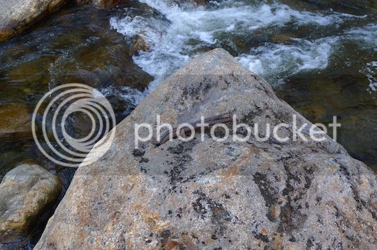
The trail was very pleasant; it was nice to be on the railroad grade. Though I kept looking for the remains of logging camps, there was nothing really visible despite the lack of leaves. When I got to the Spruce Brook Tentsite, there were “reforestation” signs a-plenty, again…. It would be much more aesthetically pleasing to just to let the forest take over without all the signs….
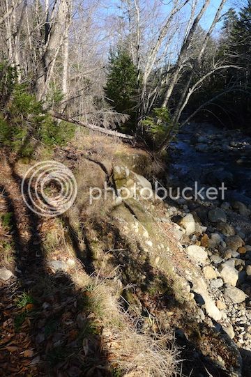
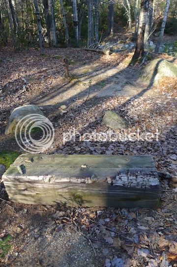
And just beyond the former shelter area were the footings of that former bridge:
I really didn’t have much trouble crossing Spruce Brook despite the lack of a bridge – the stones seemed well-placed despite the ice. A little further up the Red Brook crossing was a different story. The stones and cascades were covered in ice, and, although I had ice spikes, I didn’t put them on just for that stretch. Instead, I slipped on some ice, fell forward, and somehow managed to get very wet in the front but didn’t slip back down the ice-covered cascades… very stressful….
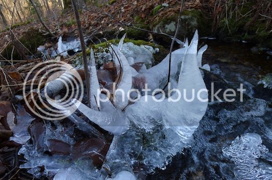
And then I turned up onto the Eagle Link. This was a very pleasant trail. Near one of the little streams this ice sculpture formed:
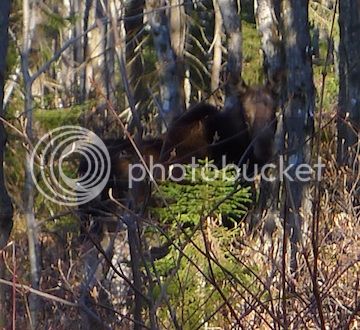
The crossing of the Wild River on this trail was quite easy – no slipping!!!! After a mile or so, I heard breaking branches in addition to my own heavy footsteps… I stopped and saw…. A moose!!! I basically NEVER see moose on-trail!!! I waited a bit and noticed a bull moose also!!! It was so cool – I watched them for a while and then headed on my way. Here’s a shot of just the cow (I never got a good shot of the bull)
Mid-afternoon the woods off the Eagle Link looked like this:
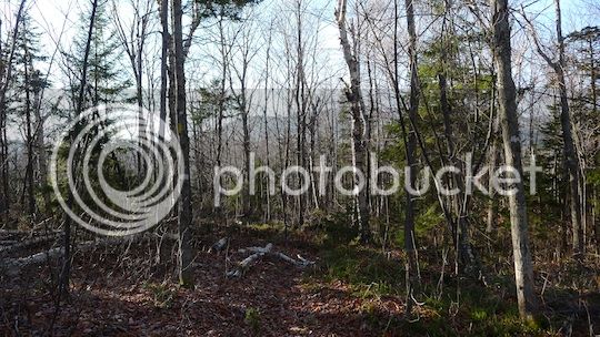
Further up, the trail looked like this:
And, looking back at the Baldfaces behind me:
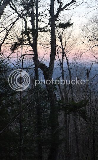
Once at the junction with the Baldface Circle Trail, the sun was setting – pretty orangey red all around:
(cont)
When I was getting ready to begin, I decided to go with the bigger pack and boots for more gear – it was reasonably cold out so I wanted to carry more cold-weather gear. I hated to give up the trailrunning shoes for the year but I needed more rugged shoes.
I decided to do the roadwalk first and then I headed up the Mt Meader Trail. Right away I felt I was going slower than usual because of my boot selection – they just weren’t built for speed!!!!
Anyway, along the way up the pleasant Mt Meader Trail, I saw this huge fungus – so big it seemed you could stand under it in a rainstorm. You get an idea how big it is when you see my hand there – I have big hands!!!
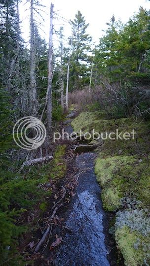
Not much to mention along that stretch of the way – bluebird skies and lots of sun through the trees – I kept regretting my winter fleece pants – it seemed so warm though it was probably in the 40’s most of the day. Once up to the Basin Rim Trail, I enjoyed the pretty views off to the sides.
Next, I took the turn at the Rim Junction and headed down the Black Angel Trail. I had been on the portion of the Black Angel running up to Carter Dome but had never been on this stretch. First thing I came upon was the Blue Brook Tentsite – former shelter location. It was amazing how many signs for “revegetation” I caught in just one picture:
I wandered around the tentsites, the connector trails, and then headed on down the Black Angel… and WAY back uphill around 600’ – not a big deal but my boots were starting to hurt – blistered heels and all despite taping them with duct tape. There were some HUGE blowdowns that looked pretty old and had no evidence of people cutting limbs off – guess not too many people headed out this way!!!
The bottom 1.5 miles of the Black Angel down to the Wild River were really nice – a typical old skidder path clear of most blowdowns – nice pleasant stroll in the middle of the woods – so cool to see!!!
OK, so, then it was down to the Wild River…. I was thinking it might be a little dicey but was optimistic since I had been there late summer and had no problems… now was a little different – lots of black ice where the rocks had touched the water. I found some apparent remnants of the Spider Bridge – and wished the rest were there!!!
I pondered the crossing and made my “leap” of faith – took me 10 minutes between when I started and when I actually crossed. My heart was pumping, for sure!!! But, I was finally happy I was wearing the heavy leather boots for stability as I balanced mid-river.
So I turned left on the Wild River Trail. There were a number of HUGE washouts, left over from Hurricane Irene.
The trail was very pleasant; it was nice to be on the railroad grade. Though I kept looking for the remains of logging camps, there was nothing really visible despite the lack of leaves. When I got to the Spruce Brook Tentsite, there were “reforestation” signs a-plenty, again…. It would be much more aesthetically pleasing to just to let the forest take over without all the signs….
And just beyond the former shelter area were the footings of that former bridge:
I really didn’t have much trouble crossing Spruce Brook despite the lack of a bridge – the stones seemed well-placed despite the ice. A little further up the Red Brook crossing was a different story. The stones and cascades were covered in ice, and, although I had ice spikes, I didn’t put them on just for that stretch. Instead, I slipped on some ice, fell forward, and somehow managed to get very wet in the front but didn’t slip back down the ice-covered cascades… very stressful….
And then I turned up onto the Eagle Link. This was a very pleasant trail. Near one of the little streams this ice sculpture formed:
The crossing of the Wild River on this trail was quite easy – no slipping!!!! After a mile or so, I heard breaking branches in addition to my own heavy footsteps… I stopped and saw…. A moose!!! I basically NEVER see moose on-trail!!! I waited a bit and noticed a bull moose also!!! It was so cool – I watched them for a while and then headed on my way. Here’s a shot of just the cow (I never got a good shot of the bull)
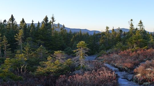
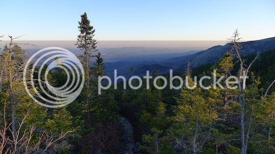
Mid-afternoon the woods off the Eagle Link looked like this:
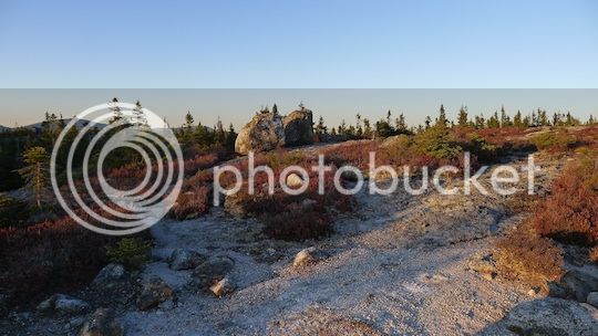
Further up, the trail looked like this:
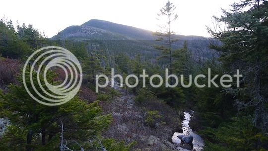
And, looking back at the Baldfaces behind me:
Once at the junction with the Baldface Circle Trail, the sun was setting – pretty orangey red all around:
(cont)
")