
halfmoon
New member
All the pictures
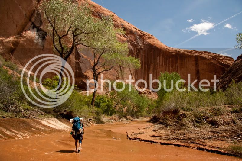
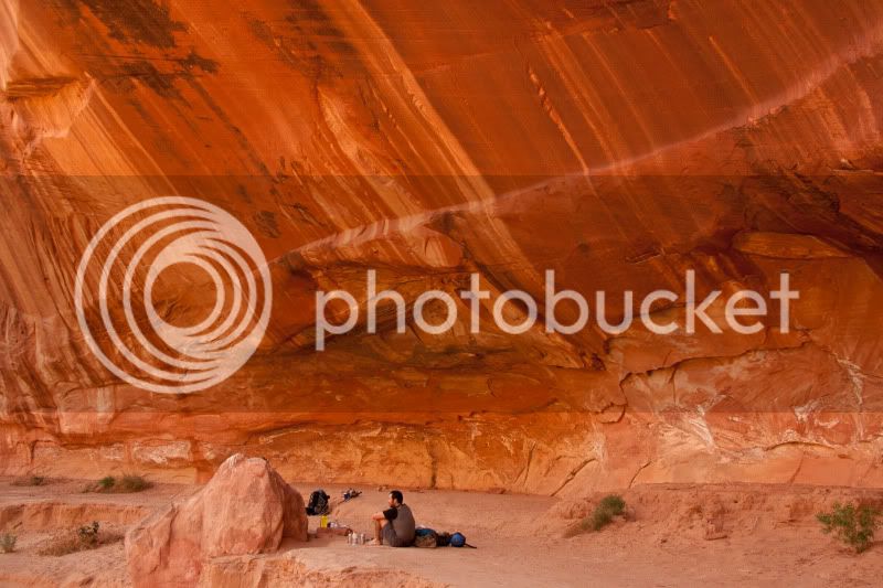
My friend and I traveled to Grand Staircase-Escalante National Monument (GSENM) from April 16 - 23, 2011 for our annual backpacking trip. The plan was to spend the week along the Hole-in-the-Rock Road descending as many canyons as time and energy allowed before returning. The core of the trip was to be a four day basecamp along the Escalante River near the mouth of Neon Canyon. From basecamp, technical descents of Neon, South Fork Choprock, and Ringtail Canyons were completed. Afterwards, the plan called for playing it by ear further down Hole-in-the-Rock Road. We ended up taking a mellow two day walk through Coyote Gulch, including a hike up to Steven's Arch, then for the final day hiking two forks of Red Breaks Canyon, including a cross country hike and search for a geologic anomaly called "The Volcano".
I would rate the technical descents of Neon, Choprock, and Ringtail beyond compare. It was truly otherworldly to be rappelling, down-climbing, swimming, and lemon squeezing through these subterranean canyons. The isolation and technical challenge of these canyons combined for a very unique experience. Flawless execution was required in the canyons as there were no escape routes, and no one was going to be coming to rescue you. Brad and I wore thick wetsuits, and carried an arsenal of technical gear that included ropes, harnesses, hardware, prussiks, pothole escape devices, and drybags. These canyons are amazing, but you need to know what you are doing to make safe descents.
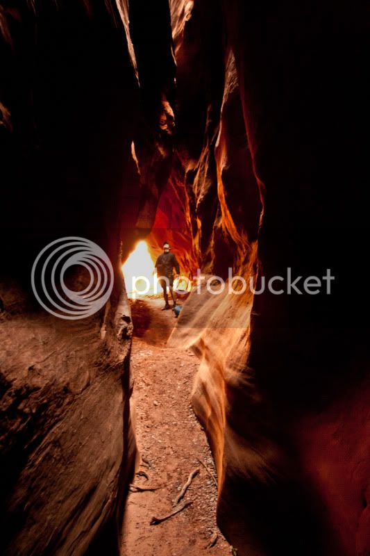
The remaining days of our trip in Coyote Gulch and Red Breaks Canyons were much more mellow, but also stunningly beautiful. We enjoyed Coyote Gulch just as much, and the canyons of Red Break were less than a foot wide at times.
Below are our pictures from the week in GSENM, enjoy.
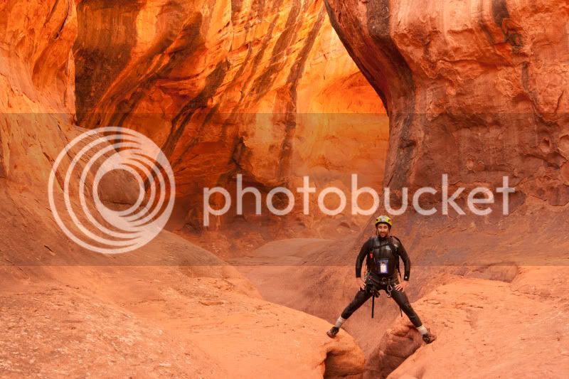
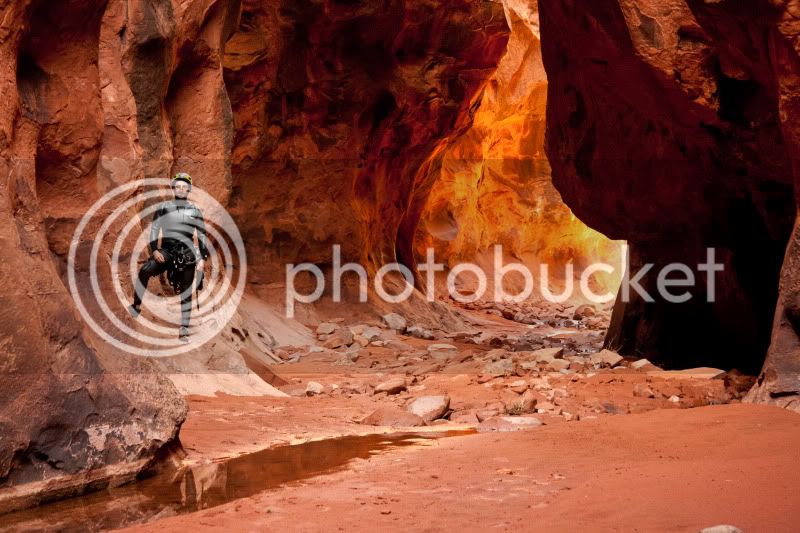
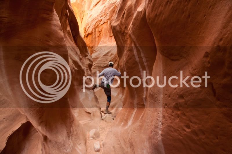
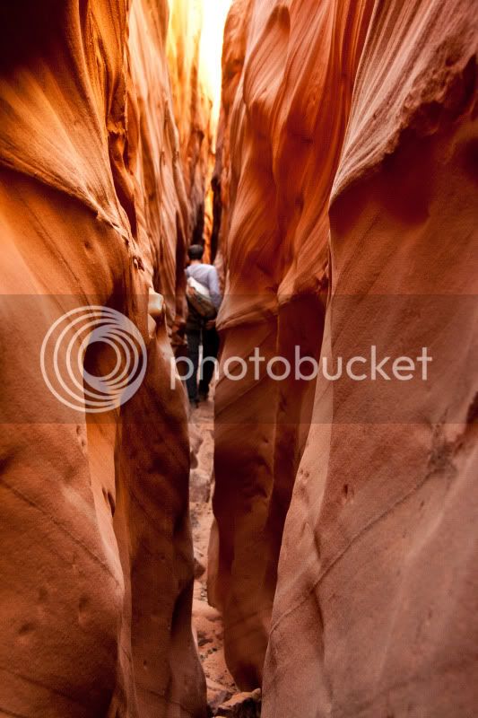
Neon Canyon Narrows
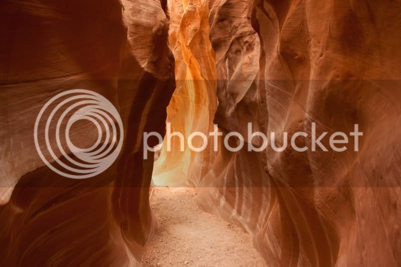
Neon Canyon
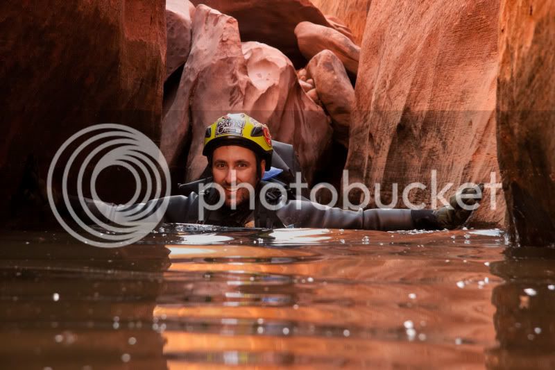
A cold, cold swim in Neon Canyon
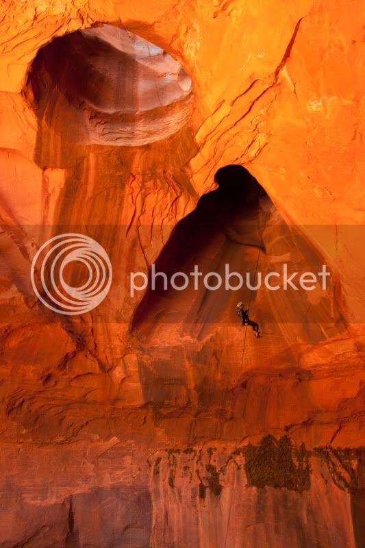
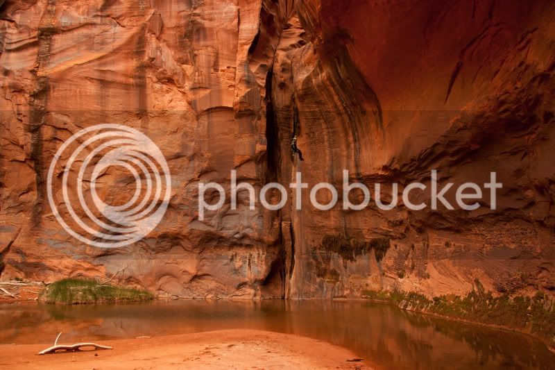
Golden Cathedral Rappel, Neon Canyon
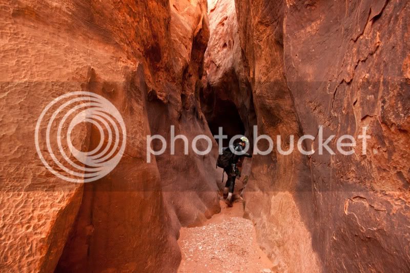
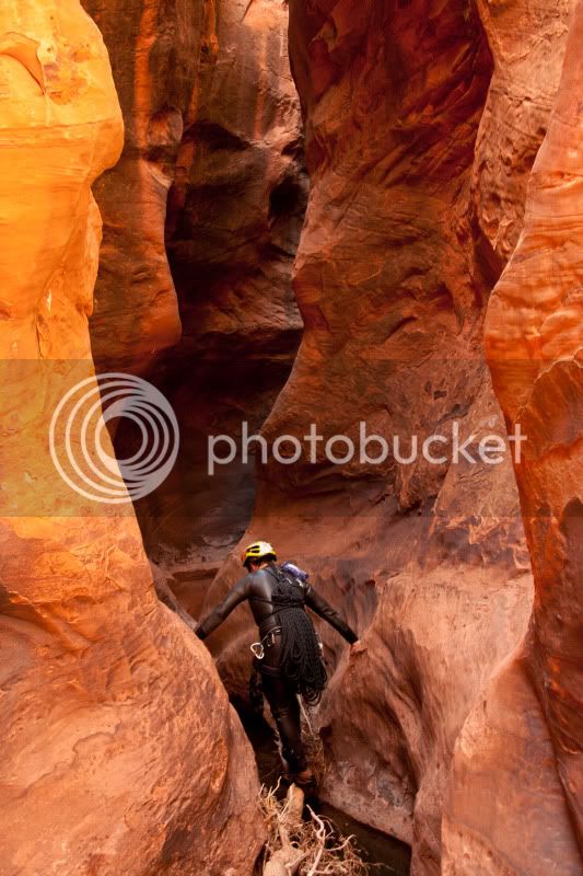
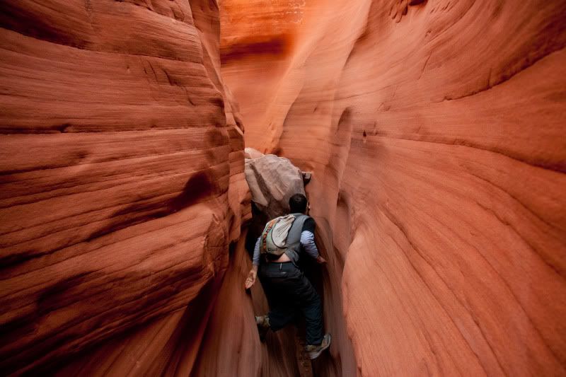
Subway Narrows, South Fork Choprock Canyon
South Fork Choprock Canyon Narrows
Final Rappel in South Fork Choprock Canyon
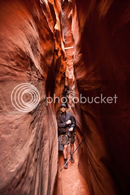
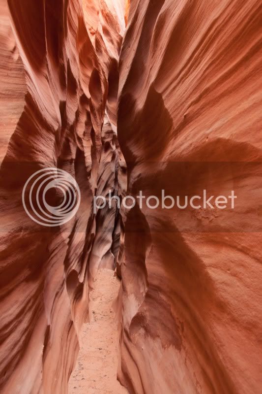
Tight Narrows of Ringtail Canyon
Ringtail Canyon Exit
My friend and I traveled to Grand Staircase-Escalante National Monument (GSENM) from April 16 - 23, 2011 for our annual backpacking trip. The plan was to spend the week along the Hole-in-the-Rock Road descending as many canyons as time and energy allowed before returning. The core of the trip was to be a four day basecamp along the Escalante River near the mouth of Neon Canyon. From basecamp, technical descents of Neon, South Fork Choprock, and Ringtail Canyons were completed. Afterwards, the plan called for playing it by ear further down Hole-in-the-Rock Road. We ended up taking a mellow two day walk through Coyote Gulch, including a hike up to Steven's Arch, then for the final day hiking two forks of Red Breaks Canyon, including a cross country hike and search for a geologic anomaly called "The Volcano".
I would rate the technical descents of Neon, Choprock, and Ringtail beyond compare. It was truly otherworldly to be rappelling, down-climbing, swimming, and lemon squeezing through these subterranean canyons. The isolation and technical challenge of these canyons combined for a very unique experience. Flawless execution was required in the canyons as there were no escape routes, and no one was going to be coming to rescue you. Brad and I wore thick wetsuits, and carried an arsenal of technical gear that included ropes, harnesses, hardware, prussiks, pothole escape devices, and drybags. These canyons are amazing, but you need to know what you are doing to make safe descents.
The remaining days of our trip in Coyote Gulch and Red Breaks Canyons were much more mellow, but also stunningly beautiful. We enjoyed Coyote Gulch just as much, and the canyons of Red Break were less than a foot wide at times.
Below are our pictures from the week in GSENM, enjoy.
Neon Canyon Narrows
Neon Canyon
A cold, cold swim in Neon Canyon
Golden Cathedral Rappel, Neon Canyon
Subway Narrows, South Fork Choprock Canyon
South Fork Choprock Canyon Narrows
Final Rappel in South Fork Choprock Canyon
Tight Narrows of Ringtail Canyon
Ringtail Canyon Exit
")